The best MTB trails around Centerville
5.0
(2)
164
riders
15
rides
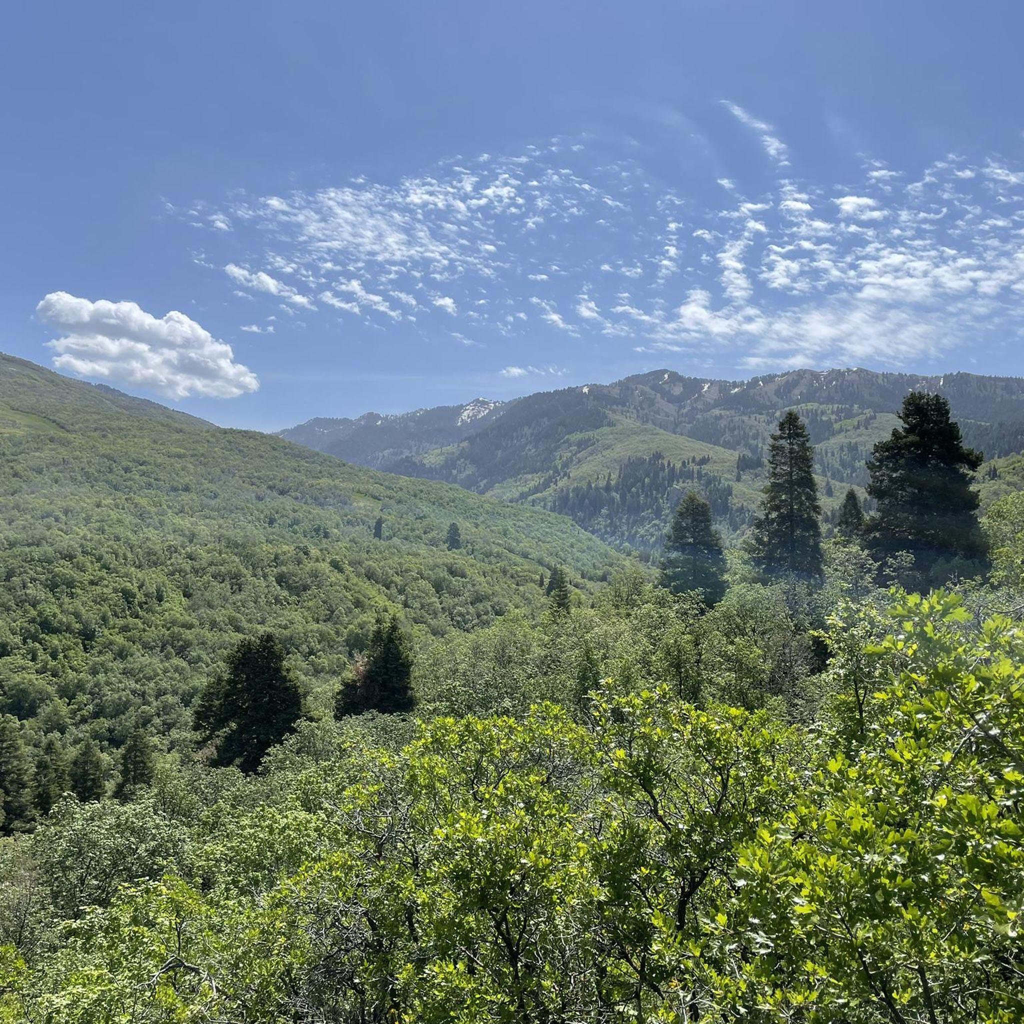
Mountain biking around Centerville, Utah, offers diverse terrain within the Uinta-Wasatch-Cache National Forest, characterized by significant elevation changes and varied landscapes. The region features trails that traverse forested areas, open ridges, and provide views of the Great Salt Lake and surrounding mountains. Riders can expect a mix of climbs and descents across different difficulty levels, from moderate paths to challenging mountain bike trails.
Best mountain bike trails around Centerville
- The most popular mountain bike trail is Parrish Creek and Buckland…
Last updated: August 17, 2026
2
riders
23.7km
03:14
1,160m
1,160m
The Parrish Creek and Buckland Ridge Trail Loop offers a truly challenging mountain biking experience through the stunning Uinta-Wasatch-Cache National Forest. You'll navigate a demanding 14.7-mile (23.7 km) route, gaining…
5.0
(1)
44
riders
30.2km
03:00
920m
920m
Hard mountain bike ride. Very good fitness required. Advanced riding skills necessary.

Sign up for free
5.0
(1)
23
riders
45.3km
04:54
1,540m
1,540m
Hard mountain bike ride. Very good fitness required. Advanced riding skills necessary. Some portions of the route may require you to push your bike.
22
riders
16.1km
01:37
440m
440m
Moderate mountain bike ride. Good fitness required. Advanced riding skills necessary.
10
riders
7.57km
00:44
210m
210m
Easy mountain bike ride. Great for any fitness level. Suitable for all skill levels.
Get access to more routes and recommendations from other explorers.
Sign up for free
Already have an account?
Our route recommendations are based on thousands of hikes, rides, and runs completed by other people on komoot.
Start today with a free account
Your next adventure awaits.
Login or Signup
Tips from the Community

I always continue up past Elephant Rock. This time I’m glad I took the split off to BST instead. Low traffic and lots of wildlife.
0
0

A challenging downhill ride with technical sections, including small drops and rocky areas. Some parts of the trail can be overgrown, making the singletrack narrow, so exercise caution, especially on descents. While there are fun sections, this trail is best suited for experienced riders. It’s primarily used for hiking, so be considerate of uphill travelers. To avoid a strenuous climb, consider shuttling or riding up Buckland Ridge Trail or Skyline Drive before descending.
0
0


With an elevation of about 9,500 feet, Francis Peak provides stunning views from the marked viewing point. From here you can see the Great Salt Lake, the Ogden Valley, and the surrounding mountain ranges.
0
0
With an elevation of about 9,500 feet, Francis Peak provides stunning views from the marked viewing point. From here you can see the Great Salt Lake, the Odgen Valley, and the surrounding mountain ranges.
0
0
The North Canyon Trail is located in the Mueller Park, Utah. While ascending along the trail, you are surrounded by lush vegetation and shaded by tall pine trees. The trail follows a small creek and features several wooden bridges. When hiking in fall, you can enjoy the beautiful colors of the surrounding trees and wildflowers.
0
0

Farmington was originally settled by Mormon pioneers in 1847 and derived its name from the surrounding lush farmlands. The town offers a retail center called Station Park, the Lagoon Amusement Park, the Davis County Fairgrounds, as well as a quaint historic Main Street.
0
0

This surprisingly powerful waterfall is the primary feature of this easy, pleasant trail, although you can continue hiking up (or down) the canyon for some distance to turn this into a longer outing. Even after you leave the waterfall behind, you can look forward to the great company of the creek nearby, and plenty of shade from the trees.
0
0
Frequently Asked Questions
How many mountain bike trails are available in Centerville?
Centerville offers over a dozen mountain bike trails, catering to various skill levels from moderate to difficult. In total, there are 12 routes available for exploration.
Are there mountain bike trails suitable for beginners in Centerville?
While many trails in Centerville are moderate to difficult, there are at least two easier mountain bike routes available. These provide a good starting point for those new to mountain biking or looking for a less strenuous ride.
What are some challenging mountain bike trails for experienced riders?
For experienced riders seeking a challenge, Centerville has several difficult trails. Consider the Parrish Creek and Buckland Ridge Trail Loop, which covers 14.7 miles (23.7 km) with significant elevation gain, or the extensive Mountainbike loop from North Salt Lake, a 31.1-mile (50.0 km) route through the foothills.
Are there any loop trails for mountain biking in Centerville?
Yes, many of Centerville's mountain bike routes are designed as loops. Examples include the Parrish Creek and Buckland Ridge Trail Loop and the View of Mueller Park Trail – Big Rock loop from Mueller Park, offering circular routes to bring you back to your starting point.
What kind of terrain can I expect on Centerville's mountain bike trails?
Mountain biking in Centerville, Utah, features diverse terrain within the Uinta-Wasatch-Cache National Forest. Riders can expect a mix of forested mountainsides, open ridges, and varied surfaces with significant elevation changes, providing both climbs and descents.
What are the best times of year for mountain biking in Centerville?
The Uinta-Wasatch-Cache National Forest, where many Centerville trails are located, is generally best for mountain biking during the spring, summer, and fall months when trails are clear of snow and weather conditions are favorable. Winter riding may be possible on lower elevation trails, but higher routes will likely be snow-covered.
What scenic views or natural features can I see along the mountain bike trails?
Centerville's mountain bike trails offer panoramic viewpoints and natural attractions. You might encounter the beautiful Waterfall at Davis Creek, enjoy expansive views of North Salt Lake from Sunset Point, or even see the majestic Bountiful Peak. The Legacy Nature Preserve also offers opportunities for wildlife viewing near some routes.
Are there any family-friendly mountain bike routes in Centerville?
While the guide highlights mostly moderate to difficult trails, the presence of easier routes suggests there are options suitable for families. These trails typically have less challenging terrain and shorter distances, making them enjoyable for riders of varying ages and skill levels.
What do other mountain bikers say about the trails in Centerville?
The mountain bike trails in Centerville are highly regarded by the komoot community, holding an average rating of 4.0 stars from over 5 reviews. More than 260 mountain bikers have used komoot to explore the varied terrain, often praising the diverse landscapes and challenging rides.
Are there any moderate-difficulty mountain bike trails in Centerville?
Yes, Centerville has several moderate-difficulty mountain bike trails. A popular choice is the View of Mueller Park Trail – Big Rock loop from Mueller Park, a 9.4-mile (15.2 km) path offering a scenic ride with varied surfaces. Another option is the Mountainbike loop from Creekwood of Indian Springs, covering 11.3 miles (18.17 km).
What is the longest mountain bike trail available in Centerville?
The longest mountain bike trail featured is the Mountainbike loop from North Salt Lake, which spans 31.1 miles (50.0 km). This challenging route typically takes around 5 hours and 13 minutes to complete, offering expansive views through the foothills.
Most popular routes around Centerville
Most popular attractions around Centerville

Get inspired with the komoot mobile app


Explore more
Browse the best MTB trails in other regions.
