The best road cycling routes around Shelburne
4.6
(22)
1,379
riders
80
rides
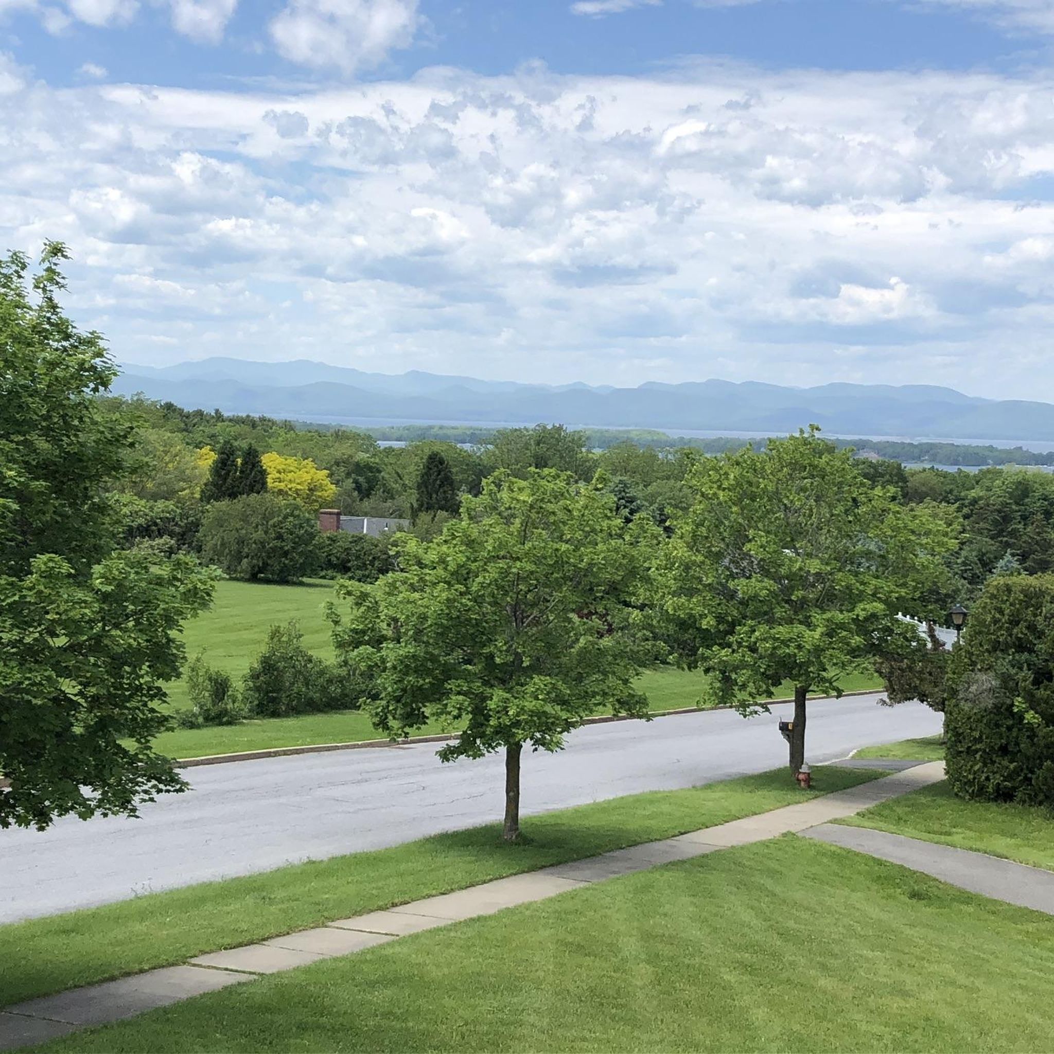
Road cycling routes around Shelburne feature a diverse landscape, characterized by rolling terrain, river valleys, and scenic waterfronts. The area offers views of Lake Champlain and the Green Mountains, providing varied backdrops for rides. Cyclists can explore routes along Shelburne Bay, which includes views of the water and distant mountains. The region's topography provides options for different fitness levels, from gentle rides to routes with moderate elevation gains.
Best road cycling routes around Shelburne
- The most popular road cycling route is Champlain Bikeway: Shelburne-Charlotte Loop, a 27.9 miles (44.9 km) trail that takes 1 hour 58 minutes to complete. This moderate route offers scenic vistas of Lake Champlain and the surrounding forests.
- Another top favourite among local road cyclists is Roadbike loop from Shelburne, an easy 15.5 miles (25.0 km) path. This route navigates through the area's rolling terrain, providing a accessible cycling experience.
- Local road cyclists also love the Shelburne Bay – Overlook Park viewpoint loop from Red Rocks Park, a 21.0 miles (33.9 km) trail leading through Shelburne Bay and past Overlook Park, often completed in about 1 hour 27 minutes.
- Road cycling around Shelburne is defined by Lake Champlain views, rolling terrain, and river valleys. The network offers options for different ability levels, from easy loops to more challenging rides with varied elevation.
- The routes in Shelburne are highly rated by the komoot community with an average score of 4.9 stars from over 10 reviews. Nearly 1,000 road cyclists have used komoot to explore Shelburne's varied terrain.
Last updated: September 27, 2026
16
riders
44.9km
01:58
410m
410m
Cycle the moderate 27.9-mile Champlain Bikeway: Shelburne-Charlotte Loop for scenic views of Lake Champlain and the Green Mountains.
21
riders
25.0km
01:04
180m
180m
Easy road ride. Great for any fitness level. Mostly well-paved surfaces and easy to ride.

5.0
(2)
20
riders
Easy road ride. Great for any fitness level. Mostly well-paved surfaces and easy to ride.
5.0
(1)
4
riders
76.9km
03:44
1,030m
1,030m
Hard road ride. Very good fitness required. Some segments of this route may be unpaved and difficult to ride.
11
riders
30.9km
01:39
210m
210m
Moderate road ride. Great for any fitness level. Some segments of this route may be unpaved and difficult to ride.
Get access to more routes and recommendations from other explorers.
Already have an account?
Our route recommendations are based on thousands of hikes, rides, and runs completed by other people on komoot.
Start today with a free account
Your next adventure awaits.


Tips from the Community

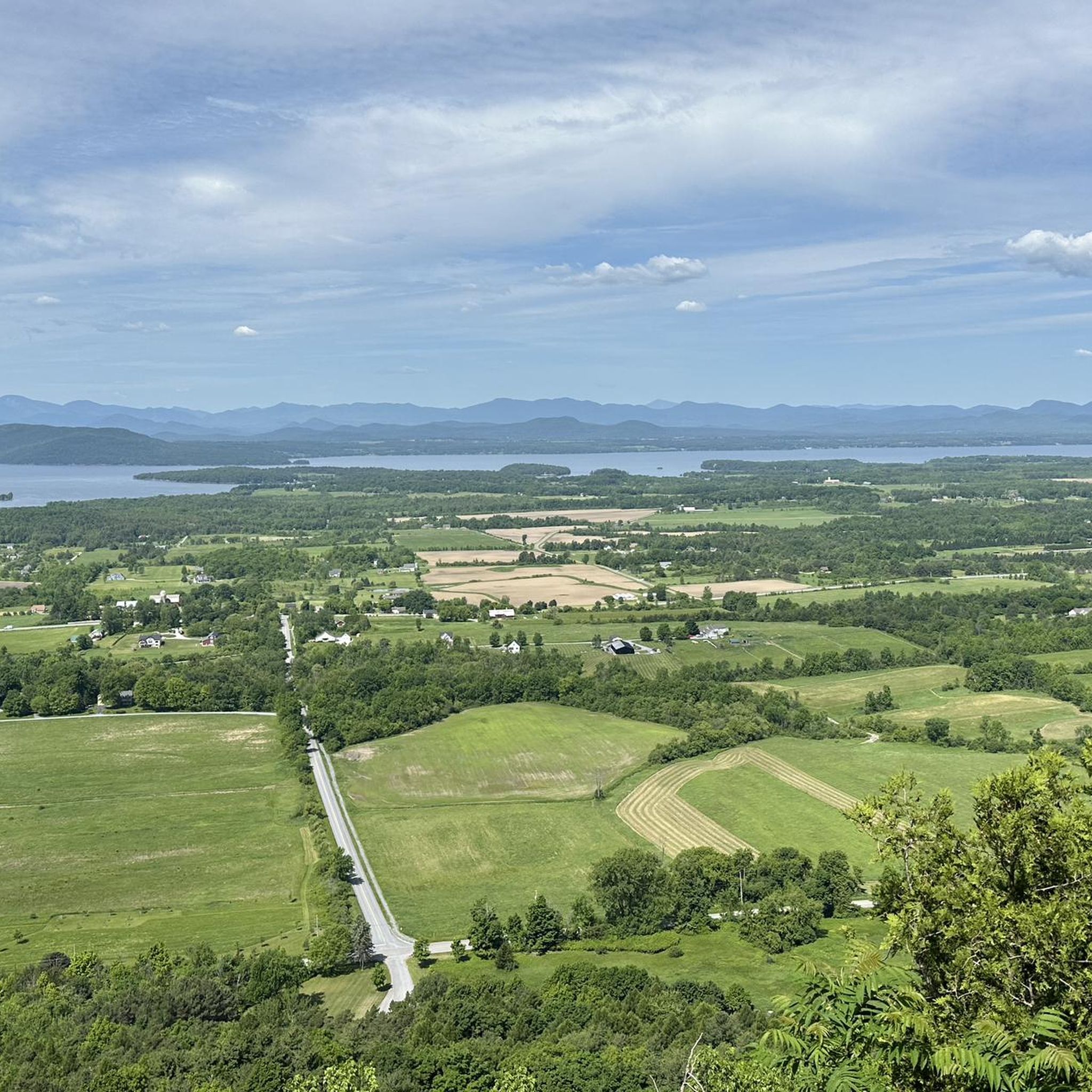
Mount Philo State Park is a nestled amidst the lush greenery of the Champlain Valley. It features a network of well-maintained walking trails and the most sublime views that stretch to Lake Champlain and the Adirondack Mountains to the west. The Green Mountains can be seen to the east and south.
0
0

Built around 1870, Holmes Creek Covered Bridge spans over a quiet inlet near Lake Champlain. This 41-foot wooden bridge—one of the shortest and lowest in the state—features a rare king post truss with a tied arch. Once vital for local orchards and hay wagons, it now stands as a charming relic just steps from the lakeshore.
0
0

From this section of the Burlington Greenway you can enjoy views of the North Beach, right off the path. If you want to stop for a break, it's a good spot for a swim or picnic. It has a sandy shoreline, restrooms, and a snack bar in summer. It can get crowded on weekends, but the lake views make it a worthwhile stop.
1
0

This 8-mile paved trail is one of the nicest cycleways in the city, knitting together neighborhoods, shops, restaurants and parks, with great views of Lake Champlain, too.
0
0
A small, cascading waterfall surrounded by a mix of forest and wetlands, it is easily accessible from the road. You can take a short detour to visit and even explore the trails around the waterfall.
0
0

Blanchard Beach is a public beach on Lake Champlain in Burlington, Vermont. Situated within Oakledge Park, it features a small sandy beach and easy access off of the Island Line Trail. From the beach, you can enjoy stunning views of the lake and the Adirondack Mountains. Facilities in the near by Oakledge Park include restrooms, picnic areas, shaded spots, and a large sundial, making it a perfect destination for locals and visitors alike.
0
0
Waterfront Park in Burlington, Vermont, is a scenic public park on the eastern shore of Lake Champlain. Known for its breathtaking views of the lake and the Adirondack Mountains, the park offers open green spaces, walking paths, and access to the Burlington Bike Path, making it a popular spot for outdoor activities like cycling, walking, and picnicking. The park also hosts numerous events and festivals throughout the year, including the Burlington Discover Jazz Festival and the Lake Champlain Maritime Festival.
1
0

The Burlington Greenway Bike/Walk Path is a jewel of our parks system and popular attraction all year round. Featuring eight miles of paved path, with aggregate shoulders for runners and walkers. Situated on the Lake Champlain shoreline, the path starts south of Oakledge park and runs north to the Winooski River. Along the way, the Greenway connects many major parks and facilities with residential neighborhoods and downtown Burlington commercial districts. The path is part of the Island Line Trail. The northern end of the Greenway features a few miles of packed gravel on a narrow causeway over western Lake Champlain, making for a spectacular view. Take the seasonal Bike Ferry to continue riding into the Champlain Islands. If you’re planning a bike trip, be sure to check out the helpful information on Local Motion’s website Restrooms (seasonal) are available at several points along the path: List of Public Restrooms Want to ride the path, but don’t have a bike? Check out these places for bike rentals. Be aware of ongoing construction on the Greenway, including engineering upgrades, updates for increased capacity, new “pause places”, and connections with recreation facilities. View the interactive map At certain times, the section of Path in Waterfront Park may be closed during events. Please read our official Path Closure Policy. Make sure to follow our guidelines for safe use:
0
0
Frequently Asked Questions
How many road cycling routes are available in Shelburne?
Shelburne offers a wide variety of road cycling routes, with over 70 different tours available. These routes cater to various skill levels, from easy rides to more challenging options.
What kind of terrain can I expect on Shelburne's road cycling routes?
The road cycling routes in Shelburne feature a diverse landscape, characterized by rolling terrain and river valleys. You'll find scenic waterfronts along Lake Champlain and Shelburne Bay, with views extending to the Green Mountains. The topography provides options for different fitness levels, from gentle rides to routes with moderate elevation gains.
Are there easy road cycling routes suitable for beginners in Shelburne?
Yes, Shelburne has numerous easy road cycling routes perfect for beginners or those looking for a relaxed ride. For instance, the Roadbike loop from Shelburne is an easy 15.5-mile (25.0 km) path that navigates through the area's rolling terrain, providing an accessible cycling experience. There are 24 easy routes in total.
What are some scenic viewpoints or landmarks I can see while road cycling in Shelburne?
Many routes offer stunning views. You can enjoy picturesque vistas of Lake Champlain and the Adirondack Mountains from Waterfront Park or View of Lake Champlain from Red Rocks Park. The Shelburne Bay – Overlook Park viewpoint loop from Red Rocks Park specifically takes you past Overlook Park, known for its scenic outlooks. You might also encounter historic elements like the Spade Farm Covered Bridge on some routes.
Are there any routes that pass by waterfalls or natural features?
Yes, the region features natural attractions like the LaPlatte River and its falls. The Overlook Park viewpoint – LaPlatte River Falls loop from Shelburne is an easy 14.4-mile (23.2 km) route that includes the LaPlatte River Falls. The LaPlatte River Marsh Natural Area is also an important habitat for migratory waterfowl, offering opportunities for exploration.
What is the best time of year to go road cycling in Shelburne?
The best time for road cycling in Shelburne is generally from spring through fall, when the weather is mild and the natural scenery is vibrant. During these seasons, you'll experience comfortable temperatures and clear views of Lake Champlain and the Green Mountains. Winter cycling is possible but requires appropriate gear for colder conditions.
Are there any family-friendly road cycling options in Shelburne?
While many road cycling routes are on public roads, some areas offer more family-friendly experiences. Shelburne Bay Park, for example, provides a dedicated bike and recreation path suitable for cycling. For specific routes, look for the 'easy' difficulty rating, such as the Overlook Park viewpoint loop from Baycrest Park, which is an easy 11.2-mile (18.0 km) ride.
What do other road cyclists enjoy most about road cycling in Shelburne?
The road cycling experience in Shelburne is highly rated by the komoot community, with an average score of 4.9 stars from over 10 reviews. Cyclists frequently praise the diverse landscapes, including the stunning Lake Champlain views, the varied rolling terrain, and the well-maintained routes that cater to different ability levels.
Are there any circular road cycling routes in Shelburne?
Yes, many of the road cycling routes in Shelburne are designed as loops, allowing you to start and end at the same point. Examples include the popular Champlain Bikeway: Shelburne-Charlotte Loop, a 27.9-mile (44.9 km) route, and the Roadbike loop from Shelburne.
Can I find routes with moderate difficulty for a more challenging ride?
Absolutely. Shelburne offers 45 routes categorized as moderate, providing a good balance of distance and elevation gain. The Champlain Bikeway: Shelburne-Charlotte Loop is a moderate 27.9-mile (44.9 km) trail that offers scenic vistas and a good workout.
Are there any specific parks or natural areas accessible by road bike in Shelburne?
Several parks and natural areas are easily accessible. Shelburne Bay Park offers bike paths and access to the bay. The LaPlatte Nature Park, encompassing 145 acres, features trails alongside the river, through woods, and hay fields, and can be reached via road cycling routes. The LaPlatte River Marsh Natural Area is also a significant natural habitat in the region.
Most popular attractions around Shelburne

Get inspired with the komoot mobile app


Explore more
Browse the best Road cycling routes in other regions.
