The best running trails around Brinnon
7
runners
3
runs
Jogging around Brinnon offers diverse running routes set against the backdrop of the Olympic Mountains and the Hood Canal. The region features varied terrain, from gentle paths along the Dosewallips River to more challenging inclines within the Olympic National Forest. Runners can explore trails leading to scenic waterfalls and through lush forests, providing a refreshing environment for outdoor exercise. This area provides a mix of accessible and varied running trails suitable for different fitness levels.
Best jogging routes around Brinnon
…Last updated: August 17, 2026
5
runners
9.98km
01:25
610m
610m
Hard run. Very good fitness required. Mostly paved surfaces. Suitable for all skill levels.
2
runners
4.78km
00:38
140m
140m
Moderate run. Good fitness required. Mostly paved surfaces. Suitable for all skill levels.

Sign up for free
7.40km
01:01
250m
250m
Moderate run. Good fitness required. Mostly paved surfaces. Suitable for all skill levels.
Our route recommendations are based on thousands of hikes, rides, and runs completed by other people on komoot.
Start today with a free account
Your next adventure awaits.
Login or Signup
Popular around Brinnon
Tips from the Community

This well-maintained trail begins with a gradual 250-foot ascent to the falls. The path levels out before the last 1/2 mile, where you get a nice incline before reaching the falls at 1,050 feet. In the spring, rhododendrons bloom, adding a splash of color and beauty to the surrounding green forest.
0
0
Dosewallips State Park is beautiful, with 425 acres surrounded by sound and sea, forest, beaches and deltas nestled along the Dosewallips River and the Hood Canal. There are 3.5 miles of trails with trees covered in moss, where you are likely to see amazing wildlife, including elk herds on the ground and bald eagles in the air. A Discovery pass is necessary for vehicle entrance to the park.
0
0
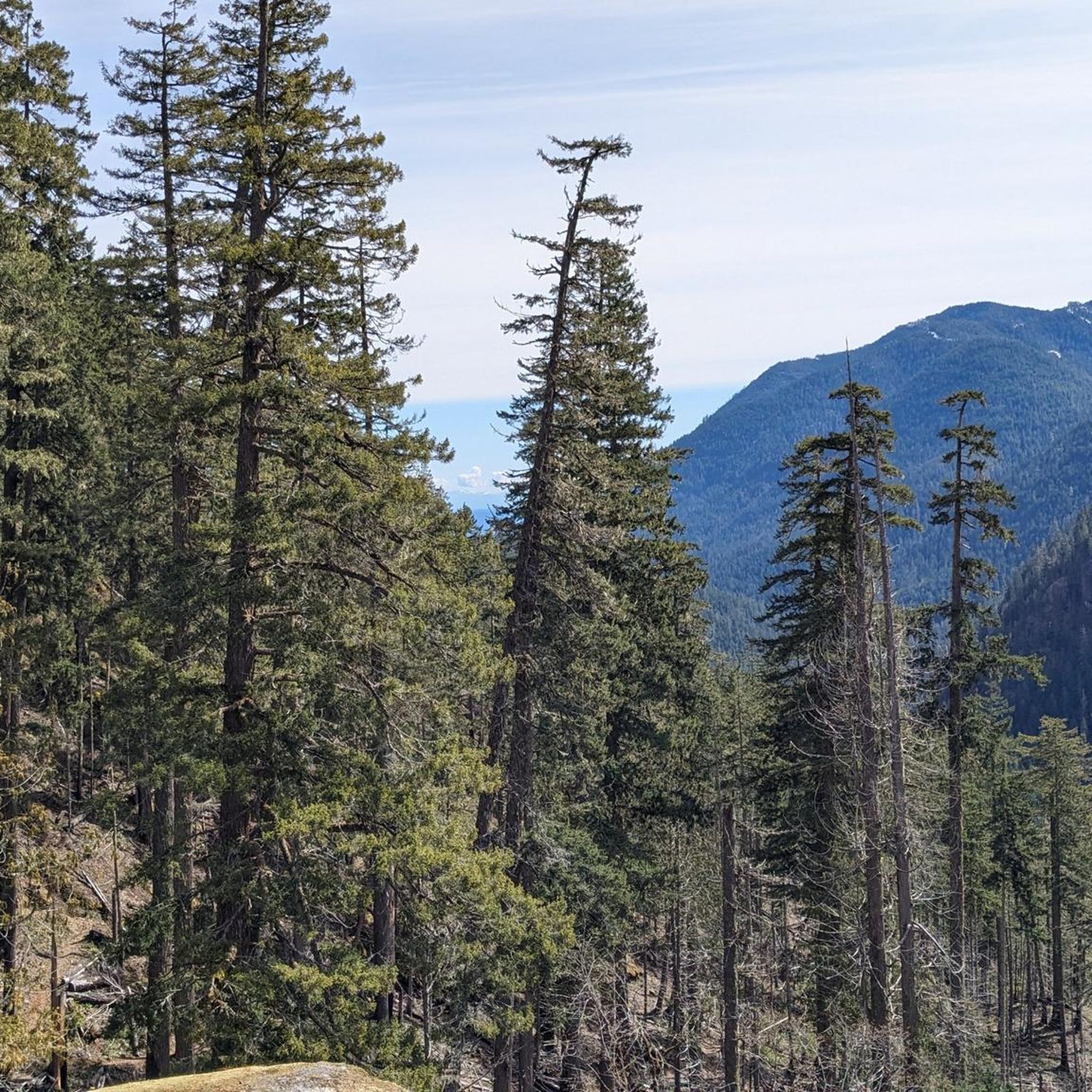
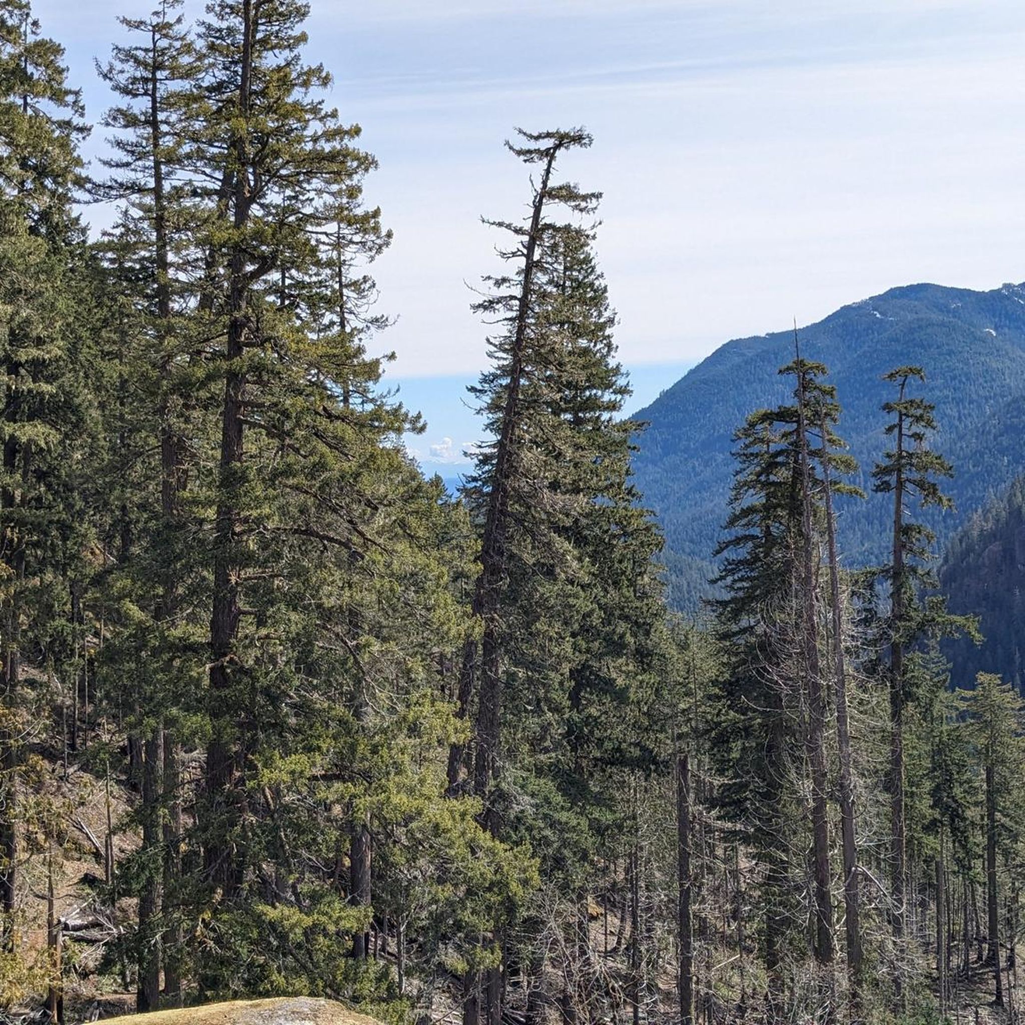
This trail takes you on a steep 2-mile run through switchbacks in a forest filled with Douglas fir. In the spring, you can enjoy beautiful salal, Oregon Grape and blooming Pacific rhododendrons (especially in June). It is a popular route for trail runners looking for a short jaunt to and from the summit.
0
0
This road makes its way around the northern portion of Mount Walker on moderate grades hidden within lush, dense forest. Once you reach the top, the road ends at a summit with two viewpoints, including a few benches and restrooms. From there, you can soak up the panoramic views before descending the steep Mount Walker Trail #894's relentless switchbacks to reach the end of a fantastic and challenging run.
0
0

The climb up can be a challenge, but the rewards are well worth it. From this viewpoint, you're treated to stunning 360 views. To the west, you'll catch a glimpse of Mt. Jupiter, the nearest high peak to Hood Canal. Further on, Mt. Constance stands as the third-highest peak in the Olympics, with its awe-inspiring rock faces. On exceptionally clear days, you'll even spot Mt. Baker to the northeast, the state's fourth-highest peak with a remarkable glacial system.
0
0
This beautiful and relatively unknown waterfall is 130 feet of roaring plunging water nestled in the middle of the lush green forest. If you visit during spring, you will see an added bonus of pink bursts of flowers blooming near the tiered falls.
0
0
Frequently Asked Questions
What kind of running trails can I expect in Brinnon?
Brinnon offers a diverse range of running trails, from gentle paths along the Dosewallips River to more challenging inclines within the Olympic National Forest. You'll find routes that lead to scenic waterfalls and through lush forests, providing a refreshing environment for outdoor exercise. The area provides a mix of accessible and varied running trails suitable for different fitness levels.
Are there any challenging running routes for experienced runners in Brinnon?
Yes, for those seeking a more strenuous run, the Mount Walker Trail loop Run — Olympic National Forest is an excellent choice. This difficult 6.2-mile (10.0 km) route features significant elevation gain, offering panoramic views of the Hood Canal, Mount Baker, and Mount Rainier on clear days.
Can I find any routes that feature waterfalls in Brinnon?
Absolutely! The Murhut Falls Trail Run — Olympic National Forest is a popular 4.6-mile (7.4 km) trail that leads through a former logging road directly to the beautiful Murhut Falls. Another easily accessible option is Rocky Brook Falls, just a short walk from the road, offering a spectacular 200-foot drop.
Are there any family-friendly jogging paths in Brinnon?
Yes, Dosewallips State Park offers several accessible paths suitable for families. The Maple Valley & Steam Donkey Loop Trail Run — Dosewallips State Park is a moderate 3.0-mile (4.8 km) route within the park that provides opportunities for wildlife spotting and is generally well-suited for a family outing.
What are some notable landmarks or viewpoints I might encounter while running in Brinnon?
Brinnon's running routes offer stunning natural scenery. From the summit of Mount Walker, accessible via the Mount Walker Trail loop Run, you can enjoy panoramic views of the Hood Canal, Mount Baker, Mount Rainier, and the Cascade Range. You can also visit the Mount Walker North Viewpoint. Many trails also run alongside the picturesque Hood Canal and the Dosewallips River.
How many jogging routes are available in the Brinnon area?
There are several dedicated jogging routes around Brinnon, with at least 3 highly-rated options featured in this guide. These routes showcase the best of the region's diverse landscape, from forest trails to mountain climbs.
What do other runners enjoy most about jogging in Brinnon?
Runners often praise Brinnon for its breathtaking natural beauty, with the Olympic Mountains and Hood Canal providing a stunning backdrop. The variety of terrain, from accessible state park paths to challenging mountain loops, is also highly appreciated, along with opportunities for wildlife spotting and discovering scenic waterfalls like Murhut Falls.
Are there any places to explore near the running trails in Brinnon?
Yes, beyond the running trails, Brinnon is rich with natural attractions. You can explore Dosewallips State Park, which offers additional hiking and biking trails. The Duckabush River and the Ranger Hole Trail are also nearby, providing more opportunities to immerse yourself in the region's natural beauty.
What is the typical length of running routes in Brinnon?
The running routes in Brinnon vary in length to suit different preferences. For example, the Maple Valley & Steam Donkey Loop Trail Run is about 3.0 miles (4.8 km), while the more challenging Mount Walker Trail loop Run extends to 6.2 miles (10.0 km).
Is Brinnon a good destination for trail running?
Absolutely. Brinnon is an excellent destination for trail running, offering diverse terrain from former logging roads to forest paths with significant elevation changes. The region's natural features, including the Olympic National Forest and scenic waterfalls, create a dynamic and rewarding environment for trail runners of all levels.
What kind of wildlife might I see while jogging in Brinnon?
The trails in Brinnon, especially within Dosewallips State Park, offer opportunities for wildlife spotting. Depending on the season and time of day, you might encounter elk, deer, and various bird species. The natural setting encourages a rich diversity of local fauna.
Are there any running routes that offer views of the Hood Canal?
Many routes in Brinnon provide glimpses or expansive views of the Hood Canal. The Mount Walker Trail loop Run, in particular, offers spectacular panoramic views of the Hood Canal from its higher elevations on clear days.
Most popular routes around Brinnon
Most popular attractions around Brinnon

Get inspired with the komoot mobile app


Explore more
Browse the best Running Trails & Routes in other regions.
