The best road cycling routes around Mead
4.6
(25)
202
riders
12
rides
Road cycling around Mead, Washington, offers diverse terrain for cyclists. The region features a network of paved paths, including sections of the Spokane River Centennial Trail, which follows the Spokane River through areas like Riverside State Park. Cyclists can also find routes through rolling hills and rural landscapes, as well as challenging climbs towards Mount Spokane. The area incorporates former railway lines converted into multi-use paths, providing accessible routes.
Best road cycling routes around Mead
- The most popular road cycling…
Last updated: October 5, 2026
5.0
(4)
64
riders
42.5km
01:40
130m
130m
Easy road ride. Great for any fitness level. Mostly well-paved surfaces and easy to ride.
4.3
(6)
26
riders
33.0km
01:28
180m
180m
Easy road ride. Great for any fitness level. Mostly well-paved surfaces and easy to ride.

7
riders
58.9km
02:40
530m
530m
Moderate road ride. Good fitness required. Mostly well-paved surfaces and easy to ride.
8
riders
13.8km
00:37
60m
60m
Moderate road ride. Great for any fitness level. Some segments of this route may be unpaved and difficult to ride.
4
riders
38.5km
01:47
400m
400m
Moderate road ride. Good fitness required. Mostly well-paved surfaces and easy to ride.
Get access to more routes and recommendations from other explorers.
Already have an account?
Our route recommendations are based on thousands of hikes, rides, and runs completed by other people on komoot.
Start today with a free account
Your next adventure awaits.
Tips from the Community

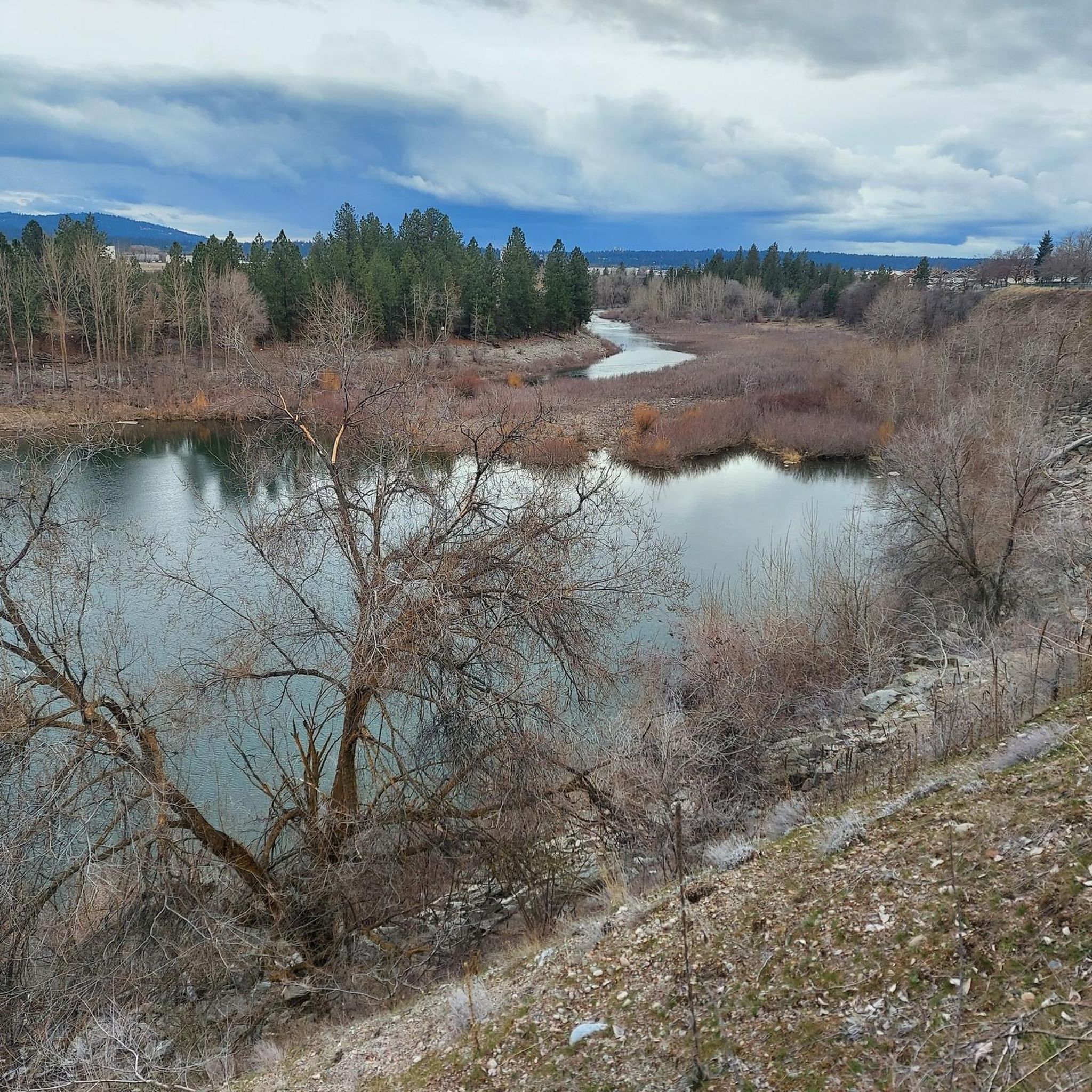
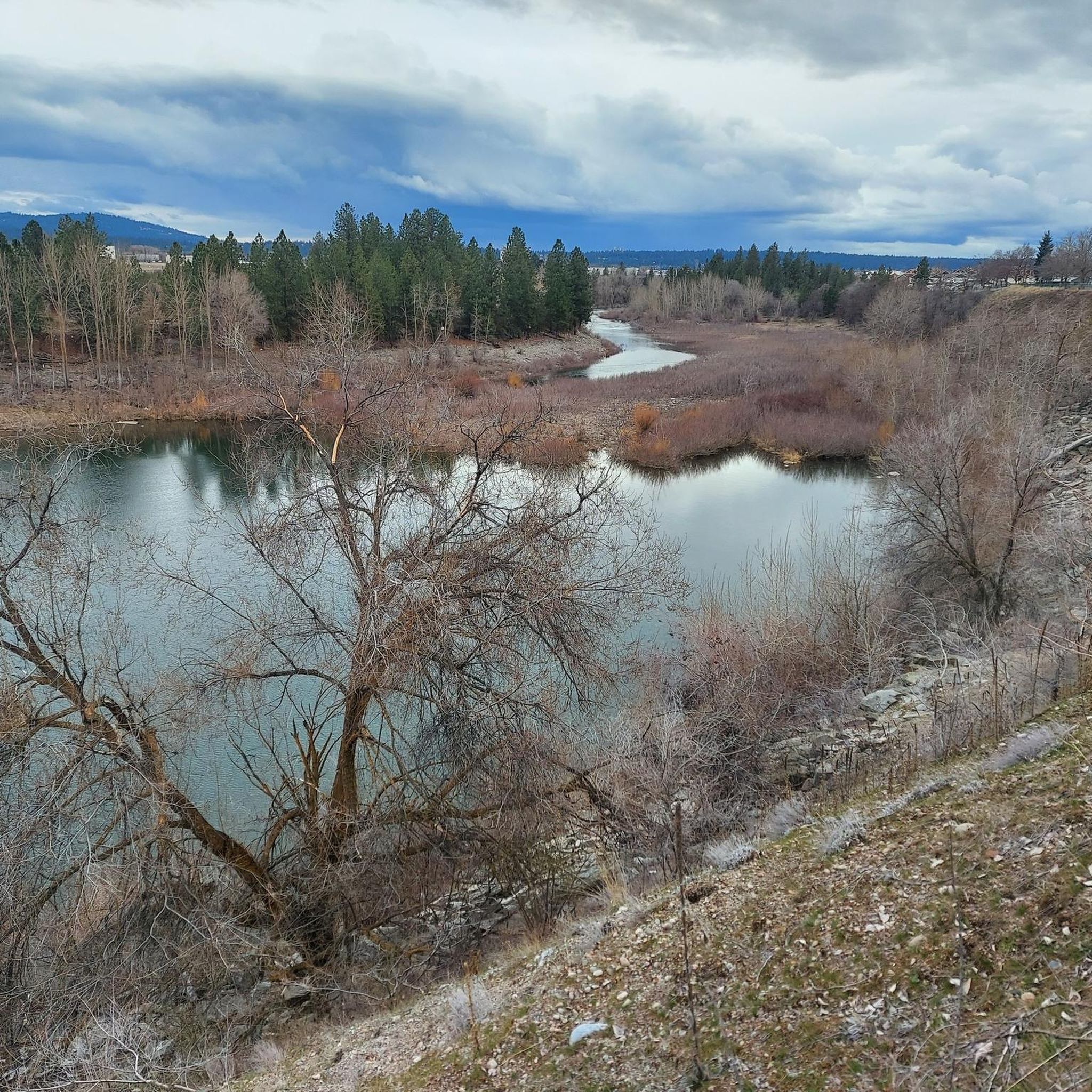
This park is along the Spokane River just before you enter Idaho. There is a dogpark section as well as trails along the river.
0
0
This section that starts in Hillyard is excellent. If you are cycling North and are feeling adventurous. You can exit at Lincoln Road and do the climb up to Mount St. Michael where there are some incredible views. Just be aware that it is a church and school.
0
0
Stop a minute and check out the view where the creek flows into the river before continuing on and up the hill.
0
0
Nice views of the calm waters of the Spokane River can be seen here. You can also see the Arborcrest Winery at the top of the hill. And take a few minutes to check out all the locks on the bridge. There are usually some quite interesting ones among the many common ones.
0
0
The viewpoint is nice. But I think the view from the bridge is better.
0
0
You get great photos if you walk onto the 9 Mile Bridge. Also while you are there check out the old employee cabins. There is a plaque and a short self guided tour.
0
0

A well-paved trail guides you to this spot. Within the vicinity, you'll discover several lookouts, each offering breathtaking views of the Nine Mile Dam.
0
0

The Children of the Sun Trail is a paved multi-use pathway in Spokane, Washington, that runs parallel to the North Spokane Corridor (SR 395). Upon completion, the trail will span approximately 10.3 miles, connecting the Wandermere area in the north to the Hillyard neighborhood in the south. The trail offers a safe route for cyclists and pedestrians, featuring some hilly terrain that provides a moderate workout. Parking is available at multiple points along the trail, including the Village Center Cinema parking lot at the northern end and near the intersection of East Columbia Avenue and North Market Street at the southern end.
0
0
Frequently Asked Questions
What types of road cycling routes can I find around Mead?
Mead offers a diverse range of road cycling experiences. You'll find leisurely paved paths like sections of the Spokane River Centennial Trail, routes through rolling hills and rural landscapes, and challenging climbs towards Mount Spokane. The area also features multi-use paths converted from former railway lines, providing accessible and generally flatter options.
How many road cycling routes are available in the Mead area?
There are over a dozen road cycling routes around Mead documented on komoot, catering to various skill levels. This includes 7 easy routes, 5 moderate routes, and 1 difficult route, ensuring options for every cyclist.
Are there any easy, family-friendly road cycling routes in Mead?
Yes, Mead has several easy routes suitable for families. The Children of the Sun Trail loop from John R. Rogers High School is a popular 33 km (20.5 miles) option that utilizes a rail-trail, offering a generally flat and accessible path. Another easy choice is the Upriver Dam Reservoir – Boulder Beach loop from Fairwood, which is 42 km (26.1 miles) long.
What are some scenic viewpoints or landmarks I can see while cycling around Mead?
The region is rich with scenic spots. Along routes, you can experience the Spokane River, Riverside State Park with its basalt formations and ponderosa pines, and the unique undulating hills of the Palouse region. Specific highlights include the Spokane River Centennial Trail itself, the Painted Rocks Nature Trail, and panoramic views from Beacon Hill.
Are there any challenging road cycling routes for experienced riders?
For experienced riders seeking a challenge, the Mead area offers routes with significant elevation gains. While not explicitly listed in the guide data, the region is known for demanding climbs towards Mount Spokane, with some routes covering substantial distances and ascents, providing rewarding views from the summit.
What is the best time of year for road cycling in Mead?
The best time for road cycling in Mead is generally during the warmer months, from spring through fall. Summer offers long daylight hours and pleasant temperatures, ideal for exploring. However, spring and fall provide cooler weather and often vibrant scenery, such as the wind-swept wheat fields of the Palouse region.
Are there any loop routes available for road cyclists?
Yes, many of the road cycling routes around Mead are designed as loops. For example, the Roadbike loop from Fairwood is a moderate 58.9 km (36.6 miles) path traversing rural roads. Another option is the Bowl and Pitcher Overlook – Riverfront Park loop from Town and Country, a longer 87.9 km (54.6 miles) route that takes you through areas near the Spokane River and Riverside State Park.
What do other road cyclists enjoy most about cycling in Mead?
The komoot community frequently praises the diverse terrain and scenic beauty of the Mead area. Cyclists appreciate the mix of traffic-free paved paths, challenging climbs, and picturesque rural roads. The presence of the Spokane River and natural features like Riverside State Park are often highlighted as key attractions. Over 50 road cyclists have used komoot to explore Mead's varied terrain.
Are there any routes that pass by rivers or offer water views?
Absolutely. The Spokane River is a prominent feature of the region's cycling landscape. Sections of the Spokane River Centennial Trail offer continuous scenic views of the river. The Bowl and Pitcher Overlook – Riverfront Park loop from Town and Country leads through areas near the Spokane River and Riverside State Park, providing excellent opportunities for water views.
Can I find routes that are suitable for a moderate fitness level?
Yes, there are several excellent options for cyclists with a moderate fitness level. The Deep Creek Bridge – 9 Mile Dam Viewpoint loop from Shadle Park High School is a moderate 36.2 km (22.5 miles) route. Another popular choice is the Roadbike loop from Fairwood, which is 58.9 km (36.6 miles) and traverses scenic rural roads.
Are there any conservation areas or parks accessible by road bike?
Yes, several routes take you through or near significant natural areas. The Spokane River Centennial Trail, for instance, runs through Riverside State Park. You can also find routes that provide access to areas like Camp Sekani Park and Holmberg Conservation Area, offering a chance to experience the region's natural beauty.
Most popular routes around Mead
Most popular attractions around Mead

Get inspired with the komoot mobile app


Explore more
Browse the best Road cycling routes in other regions.
