The best cycling routes around Picnic Point
4.3
(30)
298
riders
35
rides
Touring cycling around Picnic Point offers routes traversing urban greenways, lakefront paths, and riverfront trails. The region features moderate elevation changes, providing both flat sections and some challenging climbs. Routes often connect natural areas with residential zones, utilizing dedicated bike paths and quieter roads. The area is characterized by its coastal environment, views of Puget Sound, and varied landscapes including marshes and wooded areas.
Best touring cycling routes around Picnic Point
- The most popular touring cycling route is Edmonds/Lake Forest Park loop, a 27.3 miles (43.9 km) trail that takes 2 hours 51 minutes to complete. This difficult route includes significant elevation gain through varied terrain.
- Another top favourite among local touring cyclists is Lowell Riverfront Park – Lowell Riverfront Park loop from Ash Wy & 141st Pl SW, a moderate 19.5 miles (31.4 km) path. This route connects riverfront areas with urban sections, offering a mix of natural and developed scenery.
- Local touring cyclists also love the Floodwater reservoir – Green Lake Park loop from Beverly Acres, a 35.0 miles (56.4 km) trail leading through urban parks and around water features, often completed in about 3 hours 31 minutes.
- Touring cycling around Picnic Point is defined by lakefront paths, urban greenways, and riverfront trails. The network offers options for easy, moderate, and difficult routes, catering to different ability levels.
- The routes in Picnic Point are highly rated by the komoot community with an average score of 4.4 stars from around 18 reviews. More than 280 touring cyclists have used komoot to explore Picnic Point's varied terrain.
Last updated: July 9, 2026
4.0
(1)
5
riders
44.0km
02:51
560m
560m
Cycle the difficult Edmonds/Lake Forest Park loop, a 27.3-mile touring bicycle route with 1848 feet of elevation gain near Seattle.
44.7km
02:42
350m
350m
If you're seeking a diverse touring cycling experience near Everett, Washington, the Silver Lake - Mill Creek loop delivers a moderate 27.7 miles (44.7 km) ride with 1157 feet (353 metres) of elevation gain, typically completed in about 2 hours and 41 minutes. This route takes you through a compelling mix of urban and natural settings, offering intermittent glimpses of Mill Creek and expansive views of Silver Lake from various public parks, including Thornton A. Sullivan Park.
The loop is predominantly paved, but be prepared for some unpaved sections and moderate hills that will test your fitness. Hauge Homestead Park is a popular and convenient starting point, providing essential amenities like restrooms and water. For optimal preparation, carry a spare tube and tools, and consider full fenders if you're riding in potentially wet conditions.
This recognized cycling route is a great option for those looking for engaging Silver Lake Mill Creek loop touring cycling routes that combine a good workout with varied scenery. It's frequently used for organized rides, highlighting its appeal as a local favorite for cyclists in the Snohomish County area.

Sign up for free
12
riders
The Lowell Riverfront Park loop from Ash Wy & 141st Pl SW offers a delightful touring cycling experience, tracing the scenic Snohomish River. You'll glide past towering cottonwood trees and birch groves, keeping an eye out for local wildlife like eagles and river otters. On a clear day, the ride rewards you with stunning panoramic views of the Cascade Mountains, including the majestic Mount Baker and Mount Rainier, making for a truly memorable outing.
Starting conveniently from Ash Wy & 141st Pl SW, this moderate 19.5-mile (31.4 km) route with 861 feet (262 metres) of elevation gain is a great option for a two-hour ride. The park provides useful amenities like restrooms and picnic spots, and the trail is accessible year-round. Consider an early start to fully appreciate the tranquility and maximize your chances for those expansive mountain vistas.
This route showcases the successful transformation of a former industrial site into a vibrant community park, blending natural beauty with a touch of local history. The trail itself is largely paved and wide, though some sections might include well-groomed gravel, offering a varied cycling surface. It's a fantastic way to explore the area, combining a good workout with abundant opportunities for wildlife spotting and enjoying the peaceful riverfront atmosphere.
9
riders
49.0km
03:13
700m
700m
Hard bike ride. Very good fitness required. Mostly paved surfaces. Suitable for all skill levels.
5.0
(3)
15
riders
15.6km
00:58
100m
100m
Easy bike ride. Great for any fitness level. Mostly paved surfaces. Suitable for all skill levels.
Get access to more routes and recommendations from other explorers.
Sign up for free
Already have an account?
Our route recommendations are based on thousands of hikes, rides, and runs completed by other people on komoot.
Start today with a free account
Your next adventure awaits.
Login or Signup
Popular around Picnic Point

Tips from the Community

This northerly portion of Brackett's Landing Park has a sand beach (sometimes very crowded) and a rock jetty. There's also an underwater "city" deliberately plotted for SCUBA divers to explore. Even if you don't dive, it's fun to watch them do their thing.
0
0
All told, this paved multiuse trail runs for 24 miles from Shoreline to Everett. It's popular for both bicycle and foot-powered commuting, and this section takes you close to Lake Ballinger and, a little further to the north, Ballinger Park.
0
0

Lowell Riverfront Park is perfect for walking, biking, or relaxing with river views. The park features paved trails and open green spaces.It’s a great place for a picnic or a quiet stroll, especially during sunrise or sunset. The park is family-friendly, but it’s also a nice escape for anyone looking to unwind in nature.
0
0
Lowell Riverfront Park is perfect for walking, biking, or relaxing with river views. The park features paved trails and open green spaces.It’s a great place for a picnic or a quiet stroll, especially during sunrise or sunset. The park is family-friendly, but it’s also a nice escape for anyone looking to unwind in nature.
0
0

I like this place. Not just because there is a bathroom, but because it really is a nice place to stop.
0
0
It's red. It's a door. and it's been out standing in its field for 30+ years. Yeah.
0
0
This is a steep hill. Fun to go down, a workout to climb back up. Even so, it beats the alternative bike lane along Meridian Avenue - you are in among the trees with no cars whizzing past you at 40 mph. Take a deep breath and gear waaay down...
0
0

Located just 5.5 miles (8.85 km) south of Everett along the Bothell-Everett Highway, this suburban lake is ideal for boating, fishing, and swimming. It is surrounded by three city parks with public access, including Thornton A. Sullivan Park on the west side, which offers ample shoreline and public bathrooms.
0
0
Frequently Asked Questions
What kind of terrain can I expect when touring cycling around Picnic Point?
Touring cycling routes around Picnic Point feature a mix of urban greenways, lakefront paths, and riverfront trails. The landscape includes moderate elevation changes, offering both flat sections and some challenging climbs. Routes often connect natural areas with residential zones, utilizing dedicated bike paths and quieter roads.
How many touring cycling routes are available in the Picnic Point area?
There are over 40 touring cycling routes available around Picnic Point, catering to various skill levels. You'll find 10 easy routes, 23 moderate routes, and 10 difficult routes to explore.
Are there any family-friendly touring cycling routes in Picnic Point?
Yes, Picnic Point offers several easy touring cycling routes suitable for families. These routes typically feature gentler terrain and dedicated paths, making them enjoyable for all ages. For a moderate option that connects lakefront areas with a dedicated trail, consider the Lake Ballinger Beach – Interurban Trail loop from Mountlake Terrace.
What are some good options for beginner touring cyclists in Picnic Point?
Beginner touring cyclists will find 10 easy routes around Picnic Point. These routes are designed with less elevation gain and often follow paved paths or quiet roads, providing a comfortable introduction to the area's cycling opportunities.
What are the best times of year for touring cycling in Picnic Point?
The best times for touring cycling in Picnic Point are generally spring, summer, and early autumn. During these seasons, the weather is typically mild, and the paths are clear, offering ideal conditions for enjoying the lakefront and urban greenways. Winter cycling is possible, but be prepared for cooler temperatures and potentially wet conditions.
Are there any circular touring cycling routes around Picnic Point?
Yes, many of the touring cycling routes in Picnic Point are designed as loops, allowing you to start and end at the same point. Examples include the challenging Edmonds/Lake Forest Park loop and the moderate Lowell Riverfront Park – Lowell Riverfront Park loop from Ash Wy & 141st Pl SW.
What interesting places can I explore along the touring cycling routes?
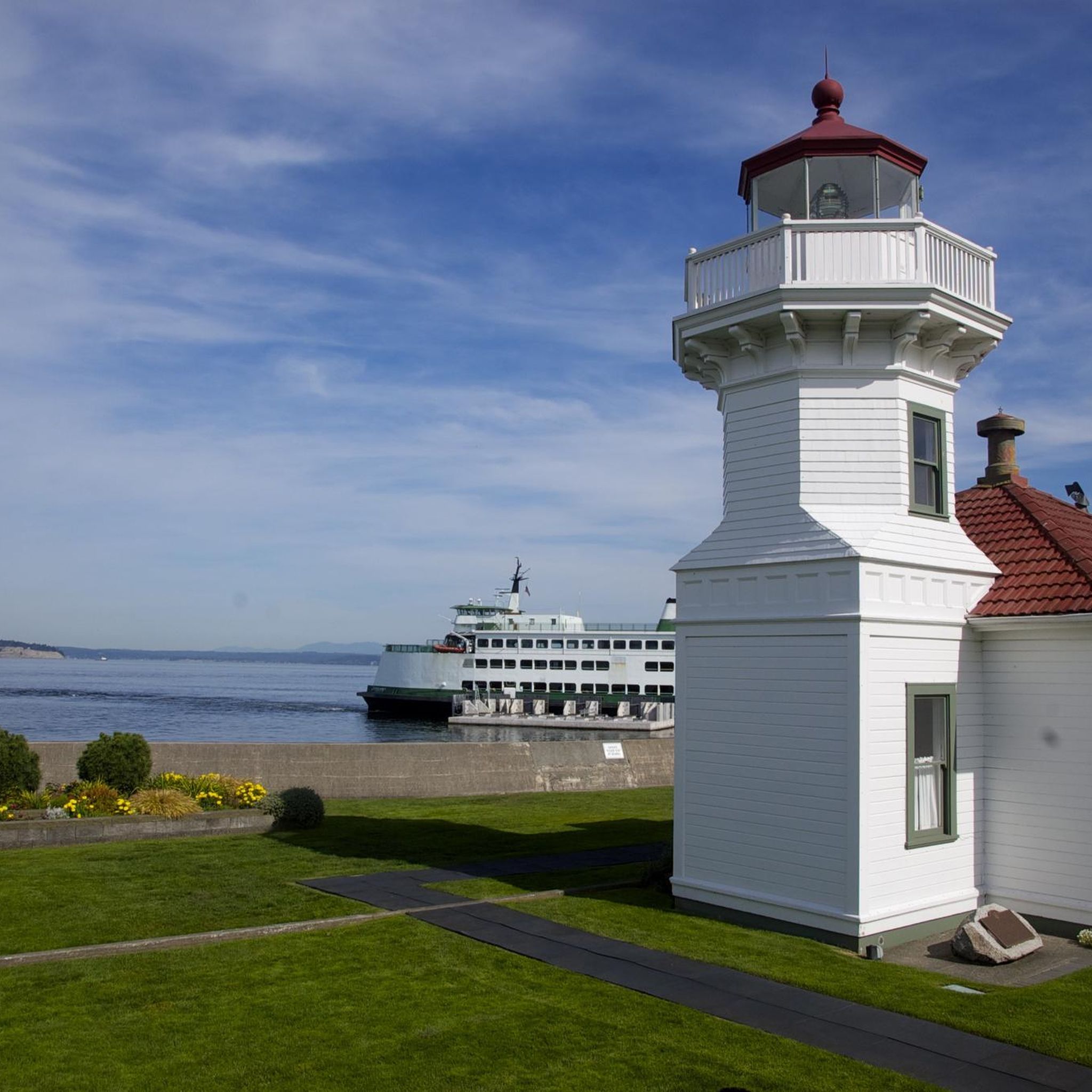
Along the touring cycling routes, you can explore various points of interest. The Interurban Trail is a prominent cycleway, and you might pass by coastal spots like Brackett's Landing or the historic Mukilteo Lighthouse. For a natural escape, routes can lead near Lynndale Park.
What do other touring cyclists enjoy most about cycling in Picnic Point?
The area is highly rated by the komoot community, with an average score of 4.5 stars from around 25 reviews. Reviewers often praise the varied terrain, which includes lakefront paths, urban greenways, and riverfront trails, offering a diverse cycling experience for different ability levels.
Are there any challenging touring cycling routes in Picnic Point?
For experienced touring cyclists seeking a challenge, Picnic Point offers 10 difficult routes. These often feature significant elevation gains and cover longer distances. An example is the Deer Lake – The Red Door loop from Possession Point State Park, which includes over 700 meters of elevation gain.
Can I find routes that connect natural areas with urban environments?
Yes, many routes in Picnic Point seamlessly blend natural landscapes with urban settings. For instance, the Floodwater reservoir – Green Lake Park loop from Beverly Acres takes you through urban parks and around water features, showcasing the region's diverse scenery.
Most popular routes around Picnic Point
Most popular attractions around Picnic Point

Get inspired with the komoot mobile app


Explore more
Browse the best Cycling routes in other regions.
