The best road cycling routes around Summit View
4.9
(15)
601
riders
10
rides
Road cycling around Summit View features routes that traverse varied terrain, including foothills and river valleys. The region offers a mix of paved roads and dedicated trails, providing diverse cycling experiences. Elevation gains are moderate, with several routes presenting rolling hills suitable for road cyclists seeking a challenge. The landscape is characterized by open stretches and areas near waterways, offering a blend of scenic and engaging rides.
Best road cycling routes around Summit View
- The most popular road cycling route…
Last updated: October 1, 2026
5.0
(4)
163
riders
61.9km
02:32
300m
300m
Moderate road ride. Good fitness required. Mostly well-paved surfaces and easy to ride.
5.0
(1)
111
riders
27.6km
01:03
60m
60m
Easy road ride. Great for any fitness level. Mostly well-paved surfaces and easy to ride.

5.0
(1)
21
riders
41.0km
01:39
190m
190m
Easy road ride. Great for any fitness level. Mostly well-paved surfaces and easy to ride.
5.0
(1)
14
riders
83.7km
03:11
140m
140m
Moderate road ride. Good fitness required. Mostly well-paved surfaces and easy to ride.
6
riders
95.4km
04:01
420m
420m
Moderate road ride. Good fitness required. Some segments of this route may be unpaved and difficult to ride.
Get access to more routes and recommendations from other explorers.
Already have an account?
Our route recommendations are based on thousands of hikes, rides, and runs completed by other people on komoot.

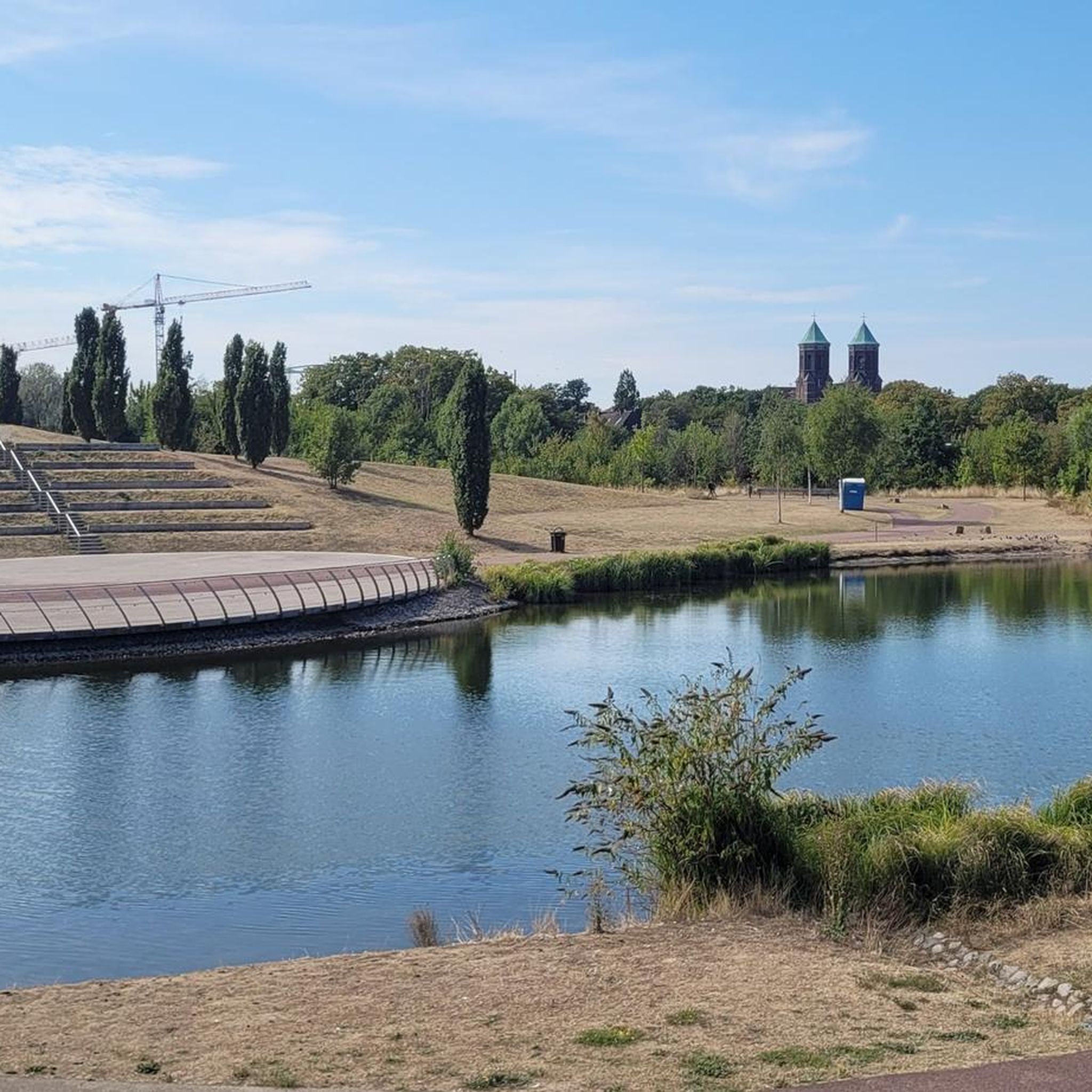

Tips from the Community

Just a simple bridge with Voight Creek views.
0
0
The Foothills Trail is a mostly paved 21-mile path from Puyallup toward Mount Rainier, perfect for walking, biking, and horseback riding. Enjoy views of Mount Rainier, wildlife, and historic sites like Melmont ghost town. Multiple access points make it easy to explore sections at your pace.
1
0

The Green River Natural Resources Area (GRNRA), just east of Van Doren's Landing Park in Kent, is a hidden gem along the Green River Trail, especially for birders, cyclists, and walkers who enjoy a mix of wetland, prairie, and river views all in one place. Originally developed as a stormwater treatment facility, the area now serves a dual purpose: it filters urban runoff and provides essential habitat for wildlife. The result is a 304-acre patchwork of restored wetlands, ponds, and native plantings that feel far more wild than their suburban surroundings suggest. From the trail, especially near Van Doren’s Landing, you’ll see viewing platforms and side paths leading into the heart of the GRNRA. Expect to spot herons, ducks, red-winged blackbirds, and—if you're lucky—bald eagles or osprey. Interpretive signs explain the ecology and the city’s innovative use of the land. It’s also a great stop for a break if you’re riding—plenty of benches and low-traffic paths make it easy to linger. Let me know if you want a good loop or spur trail that includes both the Green River Trail and the GRNRA.
0
0

Love this bridge. Would love it more if the trail actually crossed over the old broken bridge just one tenth of a mile farther north...
0
0

This is a fantastic viewpoint along the river, and the paved section of trail here is easily done on a road bike.
0
0

The Foothills Trail parallels the Carbon River for many miles, but your view is often obscured by foliage. Here you get a clear view of the river from the trail, as well as the verdant flora overhanging its banks.
0
0

This 10+ acre park along the Green River is great for families. There's a playground and climbing structure for the kids as well as plenty of grassy fields for picnics. The park is also a great place to get on the Green River Trail, which runs for nearly 20 miles across King County.
0
0
This is a fantastic trail that follows the Green River, meandering back and forth down the Kent valley. This particular spot has recently been revamped and is a great park!
0
0
Frequently Asked Questions
How many road cycling routes are available in Summit View?
There are over 10 road cycling routes available around Summit View, offering a variety of experiences for different skill levels. These routes are highly rated by the komoot community, with an average score of 4.8 stars.
What kind of terrain can I expect when road cycling in Summit View?
Road cycling in Summit View features diverse terrain, including rolling foothills and scenic river valleys. While many routes offer moderate elevation changes, some, like the Southeast Green Valley Road loop from Puyallup, provide more significant and sustained climbing experiences. The region combines paved roads with dedicated trails, ensuring varied cycling environments.
Are there routes suitable for beginners or less experienced road cyclists?
Yes, Summit View offers several routes suitable for beginners. Out of the 11 available routes, 6 are classified as easy, providing gentle rides through varied terrain. An example is the Foothills Trail loop from Waller, which is 25.4 miles long with moderate elevation.
Are there challenging routes for experienced road cyclists?
Absolutely. For experienced road cyclists seeking a challenge, there are 5 moderate routes available. The Southeast Green Valley Road loop from Puyallup is a notable option, offering the most significant elevation gain in the area over its 58.5 miles, providing a sustained climbing experience.
What scenic views or natural features can I expect along the road cycling routes?
Road cycling routes in Summit View often traverse areas with open stretches and sections near waterways, offering picturesque views of river valleys and natural landscapes. Depending on the specific 'Summit View' region, you might encounter anything from alpine vistas and majestic peaks to large lakes and lush forests, as seen in areas like Summit County, Colorado, or near Glacier National Park.
Are there any long-distance road cycling routes in Summit View?
Yes, for those looking for longer rides, Summit View has several options. The Southeast Green Valley Road loop from Puyallup is a substantial 58.5-mile route, and the Foothills Trail – Rest Stop by the Carbon River loop from McMillin covers nearly 43.3 miles, providing ample distance for endurance cyclists.
Can I find loop routes for road cycling in Summit View?
Many of the road cycling routes in Summit View are designed as loops, offering convenient starting and ending points. Examples include the popular Foothills Trail – Rest Stop by the Carbon River loop from South Hill and the Foothills Trail – Long drag of a climb loop from Pierce County Airport.
What do other cyclists say about the road cycling routes in Summit View?
The road cycling routes in Summit View are highly regarded by the komoot community, boasting an impressive average rating of 4.8 stars from over 15 reviews. Cyclists often praise the varied terrain, the mix of paved roads and dedicated trails, and the engaging rides through foothills and river valleys.
What is the best time of year to go road cycling in Summit View?
The best time for road cycling in Summit View generally aligns with warmer, drier months, typically from late spring through early autumn. This period offers the most favorable weather conditions for enjoying the diverse terrain and scenic views. Some regions, like those in mountainous areas, may even offer unique 'car-free' seasons on certain roads, providing exceptional cycling experiences.
Are there any specific landmarks or points of interest to look out for?
While specific landmarks vary by the exact location within the broader 'Summit View' regions, many routes offer views of natural features like river valleys and open landscapes. In some 'Summit' areas, you might encounter iconic routes such as Trail Ridge Road in Rocky Mountain National Park, known for its alpine vistas, or scenic lake views around Flathead Lake in Montana.
Most popular routes around Summit View
Most popular attractions around Summit View

Get inspired with the komoot mobile app


Explore more
Browse the best Road cycling routes in other regions.
