The best cycling routes around Cheat Lake
5.0
(5)
103
riders
19
rides
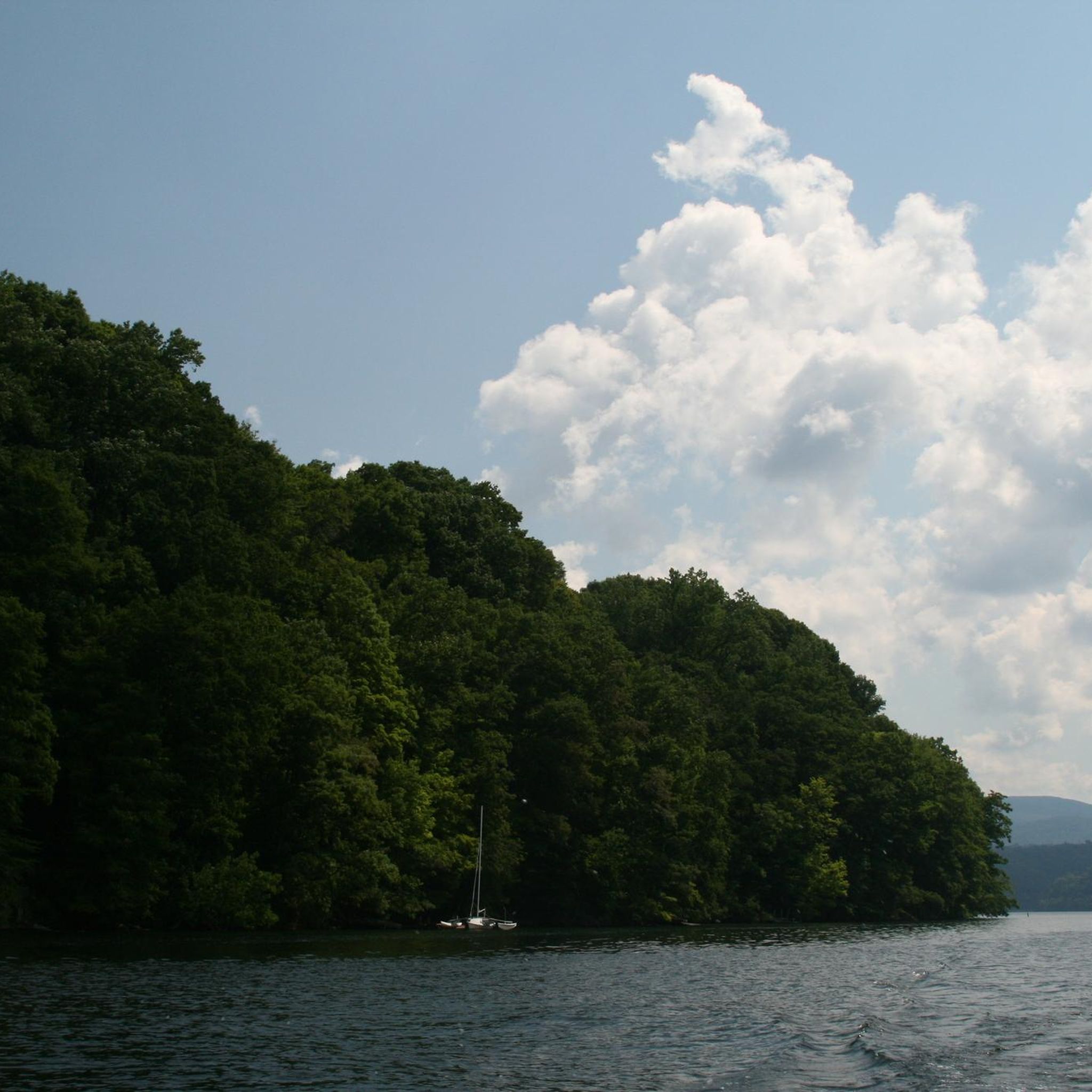
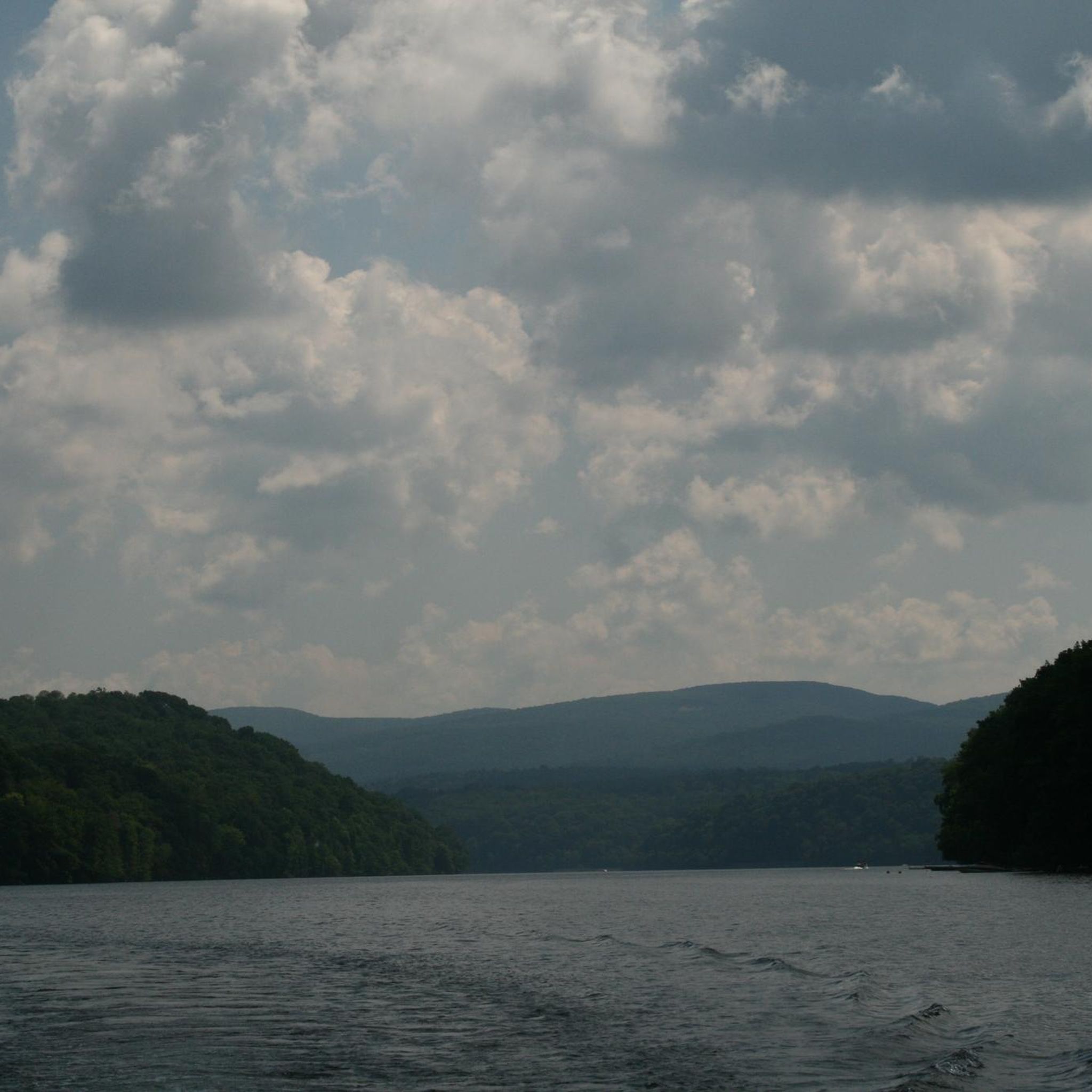
Touring cycling routes around Cheat Lake are set within a landscape characterized by a large man-made reservoir, dense woodlands, and varied elevation changes. The region features accessible trails, including former railroad rights-of-way, offering continuous views of the lake and surrounding forests. Terrain ranges from smooth, crushed limestone paths to more challenging routes with significant elevation gain, providing diverse options for cyclists.
Best touring cycling routes around Cheat Lake
- The most popular touring cycling route is Cheat Lake Trail, a 7.1 miles (11.4 km) trail that takes about 45 minutes to complete. This scenic path follows the northeastern shoreline of the lake, offering continuous views and a smooth, crushed limestone surface.
- Another top favourite among local touring cyclists is Morgantown to Mount Morris loop via Caperton Trail, a moderate 20.7 miles (33.3 km) path. This route offers river views and varied surfaces, typically completed in about 2 hours.
- Local touring cyclists also love the Deckers Creek Trail Loop, a 31.9 miles (51.4 km) trail leading through scenic West Virginia woodlands and waterways, often completed in about 3 hours 20 minutes.
- Touring cycling around Cheat Lake is defined by expansive lake views, dense woodlands, and river valleys. The network offers options for different ability levels, from easy, accessible paths to more challenging routes with significant climbs.
- The routes in Cheat Lake are highly rated by the komoot community with an average score of 5.0 stars from 2 reviews. More than 80 touring cyclists have used komoot to explore Cheat Lake's varied terrain.
Last updated: June 23, 2026
3
riders
31.6km
02:02
290m
270m
The Mon River Trail South offers a delightful touring cycling experience, winding through a picturesque wooded river valley alongside the Monongahela River. You'll find yourself on a well-packed crushed limestone surface, smooth enough for a comfortable ride, with plenty of opportunities to spot wildflowers, rock outcroppings, and scenic river views. This trail is a fantastic option for anyone seeking a relaxed ride in a natural setting, especially if you appreciate a touch of history along the way.
Planning your trip is straightforward, as the trail is consistently rated as easy with minimal elevation gain, making it ideal for families and touring cyclists of moderate ability. The southern end at Pricketts Fort State Park provides convenient amenities like parking, restrooms, and even a restaurant, making it a great access point. You can easily complete this 19.6-mile (31.6 km) route, with its 962 feet (293 metres) of elevation gain, in about 2 hours and 1 minute.
This trail is a key part of the larger Mon River Rail-Trail System, offering a gentle grade because it follows a former CSX rail line. Its connection to Pricketts Fort State Park, a significant historical site with an 18th-century frontier outpost, adds a unique cultural dimension to your ride. The Mon River Trail South is also notable for being wheelchair accessible, ensuring a welcoming experience for a wide range of visitors.
2
riders
51.4km
03:22
610m
620m
The Deckers Creek Trail Loop offers a dynamic touring cycling adventure, transitioning from paved urban paths to a well-maintained crushed limestone surface as it winds through West Virginia's varied landscape. You'll follow Deckers Creek, encountering dramatic rapids, beautiful waterfalls around miles 7, 12, and 13, and impressive rock outcroppings, all framed by forests of hardwoods and rhododendrons. This difficult 31.9-mile (51.4 km) route, with its 2013 feet (614 metres) of elevation gain, provides a consistent challenge over approximately 3 hours and 22 minutes, making it ideal for cyclists seeking a strenuous ride with rewarding natural scenery.
Planning your ride on the Deckers Creek Trail Loop is straightforward, with multiple access points and parking areas available along the route. Restrooms are conveniently located at Hazel Ruby McQuain Park and Marilla Park in Morgantown. Given the significant elevation gain and difficulty, it's wise to check weather patterns for Morgantown, West Virginia, and consider an early start to make the most of cooler temperatures, especially during summer months.
This trail is a proud part of the 48-mile Mon River Rail-Trail System and is recognized by the Rails-to-Trails Conservancy's Rail-Trail Hall of Fame, following a former railroad corridor. Beyond its natural beauty, the route offers glimpses into the region's past, including historical sites like the Bretz Coke Ovens. Its connection to the Caperton Trail and Mon River Trail also opens up possibilities for extended touring cycling routes, allowing you to explore more of West Virginia's scenic trails.

Sign up for free
3
riders
11.4km
00:45
140m
140m
The Cheat Lake Trail offers a delightful touring cycling experience, winding along the shores of Cheat Lake on a smooth, crushed limestone path. You'll enjoy continuous, expansive views of the lake and surrounding dense woodlands, with opportunities to spot local wildlife, especially near the nature viewing area at Greystone. This easy 7.1-mile (11.4 km) route, with a gentle 451 feet (137 metres) of elevation gain, is perfect for a relaxed ride that takes about 45 minutes.
This family-friendly trail is largely flat, making it accessible for all skill levels. While the trail itself is easy, be mindful that some access points, particularly on the Lake Lynn side, may involve steep hills or stairs where you might need to carry your bike. The trail also provides amenities like picnic tables, restrooms, and boat docks, making it suitable for a longer visit.
As a former rail corridor, the Cheat Lake Trail boasts a consistent, forgiving surface and is part of a larger network of rail-trails in the region. Its accessibility and numerous features, including fishing piers and a playground, make it a popular choice for those seeking an easy, scenic ride with plenty of options for recreation along the way.
1
riders
58.7km
04:06
1,070m
1,070m
Embark on a challenging touring cycling adventure from Morgantown to Coopers Rock State Forest, a difficult 36.5-mile (58.7 km) route that promises diverse landscapes and a rewarding climb. You'll pedal along the Monongahela River, then follow the Deckers Creek Trail past dramatic rapids and through lush rhododendron thickets. The journey culminates in a significant ascent to the Coopers Rock Overlook, where breathtaking panoramic views await.
This demanding ride, with its 3495 feet (1065 metres) of elevation gain, typically takes around 4 hours and 6 minutes. Be aware that portions of the route, especially within Coopers Rock State Forest, can be unpaved and rugged, potentially requiring you to dismount. Cyclists should plan their route carefully to avoid high-speed traffic on I-68, which is unsuitable for touring bikes.
Beyond the stunning overlook, the area is rich in history, with sites like the Henry Clay Iron Furnace. The Deckers Creek Trail itself is considered a gem of the interconnected Mon River Rail-Trail System, offering glimpses into the region's railroading and coal mining past. This route is a true test of endurance, perfect for experienced cyclists seeking a memorable West Virginia experience.
1
riders
33.3km
02:01
260m
260m
The Morgantown to Mount Morris loop via Caperton Trail offers a delightful touring cycling experience, transitioning from urban riverfronts to secluded wooded paths. Starting on the paved Caperton Trail, you'll glide past downtown parks and the West Virginia University Core Arboretum, with continuous views of the Monongahela River. Further north, the Mon River Trail's compacted crushed limestone surface leads you through more natural settings, revealing wildflowers and a tranquil atmosphere.
This moderate 20.7-mile (33.3 km) route, with 856 feet (261 metres) of elevation gain, can be completed in about 2 hours. While the Caperton Trail is fully paved, the Mon River Trail North section is best suited for gravel or hybrid bikes for optimal comfort. Hazel Ruby McQuain Riverfront Park is a convenient starting point with good access, and the trail's flat grade makes it accessible for many skill levels.
As part of the extensive Mon River Rail-Trail system, this route highlights the region's successful rail-to-trail conversions. The trail's flat profile is a testament to its former life as a railway line, offering a smooth ride for cyclists. You'll find numerous eateries and amenities easily accessible along the Morgantown sections, making it a great option for a day trip combining activity with local exploration.
Get access to more routes and recommendations from other explorers.
Sign up for free
Already have an account?
Our route recommendations are based on thousands of hikes, rides, and runs completed by other people on komoot.
Start today with a free account
Your next adventure awaits.
Login or Signup


Tips from the Community

The cliffs at Coopers Rock Overlook are one of the main attractions on the entire property. There are fences and barriers at most of the cliff edges, but it's still smart to be "edge aware" while in the viewing area. There are some binoculars that take quarters that you can use to get a better view of the surrounding skylines and ridges. This overlook is just a short walk from the main parking area, so it's one of the more crowded spots within the park. As you branch off on some of the hiking trails, you instantly get more solitude and really get to experience the peacefulness of this state forest.
0
0

This riverside park is a great spot to take a break and enjoy views of the river. There are picnic areas, a kayak launch and restroom facilities.
0
0

Cheat Lake spans across 1,730 acres and is a man-made reservoir, with certain areas known as "the backwaters," ideal for activities like swimming, canoeing, kayaking, and fishing. At this point, you'll find the end of the Cheat Lake Trail, providing a pleasant spot to pause and enjoy some remarkable views.
0
0
Cheat Lake spans across 1,730 acres and is a man-made reservoir, with certain areas known as "the backwaters", ideal for activities like swimming, canoeing, kayaking, and fishing. At this point, you'll find the end of the Cheat Lake Trail, providing a pleasant spot to pause and enjoy some remarkable views.
1
0
The Mon River Rail Trail South runs from Morgan town to Prickett’s Fort State Park. It is an 18 mile long, wooded trail that follows the Monongahela River and is completely traffic-free.
0
0
Pricketts Fort State Park is a reconstruction of an old colonial fort. The site is open to visitors to learn more about the fort and life at the time. More information can be find at: https://wvstateparks.com/park/pricketts-fort-state-park/
0
0
This riverside park is a great spot to take a break and enjoys views of the river. There are picnic areas, a kayak launch and restroom facilities.
1
0

The current marker is at the bottom of the falls which is 1/4 mile away.
0
0
Frequently Asked Questions
How many touring cycling routes are available around Cheat Lake?
The Cheat Lake area offers a diverse selection of over 20 touring cycling routes, catering to various skill levels and preferences. These routes provide expansive lake views, dense woodlands, and river valleys for an engaging cycling experience.
What are the different difficulty levels for touring cycling routes in the Cheat Lake area?
You'll find a good mix of routes around Cheat Lake. There are 5 easy routes perfect for a relaxed ride, 11 moderate routes for those looking for a bit more challenge, and 4 difficult routes for experienced touring cyclists seeking significant climbs and longer distances.
When is the best time of year to go touring cycling around Cheat Lake?
The Cheat Lake area is beautiful year-round, but touring cycling is particularly enjoyable during the spring and fall. Spring offers lush greenery and comfortable temperatures, while autumn is renowned for its stunning fall foliage, providing picturesque backdrops for your rides. Summer is also popular, especially if you plan to combine cycling with water activities on the lake.
Are there any easy or family-friendly touring cycling routes near Cheat Lake?
Yes, the region is home to several easy and family-friendly options. The Cheat Lake Trail is an excellent choice, featuring a smooth, crushed limestone surface and continuous lake views, making it suitable for all skill levels and families. It's a 7.1-mile path that's largely flat and accessible.
Are there any challenging touring cycling routes for experienced riders?
For experienced touring cyclists seeking a challenge, routes like the Morgantown to Coopers Rock State Forest offer significant elevation gain and longer distances. Another demanding option is the Deckers Creek Trail Loop, which is 31.9 miles long and leads through scenic West Virginia woodlands with notable climbs.
Can I find any circular touring cycling routes in the Cheat Lake region?
Yes, there are several loop options available. The Deckers Creek Trail Loop is a popular 31.9-mile circular route, and the Morgantown to Mount Morris loop via Caperton Trail offers a moderate 20.7-mile ride with river views.
What kind of scenery can I expect while touring cycling around Cheat Lake?
The region is characterized by its expansive Cheat Lake, surrounded by dense woodlands and rolling hills. You'll enjoy continuous views of the lake, especially along the Cheat Lake Trail, and pass through lush forests and river valleys. The area is particularly scenic during the fall when the leaves change color.
What interesting landmarks or attractions can I visit along the touring cycling routes?
While cycling, you can explore several points of interest. Consider visiting the Coopers Rock Overlook for stunning panoramic views, or the historical Henry Clay Furnace. The Cheat River itself is a prominent natural feature, and the Raven Rock Viewpoint also offers remarkable vistas.
Are there opportunities for swimming or other water activities near the cycling routes?
Absolutely! Cheat Lake is a hub for water activities. Cheat Lake Park, located along the Cheat Lake Trail, features a swimming beach and picnic areas. The lake's calm backwaters are ideal for swimming, canoeing, and kayaking, offering a refreshing break from your ride. You can find more information about Cheat Lake's recreational offerings at Visit Mountaineer Country.
Are the touring cycling trails around Cheat Lake dog-friendly?
Many outdoor trails in the Cheat Lake area, including the popular Cheat Lake Trail, are generally dog-friendly. However, it's always recommended to keep your dog on a leash and to check specific trail regulations or park rules before you go to ensure a pleasant experience for everyone.
Where can I find parking or trailheads for the touring cycling routes?
Parking and trailheads are conveniently located for many routes. For instance, the Cheat Lake Trail has accessible parking at Cheat Lake Park. Other routes often have designated parking areas near their starting points, especially in and around Morgantown. It's advisable to check the specific route details on komoot for precise trailhead and parking information.
What do other touring cyclists enjoy the most about touring cycling in Cheat Lake?
The touring cycling routes in Cheat Lake are highly rated by the komoot community, with an average score of 5.0 stars. Cyclists frequently praise the continuous lake views, the well-maintained surfaces of trails like the Cheat Lake Trail, and the diverse options that cater to different skill levels, from easy, accessible paths to more challenging routes with significant climbs through scenic woodlands.
Most popular attractions around Cheat Lake

Get inspired with the komoot mobile app


Explore more
Browse the best Cycling routes in other regions.
