Routes

Planner

Features

Updates

App

Login or Signup

Get the App

Login or Signup

Routes
Hikes
United States
Wisconsin
Dane County

Deforest

Photo: Feedler

The best walks and hikes around Deforest

4.3

(3)

78

hikers

11

hikes

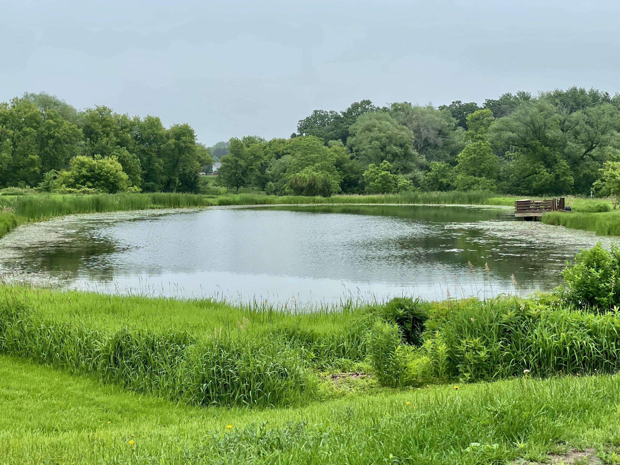
Hikes near DeForest Wisconsin explore a landscape shaped by glaciers, featuring river corridors, extensive wetlands, and preserved natural areas. The terrain is generally flat, with many trails following the Yahara River or traversing marshes on boardwalks. This makes the region suitable for accessible hikes through woodlands and restored prairies.

Best hiking trails around Deforest

  • The most popular hiking route is Upper Yahara River Trail to Sunfish Pond — Windsor, a 7.4 mile (12.0 km) trail that takes around 3 hours to complete. This route follows the Yahara River corridor, offering a mix of paved paths and boardwalks.
  • Another top favourite among local hiking enthusiasts is Cherokee Marsh North Unit loop — Madison, an easy 2.5 mile (4.0 km) path. The trail provides an immersive experience in the wetlands of the Cherokee Marsh State Natural Area.
  • Local hiking enthusiasts also love the Sunfish Pond loop from The Promenade a Conservancy Place, a 3.5 mile (5.6 km) trail leading through a conservancy area, often completed in about 1 hour 25 minutes.
  • Hiking around Deforest is defined by riverside paths, wetland boardwalks, and trails through restored prairies. The network of routes provides options for both short, easy walks and longer, more moderate hikes.
  • The routes in Deforest are rated by the komoot community with an average score of 3.6 stars from more than 15 reviews. More than 60 hikers have used komoot to explore Deforest's varied terrain.

Last updated: June 24, 2026

4.0

(1)

3

hikers

#1.

Six Mile Trail

4.73km

01:12

10m

10m

The Six Mile Trail offers a wonderfully accessible and easy hiking experience, perfect for a quick nature fix. This gentle route spans 2.9 miles (4.7 km) with a negligible elevation gain of just 30 feet (9 metres), allowing you to enjoy the natural surroundings without breaking a sweat. Expect a pleasant, mostly flat path that winds through typical Wisconsin landscapes, providing a refreshing escape for about 1 hour and 11 minutes.

For planning your visit, the Six Mile Trail is very straightforward. Trailhead access is generally easy, with parking usually available on-site, though arriving earlier in the day is always a good strategy. This trail is suitable for all seasons, but it's always a good idea to check for any specific local conditions, especially during winter months. Its short length and easy difficulty make it an excellent choice for a spontaneous outing or a relaxed afternoon stroll.

This trail is particularly well-suited for beginner hikers, families with young children, or anyone seeking a low-impact outdoor activity. Its easy difficulty and minimal elevation gain mean you don't need specialized gear or extensive preparation. It's a great way to introduce new hikers to the joys of the outdoors or simply to enjoy a peaceful walk in Dane County, Wisconsin, without the demands of more challenging routes.

Navigate with device

Send to Phone

Save

Easy

1

hikers

4.68km

01:13

20m

20m

Escape into a diverse natural tapestry on the Token Creek Loop, an easy 2.9-mile (4.7 km) hike that can be completed in about 1 hour and 12 minutes. This route guides you through a charming blend of shaded woodlands, open prairies dotted with wildflowers, and unique elevated boardwalks that offer views over sedge meadows. You'll follow the clear waters of Token Creek, fed by some of Southern Wisconsin's largest springs, making for a refreshing and scenic experience with only 80 feet (24 metres) of elevation gain.

Located within Token Creek County Park, the trailhead offers ample parking. While the trail is generally flat and accessible, be prepared for potentially damp or soggy sections, especially after rain, so waterproof footwear is a good idea. Late summer is particularly rewarding for the vibrant wildflower displays, but the trail offers a pleasant walk in any season.

Beyond the loop, Token Creek County Park spans 418 acres, providing a rich mix of prairie, woodland, and wetlands. The park is home to the largest springs in Southern Wisconsin, which contribute to Lake Mendota, and also features historical effigy mounds built by the Ho-Chunk people. It's a fantastic spot for nature lovers, offering more than just hiking with its disc golf course and dog exercise areas.

Easy
guide_signup
Let us show you the way with the komoot mobile app
With a free komoot account, you can easily find, customize, and navigate endless outdoor adventures.

Sign up for free

5.0

(1)

1

hikers

The Governor's Island Loop offers a refreshing escape from the city, providing continuous waterfront views that sweep across the Manhattan skyline, Brooklyn, and the Statue of Liberty. This easy 0.9-mile (1.4 km) route features mostly flat, paved paths, making it a serene and accessible walk for all. You'll pass by historical landmarks like Fort Jay and Castle Williams, blending rich history with modern parkland in a car-free environment.

Planning your visit means coordinating with the ferry schedule, as Governor's Island is only reachable by a short boat ride from Manhattan or Brooklyn. There's no need to worry about parking on the island itself, making public transport a convenient option for getting there. It's a quick 21-minute stroll with just 9 feet (3 metres) of elevation gain, perfect for a leisurely outing.

What truly sets this trail apart is its unique status as an urban oasis, offering a peaceful contrast to the city's hustle. It's an excellent choice for families or anyone seeking easy walking paths on Governor's Island for beginners. The blend of historical sites, panoramic viewpoints, and expansive green spaces makes it a top-rated urban hike in New York City.

Easy

The Cherokee Marsh South Unit Trails offer a serene escape into Dane County's largest wetland complex, guiding you through a mosaic of restored prairie, woodlands, and grasslands. You'll encounter gently rolling terrain, with elevated sections providing expansive views over sedge meadows and the upper Yahara River. It's a fantastic spot for birdwatching, where you might spot sandhill cranes or great blue herons amidst the rich biodiversity.

Planning your visit is straightforward, as the trails are accessible year-round. Parking is available at the trailhead, and the easy difficulty makes it ideal for families. While perfect for a quick hike in warmer months, the trails also transform into a popular destination for cross-country skiing when snow blankets the landscape.

This area is not just scenic; it's an ecologically vital "Wetland Gem" that acts as a natural filter for the Yahara lakes, highlighting its importance for water quality. Ongoing restoration efforts have transformed former agricultural fields into thriving tallgrass prairies, making it a testament to conservation and a unique natural feature in the region.

Easy

The Lu's Pond and River Trail offers a delightful, easy hike through natural surroundings, perfect for a quick escape into the outdoors. This 2.7-mile (4.3 km) route features a gentle 64 feet (20 metres) of elevation gain, making it a very accessible option for all skill levels. Expect a pleasant journey alongside water features, providing a serene backdrop for your approximately 1 hour and 6 minutes on the trail.

Planning your visit to this easy-going trail is straightforward. It's a great choice for a spontaneous outing, perhaps a morning walk or an afternoon stroll. While specific access points aren't detailed, trails like this in Dane County typically offer convenient parking. It's always a good idea to check local weather, as natural paths can be affected by rain, but overall, it's a reliable option for a relaxed hike.

This trail is an excellent example of Wisconsin's accessible natural beauty, providing a tranquil environment for bird watching or simply enjoying the fresh air. Its gentle nature makes it particularly family-friendly and a good option for beginners looking to explore the outdoors without a strenuous commitment. It's a wonderful way to experience the local flora and fauna in a peaceful setting.

Easy
Sign up for free to see 7 more hikes around Deforest.

Get access to more routes and recommendations from other explorers.

Sign up for free

Already have an account?

Our route recommendations are based on thousands of hikes, rides, and runs completed by other people on komoot.

Start today with a free account

Your next adventure awaits.

Login or Signup

Popular around Deforest

Road Cycling Routes around Deforest

Running Trails around Deforest

Cycling around Deforest

Frequently Asked Questions

What is the typical terrain like on hikes around DeForest?

The hiking terrain around DeForest is largely shaped by its glacial past, resulting in generally flat landscapes. Many trails follow the Yahara River or cross extensive wetlands on elevated boardwalks. You'll encounter a mix of paved paths, dirt trails through woodlands, and walks across restored prairies, making it accessible for most fitness levels.

Are there easy, family-friendly hikes in the DeForest area?

Yes, the region is well-suited for family outings. A great option is the Indianola Beach loop from Borchers Beach. It's a short, easy walk with very little elevation change, perfect for a relaxed stroll with children.

Can I bring my dog on the hiking trails?

Many parks and trails in the DeForest area are dog-friendly, but policies can vary, especially in State Natural Areas. Dogs are generally required to be on a leash. For example, dogs are welcome on leash at Token Creek County Park. Always check the specific regulations for the park you plan to visit before you go.

Where can I find good circular walks?

The area offers several excellent loop trails. For an immersive wetland experience, the Cherokee Marsh North Unit loop — Madison is a fantastic choice. This easy 2.5-mile (4 km) trail takes you through the heart of the largest wetland in Dane County, featuring boardwalks and scenic vistas.

Are there any hikes with waterfalls near DeForest?

Yes, for a unique hike to a waterfall, visit Parfrey's Glen State Natural Area. It's a highly-regarded local spot featuring a trail that leads you through a spectacular, moss-covered sandstone gorge to a small waterfall at the end. The trail involves navigating a stream and some rough stone, offering a cool and shady adventure.

Which hikes offer the best scenic views?

For dramatic, elevated views, a trip to Devil's Lake State Park is a must. The park, a premier hiking destination, features stunning 500-foot quartzite bluffs overlooking the lake. The East Bluff Trail, in particular, provides breathtaking vistas and access to iconic rock formations. Be prepared for a strenuous climb.

Are there any long-distance hiking trails accessible from DeForest?

Yes, the thousand-mile Ice Age National Scenic Trail passes through Dane County, west of DeForest. You can access several completed segments that showcase the region's distinct glacial landscapes, including moraines, oak savannas, and prairies. It's a great way to experience a piece of a much larger trail network.

What are some good trails for bird watching?

The river corridors and wetlands are prime spots for birding. The Upper Yahara River Trail to Sunfish Pond — Windsor is an excellent choice, as the path follows the river through forests and meadows where over 100 species have been observed. The Cherokee Marsh State Natural Area is another hotspot for seeing diverse birdlife.

Is parking generally available at the trailheads?

Most local parks and trailheads, like those for the Upper Yahara River Trail and at Token Creek Conservancy, have designated parking areas. However, popular destinations like Devil's Lake State Park and Parfrey's Glen can get very busy, especially on weekends, so arriving early is recommended. A state park vehicle admission sticker is often required for these locations.

What do other hikers enjoy about the trails around DeForest?

The trails around DeForest are well-regarded by the komoot community. Hikers often praise the peacefulness of the riverside paths and the unique experience of walking on boardwalks through the extensive wetlands. The accessibility and well-maintained nature of trails like the Upper Yahara River Trail are frequently mentioned as highlights.

Where can I find a peaceful stroll away from the main trails?

For a quieter experience, consider the Sunfish Pond loop from The Promenade a Conservancy Place. This trail winds through a conservancy area, offering a serene environment for a gentle walk around the pond.

Most popular routes around Deforest

Easy hikes around Deforest

Most popular attractions around Deforest

Places to see

Store rating

Get inspired with the komoot mobile app

With a free komoot account, you can easily find, customize, and navigate endless outdoor adventures.

or

Join komoot Now

Store rating

Explore more

Browse the best Hikes in other regions.

MadisonMononaShorewood HillsVeronaLake MendotaWaunakeeSun PrairieWindsorMcfarlandCapital Springs State Recreation Area- Monona Conservancy UnitCapital Springs State Recreation Area- Upper Mud Lake UnitMiddletonCapital Springs State Recreation Area- Mmsd Wildlife UnitCross PlainsCapital Springs State ParkCross Plains State ParkCapital Springs State Recreation Area- E-Way UnitFitchburgCapital Springs State Recreation Area- Lake Farm County Park UnitLake Kegonsa State ParkCapital Springs State Recreation Area- Jenni & Kyle UnitCottage GroveMount HorebMaple BluffOregonBlack EarthBlue MoundsMazomanieStoughton

Nearby adventure guides

Things to Do around Windsor

background

Get ready to conquer new peaks

Sign up for Free

Explore
RoutesRoute plannerFeaturesHikesMTB TrailsRoad cycling routesBikepackingSitemap
Download the app
Follow Us on Socials

© komoot GmbH

Privacy Policy