The best walks and hikes in the Flat Tops
4.8
(36)
540
hikers
48
hikes
If you've ever tried to plan hiking in the Flat Tops, you know how quickly the options can feel overwhelming. With so many trails crisscrossing this vast wilderness, it's tough to tell which routes are genuinely worth your time and effort, and which are just filler. We get it – you want the highlights, not the guesswork.
That's where komoot comes in. Our community has mapped, walked, and reviewed countless routes here, giving us a unique insight into what makes the Flat Tops truly special. We've sifted through the data to bring you a curated shortlist of the best hikes in Flat Tops Colorado, saving you the endless scrolling and ensuring every step is worth it.
Hiking in the Flat Tops is unlike anywhere else in Colorado. Expect a landscape defined by its unique flat-topped mountains and high plateaus, carved by ancient volcanic flows and glaciers. You'll traverse expansive subalpine forests and open alpine meadows, often above 10,000 feet, with impressive canyon systems plunging thousands of feet. The region is rich with water, boasting over 110 lakes and ponds. While there are plenty of easy day hikes, many of the most rewarding routes involve significant elevation gain and can be quite demanding. The best time to hike here is typically from late spring through early fall, as higher elevation trails can remain snow-covered well into summer.
If you only do one hike, make it the iconic Devils Causeway Loop, a moderate 10.3 miles (16.5 km) route that delivers unparalleled alpine views from a narrow basalt ridge. For a challenging multi-day adventure that truly captures the region's wild character, the difficult Devil's Causeway, Lost Lakes, and Chinese Wall Loop, at 19.3 miles (31.1 km) with over 3,900 feet (1,200 m) of climbing, is an absolute standout. Ready to explore? Dive into our top-rated routes and discover why over 500 hikers have already trusted komoot to guide their Flat Tops adventures.
Last updated: May 10, 2026
5.0
(1)
7
hikers
8.84km
02:33
360m
0m
The Marvine Trail offers a captivating journey through Colorado's Flat Tops Wilderness, guiding you from rolling forests with pine and aspen groves to expansive, surprisingly flat meadows on the plateau. You'll traverse rocky paths, navigate switchbacks, and discover serene alpine lakes, such as Marvine Lakes, all while following the meandering East Marvine Creek. Keep an eye out for abundant wildlife, including moose, deer, and various bird species, as you immerse yourself in this diverse landscape.
This moderate 5.5-mile (8.8 km) hike involves 1168 feet (356 metres) of elevation gain and typically takes about 2 hours and 33 minutes. Be ready for varied terrain, including potentially muddy sections and river crossings that might require rock hopping or using log bridges, so sturdy hiking boots are recommended. The trail is especially stunning during spring and summer for wildflowers, and in the fall when the foliage transforms into vibrant reds and yellows.
What makes the Marvine Trail truly special is its ability to offer solitude and a pristine backcountry adventure away from more crowded routes. Located within the Flat Tops Wilderness, the second-largest wilderness area in Colorado, it provides a glimpse into untouched landscapes characterized by volcanic cliffs and subalpine lakes. It's an ideal spot for wildlife enthusiasts and those seeking a genuine connection with nature.
3
hikers
4.38km
01:13
80m
80m
The East Elk Creek Trail offers a delightful journey through a narrow canyon, where the fresh mountain air and the constant sound of cascading waterfalls create a serene atmosphere. You'll wander along a dirt path that hugs the creek and cliffsides, passing through a rich tapestry of cottonwood, pine, willow, aspen, spruce, and fir trees. Look out for the striking rock formations and abundant wildflowers that add vibrant splashes of color to the diverse vegetation.
This easy hiking route is a great option for a quick outdoor escape, covering 2.7 miles (4.4 km) with a modest 265 feet (81 metres) of elevation gain, typically taking about 1 hour and 13 minutes. The trailhead is easily accessible north of New Castle, Colorado, and parking is available. The trail's elevation often provides a welcome temperature drop compared to lower valleys, making it a comfortable choice during warmer weather.
Beyond its natural beauty, the East Elk Creek Trail is part of the larger Centennial Trail system, known for its historical remnants further up the canyon, including an old steam engine and former gold mine tailings. The riparian corridor along the creek is a haven for wildlife and plant life, with raspberries ripening in late June. It's a popular route for both hikers and horseback riders, offering a blend of natural features and local history.

Sign up for free
31.1km
09:32
1,210m
810m
The Devil's Causeway, Lost Lakes, and Chinese Wall Loop is a truly demanding hike, covering 19.3 miles (31.1 km) with 3976 feet (1212 metres) of elevation gain, typically requiring about 9 hours and 31 minutes. This difficult route immerses you in the Flat Tops Wilderness, guiding you through forested areas, past serene alpine lakes like Causeway Lake, and across vast tundra. The highlight is undoubtedly the Devil's Causeway, a famously narrow ridge with dramatic drops that offers unparalleled 360-degree views, making it a thrilling experience for those without a fear of heights.
To tackle this advanced hiking route, plan to start early from the Stillwater Trailhead, as parking can be limited. Given the high altitudes, often above 11,000 feet, be ready for rapid weather changes and ensure you carry plenty of water, as sources can be scarce in exposed sections. Always check the forecast and trail conditions, especially for snow, which can persist well into the summer months, and be aware of potential afternoon thunderstorms.
This loop is notable not just for its physical challenge but also for its unique geology and rich history. The Flat Tops Wilderness, Colorado's second-largest wilderness area, is characterized by its distinctive basaltic cap and mesa-like features, a stark contrast to the jagged peaks found elsewhere in the state. Hiking here offers a deep dive into a remote backcountry setting, traversing diverse ecosystems from pine forests to expansive alpine tundras, and providing a sense of solitude and adventure that sets it apart from more crowded trails.
4.74km
01:41
430m
20m
The Devil's Causeway is a truly unique hiking experience in the Flat Tops Wilderness, offering a thrilling journey across a narrow natural land bridge. You'll start with serene views of Stillwater Reservoir and wildflower-filled meadows before the trail climbs steeply, leading to the dramatic, exposed Causeway itself. This geological marvel, sometimes just 3 to 4 feet wide, connects two sections of the plateau, providing unparalleled 360-degree panoramic views that make the 2.9-mile (4.7 km) route, with its 1423 feet (434 metres) of elevation gain, feel incredibly rewarding.
Planning your visit requires careful attention to the weather; the trail reaches 11,800 feet, and conditions can shift quickly. It's best to avoid the crossing if it's wet, windy, or stormy due to the significant exposure. Access is via the Stillwater Trailhead, where parking is available, but arriving early is recommended, especially during summer months, to secure a spot and beat any afternoon weather.
What makes the Devil's Causeway truly notable is its extreme narrowness and the adrenaline-pumping exposure it provides, a feature that sets it apart from many other trails. This natural land bridge, formed by past glaciation, is a testament to the unique
66.6km
17:19
440m
430m
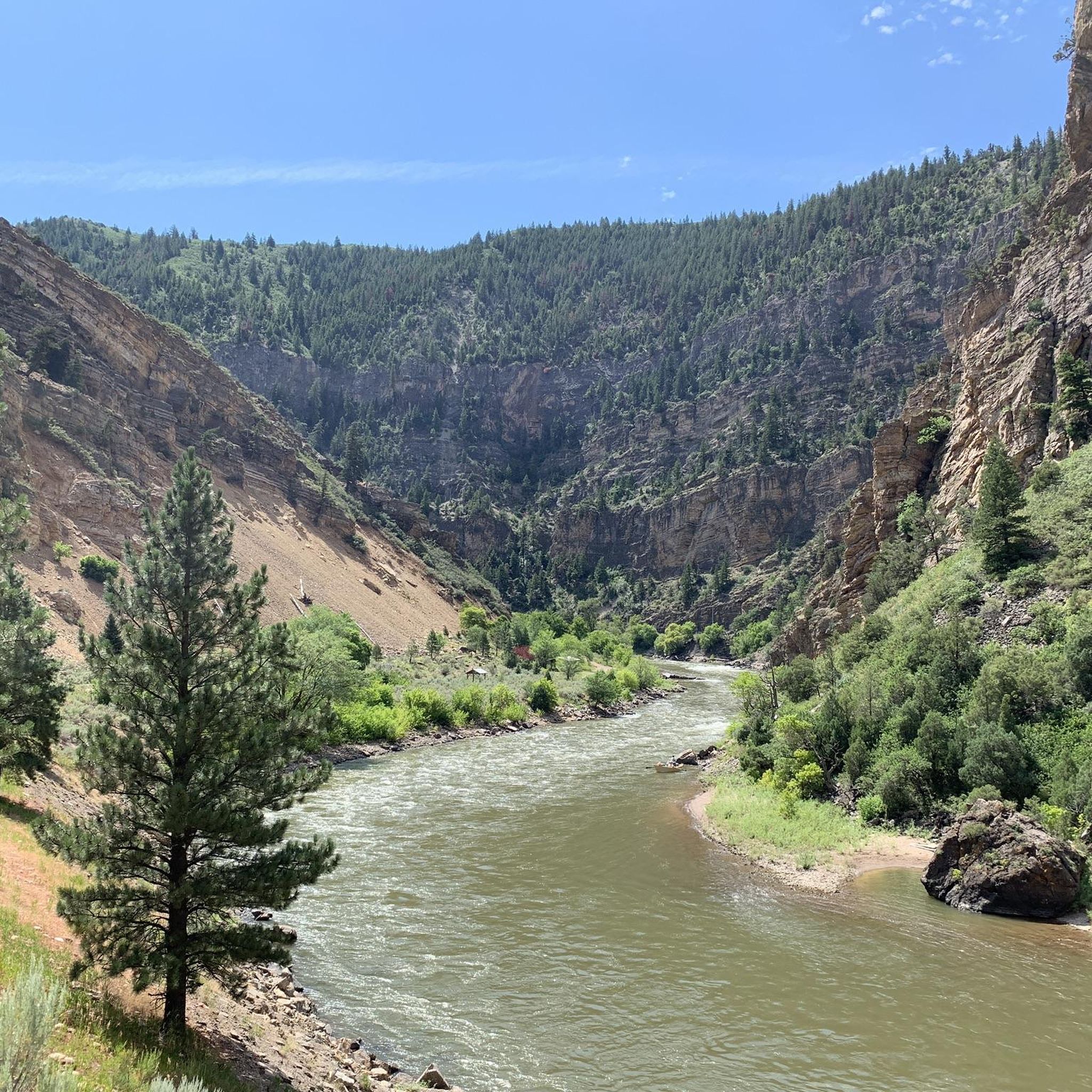
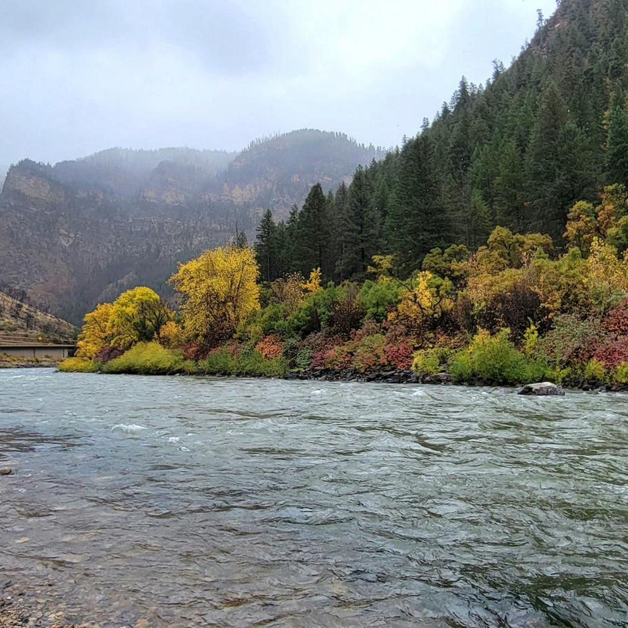
The Glenwood Canyon Recreation Trail offers an immersive journey through one of Colorado's most iconic landscapes, following the Colorado River through a dramatic canyon. This difficult 41.4-mile (66.6 km) hiking route, with 1447 feet (441 metres) of elevation gain, provides continuous views of towering canyon walls and the winding river. You'll traverse a mostly paved path, sometimes running close to the riverbanks, and might even spot bighorn sheep along the way, particularly as the trail becomes more secluded past the initial sections near Glenwood Springs.
Planning your visit requires checking seasonal conditions, as the trail can close during winter or high spring river levels. Access points are conveniently located at rest areas like No Name and Grizzly Creek, which provide parking and facilities. While the full 17 hours and 19 minutes duration makes it a significant undertaking, you can tackle sections of this trail, which is also popular with cyclists, making it easy to arrange shuttle services for one-way trips.
This trail is a testament to both natural grandeur and human ingenuity, coexisting with Interstate 70 in a unique corridor. It offers direct access to the famous Hanging Lake trail (permit required) and provides a different perspective on the canyon's geology and ecosystem. The path's primarily flat nature, despite its length, makes it accessible for many, though the sheer distance classifies it as a difficult endeavor.
766m
00:13
30m
0m
Step into a frozen wonderland on Koper's Trail, where the narrow canyon walls of Rifle Mountain Park create a breathtaking spectacle of ice. The route winds between towering red and gold limestone cliffs and Rifle Creek, leading you to the spectacular Ice Palace and The Final Curtain ice caves. Inside, you'll find massive turquoise ice sheets and glistening icicles, creating a truly magical atmosphere.
This easy 0.5-mile (0.8 km) hike, with a gentle 98 feet (30 metres) of elevation gain, can be completed in about 13 minutes during warmer months. However, in winter, the difficulty can increase to moderate due to snow and ice, making traction devices essential for safe exploration. The trail is located within Rifle Mountain Park, which has a $5 per vehicle entrance fee.
Koper's Trail is renowned for its unique ice formations, which are best viewed between December and February. Beyond the hiking, Rifle Mountain Park is also a popular destination for rock climbing in summer and ice climbing in winter, offering a diverse range of outdoor activities in a stunning canyon setting.
5.0
(25)
335
hikers
4.83km
02:11
310m
310m
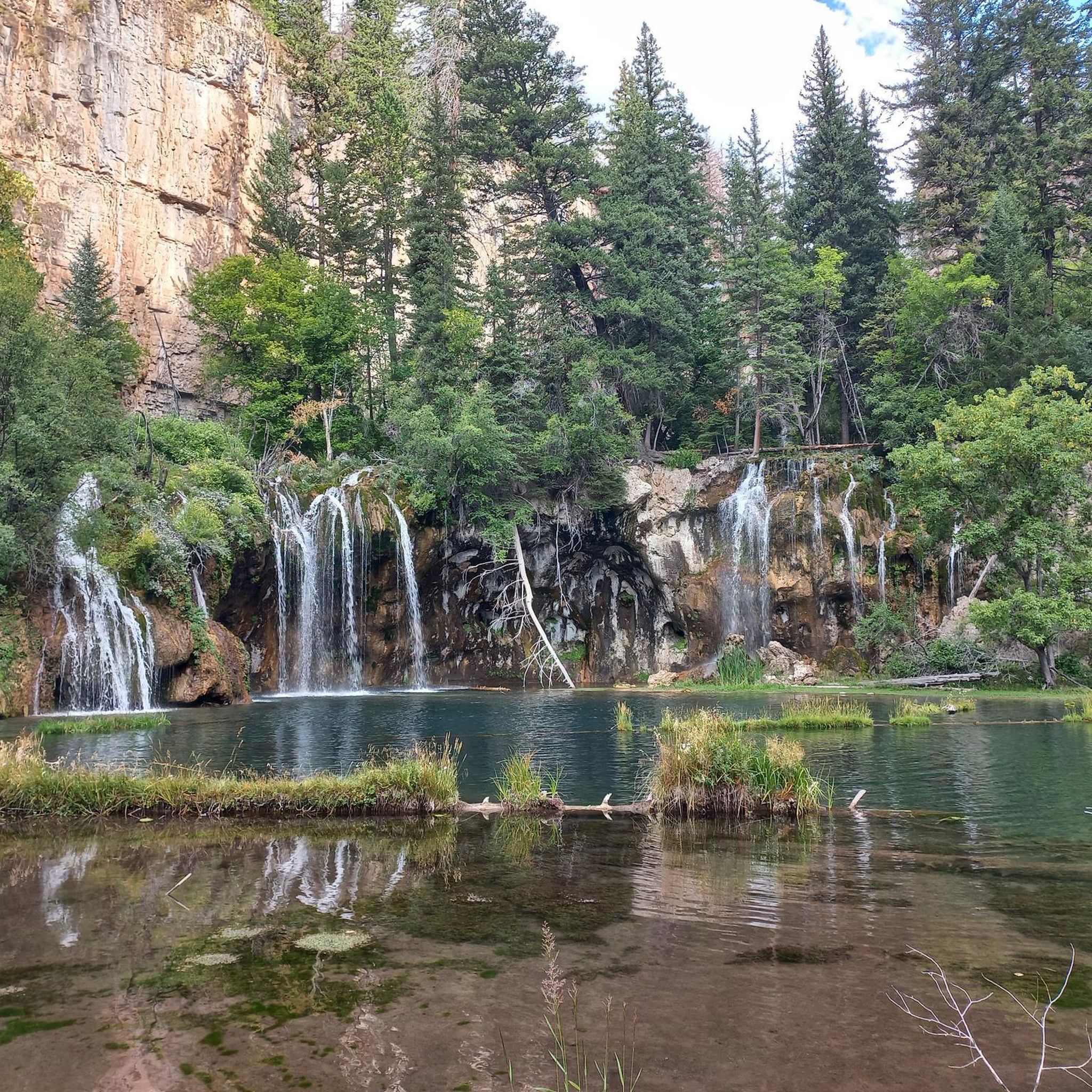
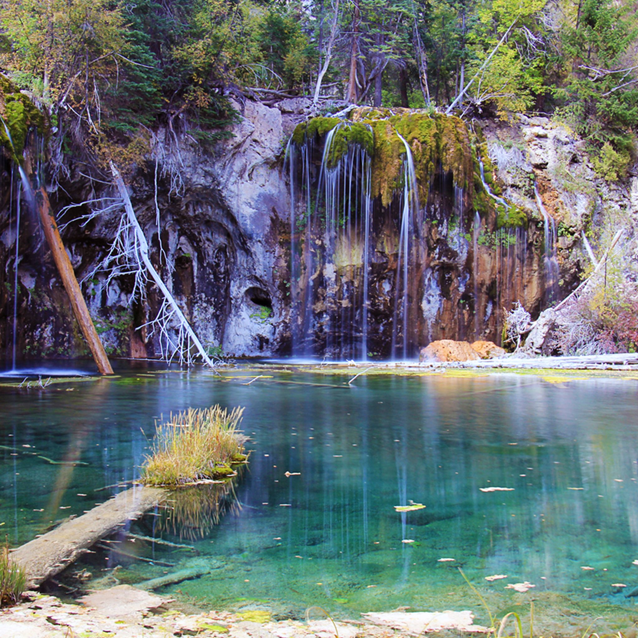
The Hanging Lake Trail is a truly unique Colorado hike, leading you through a shaded canyon alongside Deadhorse Creek to the vibrant turquoise waters of Hanging Lake. This moderate 3.0-mile (4.8 km) out-and-back route involves a consistent climb of 1021 feet (311 metres) over rocky steps and switchbacks, taking about 2 hours and 10 minutes to complete. The payoff is spectacular, with the lake's stunning color and the nearby Spouting Rock waterfall making the effort well worth it for those ready for a steep ascent. It's a rewarding experience for hikers seeking a natural wonder.
To hike the Hanging Lake Trail, you must secure a timed-entry permit online in advance, as reservations are required year-round and include a per-person fee. This system helps manage visitor numbers and protect the delicate environment. Make sure to arrive within your designated time slot, and note that facilities are only available at the trailhead, not along the route or at the lake itself. Sturdy footwear is essential, especially during winter when microspikes are often needed for icy conditions.
Hanging Lake is a designated National Natural Landmark, recognized for its rare geological formation created by travertine deposits and a geological fault. This unique process gives the lake its distinctive color and supports a fragile ecosystem, including rare hanging garden plant communities. Due to its delicate nature, swimming, fishing, touching the water, or walking on the fallen log in the lake are strictly prohibited to preserve this exceptional natural beauty.
4.8
(6)
38
hikers
11.2km
03:40
490m
490m
The Forest Hollow and Boy Scout Loop offers a dynamic hiking experience near Glenwood Springs, combining a steady climb through dense forest with an exhilarating descent. You'll traverse varied terrain, from doubletrack to narrow singletrack, enjoying abundant wildflowers and lush vegetation. The trail culminates with spectacular views high above the Colorado River on the rim of Glenwood Canyon, making it a memorable outing for those seeking both challenge and scenery.
This moderate 7.0-mile (11.2 km) route involves a significant 1599 feet (487 metres) of elevation gain, typically taking about 3 hours and 39 minutes. While the initial climb is substantial, the thrilling Boy Scout Trail descent drops directly into downtown Glenwood Springs, offering convenient access to amenities post-hike. Many hikers opt to shuttle the initial climbing sections to maximize enjoyment of the singletrack and downhill.
Known for its diverse terrain and stunning vistas, the Forest Hollow and Boy Scout Loop is a popular choice for intermediate to advanced hikers. The Boy Scout Trail itself is a notable feature, characterized by its steep, technical nature with switchbacks and rocky sections. This trail provides a unique perspective of the Glenwood Canyon area, showcasing both its natural beauty and the thrill of a challenging descent.
5.0
(1)
34
hikers
11.3km
03:42
530m
530m
The Grandstaff and Olsen Trail Loop offers a captivating journey through a canyon adorned with stunning red rock formations and vibrant plant life. You'll navigate a path that winds past towering sandstone walls, showcasing colorful streaks and ripple textures, before reaching the impressive Morning Glory Bridge, one of the largest natural rock spans in the United States. The terrain varies from relatively flat sections to gradual ascents, with some small rock ledges and areas where floods have reshaped the trail, providing continuous visual interest.
To plan your Grandstaff and Olsen Trail Loop hiking adventure, head to the designated parking area at the trailhead. This moderate 7.0-mile (11.3 km) route, with 1731 feet (528 metres) of elevation gain, typically takes around 3 hours and 42 minutes. Be sure to wear appropriate footwear for the rocky sections and carry ample water, particularly during warmer periods, to ensure a comfortable experience.
This trail is renowned for its unique geological features, offering a deep dive into the natural history of the region. The continuous views of the impressive red rock formations and the lush canyon floor make it a standout experience. The Morning Glory Bridge, a significant natural landmark, provides a memorable destination for your hike, highlighting the area's rich geological heritage.
4.5
(2)
23
hikers
16.5km
04:56
490m
490m
The Devils Causeway Loop is a truly iconic Colorado hike, taking you through diverse terrain from wildflower-filled meadows with views of Stillwater Reservoir to high alpine tundra. The route's defining feature is the Devils Causeway itself, a narrow, exposed land bridge that offers an adrenaline-pumping experience and unparalleled 360-degree views of the Flat Tops. You'll also encounter impressive geological features like the Chinese Wall formation and peaceful spots such as Little Causeway Lake along the way.
This is a challenging 10.3-mile (16.5 km) hiking route with 1616 feet (493 metres) of elevation gain, typically taking around 4 hours and 56 minutes. The trail involves a steep ascent over talus slopes to reach the ridgeline, and the highest point is around 11,800 feet above sea level. Be aware that parking can fill up quickly, especially on weekends, so plan for an early start to secure a spot at the trailhead.
What makes this trail particularly notable is the extreme exposure of the Devils Causeway, which narrows to just 3 to 4 feet wide with sheer drops on both sides. While the footing is generally stable, it's a section that many hikers find terrifying and may even crawl across. Rapidly changing weather, including afternoon thunderstorms, is common, and it's crucial to avoid the Causeway during high winds for safety.
Get access to more routes and recommendations from other explorers.
Sign up for free
Already have an account?
Our route recommendations are based on thousands of hikes, rides, and runs completed by other people on komoot.
Start today with a free account
Your next adventure awaits.
Login or Signup
Tips from the Community

The Storm King Firefighters Memorial in Glenwood Springs commemorates the 14 firefighters who died on July 6, 1994, during the devastating wildfire on Storm King Mountain. A sudden change in weather caused the fire to spread rapidly, encircling the firefighters. In their memory, a challenging hiking trail has been constructed to the site of the incident, where 14 crosses mark their final stand. A monument bearing their names and stories also stands in Two Rivers Park. The disaster led to significant improvements in fire safety and remains a powerful symbol of courage, sacrifice, and remembrance.
1
0
Nice to walk along the river, but nothing special.
1
0

This is a great place to park to access the bike path along the Colorado River through Glenwood Canyon. There are restrooms, river access, and shaded green space at the park.
1
0

Not far from Grizzly trailhead, go down a little bit to see the powerful Colorado River.
0
0

Easily accessible off of I-70, this trailhead is a great place to begin/ end your ride down the amazing Glenwood Canyon Trail. There is a small parking area, informational signs, and a vault toilet.
0
0

A spectacular stretch of the Colorado River is through Glenwood Canyon. The Glenwood Canyon section runs 12.5 miles in length and is 1,300 ft deep at the deepest point. There is great whitewater as well as fishing on this scenic section.
0
0
This is a great place to park to access the bike path along the Colorado River through Glenwood Canyon. There are restrooms, river access, and shaded green space at the park.
0
0
This is intended to be a rest stop for drivers, but works just as well as a stop for runners! Here you can use the restrooms, enjoy views of Glenwood Canyon, and you have access to the Grizzly Creek Trail (the upper section of which is closed for reforestation as of 2023) across the street.
0
0
Frequently Asked Questions
How many hiking trails are available in the Flat Tops Wilderness?
The Flat Tops Wilderness offers a wide array of hiking opportunities, with over 40 distinct trails. These routes cater to various skill levels, including easy strolls, moderate treks, and challenging multi-day backpacking trips.
What kind of terrain and difficulty can I expect on hikes in the Flat Tops?
Hikes in the Flat Tops Wilderness traverse diverse terrain, from extensive subalpine meadows carpeted with wildflowers to dense forests of aspen, spruce, and fir. You'll encounter unique volcanic plateaus, impressive canyon systems, and elevations ranging from 7,600 to nearly 13,000 feet. The difficulty varies, with 21 easy, 14 moderate, and 7 difficult routes available, ensuring options for all experience levels.
When is the best time of year to hike in the Flat Tops Wilderness?
The best time to hike in the Flat Tops Wilderness is typically during the summer months when the subalpine meadows are vibrant with wildflowers. Early autumn also offers stunning visual contrasts as the aspen forests display their vibrant fall colors. Higher elevations may remain snow-covered into early summer, so checking conditions is advisable.
Are there family-friendly hiking options in the Flat Tops?
Yes, the Flat Tops Wilderness offers several family-friendly hiking options. Many of the 21 easy routes are suitable for families, providing accessible paths through beautiful landscapes. For example, the Rifle Arch Trail is a shorter, easier hike leading to a unique natural formation.
Can I bring my dog on the hiking trails in the Flat Tops Wilderness?
The Flat Tops Wilderness is generally dog-friendly, but it's crucial to adhere to wilderness regulations. Dogs must be kept under control, typically on a leash, to protect wildlife and ensure a pleasant experience for all hikers. Always pack out waste and check for any specific trail restrictions before heading out.
Are there any notable waterfalls or unique natural features to see in the Flat Tops?
Absolutely! The Flat Tops are renowned for their unique natural features. You can visit Rifle Falls, Colorado's only 80-foot triple waterfall, or the nearby Spouting Rock Waterfall. The iconic Devil's Causeway, a narrow basalt ridge, offers breathtaking views. The region also boasts over 110 glacially-carved lakes and picturesque bluffs formed by volcanic activity.
Are there any circular hiking routes in the Flat Tops Wilderness?
Yes, there are circular hiking routes available. A prominent example is the Devils Causeway Loop Trail – Flat Tops Wilderness, which offers a challenging yet rewarding experience with expansive alpine views along the iconic Devil's Causeway.
Where can I find parking or trailheads for hiking in the Flat Tops?
Access points and trailheads for the Flat Tops Wilderness are generally found along the perimeter roads, particularly near popular areas like Trappers Lake and Rifle Falls State Park. While specific parking data isn't always available, many trailheads offer designated parking areas. Dispersed camping is also common, providing additional access points.
What do other hikers enjoy the most about hiking in Flat Tops?
The Flat Tops Wilderness is highly rated by the komoot community, with an average score of 4.7 stars from over 30 reviews. Hikers often praise the region for its sense of solitude, remote backcountry travel, and the stunning, unique volcanic landscapes. The diverse ecosystems, abundant lakes, and opportunities for wildlife viewing are also frequently highlighted.
Are there opportunities for camping near the hiking trails in the Flat Tops?
Yes, the Flat Tops Wilderness is an excellent destination for camping. Numerous campgrounds are situated throughout the area, many conveniently located near the abundant lakes and ponds. Additionally, opportunities for dispersed camping are available, allowing for a more secluded wilderness experience close to the trails.
What kind of wildlife might I encounter while hiking in the Flat Tops?
The Flat Tops Wilderness is biologically rich, offering fantastic opportunities for wildlife viewing. Hikers may spot elk (including Colorado's largest herd), deer, moose, and various smaller mammals like mink and marmots. Birdwatchers might also catch a glimpse of ptarmigan. Always maintain a respectful distance and never feed wild animals.
Are there any historical landmarks or points of interest in the Flat Tops area?
Beyond its natural beauty, the Flat Tops region holds historical significance as one of the first expanses of public land deemed 'wilderness' in the U.S. You can also find specific historical points of interest like the Pioneer Cemetery/Doc Holliday Grave, offering a glimpse into the area's past.
Most popular routes in the Flat Tops
Most popular attractions in the Flat Tops

Get inspired with the komoot mobile app


Explore more
Browse the best Hikes in other regions.
