The best MTB trails in Santa Rosa Wilderness
11
riders
3
rides
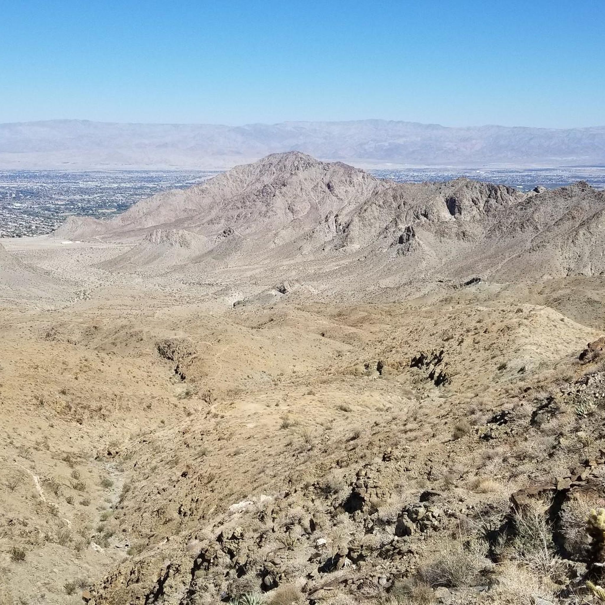
Mountain biking in Santa Rosa Wilderness offers diverse terrain within the Santa Rosa and San Jacinto Mountains National Monument. The region features a dramatic transition from desert landscapes with agave and ocotillo to higher elevations with chaparral, juniper, and pine forests. Terrain is rugged, marked by boulder-strewn canyons, washes, and significant elevation changes, ranging from near sea level to over 7,000 feet. While mountain biking is restricted in the designated wilderness, the broader monument provides extensive routes for experienced riders.
…Last updated: July 13, 2026
3
riders
48.3km
04:49
1,050m
1,050m
Hard mountain bike ride. Very good fitness required. Advanced riding skills necessary.

3
riders
25.2km
02:05
310m
920m
Moderate mountain bike ride. Good fitness required. Suitable for all skill levels.

Sign up for free
26.6km
02:42
800m
800m
Moderate mountain bike ride. Good fitness required. Suitable for all skill levels.
1
riders
36.3km
04:19
1,320m
1,320m
Hard mountain bike ride. Very good fitness required. Advanced riding skills necessary.
4
riders
84.5km
07:12
1,790m
1,790m
Hard mountain bike ride. Very good fitness required. Advanced riding skills necessary.
Our route recommendations are based on thousands of hikes, rides, and runs completed by other people on komoot.
Start today with a free account
Your next adventure awaits.
Login or Signup
Popular around Santa Rosa Wilderness

Tips from the Community


Hop off your bike right along the Pines to Palms Highway. This pullout offers breathtaking views of the desert and the serpentine highway.
0
0
This viewpoint offers breathtaking views of the Santa Rosa Mountains. The journey is well worth it, as you'll be rewarded with sweeping panoramas of the desert.
0
0

Just off the Pines to Palms Highway, south of town, is a great pullout to a viewpoint over the desert and twisting highway. This is a great spot to snap some photos before continuing on your ride.
0
0

Since 2020, Palm Canyon Trail—a multi-use trail—has seen a significant increase in users: hikers, equestrian and mountain bikers, including eBikes. Most of the trail crosses BLM and US Forest Service land. The Trail crosses private land as well as land owned by Agua Caliente. The properties the Tribe recently received as ancestral land back donations were offered to the Tribe. As a property owner with the right to regulate access to its land, the Agua Caliente chose to improve a portion of Palm Canyon Trail that is on its land—not federal land. The Tribe conducted trail maintenance work within its own property in the Indian Canyons for emergency access, security and safety for our hikers and other lawful users of the Trail. Why did it do this? Because it values its lands and prioritizes proper management of it. Unfortunately, one entitled business owner, [Dave Wood, owner of Bikes and Brews -tgk] who is unhappy over the fact that mountain biking and e-mountain biking is not allowed in this area is acting out by spreading false information, which is unnecessarily causing confusion in the community. His false narrative insultingly prioritizes his desire to financially profit from trespassing on Tribal lands, over the Tribe’s right to protect its property and its cultural resources. Tribal employees are now receiving “anonymous” threats promising more property destruction if tribal staff attempts to interfere with this illegal activity, which generates profits by organizing trail rides for groups of bikers who (unknowingly) trespass on a trail where that activity is not permitted. The Tribe has never permitted mountain biking on its land. The land acquired as land back donations is now Tribal land and consistent with our policy, mountain biking and eBikes are prohibited. Anyone on a mountain or eBike accessing the land is in trespass of Tribal lands. Trespassing on, and damaging, the property of another is never ok. We ask this business owner to ride his bicycle somewhere else where this activity is permitted.
0
0
The Palm Canyon Epic Trail is now closed to mountain biking. In April and June 2024 several landowners of wilderness areas donated their land to the Agua Caliente Band of Cahuilla Indicans (ACBCI). The donated lands included important parts of the Palm Canyon Epic Trail. As part of ACBCI policy on land use, mountain bike travel is prohibited on these lands. Recently Margaret Park-Robinson, Chief Planning Officer of ACBCI released a statement concerning the closure of the PCE. She can be reached at 760-883-1326 or email: mpark@aguacaliente-nsn.gov I append the full statement to this comment. Tom Kohn ACBCI Statement on the PCE closure Since time immemorial, Agua Caliente and other Cahuilla have lived within the lands of the National Monument, including Palm Canyon. Since time immemorial, the Palm Canyon Trail has been a significant cultural and historical pathway for Cahuilla people. Since 2000, the National Monument was established despite concerns by Agua Caliente. The legislation directs the federal agencies (BLM & USFS) to consult with Agua Caliente. Since 2008, Palm Canyon and the portion of the trail was designated as a federal Wild & Scenic River by the US Forest Service despite concerns by Agua Caliente. continues in a following post...
0
0

At the intersection of Dunn Road, Hahn/Buena Vista trail and Art Smith Trail, you can find this abandoned tank with a nearby picnic area.
0
0
Frequently Asked Questions
Is mountain biking permitted within the Santa Rosa Wilderness?
Mountain biking is generally prohibited within the designated Santa Rosa Wilderness area itself. However, the broader Santa Rosa and San Jacinto Mountains National Monument and surrounding regions offer extensive mountain biking opportunities, with 27 miles of trails available for riders.
What kind of terrain can I expect on mountain bike trails in the Santa Rosa and San Jacinto Mountains National Monument?
The terrain is rugged and diverse, transitioning from stark desert landscapes with agave and ocotillo at lower elevations to chaparral, juniper, and pine forests higher up. You'll encounter boulder-strewn canyons, deep washes, and significant elevation changes, ranging from near sea level to over 7,000 feet. Trails often feature challenging climbs and descents.
Are there any beginner-friendly mountain bike trails in the area?
The mountain biking routes in the Santa Rosa and San Jacinto Mountains National Monument primarily cater to experienced riders, with many trails rated as moderate to difficult. For example, the Palm Canyon Epic – San Bernardino National Forest is a moderate route, but still involves significant elevation changes and technical sections.
What are some challenging mountain bike trails for experienced riders?
Experienced riders can tackle routes like the Art Smith and Cathedral Trail Loop, a difficult 22.6-mile route with substantial elevation gain. Another challenging option is the Mountainbike loop from Pinyon Pines, which covers 30 miles through varied desert and mountain terrain.
What natural features or landmarks can I see while mountain biking in this region?
The area offers breathtaking panoramic views of the San Jacinto Mountains, San Gorgonio, Palm Springs, and the Salton Sea, especially from higher elevations. You'll ride through diverse ecosystems, from desert flora like agave and ocotillo to coniferous forests, and may spot unique geological formations like boulder-strewn canyons and washes.
What is the best time of year for mountain biking in the Santa Rosa and San Jacinto Mountains National Monument?
The cooler months, typically from late fall through spring, are generally the best time for mountain biking. Summers can be extremely hot, especially at lower desert elevations, making riding less comfortable and potentially hazardous due to heat exposure.
Are there any loop mountain bike trails available?
Yes, there are several loop options. The Hopalong Cassidy Loop in Palm Desert is a popular moderate 16.5-mile loop known for its challenging climbs and desert views. The Mountainbike loop from Pinyon Pines is another longer, difficult loop option.
Can I bring my dog on the mountain bike trails?
While specific trail regulations vary, designated wilderness areas often have restrictions on dogs. It's advisable to check with the appropriate land management agency (such as the BLM for the National Monument) for specific trail rules regarding pets before planning your ride.
What kind of wildlife might I encounter on the trails?
The region is home to diverse wildlife, including the rare Peninsular bighorn sheep, mule deer at higher altitudes, and various reptiles. Birdwatchers might spot great horned owls, falcons, and eagles. Always maintain a respectful distance and do not disturb wildlife.
Where can I find parking or access points for mountain biking in the area?
Access points and parking vary depending on the specific trail. Many trails within the Santa Rosa and San Jacinto Mountains National Monument are accessible from various points around Palm Desert and other nearby communities. It's recommended to check specific trailheads for parking availability and any required permits before your visit.
What do other mountain bikers enjoy most about riding in the Santa Rosa and San Jacinto Mountains National Monument?
Mountain bikers frequently praise the dramatic elevation changes, the rugged desert canyons, and the stunning panoramic views. The unique transition from desert to pine-covered ridges offers a diverse and engaging riding experience, primarily appealing to those seeking a challenging adventure.
Most popular routes in Santa Rosa Wilderness

Get inspired with the komoot mobile app


Explore more
Browse the best MTB trails in other regions.
