The best MTB trails in Mount Massive Wilderness
3.0
(1)
276
riders
12
rides
Mountain biking in Mount Massive Wilderness offers a range of trails through high-altitude terrain and scenic landscapes. The region is characterized by its mountainous environment, featuring passes and alpine lakes. Trails often traverse varied surfaces, including forest paths and open areas, providing diverse riding experiences. This area in Lake County is known for its natural beauty, with routes that cater to different skill levels.
Best mountain bike trails in Mount Massive Wilderness
- The most popular mountain bike trail is Hagerman…
Last updated: July 8, 2026
22.5km
02:32
710m
710m
Mountain bike the historic Hagerman Pass Road, a 14.0 miles (22.5 km) moderate route with 2320 feet (707 metres) of elevation gain.
18
riders
68.7km
05:37
880m
880m
Hard mountain bike ride. Very good fitness required. Advanced riding skills necessary. Some portions of the route may require you to push your bike.

Sign up for free
10
riders
45.0km
04:02
750m
750m
Moderate mountain bike ride. Good fitness required. Advanced riding skills necessary.
7
riders
12.8km
01:18
290m
290m
Moderate mountain bike ride. Great for any fitness level. Advanced riding skills necessary.
3.0
(1)
83
riders
65.3km
05:32
1,450m
1,450m
Hard mountain bike ride. Very good fitness required. Advanced riding skills necessary.
Get access to more routes and recommendations from other explorers.
Sign up for free
Already have an account?
Our route recommendations are based on thousands of hikes, rides, and runs completed by other people on komoot.
Start today with a free account
Your next adventure awaits.
Login or Signup
Popular around Mount Massive Wilderness
Tips from the Community

Hagerman Pass is a high mountain pass in Colorado at about 11,925 ft (3,635 m). The route is rough dirt/rock surface — originally a railroad grade and now a Forest Service Road (FSR 105). It is typically open late May through early-to-mid autumn, depending on snow and conditions. The road starts easy enough but becomes progressively rockier, steeper, narrower, and more technical toward the high point. You might find that some sections are too technical to ride and end up hike-a-bike. Be prepared and know your limits!
1
0
The Lyle Lake Trail enters the Holy Cross Wilderness at this point; bicycles are not permitted beyond the trail junction with Hagerman Pass Road. Hagerman Pass Road can be cycled, but it’s a challenging, technical adventure route - you're probably well aware of this if you're here! Mountain bikers should be ready for rough surfaces and steep climbs and descents.
1
0

The Powerline climb is an infamous uphill during the later stages of the Leadville 100 mile run. This steep dirt road is a common training ground for those getting ready to race at 10,000 feet. The road tops out at Sugarloaf Pass (roughly 11,200 feet) where the road and Colorado Trail intersect.
0
0

Hiking southbound, this is the junction where you decide to hike the Collegiate West alternate (which follows the Continental Divide Trail) or the Collegiate East (which is the original Colorado Trail route). The CW West is more challenging, roughly ten miles longer and takes you into higher elevation, but offers breathtaking scenery, while the CW East stays lower and offers better accessibility to trail towns and hot springs.
3
0
Shimmering Point is one of a few overlooks on the northern road at Turquoise Lake. This road stays closed in the winter, but it is utilized by cars, runners, and bikers in the warm months.
0
0

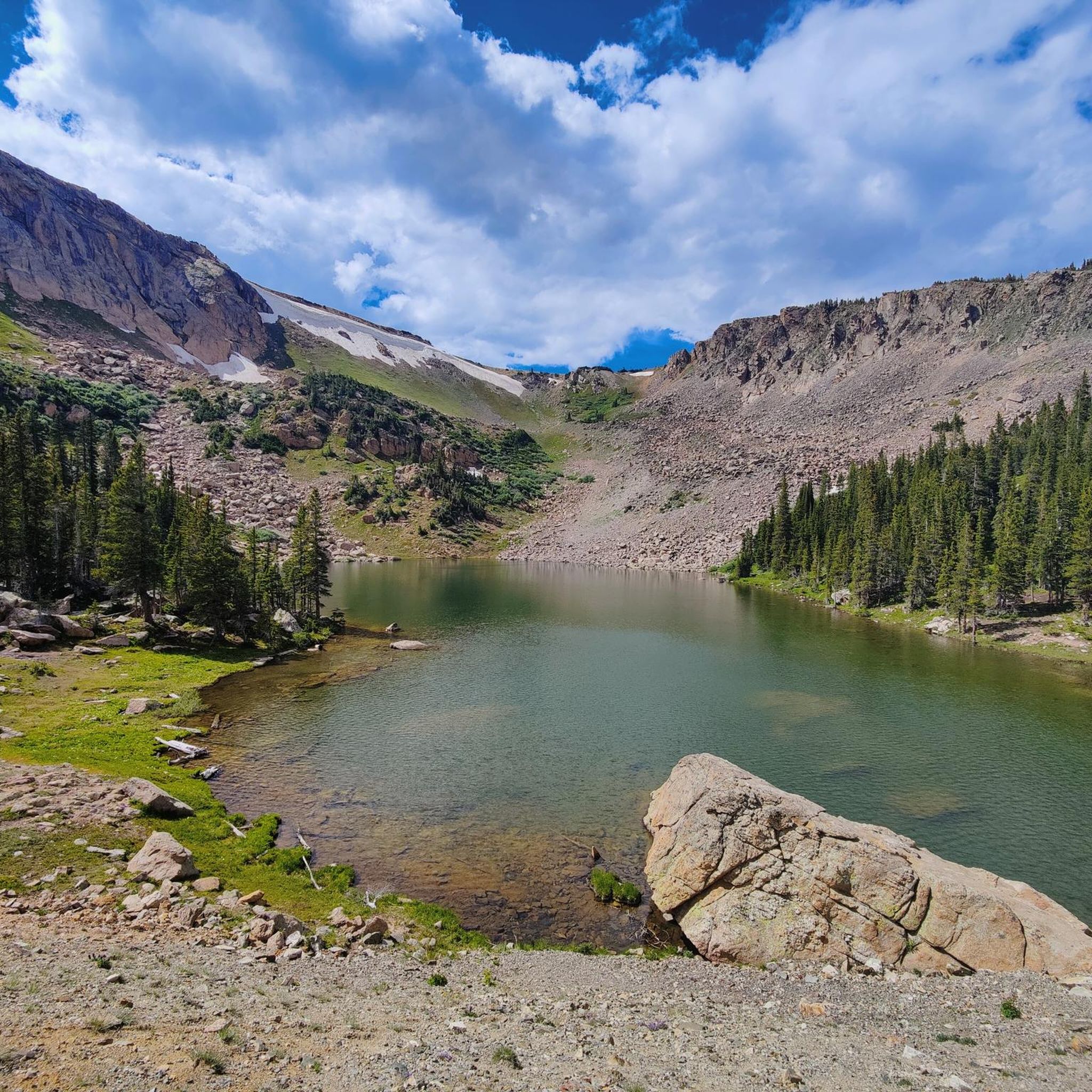
Turquoise Lake is an 1,800-acre alpine lake five miles outside Leadville. Named for the turquoise mine that was once there, it's now a recreational destination. The land surrounding Turquoise Lake is lined with trails and low trafficked paved roads. The lake itself offers boating, fishing and windsurfing.
0
0
The more northern miles of Turquoise Lake Trail (the section past the campsites) are known for being the rootier, rockier, hillier, and more technical portions of trail. With rocky access down to the shore at the end towards May Queen Campground, the rest of this section of trail stays in the trees crossing creeks and bridges.
0
0
Turqoise Lake is an 1,800-acre alpine lake five miles outside Leadville. Named for the turquoise mine that was once there, it's now a recreational destination. The land surrounding Turquoise Lake is lined with trails and low trafficked paved roads. The lake itself offers boating, fishing and windsurfing.
0
0
Frequently Asked Questions
How many mountain bike trails are available in Mount Massive Wilderness?
Mount Massive Wilderness offers a selection of over 15 mountain bike trails, catering to various skill levels. These routes traverse high-altitude terrain, mountain passes, and scenic alpine lakes.
What is the best time of year to go mountain biking in Mount Massive Wilderness?
The best time for mountain biking in Mount Massive Wilderness is typically during the late spring, summer, and early fall months. During these periods, trails are generally free of snow, and the weather is most favorable for high-altitude riding. Always check local conditions before heading out, especially in shoulder seasons.
Are there mountain bike trails suitable for beginners in Mount Massive Wilderness?
While many trails in Mount Massive Wilderness involve significant elevation changes and high-altitude riding, there are moderate options available. For instance, Hagerman Pass Road is a moderate 14-mile route that offers a journey through a historic mountain pass without extreme technical demands.
Are there any family-friendly mountain biking options in Mount Massive Wilderness?
For families looking for a less strenuous ride, routes around the lakes, such as parts of the Turquoise Lake – Turquoise Lake Dam loop from Sugarloaf Dam, can be suitable. These areas often feature more gradual terrain and scenic views, though some sections may still require a moderate fitness level due to the altitude.
Where can I find advanced mountain bike routes in Mount Massive Wilderness?
Experienced riders seeking a challenge will find several difficult routes in the area. The Twin Lakes loop from Sugarloaf Dam is a challenging 42.7-mile path with extensive views and significant elevation changes. Another demanding option is the Turquoise Lake Dam – Lookout over Turquoise Lake loop from Sugarloaf Dam, which features substantial climbs.
Are there any loop mountain bike trails in Mount Massive Wilderness?
Yes, Mount Massive Wilderness features several excellent loop trails. Popular options include the challenging Twin Lakes loop from Sugarloaf Dam and the scenic Turquoise Lake – Turquoise Lake Northern Shore loop from Sugarloaf Dam, which takes you through lakeside and forested areas.
What kind of terrain can I expect on mountain bike trails in Mount Massive Wilderness?
The terrain in Mount Massive Wilderness is diverse, characterized by high-altitude landscapes, mountain passes, and alpine lakes. You can expect a mix of forest paths, open areas, and varied surfaces, often with significant elevation gains and descents. The region's mountainous environment ensures a dynamic riding experience.
What do other mountain bikers enjoy most about the trails in Mount Massive Wilderness?
The mountain bike trails in Mount Massive Wilderness are highly rated by the komoot community, with an average score of 3.5 stars. Riders frequently praise the stunning high-altitude scenery, the challenge of the mountain passes, and the serene beauty of the alpine lakes. The diverse routes offer something for various skill levels.
Are there any viewpoints or scenic spots along the mountain bike trails?
Many trails in Mount Massive Wilderness offer breathtaking viewpoints due to the region's mountainous nature. Routes circling the Twin Lakes, such as the Twin Lakes loop from Sugarloaf Dam, provide extensive panoramic views. The high-altitude passes and lakeside paths consistently offer scenic vistas of the surrounding wilderness.
How long do mountain bike trails typically take to complete in Mount Massive Wilderness?
Trail durations vary significantly based on length and difficulty. A moderate route like Hagerman Pass Road (14.0 miles) typically takes around 2 hours 32 minutes. Longer, more difficult loops, such as the Turquoise Lake – Turquoise Lake Northern Shore loop from Sugarloaf Dam (28.0 miles), can take approximately 4 hours 2 minutes or more, depending on your pace and stops.
What are the typical trail conditions during winter in Mount Massive Wilderness?
During winter, mountain bike trails in Mount Massive Wilderness are generally covered in snow and ice, making them unsuitable for traditional mountain biking. Many high-altitude passes become impassable. Winter conditions can persist well into late spring, so it's crucial to check current trail reports and weather forecasts before planning a ride during colder months.

Get inspired with the komoot mobile app


Explore more
Browse the best MTB trails in other regions.
