Routes

Planner

Features

Updates

App

Login or Signup

Get the App

Login or Signup

Routes
Running Trails
United States
Colorado
Saguache County

Sangre De Cristo Wilderness

The best running trails in Sangre De Cristo Wilderness

237

runners

27

runs

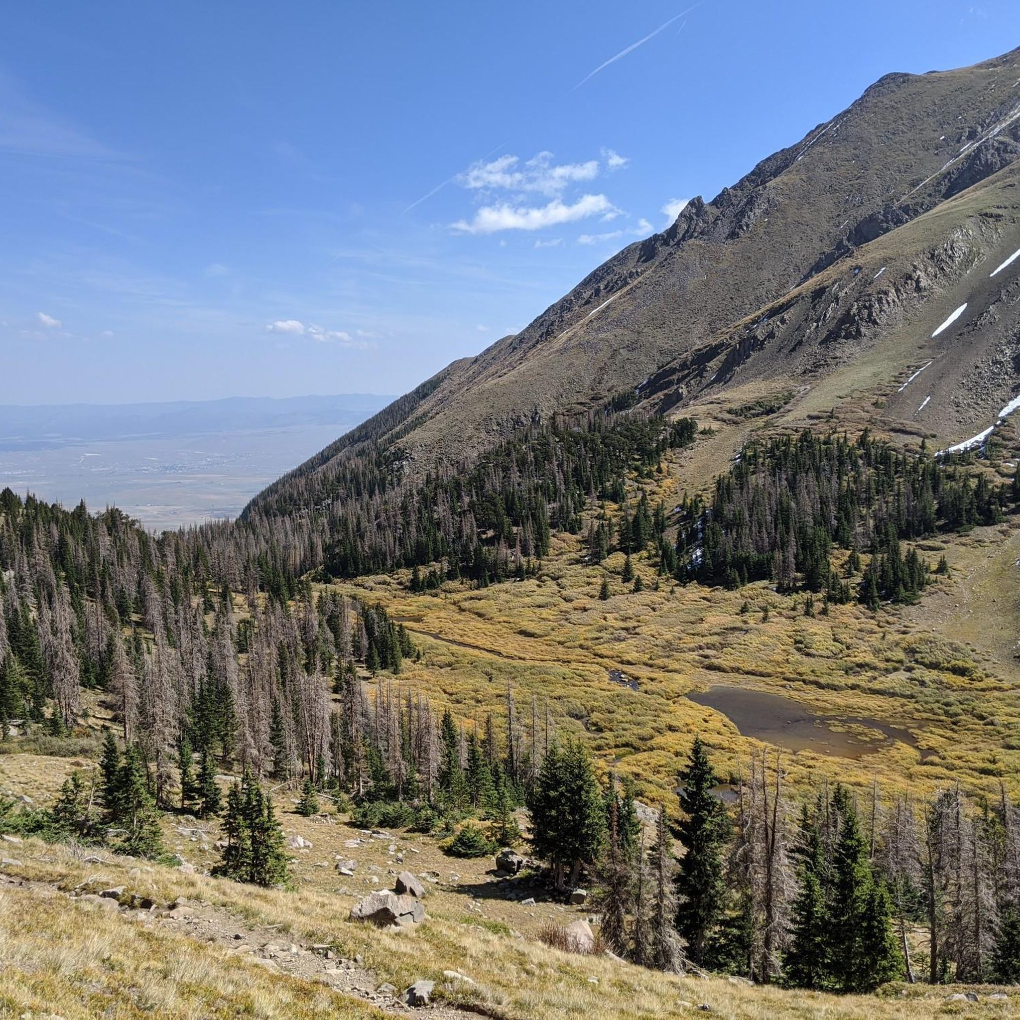
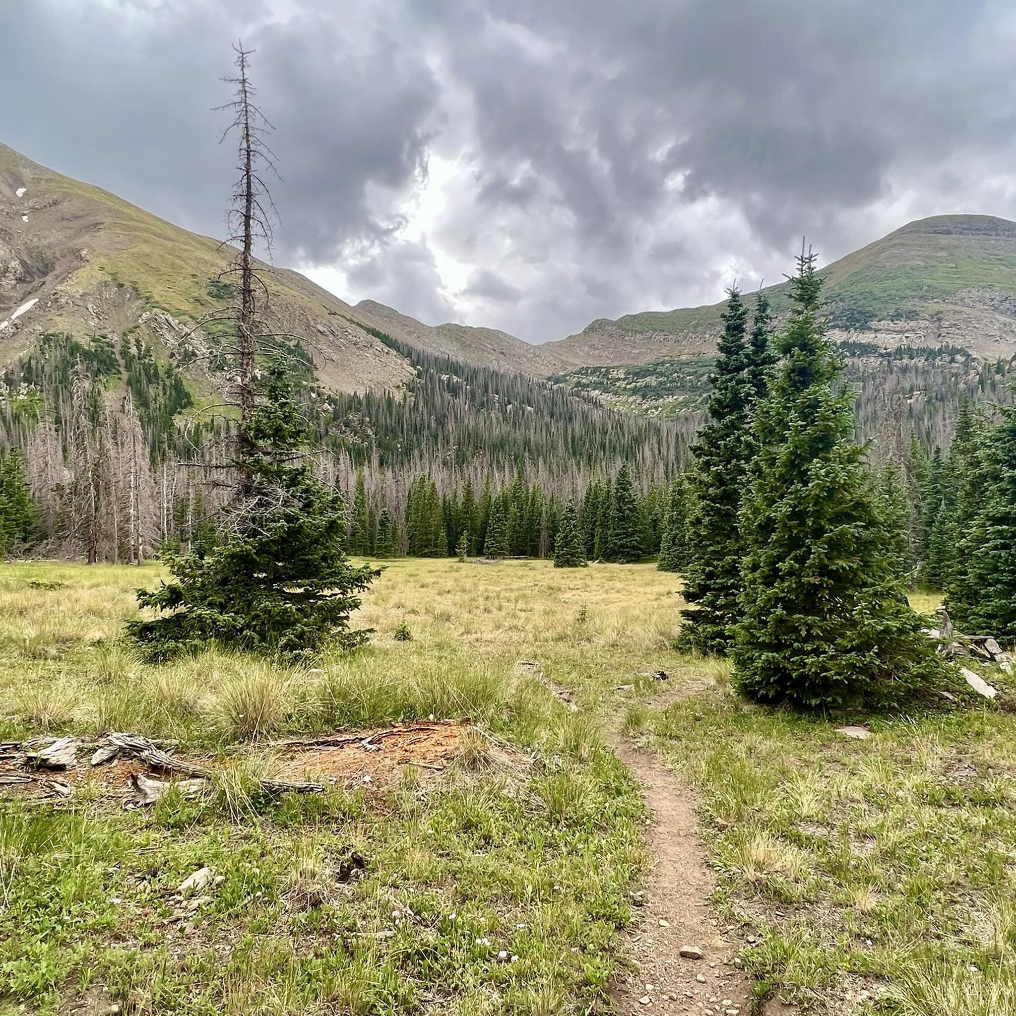
Jogging in Sangre De Cristo Wilderness offers access to a rugged and scenic landscape, characterized by dramatic mountain peaks, pristine alpine lakes, and lush valleys. The region features high-elevation terrain with extensive networks of trails, providing varied experiences for runners. These routes often include steep ascents and descents, leading through forests of aspen, spruce, and fir, and into high-altitude basins above the treeline. The wilderness spans over 220,000 acres, offering diverse natural features for trail running.

Best jogging routes in Sangre De Cristo Wilderness

  • The most popular jogging route is Venable-Comanche Trail loop, a 12.2 miles (19.6 km) trail that takes 2 hours 41 minutes to complete. This difficult route offers challenging climbs and panoramic views of the surrounding wilderness.
  • Another top favourite among local runners is Rito Alto four pass loop, a difficult 23.1 miles (37.3 km) path. This extensive route traverses multiple mountain passes, providing a demanding workout amidst high-alpine scenery.
  • Local runners also love the Crestone Needle via South Colony Lakes, a 11.1 miles (17.8 km) trail leading through alpine lakes and rugged mountain terrain, often completed in about 3 hours 10 minutes.
  • Jogging in Sangre De Cristo Wilderness is defined by dramatic mountain peaks, pristine alpine lakes, and lush valleys. The network offers options for different ability levels, from moderate paths to very challenging high-elevation routes.
  • The guide includes highly-rated routes that showcase the best of the region's landscape. More than 200 runners have used komoot to explore Sangre De Cristo Wilderness's varied terrain.

Last updated: July 7, 2026

8

runners

#1.

Venable-Comanche Trail loop

19.6km

02:42

1,160m

1,160m

Embark on the Venable-Comanche Trail loop, a difficult jogging route spanning 12.2 miles (19.6 km) with a significant 3805 feet (1160 metres) of elevation gain. This high-alpine trek, estimated to take 2 hours and 41 minutes, leads you through dense pine forests and vibrant wildflower meadows before ascending above the treeline. You will encounter the impressive multi-tiered Venable Falls and pristine alpine Venable Lakes, culminating at the beautiful Comanche Lake, offering a truly demanding and rewarding experience.

Planning your visit is key for this challenging route, which is best enjoyed during summer and early fall; snow typically covers the higher elevations from November through spring. Be prepared for varied and demanding terrain, including rocky creek beds and steep ascents. The Phantom Terrace, a narrow and exposed ledge, requires mental fortitude, while the Comanche side features loose rock and a steep grade on the descent, adding to the physical demands of the high altitude.

This loop is set within the rugged Sangre de Cristo Wilderness, known for its dramatic landscapes and high-altitude environments. The trail's unique features, such as the series of alpine lakes and the panoramic views from the Phantom Terrace, make it a standout option for experienced and well-prepared trail runners. It offers a deep immersion into a remote mountain setting, showcasing the raw beauty of the Colorado Rockies.

Navigate with device

Send to Phone

Save

Hard

6

runners

37.3km

05:05

1,880m

1,880m

Embark on the Rito Alto four pass loop, a difficult jogging route that challenges you with 23.2 miles (37.3 km) of high-alpine terrain. You will gain a significant 6156 feet (1876 metres) in elevation, typically taking around 5 hours and 5 minutes to complete. As you traverse this demanding path, expect sweeping vistas of the Sangre de Cristo Mountains and the dramatic cirques surrounding Eureka Mountain. The route also guides you past serene alpine lakes, including the notable Venable Lakes, and offers views of the impressive Venable Falls. This journey provides a true remote wilderness experience, often showcasing vibrant wildflowers or golden aspens depending on the season.

Planning your visit to this difficult route requires careful consideration. This strenuous loop demands very good fitness and prior alpine experience due to its significant elevation changes and high altitude. Be prepared for considerable exposure to wind and sun, especially above treeline. It is wise to start early in the day to allow ample time for completion. Remember that nights can be quite cold, with temperatures potentially dropping into the 20s Fahrenheit, so pack accordingly.

The Rito Alto four pass loop is situated within the expansive Sangre de Cristo Wilderness, offering a deep dive into a pristine natural environment. This area is renowned for its rugged beauty and the feeling of true remoteness it provides. The trail's unique feature of traversing four distinct passes makes it a standout challenge in the region. You will experience a continuous journey through varied high-alpine landscapes, making it a memorable experience for those seeking a demanding wilderness adventure.

Hard
guide_signup
Let us show you the way with the komoot mobile app
With a free komoot account, you can easily find, customize, and navigate endless outdoor adventures.

Sign up for free

2

runners

Prepare for a challenging jogging adventure on Crestone Needle via South Colony Lakes, a difficult route that quickly transitions from a clear path to a technical mountaineering endeavor. You will cover 11.1 miles (17.8 km) and ascend 3898 feet (1188 metres), with Komoot estimating a duration of about 3 hours and 10 minutes. The initial approach leads you through spectacular alpine scenery towards the pristine South Colony Lakes, nestled in a stunning basin. As you continue, expect significant exposure, loose rock, and Class 3 and Class 4 climbing sections towards the summit. The lower South Colony Lake offers classic Colorado vistas, often reflecting the dramatic 14,000-foot peaks above.

Before you set out, understand that this route is primarily a mountaineering challenge, and jogging is only suitable for its initial approach to the lakes. The terrain involves sustained rock climbing, so be prepared for that transition. Snowfields can persist around the peak throughout the summer, adding another layer of complexity to your journey. Navigation is challenging, with considerable rockfall danger and potential for misleading cairns, so careful route-finding is essential for your safety.

This route stands out as a gateway to the Sangre de Cristo Wilderness, offering a unique blend of high-alpine beauty and serious mountaineering. It provides access to a basin surrounded by several prominent 14,000-foot peaks, making it a notable destination for peak baggers and experienced adventurers. The dramatic landscape, shaped by ancient geological forces, creates a rugged and isolated environment that truly tests your skills and endurance.

Hard

1

runners

16.4km

02:24

740m

740m

Embark on the Lake of the Clouds Loop, a difficult jogging route spanning 10.2 miles (16.4 km) with a significant elevation gain of 2421 feet (738 metres). You can expect to complete this challenging journey in about 2 hours and 24 minutes. As you navigate the rugged terrain, you will encounter dramatic cliffs, lush forests, and the pristine Lake of the Clouds, offering a rewarding experience amidst the wild beauty of the Sangre de Cristo Wilderness. Prepare for a true test of endurance with rocks, roots, and substantial climbs.

To begin your adventure, head to the Gibson Creek Trailhead, where you will find convenient parking. Given the route's difficult rating and the rugged nature of its terrain, this trail is best suited for experienced trail runners seeking a demanding workout. Always check local conditions before you go, paying close attention to weather forecasts and any potential trail accessibility updates. This preparation ensures a safe and enjoyable jogging experience.

This route stands out in the Sangre de Cristo Wilderness for its challenging profile and the stunning natural environment it traverses. The trail offers a unique opportunity to push your limits while being surrounded by thick forests and small meadows. It is a demanding workout that promises a rewarding sense of accomplishment, making it a notable choice for those who thrive on difficult and scenic jogging trails.

Hard

1

runners

10.1km

01:50

770m

770m

Embark on a challenging jogging route up Humboldt Peak, where the path transitions from stable ground into forested areas and willows. As you climb, you will pass the serene South Colony Lake, offering views of wildflowers and the rugged Crestone Peak. This difficult 6.3 miles (10.1 km) route involves a significant 2527 feet (770 metres) of elevation gain, typically taking around 1 hours and 50 minutes to complete. The journey culminates at the 14,064-foot summit, rewarding your effort with expansive vistas.

When planning your visit, be aware that continuous jogging becomes difficult at higher elevations due to steep inclines, uneven rocky sections, and boulder fields. The final half-mile to the summit requires rock scrambling, making it unsuitable for jogging. It is wise to start early to avoid afternoon thunderstorms, as weather in the Sangre de Cristo Range can be unpredictable. Check for any required permits for day use or overnight stays, especially if you intend to camp.

This high-altitude adventure in the Sangre de Cristo Wilderness offers a unique experience for runners seeking a demanding ascent. From the summit of Humboldt Peak, you are treated to a full 360-degree panorama of the South Colony Lakes Basin and the vast surrounding wilderness. The trail provides a distinct perspective on the region's rugged beauty, making it a notable challenge for those ready to tackle its demanding terrain.

Hard
Sign up for free to see 23 more runs in Sangre De Cristo Wilderness.

Get access to more routes and recommendations from other explorers.

Sign up for free

Already have an account?

Our route recommendations are based on thousands of hikes, rides, and runs completed by other people on komoot.

Start today with a free account

Your next adventure awaits.
Login or Signup

Popular around Sangre De Cristo Wilderness

Hiking in Sangre De Cristo Wilderness

MTB Trails in Sangre De Cristo Wilderness

Road Cycling Routes in Sangre De Cristo Wilderness

Cycling in Sangre De Cristo Wilderness

Gravel biking in Sangre De Cristo Wilderness

Tips from the Community

Zachary
November 24, 2023, Hermit Pass

From the top of Hermit Pass you get incredible views of both the east and west sides of the Sangre de Cristos. The Hermit Pass Road which leads up here from the east is a nontechnical climb on a semi-rocky road past an alpine lake and mountain peaks. The trail down the west side is a beautiful singletrack.

0

0

There is a gravel lot at the top of North Taylor Road. From here you can run south along the Rainbow Trail (doubletrack forest road) all the way down the foothills of the Sangre de Cristos or head up into the Mountains. You can run up to Lakes of the Clouds by going north, or head south along forest roads to reach the Hermit Pass ascent.

0

0

maniboyflex
November 24, 2023, Humboldt Peak

The fantastic views from Humboldt Peak (14056 ft) make this run totally worth it. From Humboldt Peak, there's a panoramic view of the North and South Colony Valleys, Crestone Needle, and Obstruction Peak. This summit is not as challenging as the neighbor Crestone Needle.

0

0

maniboyflex
November 24, 2023, South Colony Lake

South Colony Lakes are at the base of Crestone Needle, giving you a privileged view of the peak, with green clear water surrounded by grass and a creek that flows from the lakes. This can be a good spot to camp before reaching the needle.

0

0

maniboyflex
November 24, 2023, Venable Lakes

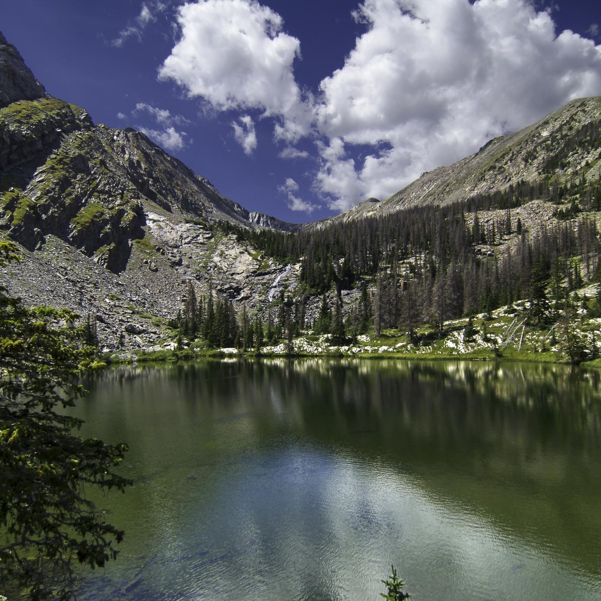
Close to Venable Trail, there's a short steadily steep trail to Venable Lakes, a group of small alpine lakes with fantastic views of Rio Grande National Forest.

0

0

maniboyflex
August 30, 2023, Comanche Lake

Comanche Lake is a beautiful alpine lake in San Isabel National Forest. The trail to the lake is short, but can be rocky and steep; hiking poles are recommended to get down from the lake. Coming from Venable trail, you need to cross Phantom Terrace, a small ledge that connects the Comanche trail to Venable trail, this part seems to be more sketchy than it really is, you just need to have caution. The trail is better experienced between May and October due to snow and muddy conditions.

0

0

maniboyflex
August 30, 2023, Venable Falls

Venable Falls is a 30 ft waterfall tumbling down at least three tiers, the river flowing between ferns and pines. An amazing place to have some quiet time while enjoying the surroundings. While walking to Venable Trail, you can see how the valley was eroded due to intense power of water over time.

0

0

maniboyflex
August 30, 2023, Humboldt Peak

The fantastic views from Humboldt Peak (14056 ft) make this hike totally worth it. From Humboldt Peak, there's a panoramic view of the North and South Colony Valleys, Crestone Needle, and Obstruction Peak. This summit is not as challenging as the neighbor Crestone Needle.

0

0

Frequently Asked Questions

How many running routes are available in the Sangre De Cristo Wilderness?

There are over 25 dedicated running routes in the Sangre De Cristo Wilderness, offering a wide range of experiences. While many are challenging, there are also several moderate options available for those looking for a less strenuous run.

What kind of terrain can I expect on the running trails in Sangre De Cristo Wilderness?

The Sangre De Cristo Wilderness is known for its rugged, high-elevation terrain. Runners can expect varied surfaces, including steep ascents and descents, rocky paths, and trails winding through dense forests of aspen, spruce, and fir. Many routes also lead into high-alpine basins above the treeline, offering dramatic views.

Are there any running routes that feature waterfalls or alpine lakes?

Yes, the wilderness is rich with natural water features. For instance, the Venable-Comanche Trail loop passes near the beautiful Venable Lakes. You can also find routes that lead to other pristine alpine lakes like Willow Lake or Horn Lake, and the multi-tiered Venable Falls is a notable sight along some trails.

Are there any circular running routes in the Sangre De Cristo Wilderness?

Yes, several excellent circular routes allow you to start and finish at the same point. A popular option is the Venable-Comanche Trail loop, which is 12.2 miles (19.6 km) long and offers challenging climbs and panoramic views. Another extensive loop is the Rito Alto four pass loop, covering 23.1 miles (37.3 km) through high-alpine scenery.

What are some notable landmarks or viewpoints I can experience while running in the area?

The Sangre De Cristo Wilderness offers breathtaking landmarks. Many routes provide views of dramatic 'fourteeners' like Humboldt Peak and Ellingwood Point. The Crestone Needle via South Colony Lakes route, for example, offers stunning mountain vistas and passes by alpine lakes.

Is the Sangre De Cristo Wilderness suitable for family-friendly running or hiking?

While many trails are rated difficult due to significant elevation gain, there are moderate options that families might find more accessible for hiking or shorter runs. It's important to check the specific trail details for distance and elevation before heading out with children. The wilderness offers a chance for immersion in nature, but preparedness is key.

What is the best time of year for running in the Sangre De Cristo Wilderness?

The best time for running in the Sangre De Cristo Wilderness is typically from late spring through early fall. During these months, trails are generally free of snow, and the weather is more favorable. However, conditions can change rapidly at high elevations, so always check the forecast and be prepared for varying temperatures and potential afternoon thunderstorms.

Are there any specific challenges or considerations for running in this wilderness area?

Runners should be aware of the high elevation, which can make even moderate routes feel more strenuous. The terrain is rugged, with steep ascents and descents. It's crucial to carry enough water, appropriate gear for changing weather, and be mindful of wildlife such as bears and mountain lions. Staying on marked trails is also important for safety and wilderness preservation.

Can I spot wildlife while running in the Sangre De Cristo Wilderness?

Yes, the Sangre De Cristo Wilderness is home to diverse wildlife. Runners might encounter elk, deer, and bighorn sheep. While less common, black bears and mountain lions also inhabit the area. Maintaining a respectful distance and being aware of your surroundings is always recommended.

What do other runners enjoy most about the trails in Sangre De Cristo Wilderness?

Runners frequently praise the incredible views, the solitude, and the opportunity for a challenging workout amidst pristine nature. The diverse scenery, from lush forests to dramatic alpine basins, is often highlighted. Many appreciate the chance to 'lose your stress and recharge' in this rugged environment.

Are there any easy or moderate running routes for beginners in the Sangre De Cristo Wilderness?

While the majority of routes are rated difficult, there are 7 moderate running routes available in the Sangre De Cristo Wilderness. These routes offer a less strenuous experience compared to the more challenging high-elevation trails, making them more suitable for beginners or those seeking a gentler run.

Where can I find information about parking at trailheads in the Sangre De Cristo Wilderness?

Information regarding parking at specific trailheads is usually available through the U.S. Forest Service or National Park Service websites, as they manage the wilderness area. It's advisable to check these resources or local visitor centers for details on trailhead access and parking availability before your run. Some areas may require permits or have limited parking.

Most popular routes in Sangre De Cristo Wilderness

Hiking in Sangre De Cristo Wilderness

Most popular attractions in Sangre De Cristo Wilderness

Places to see

Store rating

Get inspired with the komoot mobile app

With a free komoot account, you can easily find, customize, and navigate endless outdoor adventures.

or

Join komoot Now

Store rating

Explore more

Browse the best Running Trails & Routes in other regions.

Sangre De Cristo Wilderness

Nearby adventure guides

Things to Do in Sangre De Cristo Wilderness

Things to Do in Mcintyre Hills Wilderness Study Area

background

Get ready to conquer new peaks

Sign up for Free

Explore
RoutesRoute plannerFeaturesHikesMTB TrailsRoad cycling routesBikepackingSitemap
Download the app
Follow Us on Socials

© komoot GmbH

Privacy Policy