Lewis Fork Wilderness
Lewis Fork Wilderness
The best walks and hikes in Lewis Fork Wilderness
4.8
(11)
329
hikers
48
hikes
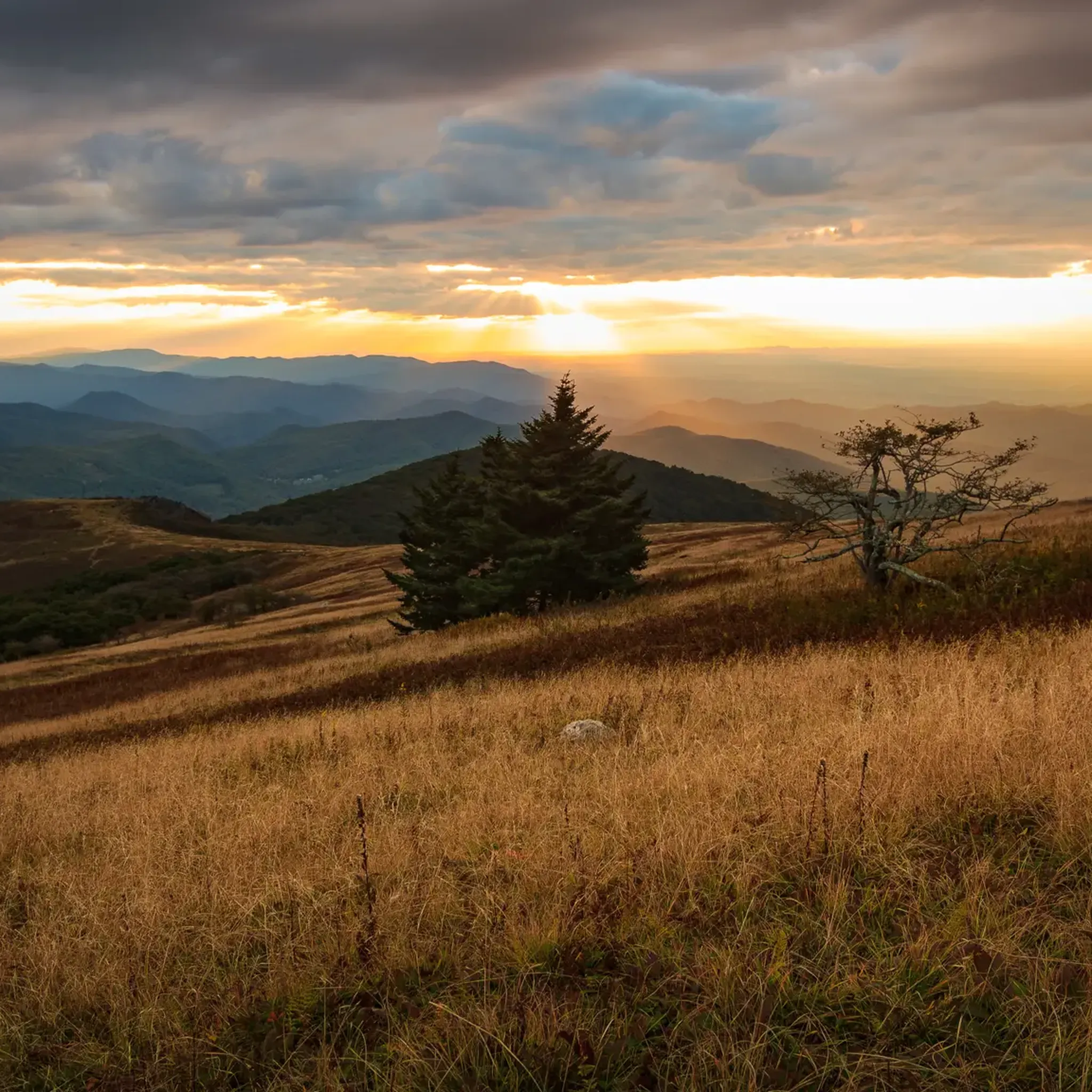
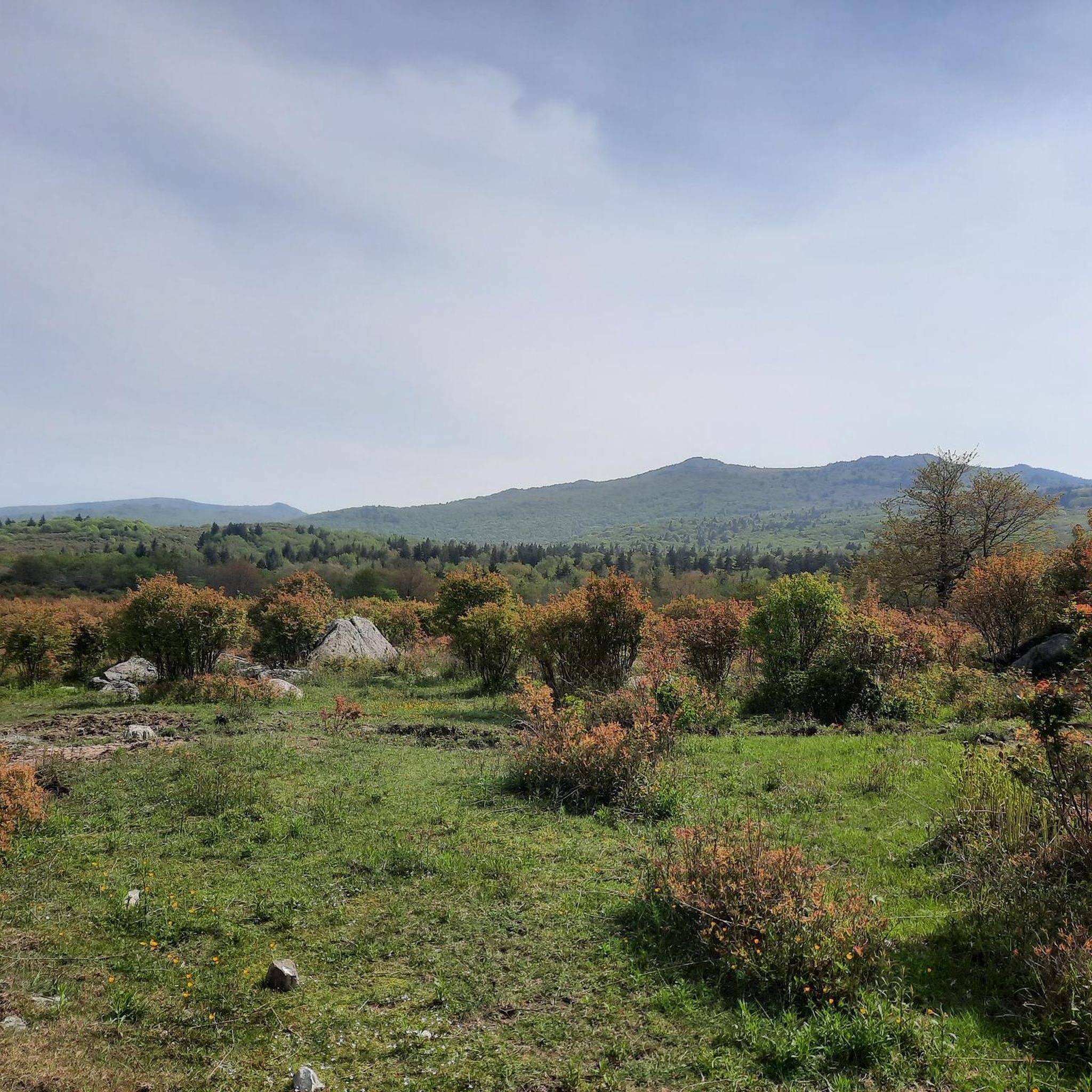
Hiking in Lewis Fork Wilderness is located within Virginia's Mount Rogers National Recreation Area, characterized by high-elevation ridges, spruce-fir forests, and open grassy balds. The terrain includes the slopes of Mount Rogers, Virginia's highest peak at 5,729 feet (1,746 m), and is traversed by sections of the Appalachian Trail and the Virginia Highlands Horse Trail. This wilderness area offers a remote and secluded environment, preserving its natural condition and prohibiting motorized vehicles. The landscape changes dramatically with elevation, featuring diverse forests and numerous cold-water streams.
Best hiking trails in Lewis Fork Wilderness
- The most popular hiking route is Mount Rogers and Appalachian Trail Loop, a difficult 16.9 miles (27.1 km) trail that takes about 7 hours 58 minutes to complete. This route involves significant elevation gain and offers expansive views.
- Another top favourite among local hikers is Elk Garden to Buzzard Rock via Appalachian Trail, a moderate 7.1 miles (11.4 km) path. This trail provides access to sections of the renowned Appalachian Trail.
- Local hikers also love the Appalachian Trail: Iron Mountain & Brushy Mountain, a 4.7 miles (7.5 km) trail leading through forested mountain terrain, often completed in about 2 hours 23 minutes.
- Hiking in Lewis Fork Wilderness is defined by prominent ridges, dense spruce-fir forests, and sections of the Appalachian Trail. The trail network provides options for moderate day hikes as well as more difficult multi-day backpacking loops.
- The routes in Lewis Fork Wilderness are highly rated by the komoot community with an average score of 4.9 stars from more than 10 reviews. More than 340 hikers have used komoot to explore Lewis Fork Wilderness's varied terrain.
Last updated: July 9, 2026
5.0
(1)
19
hikers
27.1km
07:57
660m
960m
The Mount Rogers and Appalachian Trail Loop offers a truly unique hiking experience, guiding you through dense forests, expansive highland meadows, and a rare high-altitude spruce-fir forest. You'll encounter diverse terrain, from rocky sections around Wilburn Ridge to lush grassy balds, all while gaining 2172 feet (662 metres) over 16.9 miles (27.1 km). The highlight for many is spotting the wild ponies that freely roam these scenic landscapes, making this a memorable and challenging adventure.
This difficult route typically takes around 7 hours and 57 minutes to complete as a day hike, though many hikers choose to backpack it over several days. The trail is located within the Mount Rogers National Recreation Area, offering various access points. Be prepared for potentially muddy and rocky conditions, especially after rain, and always check weather forecasts for higher elevations before you go.
Beyond the stunning scenery, this loop is notable for incorporating a significant section of the iconic Appalachian Trail and leading to Mount Rogers, Virginia's highest point. The unique ecosystems, including the spruce-fir forest, provide a glimpse into a rare natural world. It's one of the best loop trails Mount Rogers AT has to offer for those seeking a substantial and rewarding backcountry experience.
5
hikers
11.4km
03:24
380m
370m
The hike from Elk Garden to Buzzard Rock on the Appalachian Trail offers a delightful journey through varied landscapes, transitioning from dense, fern-lined woodlands to expansive, grassy balds. As you ascend, you'll be treated to increasingly open views, culminating in the impressive Buzzard Rock viewpoint, which provides sweeping panoramas of Mount Rogers and Whitetop Mountain. The trail's blend of forest paths and open meadows makes for a visually engaging experience, perfect for those who appreciate diverse natural beauty.
This moderate 7.1-mile (11.4 km) out-and-back route involves a steady 1231 feet (375 metres) of elevation gain, typically taking around 3 hours and 23 minutes to complete. Parking is available at the Elk Garden trailhead, but arriving early is recommended, especially on weekends. Be prepared for cooler temperatures at higher elevations, and note that a reliable spring is located about 2.5 miles into the trail for water refills.
This section of the Appalachian Trail is renowned for its spectacular vistas and unique geological features, including the ancient Rhyolite rock of Buzzard Rock. It's an excellent way to experience a scenic part of the AT, offering a taste of its famous high meadows and open balds. You can even extend your adventure with an optional, short but steep climb to Elk Garden Peak for even more expansive views.

Sign up for free
2
hikers
7.54km
02:23
450m
100m
Embark on a moderate hike along the Appalachian Trail, covering 4.7 miles (7.5 km) with an elevation gain of 1487 feet (453 metres). This route, typically completed in 2 hours and 23 minutes, offers a diverse landscape as you traverse Iron Mountain and Brushy Mountain. You'll experience varied terrain, from lush, moss-covered hardwood forests to sections of pine, with the chance to spot vibrant wildflowers in spring. The trail provides dramatic scenery, including steep mountain ridges and the notable Junction of Five Trails at Scales, offering a true wilderness feel.
Accessing the trailhead for this section of the Appalachian Trail is generally straightforward, with convenient parking options available nearby. If you plan to bring your dog, you'll be pleased to know they are typically allowed on these trails, making it a great outing for your canine companion. Before heading out, always check local conditions, particularly if you're hiking during hunting season, as this area is popular with both hikers and hunters. Starting your hike earlier in the day can help you avoid crowds and enjoy the peaceful atmosphere.
This segment of the Appalachian Trail is nestled within the Mount Rogers National Recreation Area, a region renowned for its natural beauty and extensive trail network. The trail's journey through hardwood and pine forests highlights the diverse ecosystems found in this part of Virginia. It offers a rewarding experience for hikers seeking a solid workout and a genuine connection with the wilderness, away from urban distractions.
1
hikers
49.1km
14:29
1,470m
1,470m
Embark on the Mount Rogers and Appalachian Trail Loop, a difficult hiking route that spans 30.5 miles (49.1 km) and involves a significant 4811 feet (1466 metres) of elevation gain. This challenging journey, estimated to take around 14 hours and 29 minutes, immerses you in a landscape of varied terrain. You will traverse forested climbs leading to open, alpine-like peaks, offering vast mountain views, particularly from spots like Wilburn Ridge and Rhododendron Gap. Keep an eye out for the wild ponies that often roam the expansive grassy meadows, especially between Massie Gap and Thomas Knob Shelter. The trail also guides you through a unique spruce-fir ecosystem, home to Fraser firs, even as the Mount Rogers Summit remains densely wooded.
Given its extensive length and challenging nature, you might consider tackling this loop as a multi-day backpacking trip, taking advantage of the excellent backcountry camping options available along the way. For the best hiking conditions and views, plan your visit during Spring or Fall. Be prepared for potentially muddy sections, particularly if you venture onto the Mount Rogers Spur Trail. Always check weather conditions before you go, as mountain weather can change rapidly.
This route is a true test of endurance for experienced hikers, offering a deep dive into the natural beauty of Grayson Highlands State Park. The chance to encounter wild ponies freely roaming adds a memorable, unique element to your adventure. You will also experience a rare spruce-fir ecosystem, a distinct feature of this region. This loop stands out as a premier backpacking destination in the area, providing a comprehensive exploration of its diverse landscapes.
1
hikers
49.1km
14:29
1,470m
1,470m
Embark on the Mount Rogers and Grayson Highlands Loop, a difficult 30.5 miles (49.1 km) hiking route that takes you through Virginia's highest peaks. You will gain 4811 feet (1466 metres) in elevation, a journey that typically requires around 14 hours and 29 minutes to complete. The trail offers a diverse landscape, from the dense spruce-fir forests near Mount Rogers Summit to expansive, open balds that evoke the Scottish Highlands. Look out for unique rock formations along Wilburn Ridge and enjoy sweeping ridgeline vistas of distant mountains as you traverse this challenging terrain.
While the trail is accessible year-round, planning your visit for spring or fall will offer the most pleasant temperatures and vibrant scenery. If you are considering a winter hike, be prepared for strong winds and cold conditions, as the exposed sections can be harsh. Many backpackers choose to complete this extensive loop over two to three days, making use of the available backcountry camping options and shelters like Thomas Knob Shelter and Wise Shelter. Always check for current conditions and regulations before you go.
This route is a highlight within the Mount Rogers National Recreation Area, known for its unique natural environment. A truly special feature of the Grayson Highlands is the opportunity to encounter herds of wild ponies roaming freely across the open balds. These iconic animals add a magical and memorable element to your hiking experience, setting this trail apart as a distinctive adventure in the region.
Get access to more routes and recommendations from other explorers.
Sign up for free
Already have an account?
Our route recommendations are based on thousands of hikes, rides, and runs completed by other people on komoot.
Start today with a free account
Your next adventure awaits.
Login or Signup

Tips from the Community

Highest mountain in Verginia on the Appalachian Trail without view due to dense forest
0
1

Mount Rogers is not only right on the famous Appalachian Trail, it is also the highest mountain in the state of Virginia at 5,729 feet. The detour to the summit is only half a mile, with just 240 feet of ascent. But you can't expect a grand view because of the dense forest.
0
0

Great view of Whitetop Mountain from Buzzard Rock and the Appalachian Trail. It is a good place for a break to enjoy the wonderful vista.
0
0

This parking area is great for bikers as well as overnight hikers. There is a restroom here and a convergence of trails, including the Appalachian Trail, Elk Garden Trail, Virginia Highlands Horse Trail, Whitetop Road, and the county line. There is also a historical marker for the tallest mountain in Virginia, Mount Rogers.
0
0
Scales is a campground and the junction of five different trails, including the Appalachian Trail. Though referred to as a campground, it's not that official; it’s a fenced-off field with no officially marked campsites that the Forest Service allows you to camp in. Once you leave Fairwood Road, you come to Pine Mountain Road. It's a gravel ride but also a road, so it's wide enough and well maintained enough for cars.
0
0
You just have to climb up the rock for a short time, which is not difficult, and you get such a beautiful view
1
0
Frequently Asked Questions
Are dogs allowed on the trails in Lewis Fork Wilderness?
Yes, dogs are generally permitted within the Mount Rogers National Recreation Area, which includes Lewis Fork Wilderness, but they must be kept on a leash at all times. It's important to maintain control of your dog, especially in areas with wildlife or near the wild ponies of the adjacent Grayson Highlands State Park.
Where are the best places to see the wild ponies?
The famous wild ponies are most commonly found on the open, grassy balds within the adjacent Grayson Highlands State Park. Trails that cross these balds, particularly sections of the Appalachian Trail near Wilburn Ridge and Rhododendron Gap, offer the best opportunities for sightings. Remember to keep a safe distance and never feed the ponies.
Are there any hikes with waterfalls?
While the region is more famous for its high-elevation balds, you can find beautiful water features along its creeks. The Rowland Creek Trail is a great option that follows the water, offering views of numerous cascades as it winds through the forest.
What are the options for easy, family-friendly hikes?
The terrain in Lewis Fork Wilderness is generally rugged, with most trails rated as moderate or difficult. For easier, more family-friendly options, consider the trails within the adjacent Grayson Highlands State Park, which often feature gentler grades and access to the open balds where the wild ponies graze.
Can I go backpacking in the wilderness?
Yes, backpacking is a popular activity. The area offers excellent opportunities for multi-day trips, with numerous loop options connecting the Appalachian Trail, the Virginia Highlands Horse Trail, and other local trails. Dispersed camping is permitted, but be sure to follow Leave No Trace principles and check current regulations for any specific restrictions.
What kind of views can I expect?
The trails along the high ridges, such as Wilburn Ridge and Elk Ridge, provide stunning 360-degree panoramic views of the surrounding mountains and valleys. The hike to Whitetop Mountain is another excellent choice for expansive vistas from its broad, open summit.
How many trails are there in Lewis Fork Wilderness?
You can explore over 25 different hiking routes in and around the Lewis Fork Wilderness. These range from short, moderate walks to challenging, multi-day backpacking loops, offering a wide variety of experiences across the region's diverse terrain.
What do other hikers think of the area?
The trails in Lewis Fork Wilderness are highly regarded by the komoot community, with an average rating of 4.9 out of 5 stars. Hikers frequently praise the stunning panoramic views from the grassy balds, the unique spruce-fir forests on the higher slopes, and the well-maintained sections of the Appalachian Trail.
What should I know about the trail conditions?
The weather can change rapidly at high elevations. Trails can be rocky, and some sections, particularly on the ridges, are very exposed to wind and sun. The upper slopes of Mount Rogers are often shrouded in clouds and can be damp and cool even in summer. Always carry layers, rain gear, and plenty of water.
Where can I park to access the trails?
Popular trailheads with parking include Elk Garden on VA-600, which provides direct access to the Appalachian Trail, and the Massie Gap parking area within Grayson Highlands State Park (which may require an entrance fee). Arrive early, especially on weekends, as parking spots can fill up quickly.
Are there any trails with rock scrambles?
Yes, for those who enjoy a bit of scrambling, the Wilburn Ridge Trail is a must-do. This trail, often combined with the Appalachian Trail, involves navigating through and over large rock formations, rewarding you with exceptional views from the top.
Most popular routes in Lewis Fork Wilderness

Get inspired with the komoot mobile app


Explore more
Browse the best Hikes in other regions.
