The 13 Most Amazing Peaks around Putzleinsdorf
Best mountain peaks around Putzleinsdorf are found within the scenic Mühlviertel region, characterized by elevated areas and diverse hiking opportunities. The area offers a landscape of forest and meadow paths, with the Lutzenkreuz being a prominent elevated point at 907 meters within the municipality. These locations provide opportunities for outdoor recreation and scenic views of the countryside.
Best mountain peaks around Putzleinsdorf
- The most popular mountain peaks is Penzenstein Viewpoint, Chapel and Summit Cross, a viewpoint and summit that…
Last updated: July 8, 2026
Eidenberger Lusen Summit
Highlight • Summit
Translated by Google •
Tip by

Ameisberg Tower
Highlight • Viewpoint
Translated by Google •
Tip by

Sign up now to discover places like this
Get recommendations on the best single tracks, peaks, & plenty of other exciting outdoor places.
Sign up for free
Cooling stone
Highlight • Viewpoint
A beautiful hike from all sides and a fantastic view
Translated by Google •
Tip by

Lutzenkreuz
Highlight • Summit
A popular destination for everyone because it is easy to reach...on foot or by bike. A wonderful place to rest or for a bike ride.
Translated by Google •
Tip by
Penzenstein Viewpoint, Chapel and Summit Cross
Highlight • Viewpoint
Translated by Google •
Tip by

Sign up for free to discover even more peaks around Putzleinsdorf.
Sign up for free
Already have an account?
Start today with a free account
Your next adventure awaits.
Login or Signup

Tips from the Community

The Donaublick Penzenstein is a viewing point overlooking the Danube. Visitors here enjoy magnificent views of the Danube Valley, the Jochenstein Power Plant, and Engelhartszell. The most popular tourist destination in the municipality is a must-see. At Penzenstein there is also a small chapel, where mass is held during the summer months (every 13th of the month) and which is also a popular pilgrimage destination. There is also a rest area on the Donausteig trail. Source: https://www.urlaub-neustift.at/genussurlaub/sehenswuerdigkeiten/details/6-donaublick-penzenstein.html
2
0
On the Penzenstein, a 568 m high rocky outcrop with an iron cross and views of the Danube Valley and Engelhartszell, the chapel, built in 1790, nestles against the rocks. Legend tells that "Seppenhans" from Kramesau saved a statue of "St. Nepomuk" from a flood. When a wooden chapel was built on the Penzenstein, he placed his Nepomuk there, but this brought terrible misfortune to the Kramesau. He brought the statue home, but the surrounding villages continued to be haunted. A farmer from Großmollsberg decided to put an end to the haunting and built a new chapel on the Penzenstein. Only then did peace return.
2
0

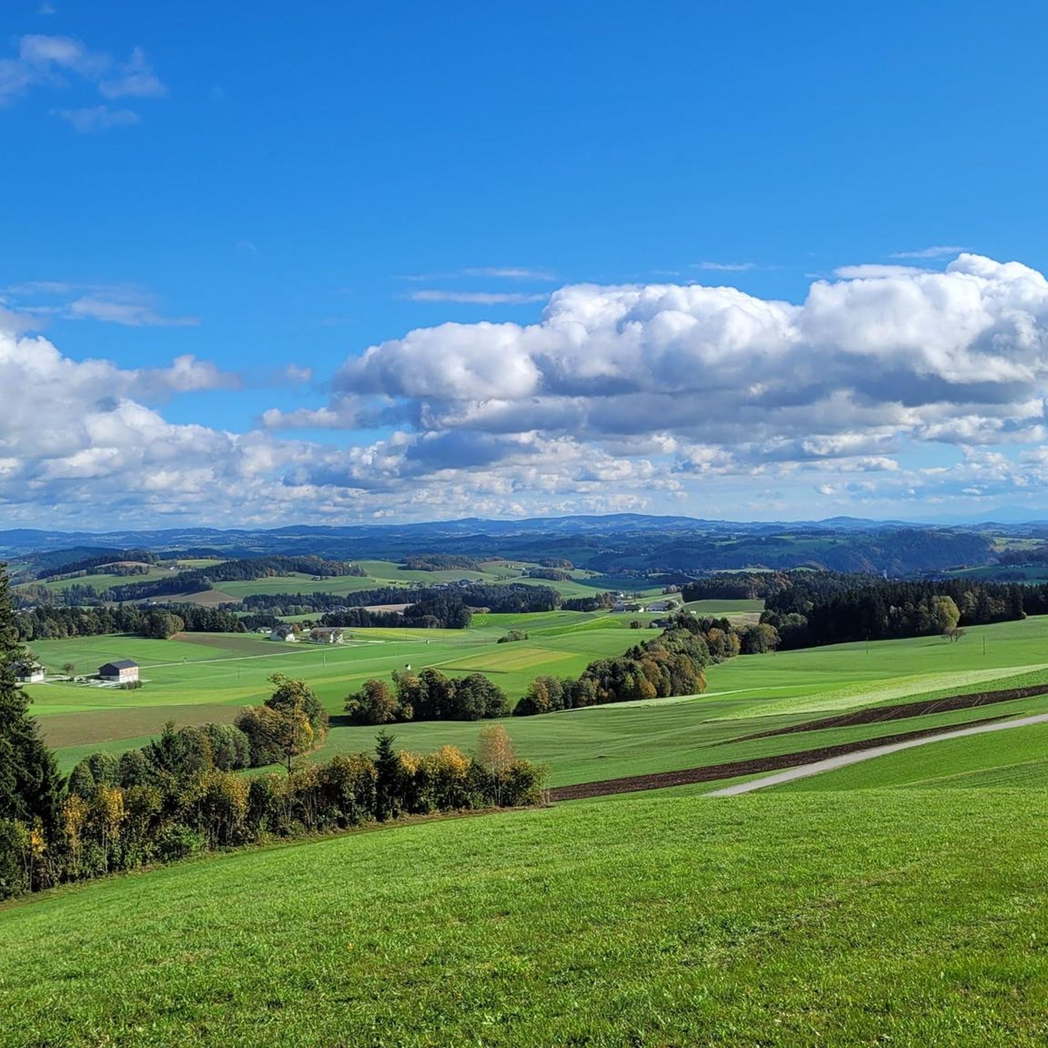
The Lutzenkreuz is the highest elevation in the Mühlviertel municipality of Putzleinsdorf and is beautifully situated in the forest with a lovely rest area.
0
1

Short climb to push, but it's definitely worth it 🤩
0
0

Beautiful hiking trails and also an experience with the mountain bike
3
0

Great tips and information to make you want to visit this place. Thank you for that!
3
0


Unfortunately mostly closed as it is privately owned.
4
0
Frequently Asked Questions
What are the most popular elevated points and viewpoints to explore near Putzleinsdorf?
The region around Putzleinsdorf offers several highly-rated elevated points and viewpoints. Among the most popular are Penzenstein Viewpoint, Chapel and Summit Cross, which provides stunning views over the Danube valley, and the Ameisberg Tower, a 24-meter-high structure on the 941-meter Ameisberg summit. Another favorite is Eidenberger Lusen Summit, known for its nearly 180-degree view towards the Bohemian Forest and the Rannastausee.
Are there any family-friendly hiking options around Putzleinsdorf's elevated areas?
Yes, many of the elevated areas and trails around Putzleinsdorf are suitable for families. For instance, the Lutzenkreuz, the highest point in the municipality at 907 meters, is easily accessible and features a pleasant rest area, making it a popular destination for all ages. The Ameisberg Tower and Cooling stone are also categorized as family-friendly.
What kind of natural features can I expect to see on the trails around Putzleinsdorf?
The region is characterized by a scenic landscape of forest and meadow paths. You'll encounter natural monuments, dense forests, and numerous viewpoints offering wide vistas. For example, the Cooling stone is a natural monument with historical significance, offering a wide view of the Kleine Mühl valley and the Bohemian Forest.
What is the highest point in the immediate vicinity of Putzleinsdorf?
The highest elevation within the municipality of Putzleinsdorf is the Lutzenkreuz, reaching 907 meters (approximately 2,976 feet). It's known for its beautiful forest location and a pleasant rest area, making it a moderate and accessible undertaking for hikers.
Are there specific hiking trails near these elevated points?
Yes, there are numerous hiking trails that incorporate these elevated points. For example, you can explore routes like the 'Lutzenkreuz (907 m) – Leitner Cross loop from Putzleinsdorf' or the 'Maria Bründl Chapel – Ameisberg Tower loop from Putzleinsdorf'. You can find more details and other options in the Hiking around Putzleinsdorf guide.
What do visitors enjoy most about the elevated areas around Putzleinsdorf?
Visitors frequently praise the stunning panoramic views, the serene forest settings, and the well-maintained paths. Many appreciate the opportunities for relaxation at various rest areas and the chance to experience the highest points in the region. The Penzenstein Viewpoint, for instance, is highlighted for its wonderful views and great rest area.
Are there any cycling routes that include these elevated areas?
While the focus of this guide is on mountain peaks, the broader region around Putzleinsdorf offers cycling opportunities. You can find various routes, including challenging ones like the 'Untermühl – Doppl Bridge loop from Putzleinsdorf', in the Cycling around Putzleinsdorf guide.
What is the difficulty level of hiking to these elevated points?
The difficulty levels vary, but many trails to these elevated points are considered moderate, suitable for various fitness levels. For example, the hike to Lutzenkreuz is a moderate undertaking with well-accessible paths. Some routes, like the 'Maria Bründl Chapel – Ameisberg Tower loop', can be more difficult, requiring good fitness and sure-footedness.
Are there any historical or cultural sites associated with these elevated points?
Yes, some elevated points have historical significance. The Cooling stone, for example, is an earlier place of sacrifice with pottery shards, walls, and trenches indicating its past. The Penzenstein Viewpoint features a small chapel and hosts an annual pilgrimage.
Can I find easy hiking trails near Putzleinsdorf's elevated areas?
Absolutely. For those seeking less strenuous options, there are several easy hiking trails available. Examples include the 'Raiffeisen Rest Area – Bauernkriegweg loop from Putzleinsdorf' and the 'Dorfer Cross – Leitner Cross loop from Putzleinsdorf'. More easy routes can be found in the Easy hikes around Putzleinsdorf guide.
What kind of views does the Eidenberger Lusen Summit offer?
From the 733-meter-high Eidenberger Lusen Summit, you can enjoy a nearly 180-degree panoramic view. This includes sights over Wegscheid towards the Dreisesselberg massif, the Steinerne Meer, Plöckenstein, Hochficht, and to the west, the Rannastausee.
Most popular routes around Putzleinsdorf
Most popular attractions around Putzleinsdorf

Get inspired with the komoot mobile app


Explore more
See even more amazing summits around Putzleinsdorf with these guides:
