The best MTB trails around Soutelo De Aguiar
4.2
(18)
91
riders
6
rides
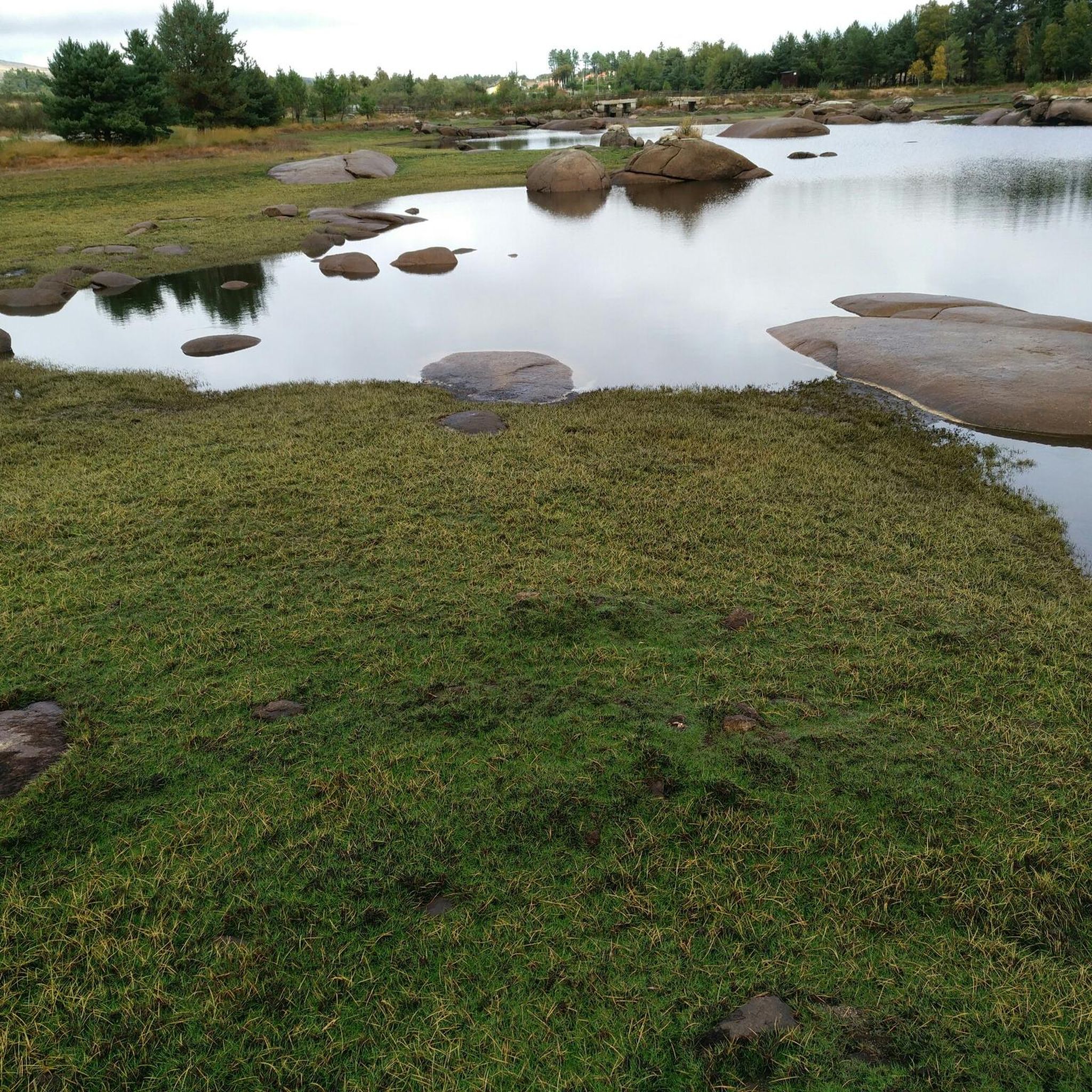
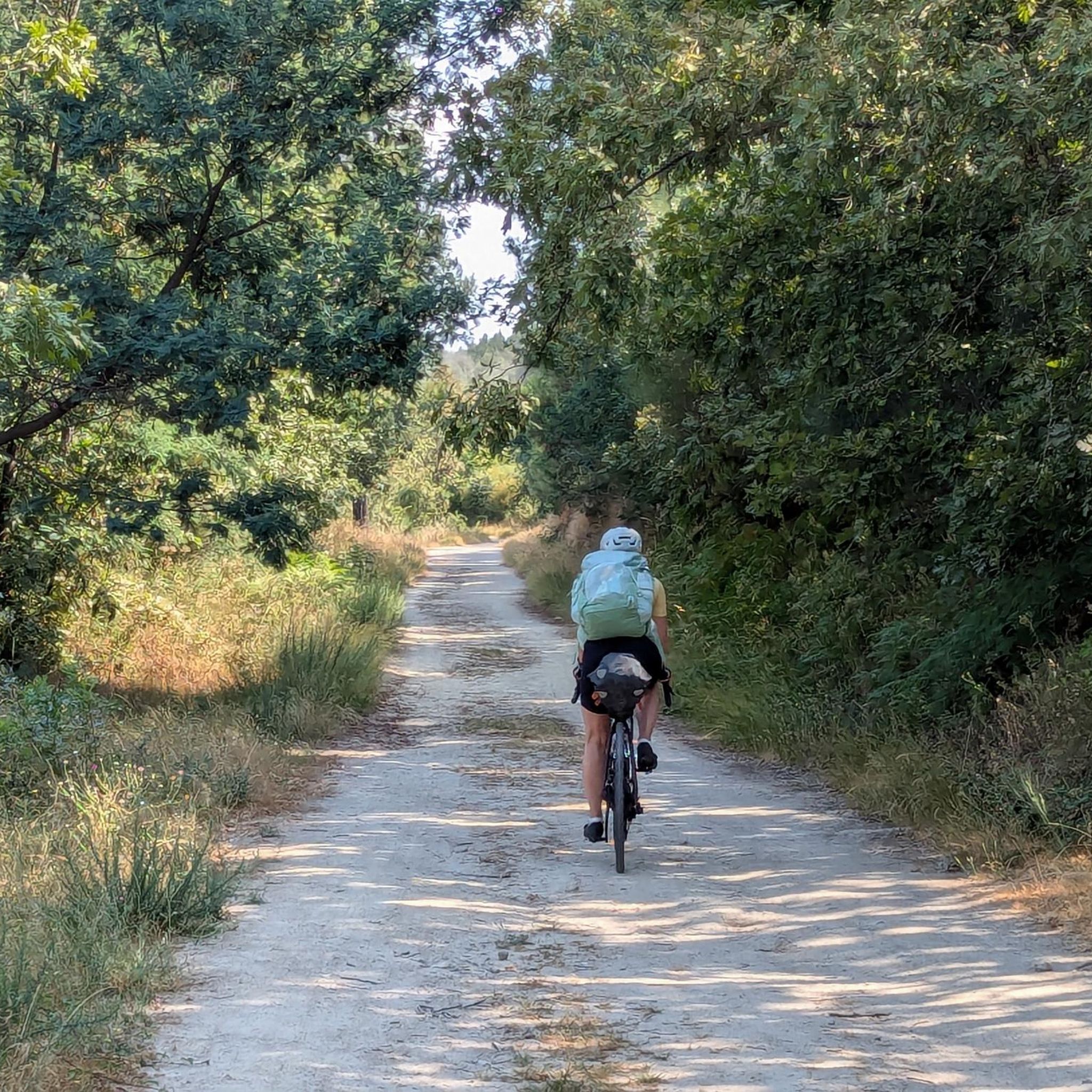
Mountain biking around Soutelo De Aguiar offers diverse terrain amidst northern Portugal's lush hills and granite landscapes. The region, situated at an average elevation of 851 meters, provides a consistently hilly to mountainous environment ideal for elevation changes. Characterized by rugged granite formations and wild mountains, the area features challenging climbs and scenic routes through valleys and alongside crystal-clear streams.
Best mountain bike trails around Soutelo De Aguiar
- The most popular mountain bike trail is Tourencinho Water Fountain – Sabarú…
Last updated: July 9, 2026
3.0
(1)
20
riders
69.5km
06:26
1,630m
1,630m
Hard mountain bike ride. Very good fitness required. Suitable for all skill levels.
5.0
(2)
20
riders
85.2km
05:20
850m
850m
Hard mountain bike ride. Very good fitness required. Suitable for all skill levels.

Sign up for free
4.0
(1)
7
riders
48.1km
03:12
690m
690m
Moderate mountain bike ride. Good fitness required. Suitable for all skill levels.
2
riders
62.6km
06:00
1,660m
1,660m
Hard mountain bike ride. Very good fitness required. Suitable for all skill levels.
2
riders
49.6km
03:42
730m
720m
Moderate mountain bike ride. Good fitness required. Suitable for all skill levels.
Our route recommendations are based on thousands of hikes, rides, and runs completed by other people on komoot.
Start today with a free account
Your next adventure awaits.
Login or Signup
Popular around Soutelo De Aguiar
Tips from the Community

It's always good to know where we have water :)
0
0
The Tâmega and Corgo Ecovia is the Cross-Border Ecological Corridor that connects Chaves and Verín, always along the riverbank. A route to explore on foot or by bike, enjoying contact with the landscape.
0
0
The medieval castle At the time of the Christian Reconquest of the Iberian Peninsula, Chaves was initially taken from the Moors by Alfonso III of León (866-910), who ordered the reconstruction of its defenses. This original construction of the castle is attributed to Count Odoarius in the 9th century. In the first quarter of the 10th century, however, Chaves fell back under Moorish rule.
0
0
The Pedras Salgadas Railway Station is a closed junction of the Corgo Line, which served the town and the spa of Pedras Salgadas, in the Vila Real District, Portugal. A decree of 13 September 1905 approved the project for the section between Ribeiro de Varges and Pedras Salgadas Station.[ The section between Vila Real and Pedras Salgadas of the Corgo Line was opened on 15 July 1907, while the next section, to Vidago, opened on 20 March 1910.
0
0
everything around is beautiful to appreciate
1
0
Magic, it feels really good, drink it, refresh your body, and enjoy a break 👌 Water source: Baldios de Tourencinho Management Board, Vila Pouca de Aguiar, next to the Corgo Ecopista.
0
0
Tâmega and Corgo International Ecovia "Poldrado de Curalha - 1889. Designed by Engineer Augusto Xavier Teixeira, this granite bridge (poldras or walkway) is very well preserved and is used for people and animals to cross the river.
0
0
Frequently Asked Questions
What types of mountain bike trails can I expect around Soutelo de Aguiar?
The region offers a diverse range of mountain bike trails, characterized by lush hills, rugged granite landscapes, and wild mountains. You'll find routes with challenging climbs and scenic descents, often passing through valleys and alongside crystal-clear streams. The terrain varies from asphalt to cobbled paths and dirt roads, catering to different riding experiences.
How many mountain bike trails are available in the Soutelo de Aguiar area?
There are 6 mountain bike trails detailed in this guide for the Soutelo de Aguiar area. These routes are split evenly between moderate and difficult ratings, offering options for various skill levels.
Are there any family-friendly mountain bike trails in Soutelo de Aguiar?
While the listed routes are rated moderate to difficult, the broader Vila Pouca de Aguiar municipality, which includes Soutelo de Aguiar, features the Ecopista do Corgo. This 29-kilometer route has varied surfaces and may offer sections more suitable for families, though specific family-friendly routes directly within Soutelo de Aguiar are not highlighted in this guide.
What are the difficulty levels of the mountain bike trails?
The mountain bike trails around Soutelo de Aguiar are rated as either moderate or difficult. There are 3 moderate routes and 3 difficult routes, providing options for riders seeking different levels of challenge.
What kind of elevation gain can I expect on these trails?
The trails in Soutelo de Aguiar feature significant elevation changes due to the mountainous terrain. For example, the difficult route Carril Fountain loop from Vila Pouca de Aguiar includes over 1600 meters of elevation gain, while moderate routes like Tourencinho Water Fountain – Sabarú Old Train Station loop from Vila Pouca de Aguiar have around 500 meters of ascent.
What do other mountain bikers say about the trails in Soutelo de Aguiar?
The mountain bike trails in Soutelo de Aguiar are highly rated by the komoot community, with an average score of 4.2 stars from over 10 reviews. More than 90 mountain bikers have used komoot to explore the varied terrain, often praising the challenging climbs and scenic routes through the region's natural beauty.
Are there any circular mountain bike routes available?
Yes, all the mountain bike routes listed in this guide are circular. Examples include the moderate Alvão Dam loop from Vidago and the challenging Poldrado de Curalha – Palácio de Vidago loop from Vila Pouca de Aguiar.
What natural attractions or landmarks can I see while mountain biking?
The region is rich in natural beauty. You can expect to ride through areas characterized by granite landscapes, wild mountains like Serra do Alvão and Serra da Padrela, and scenic valleys with crystal-clear streams. Some routes may pass by features like the Alvão Dam.
What is the best time of year for mountain biking in Soutelo de Aguiar?
While specific seasonal recommendations aren't provided, the region's diverse terrain and natural scenery can be enjoyed across various seasons. Given its northern Portugal location and mountainous character, spring and autumn generally offer pleasant temperatures for outdoor activities, avoiding the peak heat of summer or potential winter conditions at higher elevations.
Are there any long-distance mountain bike routes for experienced riders?
Yes, there are several longer routes for experienced riders. For instance, the difficult Mountainbike loop from Pedras Salgadas covers over 62 kilometers with significant elevation gain, and the Poldrado de Curalha – Palácio de Vidago loop from Vila Pouca de Aguiar is over 85 kilometers long.
Can I find routes that pass by water features?
Yes, the region is known for its valleys and crystal-clear streams. Routes like the Tourencinho Water Fountain – Sabarú Old Train Station loop from Vila Pouca de Aguiar suggest proximity to water features, and the Alvão Dam loop from Vidago directly incorporates a significant water body.
Most popular routes around Soutelo De Aguiar

Get inspired with the komoot mobile app


Explore more
Browse the best MTB trails in other regions.
