The best walks and hikes around Sá
4.4
(19)
105
hikers
7
hikes
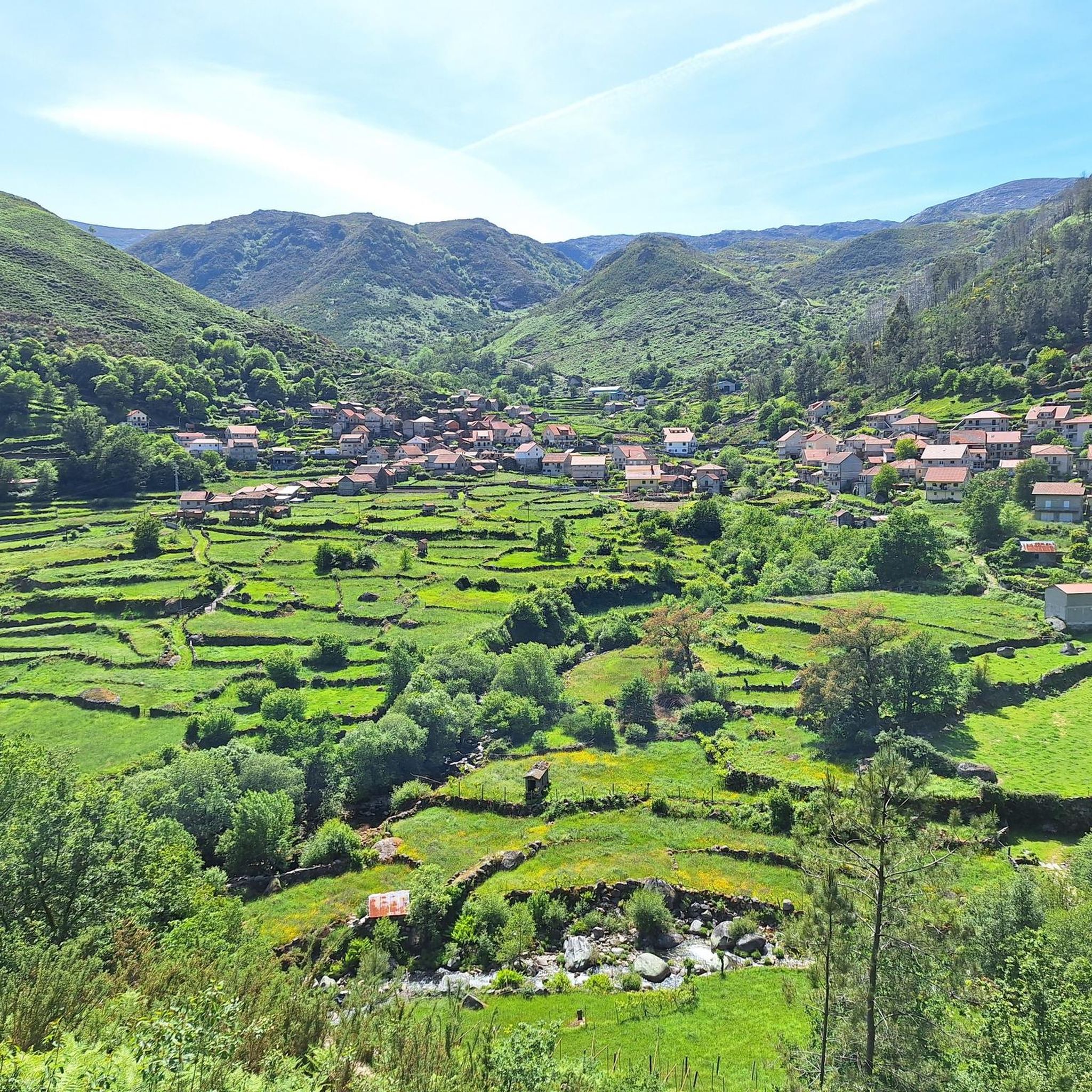
Hiking around Sá features varied terrain with routes exploring historical sites, river valleys, and ancient landmarks. The region includes ascents and descents, indicating a landscape of rolling hills and natural features. Trails often lead through areas with cultural significance, such as ruins and petroglyphs.
Best hiking trails around Sá
- The most popular hiking route is Branda da Lapinheira (Ruin) – Branda de Crastibô loop from Rio de Aveleira, a 8.4 miles (13.5 km) trail that takes 5 hours 7…
Last updated: July 4, 2026
4.0
(7)
49
hikers
Hard hike. Very good fitness required. Mostly accessible paths. Sure-footedness required.
5.0
(4)
10
hikers
6.19km
01:50
180m
170m
Easy hike. Great for any fitness level. Easily-accessible paths. Suitable for all skill levels.

Sign up for free
5.0
(2)
13
hikers
13.5km
04:16
560m
550m
Moderate hike. Good fitness required. Easily-accessible paths. Suitable for all skill levels.
4.0
(2)
7
hikers
8.93km
02:30
180m
180m
Moderate hike. Good fitness required. Easily-accessible paths. Suitable for all skill levels.
3.0
(2)
3
hikers
4.45km
01:18
130m
130m
Easy hike. Great for any fitness level. Easily-accessible paths. Suitable for all skill levels.
Get access to more routes and recommendations from other explorers.
Sign up for free
Already have an account?
Our route recommendations are based on thousands of hikes, rides, and runs completed by other people on komoot.
Start today with a free account
Your next adventure awaits.
Login or Signup

Tips from the Community

Traditional haystack (Meda de feno) at Branda do Furado. These cone-shaped stacks were carefully built to store and dry grass for the winter. A central wooden pole stabilizes the pile and prevents the hay from slipping or being blown away, preserving it for livestock. They are a distinctive feature of the traditional agricultural life in the Peneda-Gerês mountains.
0
0
Here the trail passes several ruins belonging to Branda de Crastibô. A branda is a type of seasonal settlement in the mountains, where people used to move with their cattle in summer (transhumance tradition, especially in Peneda-Gerês).
0
0
A branda is a type of seasonal settlement in the mountains, where people used to move with their cattle in summer (transhumance tradition, especially in Peneda-Gerês).
0
0

In the 12th century it was the main border defense of Alto Minho, forming the northernmost guard post in Portugal on the section where the Minho River begins its border function and monitoring the crossing into Galicia (WIKIPEDIA). Today just a ruin. There is a small museum in the preserved keep.
0
0

Visiting hours: M-D: 10:00-17:00. L: closed
0
0

Not suitable for buggies
0
0

The Concello de As Neves has a rich natural and cultural heritage. Among its main archaeological resources is one of the main petroglyph stations in Galicia.
9
0
In the parish of Taboexa and in the council of As Neves, we will find very close to the Castro de Altamira, the remains of a set of flour mills under a leafy forest made up of oaks that survived the voracious fires of the year 2017 and that burned all this zone.
9
0
Frequently Asked Questions
What kind of terrain can I expect when hiking in Sá?
Hiking in Sá features a diverse landscape characterized by rolling hills, river valleys, and areas with significant ascents and descents. Trails often lead through historical sites and ancient landmarks, offering a blend of natural beauty and cultural exploration.
Are there easy hiking trails suitable for beginners in Sá?
Yes, Sá offers several easy hiking options. For instance, the Hiking loop from Branda da Aveleira is an easy 6.2 km route, and the A Coutada Petroglyphs loop from A Lomba is another easy trail covering 4.5 km, perfect for a more relaxed outing.
What historical sites and landmarks can I discover along the hiking trails in Sá?
Sá is rich in historical and cultural landmarks. You can explore sites like the Castle of Melgaço, which is part of the Castle of Melgaço loop from Melgaço. Other notable historical points include the Grande Hotel do Pezo Ruins and the ancient A Coutada Petroglyphs.
Are there any circular hiking routes available in Sá?
Yes, many of the trails in Sá are designed as loops, offering convenient circular routes. Examples include the challenging Branda da Lapinheira (Ruin) – Branda de Crastibô loop from Rio de Aveleira, the moderate Hiking loop from Tangil, and the easy Hiking loop from Branda da Aveleira.
What natural features are prominent in the Sá hiking region?
The Sá region is characterized by its river valleys and rolling hills. Hikers can also encounter unique natural monuments such as the Terraced Fields of the Vez Valley and various summits like Alto San Nomedio Summit and Hermitage, offering scenic views.
What do other hikers enjoy most about hiking in Sá?
The area is highly rated by the komoot community, with an average score of 4.25 stars from over 18 reviews. Hikers often praise the varied terrain, the historical significance of the routes, and the opportunities to explore river valleys and ancient landmarks.
Are there any viewpoints or summits to reach during hikes in Sá?
Yes, the region offers several elevated points with potential viewpoints. The Alto San Nomedio Summit and Hermitage and Alto de San Fins are notable summits that provide panoramic views of the surrounding landscape.
How long do hikes in Sá typically take?
The duration of hikes in Sá varies depending on the route and your pace. Easy trails like the A Coutada Petroglyphs loop from A Lomba can be completed in about 1 hour 18 minutes, while more challenging routes such as the Branda da Lapinheira (Ruin) – Branda de Crastibô loop from Rio de Aveleira may take around 5 hours 7 minutes.
Are there any trails in Sá that feature bridges or unique man-made structures?
Yes, you can find interesting structures like the Ponte da Barbeita, a bridge that adds to the scenic beauty and historical context of the area. The Terraced Fields of the Vez Valley also represent a significant man-made feature integrated into the natural landscape.
What is the longest hiking route available in Sá?
The longest hiking routes in Sá are approximately 13.5 km (8.4 miles) in length. These include the challenging Branda da Lapinheira (Ruin) – Branda de Crastibô loop from Rio de Aveleira and the moderate Hiking loop from Tangil, both offering extensive exploration of the region.
Can I find trails that combine natural beauty with cultural exploration in Sá?
Absolutely. Many trails in Sá are designed to showcase both the natural environment and the region's rich history. Routes often pass through river valleys and rolling hills while also leading to ancient landmarks, ruins, and petroglyphs, providing a comprehensive experience.
Most popular routes around Sá
Most popular attractions around Sá

Get inspired with the komoot mobile app


Explore more
Browse the best Hikes in other regions.
