The best cycling routes around Padroso
5.0
(1)
36
riders
4
rides
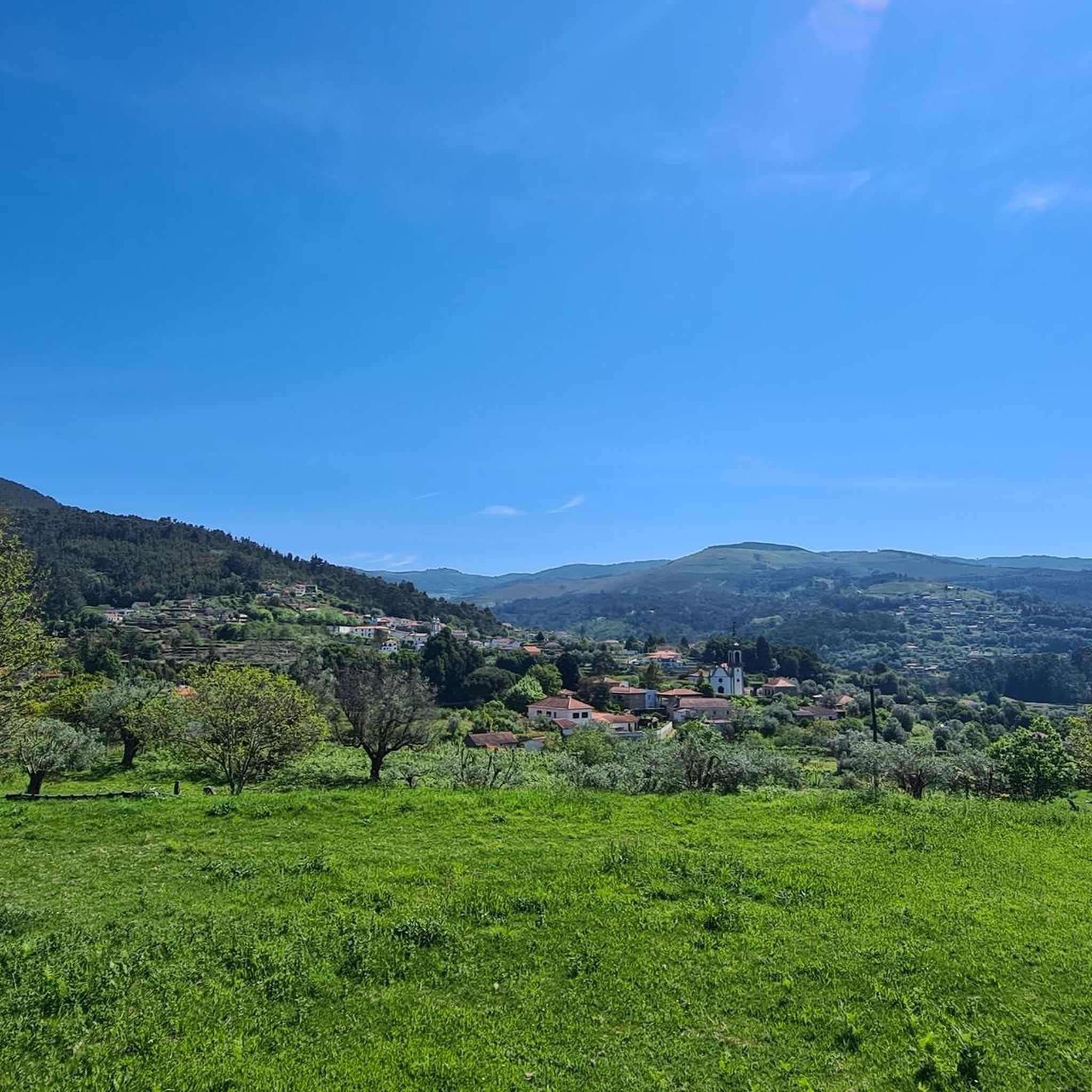
Touring cycling around Padroso features routes through varied terrain, often characterized by significant elevation changes and historical landmarks. The region's landscape includes river valleys, such as those crossed by medieval and Roman bridges, and areas with notable architectural structures like towers and palaces. These routes provide opportunities to explore the cultural and natural features of the area.
Best touring cycling routes around Padroso
- The most popular touring cycling route is Vilarinho Medieval Bridge – Bar Kay's de Vez loop from…
Last updated: July 4, 2026
20
riders
56.7km
05:18
1,310m
1,310m
Hard bike ride. Very good fitness required. Mostly paved surfaces. Suitable for all skill levels.
5.0
(1)
9
riders
74.4km
05:05
1,150m
1,150m
Hard bike ride. Very good fitness required. You may need to push your bike for some segments of this route.

Sign up for free
6
riders
24.3km
01:34
280m
280m
Moderate bike ride. Good fitness required. Mostly paved surfaces. Suitable for all skill levels.
1
riders
36.8km
02:56
960m
960m
Hard bike ride. Very good fitness required. Mostly paved surfaces. Suitable for all skill levels.
Our route recommendations are based on thousands of hikes, rides, and runs completed by other people on komoot.
Start today with a free account
Your next adventure awaits.
Login or Signup
Popular around Padroso

Tips from the Community

For those of us who are older, it reminds us of what it was like to cross from one country to another, when you might randomly have to open the trunk of your car so that both police forces could check what you were carrying, so that younger people could get their documents, and above all so that everyone can see how beautiful and enriching it is to be able to live in peace between neighboring countries.
0
0


Fantastic area for cycling or walking
1
0

The Tui International Bridge is a landmark on the border between Portugal and Spain, connecting the Galician city of Tui to Valença, Portugal, across the Minho River. This historic metal truss bridge serves as a crossing for cars, trains, and pedestrians. It is also part of the Camino de Santiago route, offering views of the river and both cities.
1
0
The Tui International Bridge is a landmark on the border between Portugal and Spain, connecting the Galician city of Tui to Valença, Portugal, across the Minho River. This historic metal truss bridge serves as a crossing for cars, trains, and pedestrians. It is also part of the Camino de Santiago route, offering views of the river and both cities.
1
0
The Tui International Bridge is a landmark on the border between Portugal and Spain, connecting the Galician city of Tui to Valença, Portugal, across the Minho River. This historic metal truss bridge serves as a crossing for cars, trains, and pedestrians. It is also part of the Camino de Santiago route, offering views of the river and both cities.
1
0

the river is impeccable, it has very clean water, shade and river beaches
2
0

Frequently Asked Questions
How many touring cycling routes are available around Padroso?
There are 4 touring cycling routes around Padroso, offering a variety of experiences for different skill levels. The region is known for its varied terrain, historical landmarks, and significant elevation changes.
Are there any easy or beginner-friendly touring cycling routes in Padroso?
While Padroso's touring cycling routes are generally characterized by significant elevation changes, there is one moderate route available: Lapela Tower – Brejoeira Palace loop from Trute. This 15.1-mile (24.3 km) trail is a good option for those looking for a less strenuous ride compared to the more difficult options.
What are some of the longer touring cycling routes near Padroso?
For those seeking a longer challenge, the Roman Bridge of Pontenova – Ponte de Fillaboa loop from Tui is a difficult 46.1-mile (74.2 km) path. Another substantial option is the Vilarinho Medieval Bridge – Bar Kay's de Vez loop from Arcos de Valdevez, which covers 35.7 miles (57.4 km).
Are there any circular touring cycling routes in the Padroso area?
Yes, all the touring cycling routes listed for Padroso are designed as loops, allowing you to start and end at the same point. Examples include the Vilarinho Medieval Bridge – Bar Kay's de Vez loop from Arcos de Valdevez and the Lapela Tower – Brejoeira Palace loop from Trute.
What kind of historical landmarks can I expect to see on touring cycling routes around Padroso?
Padroso's touring cycling routes often feature historical landmarks. You can encounter medieval and Roman bridges, such as the Vilarinho Medieval Bridge, and architectural structures like the Lapela Tower and Brejoeira Palace. The region's landscape also includes river valleys, adding to the scenic and historical appeal.
What is the best season for touring cycling in Padroso?
Given the significant elevation changes and varied terrain, spring and autumn are generally ideal for touring cycling in Padroso. The weather is typically milder, making the climbs more manageable and the scenery vibrant. Summer can be warm, especially on exposed sections, while winter might bring cooler temperatures and potentially wet conditions.
What should I bring for a touring cycling trip in Padroso?
Due to the varied terrain and elevation changes, it's advisable to bring appropriate gear. This includes a well-maintained touring bicycle, a helmet, sufficient water, snacks, and layers of clothing to adapt to changing weather. Given the potential for longer routes and remote sections, a basic repair kit and navigation tools are also recommended.
Are there any natural attractions or viewpoints along the touring cycling routes?
While specific viewpoints are not detailed for every route, the region offers natural beauty. You can explore areas like the Terraced Fields of the Vez Valley and the Poço das Caldeiras River Beach. The routes themselves traverse river valleys and offer extensive views of the landscape.
What do other touring cyclists say about the routes in Padroso?
The touring cycling routes in Padroso are highly rated by the komoot community, with an average score of 5.0 stars from over 1 review. More than 30 touring cyclists have used komoot to explore the region, often praising the challenging yet rewarding terrain and the opportunity to discover historical and natural features.
Are there any other notable places to explore near the touring cycling routes?
Beyond the routes themselves, the area around Padroso offers several points of interest. You can find the Castelo das Furnas, the Corno de Bico Summit (883 m), and the wooden boardwalk along the river in the Transboundary Gerês–Xurés Biosphere Reserve. These provide additional opportunities for exploration before or after your ride.
What is the elevation gain like on Padroso's touring cycling routes?
The touring cycling routes around Padroso are characterized by significant elevation changes. For example, the Vilarinho Medieval Bridge – Bar Kay's de Vez loop from Aboim das Choças involves an ascent of approximately 965 meters (3,166 feet), indicating a challenging and hilly terrain across the region.
Most popular routes around Padroso
Most popular attractions around Padroso

Get inspired with the komoot mobile app


Explore more
Browse the best Cycling routes in other regions.
