The best road cycling routes around Galveias
4.0
(4)
112
riders
13
rides
Road cycling around Galveias offers routes through an undulating landscape, characterized by open countryside and views of local water bodies. The region features a network of roads suitable for various road cycling experiences. Routes often include moderate elevation changes, providing a balanced challenge for cyclists. The area's terrain supports both shorter rides and longer, more demanding excursions.
Best road cycling routes around Galveias
- The most popular road cycling route is Roadbike loop from Tramaga, a 41.8 miles (67.3 km)…
Last updated: October 25, 2026
13
riders
68.8km
03:12
430m
430m
Moderate road ride. Good fitness required. Mostly well-paved surfaces and easy to ride.
13
riders
Moderate road ride. Good fitness required. Mostly well-paved surfaces and easy to ride.

9
riders
68.7km
03:00
590m
590m
Moderate road ride. Good fitness required. Mostly well-paved surfaces and easy to ride.
4.0
(4)
9
riders
44.4km
02:00
430m
430m
Moderate road ride. Good fitness required. Mostly well-paved surfaces and easy to ride.
5
riders
Moderate road ride. Good fitness required. Mostly well-paved surfaces and easy to ride.
Get access to more routes and recommendations from other explorers.
Already have an account?
Our route recommendations are based on thousands of hikes, rides, and runs completed by other people on komoot.
Tips from the Community

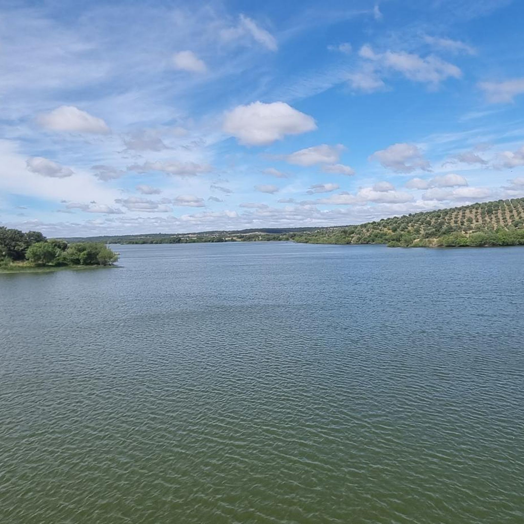
The Albufeira do Maranhão is a large reservoir near Avis in the Portuguese region of Alentejo, east of Montargil. It was created by the construction of the dam on the Ribeira de Seda river, which was completed in 1957. The lake covers around 1,960 hectares and is primarily used for the irrigation of agricultural land and for power generation. Its widely branched shores with cork oaks, olive trees, and gentle hills characterize the typical landscape of the Alentejo.
2
0
The Barragem de Montargil is a large reservoir near Ponte de Sor in the Portuguese region of Alentejo. The dam, completed in 1958, impounds the Sor River into a lake about 20 kilometers long, which was originally created for the irrigation of agricultural land and for power generation.
1
0
The municipal airfield of Ponte de Sor is located in the Portuguese region of Alentejo and was opened on November 17, 2004. Originally, it had an 800-meter-long runway, which was extended to 1,800 meters in 2008. Today, the airfield is an important center for pilot training, aircraft maintenance, and the deployment of firefighting aircraft for forest fire suppression. The site features modern aircraft hangars, training facilities, and a flight control tower opened in 2023. The airfield is also known for the international Portugal Air Summit, where new developments in aviation are presented.
1
0
Vale da Bica was formerly an important agricultural area for Ponte de Sor due to its fertile soils and good water supply.
2
0

Fountain providing fresh water all year round, even on days when the thermometer 🌡 exceeds 40°C.
12
0
The Ponte de Sor pedestrian bridge, inaugurated in 2012, is a 32-meter-long tubular metal structure over the Ribeira de Sor. Designed by artist Leonel Moura as an interactive sculpture, it stands out for its LED lights that change color with the passage of pedestrians and cyclists. Main Features Structure: 32 meters long in a tubular three-dimensional truss, without central pillars. Author: Plastic conception by the visual artist Leonel Moura. Usefulness: Connects the riverside area (next to the restored mill) to the left bank (Arneiro area), serving pedestrians, cyclists, and hand-pushed motorcycles. Night Lighting: Equipped with sensors and lights that interact and change color according to the movement of passers-by. Location and Setting Location: Riverside area of Ponte de Sor, in the district of Portalegre. Routes: Part of the local urban art route and the PR1 PSR - Percurso da Ribeira de Sor hiking trail.
8
0

Sophia de Mello Breyner Andresen (Porto, 1919 – Lisbon, 2004) is one of the highest voices of the European twentieth century. The first woman to win the prestigious Camões Prize (1999), her poetry combines the light of the Mediterranean, classical myth, love for the sea, and a rigorous civil commitment against the dictatorship.
1
0
This tribute is a public art piece in corten steel titled "Voa", developed after a challenge launched by the municipality. The Concept: The sculpture cuts out the silhouettes, in positive and negative, of a flock of swallows in full flight. They appear united with each other, conveying a strong idea of freedom and ascent towards the sky. The Link to the Poetess: The piece was specifically designed to integrate a poem by Sophia de Mello Breyner Andresen focused on the values of freedom and justice, making the perfect counterpoint to the Court building located there. The choice of location and poem evokes Sophia's famous thought, so often cited in Ponte de Sor: "We see, we hear and we read, we cannot ignore".
10
0
Frequently Asked Questions
What is the general difficulty level of road cycling routes around Galveias?
The road cycling routes in Galveias are primarily moderate, with a few more challenging options. There are 12 moderate routes and 1 difficult route available, making the area suitable for cyclists with some experience. Beginners might find the moderate routes a good challenge.
Are there any challenging road cycling routes for experienced riders in Galveias?
Yes, for experienced riders seeking a challenge, there is at least one difficult route available. The region's undulating landscape and moderate elevation changes across many routes also provide a good workout for those looking to push themselves.
What is the typical length and duration of road cycling routes in the Galveias area?
Road cycling routes around Galveias vary in length, generally ranging from around 40 to over 100 kilometers. For example, the Roadbike loop from Tramaga is 67.3 km and takes about 3 hours 6 minutes, while the View of the Montargil Dam – Cabeção Railway Halt loop from Ponte de Sor extends to 109.3 km, typically completed in around 4 hours 40 minutes.
Are the road cycling routes around Galveias mostly circular?
Yes, many of the road cycling routes in the Galveias area are designed as loops. This allows cyclists to start and finish at the same point, which is convenient for those traveling by car. Examples include the Roadbike loop from Tramaga and the View of the Montargil Dam loop from Ponte de Sor.
What kind of scenery can I expect while road cycling near Galveias?
The road cycling routes around Galveias offer scenic views of open countryside, rolling terrain, and local water bodies, including dams. You can expect a mix of rural landscapes and expansive vistas. For instance, the View of the Montargil Dam loop from Ponte de Sor provides excellent views of the Montargil Dam.
What do other road cyclists say about the routes in Galveias?
The road cycling routes in Galveias are highly rated by the komoot community, with an average score of 4.0 stars from over 4 reviews. Cyclists often praise the varied terrain and the opportunities to explore the region's open countryside.
Are there any specific landmarks or points of interest along the road cycling routes?
While the guide data does not list specific nearby attractions, the routes often pass through varied countryside and offer views of local features like the Montargil Dam. The region's charm lies in its natural landscapes and rural character.
What are the road conditions like for cycling in Galveias?
The roads in Galveias are generally suitable for road cycling, forming a network that supports various cycling experiences. As with any rural area, road quality can vary, but the routes are chosen to provide a balanced challenge and enjoyable ride.
When is the best season for road cycling around Galveias?
While specific seasonal recommendations are not provided, regions with open countryside like Galveias are often best enjoyed in spring and autumn when temperatures are milder. Summer can be very warm, so early morning or late afternoon rides might be preferable during that season.
Are there options for less crowded road cycling routes in Galveias?
The Galveias region is characterized by open countryside, suggesting that many routes offer a sense of solitude away from urban crowds. Exploring routes like the Train Station – Countryside Landscape loop from Ponte de Sor can provide a peaceful cycling experience through varied rural settings.
How many road cycling routes are available in the Galveias area?
There are over 10 road cycling routes available around Galveias, offering a good selection for different preferences and fitness levels. In total, there are 13 tours listed in the area.
Most popular routes around Galveias
Most popular attractions around Galveias

Get inspired with the komoot mobile app


Explore more
Browse the best Road cycling routes in other regions.
