The best running trails around Sazes Da Beira
158
runners
13
runs
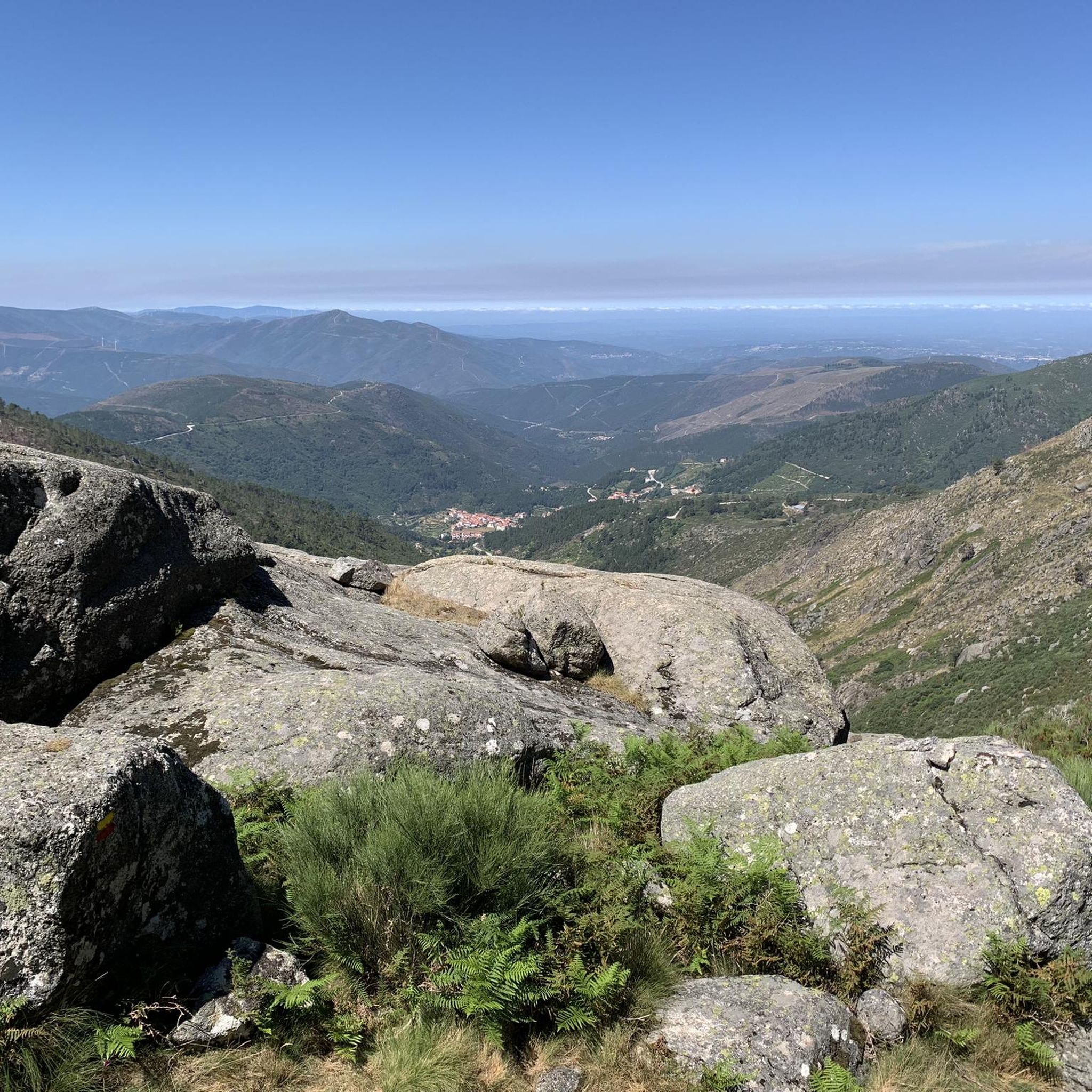
Jogging routes around Sazes da Beira traverse a diverse landscape within the Serra da Estrela mountain range, characterized by granite plateaus, deep U-shaped glacial valleys, and pristine rivers. The region offers varied terrain, including paths alongside ancient irrigation channels and routes through pine forests and terraced agricultural fields. These running routes provide access to dramatic mountain scenery and historical sites, catering to different fitness levels.
Best jogging routes around Sazes Da Beira
- The most popular jogging route is Oh Meu…
Last updated: July 7, 2026
8
runners
57.0km
08:32
2,990m
3,050m
Hard run. Very good fitness required. Mostly paved surfaces. Suitable for all skill levels.
38
runners
25.3km
04:01
1,470m
1,470m
Hard run. Very good fitness required. Mostly paved surfaces. Suitable for all skill levels.

Sign up for free
12
runners
Hard run. Very good fitness required. Mostly paved surfaces. Suitable for all skill levels.
7
runners
8.50km
00:55
120m
130m
Moderate run. Good fitness required. Mostly paved surfaces. Suitable for all skill levels.
9
runners
21.4km
02:41
470m
470m
Hard run. Very good fitness required. Mostly paved surfaces. Suitable for all skill levels.
Get access to more routes and recommendations from other explorers.
Sign up for free
Already have an account?
Our route recommendations are based on thousands of hikes, rides, and runs completed by other people on komoot.
Start today with a free account
Your next adventure awaits.
Login or Signup
Other adventures around Sazes Da Beira

Tips from the Community

The way is arduous, but the destination is worth it.
0
0

The Devil's Horns are a prominent granite rock formation with two horn-like points, located in the Serra da Estrela mountain range, near Lapa dos Dinheiros and Senhora do Desterro (not in Gerês, but in Seia, Portugal). They are the highlight of a famous circular hiking trail that follows a water channel and the Caniça stream, offering stunning landscapes, lagoons, and waterfalls. 👍🥾
0
0

Covão dos Conchos is an artificial lagoon located in the Serra da Estrela Natural Park, Portugal, near the mountain village of Sabugueiro. Covão dos Conchos became famous for its bell-mouth spillway[1]. The spillway was built in 1955 to allow water to be transferred from the Ribeira das Naves River to Lagoa Comprida. It is part of the Serra da Estrela Hydroelectric System. This science fiction-style spillway became famous when photographs of the hole went viral on social media in 2016. Over the past 60 years, the growth of vegetation at the funnel's mouth has created extraordinary biodiversity and increased its ethereal allure. It is 4.6 meters high and 48 meters in circumference. The tunnel that collects the water is 1,519 meters long.
2
0
Covão dos Conchos is an artificial lagoon located in the Serra da Estrela Natural Park, Portugal, near the mountain village of Sabugueiro. Covão dos Conchos became famous for its bell-mouth spillway[1]. The spillway was built in 1955 to allow water to be transferred from the Ribeira das Naves River to Lagoa Comprida. It is part of the Serra da Estrela Hydroelectric System. This science fiction-style spillway became famous when photographs of the hole went viral on social media in 2016. Over the past 60 years, the growth of vegetation at the funnel's mouth has created extraordinary biodiversity and increased its ethereal allure. It is 4.6 meters high and 48 meters in circumference. The tunnel that collects the water is 1,519 meters long.
1
0
The Lapa dos Dinheiros river beach is in perfect harmony with nature. Located in the parish of Lapa dos Dinheiros, on the Caniça River, a right-bank tributary of the Alva River, this bathing area is nestled in a mountainous landscape dominated by the Lapa Souto (south of Lapa) and imposing granite outcrops. With clear water, very appealing for swimming, the beach boasts the award for accessible beach and has lifeguards and a bar available to visitors. The rugged terrain of the valley causes the river to form a succession of small waterfalls nearby. The Lapa Souto, in addition to its valuable collection of centuries-old chestnut trees, is also home to a high level of biodiversity. From the bridge, a pedestrian path leads to the Moura Hole and a viewpoint over the Caniça Waterfalls. The Buraco da Moura is a natural cave system created by the sliding and accumulation of large granite blocks, which formed a complex system of rooms and galleries. How to get there? Once in Seia, follow the EN231 to S. Romão. From there, continue uphill for about 5 km, toward Loriga/Lapa, until you find the sign for Lapa dos Dinheiros on the left. Once inside the town, simply follow the beach signs. Coordinates: 40º 23′ 07.0″ N / 7º 41′ 50.1″ W
1
0

The Sanctuary of Our Lady of Desterro stands on the banks of the Alva River as an authentic path of faith, marked by ten chapels built over more than two centuries, between 1650 and 1892. Near the village, nature itself left its masterpiece: a curious rock, sculpted by time, that resembles the head of an old woman watching over the mountains.
0
0

A beautiful nature trail, about 9 km round trip to Covão dos Conchos. Unfortunately, on August 15th, the water couldn't reach the hole and thus reveal the waterfalls. It's a reservoir, part of the Serra da Estrela hydroelectric system. A funnel-shaped drainage structure that allows water to flow from this body of water to Lagoa Comprida. The spillway was built in 1955 to divert water from Ribeira das Naves to Lagoa Comprida. Over the past 60 years, moss and foliage have grown over the mouth of the funnel, creating a captivating spectacle. It is 4.6 meters high and 4.8 meters in circumference. The tunnel that collects the water is 1,519 meters long. It's a stunning place to visit, not only for the combination of human intervention and nature, but also for the surrounding landscape.
2
1
This reservoir, part of the Serra da Estrela hydroelectric system, is a popular tourist destination. Part of this attraction comes from a funnel-shaped drainage structure that allows water to flow from this body of water to Lagoa Comprida. The spillway was built in 1955 to divert water from Ribeira das Naves to Lagoa Comprida. The conical spillway was little known until photos of the hole went viral in 2016. Over the past 60 years, moss and foliage have grown over the mouth of the funnel, creating a captivating spectacle. It is 4.6 meters high and 4.8 meters in circumference. The tunnel that collects the water is 1,519 meters long. It is a stunning place to visit, not only for the combination of human intervention on nature, but also for the surrounding landscape. The trail from Lagoa Comprida leads here is truly beautiful in any season. Bring windbreaker and water.
2
0
Frequently Asked Questions
What types of terrain can I expect on the running routes around Sazes Da Beira?
The running routes in Sazes Da Beira, nestled within the Serra da Estrela mountain range, offer a diverse range of terrains. You'll encounter granite plateaus, deep U-shaped glacial valleys, and paths alongside pristine rivers and ancient irrigation channels (levadas). Many trails also wind through pine forests and terraced agricultural fields, providing varied surfaces and scenic views.
Are there any less challenging running routes for beginners in the Sazes Da Beira area?
While many routes in the region are rated as difficult, there are moderate options available. For instance, the area offers paths that follow ancient levadas or trace rivers, which tend to be flatter or gently undulating. These can be a good starting point for those looking for a less strenuous run. You can find several moderate routes listed in the guide.
Can I find long-distance running trails in Sazes Da Beira?
Yes, Sazes Da Beira is an excellent destination for long-distance running. For example, the Oh Meu Deus 50k Trail is a challenging 35.4 miles (57.0 km) route, offering significant elevation gain and a comprehensive experience of the mountainous landscape. Another option is the Pico da Serra da Estrela loop from Loriga, which spans 15.9 miles (25.7 km) with panoramic views.
Are there any circular running routes available in Sazes Da Beira?
Yes, several running routes in the Sazes Da Beira area are circular, allowing you to start and finish at the same point. A notable example is the Cornos do Diabo – Aqueduct of the Caniça Route loop from Lapa dos Dinheiros, a 7.0 miles (11.2 km) trail that takes you through historical aqueduct areas.
What kind of natural attractions or landmarks can I see while running in Sazes Da Beira?
The running routes around Sazes Da Beira are rich with natural beauty and historical sites. You might encounter stunning glacial valleys, impressive rock formations, and picturesque rivers. Specific highlights include the unique Covão dos Conchos Trail, the serene Long Lake, and the dramatic Cornos do Diabo. You can also discover traces of old wolfram mines and charming villages like Sazes da Beira itself, known for its imposing fountain.
Are there any running routes that pass by waterfalls or lakes?
Absolutely. The region is known for its pristine rivers and water features. You can find routes that lead to beautiful lakes such as Long Lake and Covão do Ferro Lake. For a waterfall experience, consider exploring trails near Poço da Broca de Serapitel.
What is the best time of year to go running in Sazes Da Beira?
Sazes Da Beira offers a compelling environment for running throughout much of the year. Spring and autumn generally provide pleasant temperatures and vibrant landscapes. Summer can be warm but is ideal for higher altitude routes. Winter running is possible, but conditions can be challenging due to snow and ice, especially at higher elevations within the Serra da Estrela.
Are there options for family-friendly running or walking in the Sazes Da Beira area?
While many routes are challenging, the diverse terrain includes gentler paths suitable for families. Trails following ancient levadas or river paths often provide scenic and relatively flat options. These can be great for a family outing, allowing everyone to enjoy the natural beauty at a more relaxed pace.
Can I bring my dog on the running routes around Sazes Da Beira?
Many outdoor trails in Portugal, especially in natural parks like Serra da Estrela, are generally dog-friendly, provided dogs are kept under control, ideally on a leash, and owners clean up after them. It's always a good idea to check specific trail regulations or local signage, but generally, you should be able to enjoy the natural paths with your canine companion.
How many running routes are available in the Sazes Da Beira region?
There are over a dozen dedicated running routes around Sazes Da Beira documented on komoot, offering a variety of distances and difficulty levels. This includes 5 moderate routes and 9 difficult routes, ensuring options for different fitness levels and preferences.
What makes the running experience in Sazes Da Beira unique compared to other regions?
The running experience in Sazes Da Beira is unique due to its location within the majestic Serra da Estrela mountain range. You'll find a blend of dramatic glacial landscapes, historical elements like old wolfram mines and ancient terraced fields, and charming mountain villages. The combination of varied terrain, panoramic views, and cultural points of interest creates a distinctive and rewarding running environment.
Are there any challenging running routes for experienced runners?
Yes, Sazes Da Beira is well-suited for experienced runners seeking a challenge. Many routes feature significant elevation gains and technical terrain. For example, the Oh Meu Deus 50k Trail and the Covão dos Conchos loop from Albufeira de Lagoa Comprida are both rated as difficult and offer substantial distances and climbs.
Most popular routes around Sazes Da Beira
Most popular attractions around Sazes Da Beira

Get inspired with the komoot mobile app


Explore more
Browse the best Running Trails & Routes in other regions.
