The best running trails around São Romão
4.5
(6)
371
runners
23
runs
Jogging around São Romão offers diverse terrain, from challenging mountain paths in the Serra da Estrela to trails featuring aqueducts and natural lagoons. The region is characterized by significant elevation changes, dense forest sections, and open mountain landscapes. Runners can expect a mix of technical trails and more runnable paths, often with scenic viewpoints.
Best jogging routes around São Romão
- The most popular jogging route is Oh Meu Deus 50k Trail, a 35.4 miles (57.0 km) trail that takes…
Last updated: October 25, 2026
8
runners
57.0km
08:32
2,990m
3,050m
This difficult 35.4-mile circular jogging route in Serra da Estrela Natural Park features 9815 feet of elevation gain and stunning mountain
46
runners
25.3km
04:00
1,470m
1,470m
Hard run. Very good fitness required. Mostly paved surfaces.

9
runners
21.4km
02:41
470m
470m
Hard run. Very good fitness required. Mostly paved surfaces.
8
runners
9.42km
01:01
170m
170m
Moderate run. Good fitness required. Mostly paved surfaces.
7
runners
4.89km
00:40
190m
190m
Moderate run. Good fitness required. Mostly paved surfaces.
Get access to more routes and recommendations from other explorers.
Already have an account?
Our route recommendations are based on thousands of hikes, rides, and runs completed by other people on komoot.
Start today with a free account
Your next adventure awaits.
Tips from the Community

The way is arduous, but the destination is worth it.
0
0

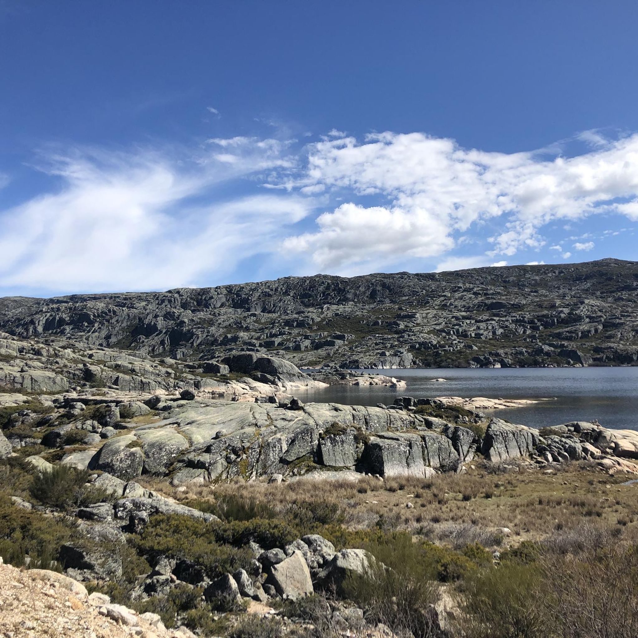
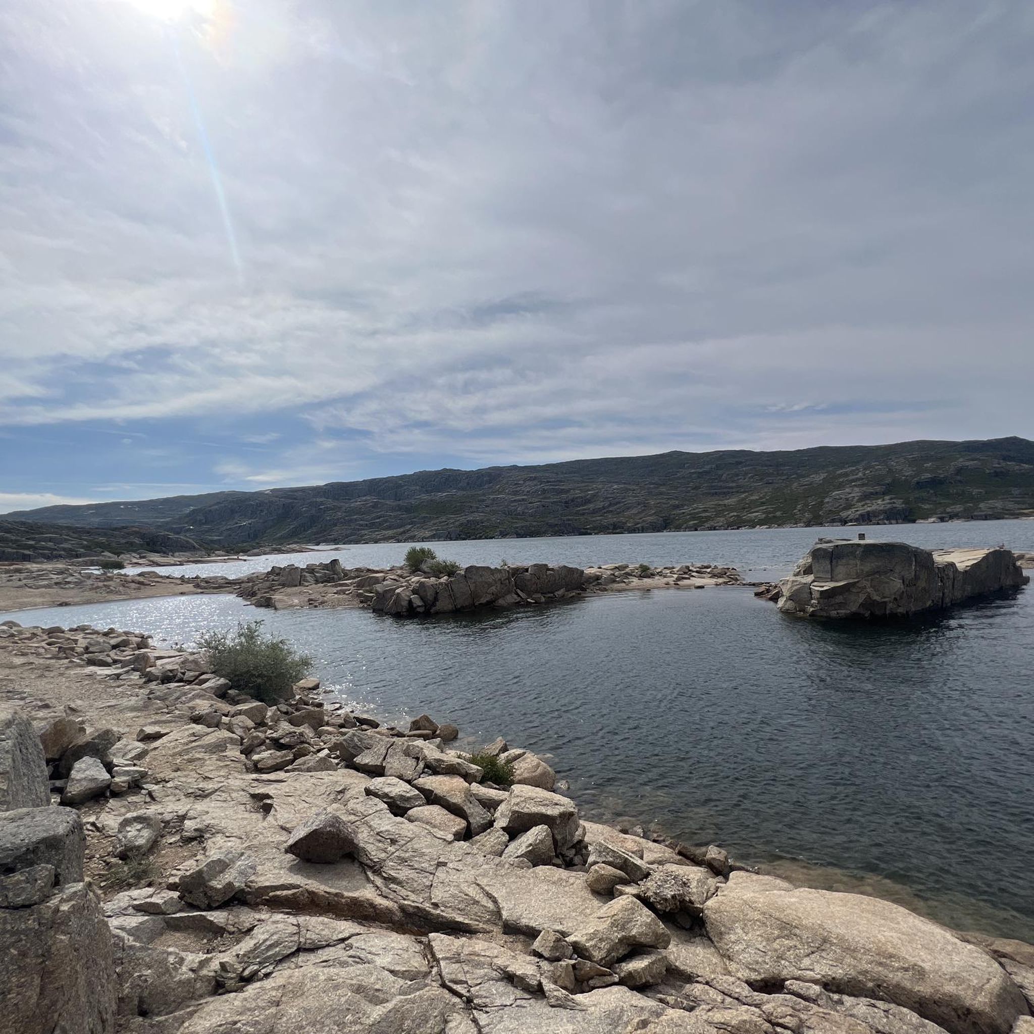
Covão dos Conchos is an artificial lagoon located in the Serra da Estrela Natural Park, Portugal, near the mountain village of Sabugueiro. Covão dos Conchos became famous for its bell-mouth spillway[1]. The spillway was built in 1955 to allow water to be transferred from the Ribeira das Naves River to Lagoa Comprida. It is part of the Serra da Estrela Hydroelectric System. This science fiction-style spillway became famous when photographs of the hole went viral on social media in 2016. Over the past 60 years, the growth of vegetation at the funnel's mouth has created extraordinary biodiversity and increased its ethereal allure. It is 4.6 meters high and 48 meters in circumference. The tunnel that collects the water is 1,519 meters long.
2
0
Covão dos Conchos is an artificial lagoon located in the Serra da Estrela Natural Park, Portugal, near the mountain village of Sabugueiro. Covão dos Conchos became famous for its bell-mouth spillway[1]. The spillway was built in 1955 to allow water to be transferred from the Ribeira das Naves River to Lagoa Comprida. It is part of the Serra da Estrela Hydroelectric System. This science fiction-style spillway became famous when photographs of the hole went viral on social media in 2016. Over the past 60 years, the growth of vegetation at the funnel's mouth has created extraordinary biodiversity and increased its ethereal allure. It is 4.6 meters high and 48 meters in circumference. The tunnel that collects the water is 1,519 meters long.
1
0

A beautiful nature trail, about 9 km round trip to Covão dos Conchos. Unfortunately, on August 15th, the water couldn't reach the hole and thus reveal the waterfalls. It's a reservoir, part of the Serra da Estrela hydroelectric system. A funnel-shaped drainage structure that allows water to flow from this body of water to Lagoa Comprida. The spillway was built in 1955 to divert water from Ribeira das Naves to Lagoa Comprida. Over the past 60 years, moss and foliage have grown over the mouth of the funnel, creating a captivating spectacle. It is 4.6 meters high and 4.8 meters in circumference. The tunnel that collects the water is 1,519 meters long. It's a stunning place to visit, not only for the combination of human intervention and nature, but also for the surrounding landscape.
2
1
This reservoir, part of the Serra da Estrela hydroelectric system, is a popular tourist destination. Part of this attraction comes from a funnel-shaped drainage structure that allows water to flow from this body of water to Lagoa Comprida. The spillway was built in 1955 to divert water from Ribeira das Naves to Lagoa Comprida. The conical spillway was little known until photos of the hole went viral in 2016. Over the past 60 years, moss and foliage have grown over the mouth of the funnel, creating a captivating spectacle. It is 4.6 meters high and 4.8 meters in circumference. The tunnel that collects the water is 1,519 meters long. It is a stunning place to visit, not only for the combination of human intervention on nature, but also for the surrounding landscape. The trail from Lagoa Comprida leads here is truly beautiful in any season. Bring windbreaker and water.
2
0
Located at an altitude of approximately 1,600 meters, Lagoa Comprida is the largest water reservoir in the Serra da Estrela, intended for hydroelectric generation. This natural lake lies in a wide depression of glacial origin, approximately one kilometer long, which fed the Covão Grande glacier. Numerous glacial scars are visible along its banks, making this lake one of the most interesting geomorphological sites in the Serra da Estrela. Construction on this lake began in 1911, and by 1914, it was already six meters high. Later, in 1965, it underwent heightening work that increased its height to 28 meters, currently boasting a storage capacity of approximately 14 cubic hectometers, flooding an area of approximately 80 hectares. Small streams of water flow into this lagoon, as well as water retained in the Covões dos Conchos and Covões do Meio and carried to this lagoon through underground tunnels.
7
1

The Serra da Estrela Natural Park is something truly special. This 1,000-square-kilometer park, spread across six municipalities, was the first and currently the largest protected natural park in Portugal. It is home to the highest point on the Portuguese mainland, the country's only ski slope, the source of two important rivers, and a fascinating, alpine-like landscape formed by glaciers.
5
1

At exactly 1993 meters above sea level, Torre is the highest point in mainland Portugal, where the only ski resort is located. The landscape on the upper plateau of the Serra da Estrela is like a sprinkling of granite rocks over low scrub and patches of snow and ice, which the sun threatens to melt soon in the summer and which always returns the following winter. In winter, it sometimes becomes inaccessible.
6
0
Frequently Asked Questions
How many running routes are available around São Romão?
There are over 25 running routes available around São Romão, offering a wide range of distances and difficulties. The region is known for its diverse terrain, from challenging mountain paths to scenic forest trails.
Are there any easy running trails for beginners in São Romão?
While São Romão is primarily known for its challenging mountain terrain, there is at least one easy running route available. Most trails in the area are rated moderate to difficult, so beginners should carefully check the route details before heading out.
What are some challenging long-distance running routes in the São Romão area?
For experienced runners seeking a challenge, the region offers several demanding long-distance routes. The Oh Meu Deus 50k Trail is a significant 57 km route with substantial elevation gain. Another demanding option is the Pico da Serra da Estrela loop from Loriga, which covers 25.7 km and ascends towards the prominent Pico da Serra da Estrela.
Can I find circular running routes around São Romão?
Yes, many running routes in São Romão are designed as loops, allowing you to start and finish in the same location. Examples include the Pico da Serra da Estrela loop from Loriga, the Cornos do Diabo – Aqueduct of the Caniça Route loop from Lapa dos Dinheiros, and the Covão dos Conchos loop from Albufeira de Lagoa Comprida.
What kind of scenery can I expect on the running trails near São Romão?
Running trails near São Romão offer diverse and dramatic scenery. You can expect mountainous landscapes, dense forest paths, and open mountain vistas. Many routes feature historical aqueducts and natural rock formations, with some providing expansive views, especially on trails ascending the Serra da Estrela.
Are there any interesting landmarks or natural attractions to see while running in São Romão?
Absolutely. The region is rich in natural and historical attractions. Along your runs, you might encounter the unique Covão dos Conchos Trail, the serene Long Lake, or the picturesque Lapa dos Dinheiros River Beach. The majestic Torre (Serra da Estrela Summit) is also a prominent feature in the landscape.
What do other runners enjoy the most about jogging in São Romão?
The running routes in São Romão are highly rated by the komoot community, with an average score of 5.0 stars. Runners often praise the challenging terrain, the stunning mountain views, and the unique natural features like aqueducts and rock formations that make each run an adventure.
Are there running routes that pass by water features in São Romão?
Yes, several routes incorporate water features. The Covão dos Conchos loop from Albufeira de Lagoa Comprida, for instance, takes you near the famous Covão dos Conchos and the Long Lake, offering beautiful lakeside running sections.
What is the best time of year for running in São Romão?
The best time for running in São Romão is generally from spring to autumn (April to October) when the weather is milder and the mountain trails are more accessible. During winter, higher elevations in the Serra da Estrela can experience snow and ice, making some routes challenging or impassable. Always check local weather conditions before heading out.
Are there any running trails that feature historical elements?
Yes, the region's history is woven into its landscape. The Cornos do Diabo – Aqueduct of the Caniça Route loop from Lapa dos Dinheiros is a prime example, leading you through historical aqueducts and showcasing the area's heritage.
How varied is the terrain on São Romão's running trails?
The terrain in São Romão is highly varied, reflecting its location in the Serra da Estrela. You'll encounter everything from technical mountain paths with significant elevation changes to smoother forest trails. Runners should be prepared for a mix of rocky sections, dirt paths, and sometimes paved stretches, often within the same route.
Most popular attractions around São Romão

Get inspired with the komoot mobile app


Explore more
Browse the best Running Trails & Routes in other regions.
