The best MTB trails around Pinhanços
3.8
(8)
114
riders
9
rides
Mountain biking around Pinhanços offers routes through the rugged terrain of the Serra da Estrela Mountains, Portugal's highest range. The region is characterized by granite formations, pine forests, and glacial valleys, providing varied landscapes for mountain bikers. Riders can expect challenging ascents and descents, with routes often traversing dirt tracks and natural features like reservoirs and river basins. This area provides a diverse environment for outdoor activities, including mountain biking.
Best mountain bike trails around Pinhanços
- The most popular mountain…
Last updated: June 28, 2026
29
riders
54.5km
05:54
1,930m
1,940m
Hard mountain bike ride. Very good fitness required. Suitable for all skill levels.
27
riders
23.2km
02:19
610m
610m
Moderate mountain bike ride. Good fitness required. Suitable for all skill levels.

Sign up for free
22
riders
59.4km
05:18
1,020m
1,020m
Hard mountain bike ride. Very good fitness required. Advanced riding skills necessary.
13
riders
62.0km
05:09
1,790m
1,790m
Hard mountain bike ride. Very good fitness required. Suitable for all skill levels.
5.0
(2)
7
riders
26.3km
02:03
670m
670m
Moderate mountain bike ride. Good fitness required. Suitable for all skill levels.
Get access to more routes and recommendations from other explorers.
Sign up for free
Already have an account?
Our route recommendations are based on thousands of hikes, rides, and runs completed by other people on komoot.
Start today with a free account
Your next adventure awaits.
Login or Signup



Tips from the Community

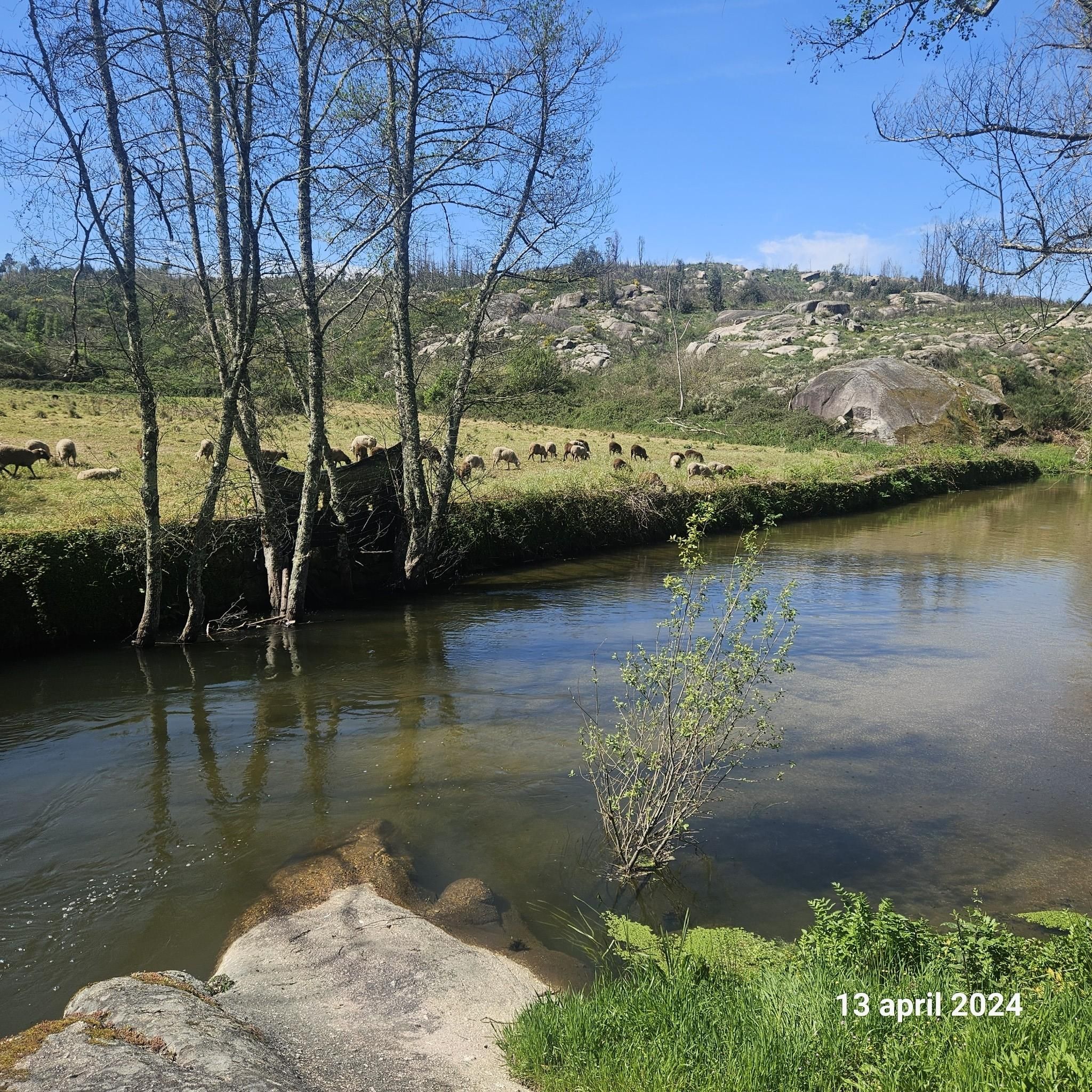
The Lapa dos Dinheiros river beach is in perfect harmony with nature. Located in the parish of Lapa dos Dinheiros, on the Caniça River, a right-bank tributary of the Alva River, this bathing area is nestled in a mountainous landscape dominated by the Lapa Souto (south of Lapa) and imposing granite outcrops. With clear water, very appealing for swimming, the beach boasts the award for accessible beach and has lifeguards and a bar available to visitors. The rugged terrain of the valley causes the river to form a succession of small waterfalls nearby. The Lapa Souto, in addition to its valuable collection of centuries-old chestnut trees, is also home to a high level of biodiversity. From the bridge, a pedestrian path leads to the Moura Hole and a viewpoint over the Caniça Waterfalls. The Buraco da Moura is a natural cave system created by the sliding and accumulation of large granite blocks, which formed a complex system of rooms and galleries. How to get there? Once in Seia, follow the EN231 to S. Romão. From there, continue uphill for about 5 km, toward Loriga/Lapa, until you find the sign for Lapa dos Dinheiros on the left. Once inside the town, simply follow the beach signs. Coordinates: 40º 23′ 07.0″ N / 7º 41′ 50.1″ W
1
0

Located at an altitude of approximately 1,600 meters, Lagoa Comprida is the largest water reservoir in the Serra da Estrela, intended for hydroelectric generation. This natural lake lies in a wide depression of glacial origin, approximately one kilometer long, which fed the Covão Grande glacier. Numerous glacial scars are visible along its banks, making this lake one of the most interesting geomorphological sites in the Serra da Estrela. Construction on this lake began in 1911, and by 1914, it was already six meters high. Later, in 1965, it underwent heightening work that increased its height to 28 meters, currently boasting a storage capacity of approximately 14 cubic hectometers, flooding an area of approximately 80 hectares. Small streams of water flow into this lagoon, as well as water retained in the Covões dos Conchos and Covões do Meio and carried to this lagoon through underground tunnels.
6
1

The Serra da Estrela Natural Park is something truly special. This 1,000-square-kilometer park, spread across six municipalities, was the first and currently the largest protected natural park in Portugal. It is home to the highest point on the Portuguese mainland, the country's only ski slope, the source of two important rivers, and a fascinating, alpine-like landscape formed by glaciers.
5
1

At exactly 1993 meters above sea level, Torre is the highest point in mainland Portugal, where the only ski resort is located. The landscape on the upper plateau of the Serra da Estrela is like a sprinkling of granite rocks over low scrub and patches of snow and ice, which the sun threatens to melt soon in the summer and which always returns the following winter. In winter, it sometimes becomes inaccessible.
6
0

Gouveia is a picturesque Portuguese town and municipality located in the district of Guarda, on the northern edge of the Serra da Estrela Natural Park. With an elevated position that provides it with a mountain climate and picturesque views, Gouveia is considered one of the "gateways" to the highest mountain range in mainland Portugal. The town stands out for its rich historical and architectural heritage, with a charming old town characterized by narrow cobbled streets, traditional houses and monuments such as the Mother Church of São Pedro and the Paços do Concelho (Town Hall). Gouveia is also renowned for the production of the famous Queijo Serra da Estrela, a DOP sheep's cheese, and for its tradition of the Cão da Serra da Estrela dog breed. Its proximity to the Natural Park makes it an excellent base for exploring the natural beauty of the Serra.
0
0
The village is famous for its granite houses, cobbled streets and its imposing medieval castle, which offers spectacular views of the surrounding landscape. Legend has it that Folgosinho was founded by Lusone, grandson of Noah, which adds a touch of mysticism to its already fascinating history.
0
0
Lagoa Comprida is the largest glacial lake in Serra da Estrela, Portugal, and one of the most iconic spots in the Natural Park. Its name, meaning "Long Lake," perfectly describes its elongated shape, nestled between the surrounding peaks. Originally a glacial lake, it was artificially enlarged with the construction of a dam in the early 20th century for hydroelectric power generation, becoming an important reservoir. Its crystalline waters reflect the sky and the rugged surrounding mountains, creating breathtaking views. It is a popular starting point for hikes and treks to other lagoons and peaks, and offers a sense of grandeur and serenity typical of alpine environments.
2
0
Frequently Asked Questions
How many mountain bike trails are available around Pinhanços?
There are over 10 mountain bike trails documented around Pinhanços on komoot. These routes offer a variety of experiences through the rugged terrain of the Serra da Estrela Mountains.
What is the general difficulty level of mountain biking in Pinhanços?
Mountain biking in Pinhanços ranges from moderate to difficult. There are 7 moderate routes and 3 difficult routes, often featuring significant elevation gain and challenging terrain. There are no easy routes listed, so riders should be prepared for a demanding experience.
Are there any family-friendly mountain bike trails in Pinhanços?
The mountain bike trails around Pinhanços are generally rated as moderate to difficult, with no easy routes available. This suggests that most trails may not be suitable for young children or beginners. Riders should have some experience and be prepared for challenging ascents and descents.
What kind of landscapes can I expect to see while mountain biking in Pinhanços?
Pinhanços, located within the Serra da Estrela Mountains, offers diverse landscapes characterized by granite formations, dense pine forests, and crystal-clear water sources. You'll traverse rugged terrain, glacial valleys like the Zêzere Valley, and ride alongside rivers such as the Mondego, providing panoramic views and varied natural scenery.
Are there any circular mountain bike routes in the Pinhanços area?
Yes, many routes around Pinhanços are designed as loops. For example, you can explore the Folgosinho – Folgosinho loop from Gouveia, a moderate 26.2 km ride, or the more challenging Caniçada Waterfall – Casa das Obras Fountain loop from Seia, which covers 54.6 km.
What are some scenic highlights or natural attractions I can visit along the mountain bike trails?
The region offers several natural attractions. You can ride near the stunning Vale do Rossim Reservoir, known for its clear waters and granite outcrops. Another unique spot is Cornos do Diabo, featuring six-meter-high granite formations and small lagoons. The Lapa dos Dinheiros River Beach also offers a refreshing stop by the Caniça River.
What do other mountain bikers say about the trails in Pinhanços?
The mountain bike trails in Pinhanços are highly rated by the komoot community, with an average score of 3.8 stars from 7 reviews. Over 100 mountain bikers have used komoot to explore the varied terrain, often praising the challenging ascents and the natural beauty of the Serra da Estrela Mountains.
Are there any long-distance mountain bike routes for experienced riders?
Yes, experienced riders looking for longer distances will find challenging options. The Long Lake – Serra da Estrela loop from Seia is a difficult 62.3 km trail, typically completed in about 5 hours 10 minutes. Another demanding option is the Afonso Costa Statue – Casa das Obras Fountain loop from Seia, spanning 59.4 km.
What kind of terrain should I expect on the mountain bike trails?
You should expect varied terrain, including dirt tracks, challenging ascents and descents over rugged granite formations, and paths through pine forests. The region's glacial valleys and river basins also contribute to a diverse riding experience.
Are there any shorter mountain bike routes for a quicker ride?
For a shorter, moderate ride, consider the Gouveia loop from Aldeias. This route is 16.8 km long and typically takes around 1 hour 16 minutes to complete, offering a good option for a quicker outing.
Most popular routes around Pinhanços
Most popular attractions around Pinhanços

Get inspired with the komoot mobile app


Explore more
Browse the best MTB trails in other regions.
