The best road cycling routes around Ruivós
4.0
(1)
53
riders
17
rides
Road cycling around Ruivós offers diverse terrain, characterized by mountainous landscapes and varied elevation, particularly at the foot of the Serra da Cabreira mountains. The region features lush forests and river valleys, providing scenic backdrops for rides. Cyclists can expect routes with significant elevation gains, traversing both well-paved roads and some more challenging segments. This area provides a compelling mix of natural beauty and varied topography for road cyclists.
Best road cycling routes around Ruivós
- The most popular road cycling…
Last updated: July 11, 2026
7
riders
38.7km
01:51
490m
490m
Moderate road ride. Good fitness required. Mostly well-paved surfaces and easy to ride.
5
riders
59.6km
02:56
770m
770m
Moderate road ride. Good fitness required. Mostly well-paved surfaces and easy to ride.

Sign up for free
5
riders
36.9km
01:44
470m
470m
Moderate road ride. Good fitness required. Mostly well-paved surfaces and easy to ride.
6
riders
60.7km
02:54
740m
740m
Moderate road ride. Good fitness required. Mostly well-paved surfaces and easy to ride.
4
riders
47.4km
02:13
600m
600m
Moderate road ride. Good fitness required. Mostly well-paved surfaces and easy to ride.
Get access to more routes and recommendations from other explorers.
Sign up for free
Already have an account?
Our route recommendations are based on thousands of hikes, rides, and runs completed by other people on komoot.
Start today with a free account
Your next adventure awaits.
Login or Signup
Popular around Ruivós

Tips from the Community

Sabugal Castle is one of the most imposing and well-preserved medieval fortifications in Portugal. It is known as the "Castle of the Five Corners" due to the unusual shape of its impressive pentagonal keep, the castle's most iconic feature. Its pentagonal (five-cornered) plan is considered unique in Portuguese military architecture. It is approximately 30 meters high and offers incredible views. The castle has a double ring of walls. You can walk along the ramparts on top of the walls for a panoramic view over the city and the Côa River. From the top, you can see the Côa River winding its way through the city and the natural landscape of the Serra da Malcata mountain range.
1
0
Sabugal, a town that deserves a visit to its castle and the entire surrounding area, especially the magnificent river beach on the Côa River.
1
0

Alfaiates holds centuries of history intertwined with the very formation of Portugal. Its castle, once called Castillo de la Luna (Moon Castle) because it seemed to touch the sky, was built in the 13th century and passed to Portuguese territory by the Treaty of Alcañices in 1297. Between charters, royal alliances, and battles, it was the scene of moments of glory and strategic defense, even withstanding the French invasions. Today, amid crumbling walls and living traditions like the capeia arraiana (a bullfight in which the bull is faced by 20 or 30 men who hold off its charges with a huge pitchfork), Alfaiates continues to reveal the charm of its legendary memory.
2
0
Soito, also called Souto, is now a village, a title it acquired in 1999. The name comes from the chestnut trees that once graced the local landscape. As early as 1527, according to the Royal Register, this was the most important center of the municipality, with 160 residents.
2
0
Among the secret corners of Portugal, the Côa River is a discreet treasure. It rises in Fóios and flows through valleys and hills until it joins the Douro River in Vila Nova de Foz Côa. Even here, where it flows gently and seems like just a trickle, the valley reveals all its magic. It's the ideal place to rest for a moment, cool your feet, and let yourself be enveloped by the river's serenity before resuming your journey.
2
0
Built on the Côa River, Sabugal Castle preserves centuries of borders and memory. Once part of the Kingdom of León, it passed to Portugal in 1297 and became a strategic staging ground for the Portuguese-British troops during the Third French Invasion. Today, it continues to stand as a living testament to the long history of one of Europe's oldest nations.
2
0

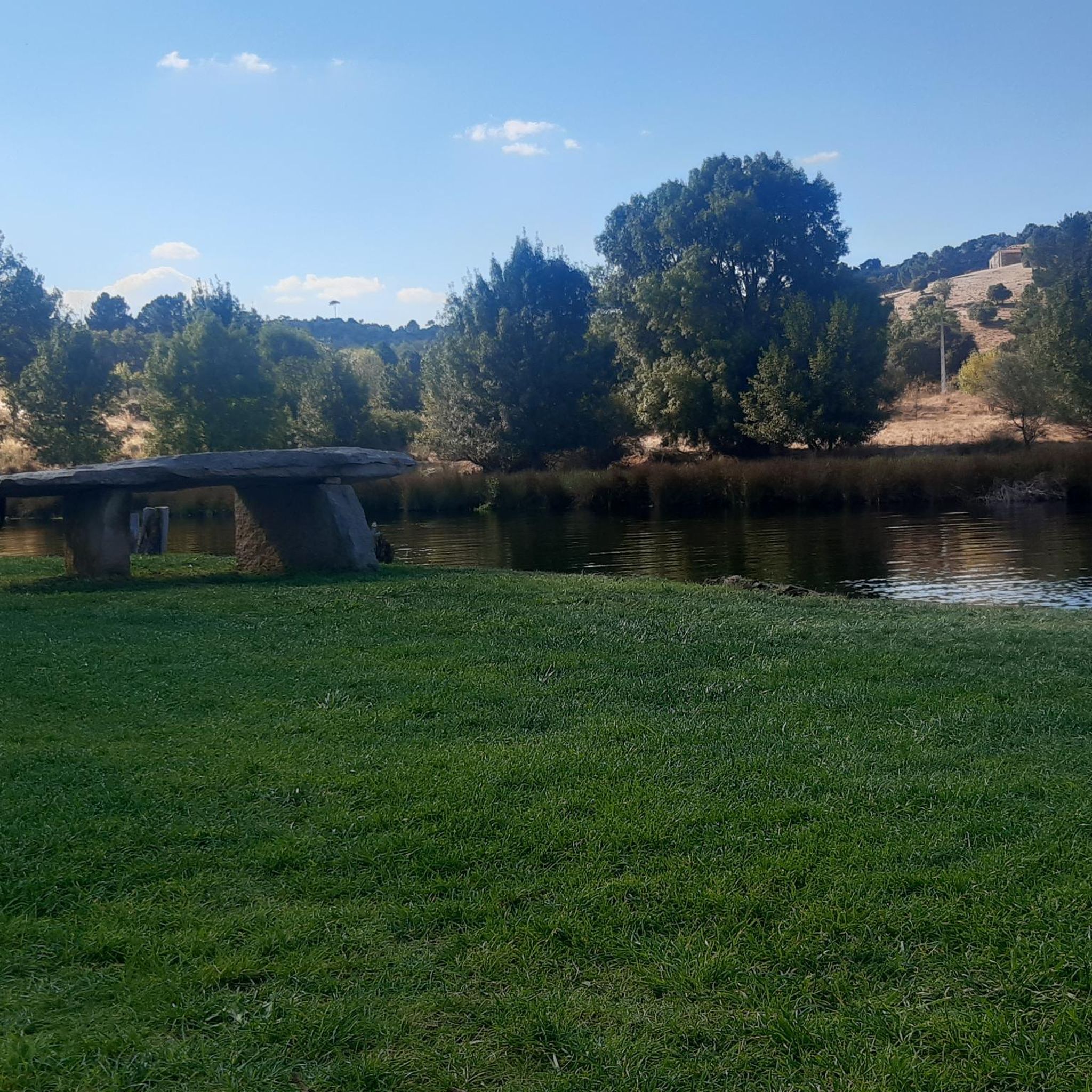
Wetland where a pond full of water appears with a beautiful bridge that crosses it. Nearby, there is the Chapel of Santo António, close to the road and small at the same time!
1
0
Frequently Asked Questions
How many road cycling routes are available around Ruivós?
There are over 15 road cycling routes available around Ruivós, offering a diverse range of experiences for cyclists. The region features a mix of moderate and challenging routes, with 13 routes classified as moderate and 4 as difficult.
What kind of terrain can I expect when road cycling in Ruivós?
Road cycling in Ruivós is characterized by mountainous landscapes and varied elevation, particularly at the foot of the Serra da Cabreira mountains. You'll encounter lush forests and river valleys, providing scenic backdrops. Routes often include significant elevation gains, traversing both well-paved roads and some more challenging segments.
Are there road cycling routes suitable for beginners in Ruivós?
While the routes around Ruivós generally feature varied elevation and can be challenging, many are classified as moderate, making them accessible for cyclists with a reasonable fitness level. There are no routes specifically listed as 'easy', but moderate options like the Alto da Texugueira – Soito loop from Souto offer a balanced ride.
What are the options for advanced road cyclists seeking a challenge?
Advanced road cyclists will find several challenging options in Ruivós. The region's mountainous terrain ensures routes with significant elevation gains. For example, the Alfaiates – Bridge over the Côa River loop from Alfaiates covers 37.9 miles (61.0 km) with substantial climbing, offering an extensive ride through varied terrain.
Are there any circular road cycling routes around Ruivós?
Yes, many of the road cycling routes in Ruivós are designed as loops, allowing you to start and finish in the same location. Popular examples include the Alto da Texugueira – Soito loop from Souto and the Soito loop from Souto, which provide balanced rides through the local countryside.
What natural features or attractions can I see along the road cycling routes?
The region around Ruivós is rich in natural beauty. While cycling, you might encounter lush forests, river valleys, and scenic viewpoints. The broader area is known for waterfalls and natural pools like the Blue Pool and Pincães Waterfall, though these might require short detours from road cycling routes. You can also explore the Aldeia da Ponte Stream.
Are there any historical landmarks to explore while cycling?
Yes, the region boasts historical intrigue. While cycling, you might pass through areas with traditional architecture and ancient roads. Notable historical sites nearby include the village of Alfaiates, which features a castle, and the settlement of Vila Maior. The historical Ponte da Misarela, a public interest property, is also a significant landmark in the broader area.
What is the typical distance of road cycling routes in the Ruivós area?
The road cycling routes in Ruivós vary in distance, catering to different preferences. Many routes range from approximately 22 to 38 miles (35 to 60 km). For instance, the Soito – Alfaiates loop from Souto is about 29.5 miles (47.4 km), offering a substantial ride.
What is the best time of year for road cycling in Ruivós?
The diverse natural landscapes of Ruivós make it appealing for road cycling through much of the year. Spring and autumn generally offer pleasant temperatures and vibrant scenery, ideal for tackling the varied terrain. Summer can be warm, but early morning rides are often enjoyable. Winter cycling is possible, but conditions may vary, especially in higher elevations.
What do other road cyclists enjoy most about the routes in Ruivós?
Road cyclists frequently praise the diverse terrain and scenic beauty of Ruivós. The mix of mountainous landscapes, lush forests, and river valleys provides a compelling backdrop for rides. The variety of routes, from moderate to difficult, is also appreciated, allowing cyclists to find challenges suited to their fitness levels. Over 50 road cyclists have used komoot to explore this area.
Are there longer routes for extended rides in Ruivós?
Yes, for those looking for longer rides, Ruivós offers several options that extend beyond typical distances. Routes like the Aldeia da Ponte Stream – Alfaiates loop from Souto cover approximately 37.7 miles (60.6 km), providing an extensive journey through the region's varied landscapes.
Can I find routes with scenic viewpoints in Ruivós?
Given its mountainous terrain and position at the foot of the Serra da Cabreira mountains, many road cycling routes in Ruivós naturally offer scenic viewpoints. As you ascend and traverse the varied elevations, you'll be treated to panoramic vistas of lush forests and river valleys, providing beautiful backdrops for your ride.
Most popular routes around Ruivós
Most popular attractions around Ruivós

Get inspired with the komoot mobile app


Explore more
Browse the best Road cycling routes in other regions.
