The best running trails around Atalaia Do Campo
56
runners
5
runs
Jogging around Atalaia Do Campo offers diverse landscapes, characterized by a mix of terrain suitable for various fitness levels. The region features pine and oak forests, providing shaded routes, alongside inspiring mountain views of the Serra da Gardunha range. Varied elevations and fertile terraces create interesting paths for running, with some routes including significant climbs.
Best jogging routes around Atalaia Do Campo
- The most popular jogging route is Gardunha – Castelo Velho loop from Louriçal do Campo, a 9.1…
Last updated: July 11, 2026
21
runners
14.6km
02:00
600m
600m
Hard run. Very good fitness required. Mostly accessible paths. Some sure footedness required.
7
runners
29.1km
03:41
1,030m
1,040m
Hard run. Very good fitness required. Mostly paved surfaces. Suitable for all skill levels.

Sign up for free
7
runners
11.0km
01:23
420m
420m
Hard run. Very good fitness required. Mostly paved surfaces. Suitable for all skill levels.
5
runners
11.5km
01:24
340m
340m
Hard run. Very good fitness required. Mostly paved surfaces. Suitable for all skill levels.
5
runners
9.08km
01:06
390m
390m
Hard run. Very good fitness required. Mostly paved surfaces. Suitable for all skill levels.
Our route recommendations are based on thousands of hikes, rides, and runs completed by other people on komoot.
Start today with a free account
Your next adventure awaits.
Login or Signup

Tips from the Community

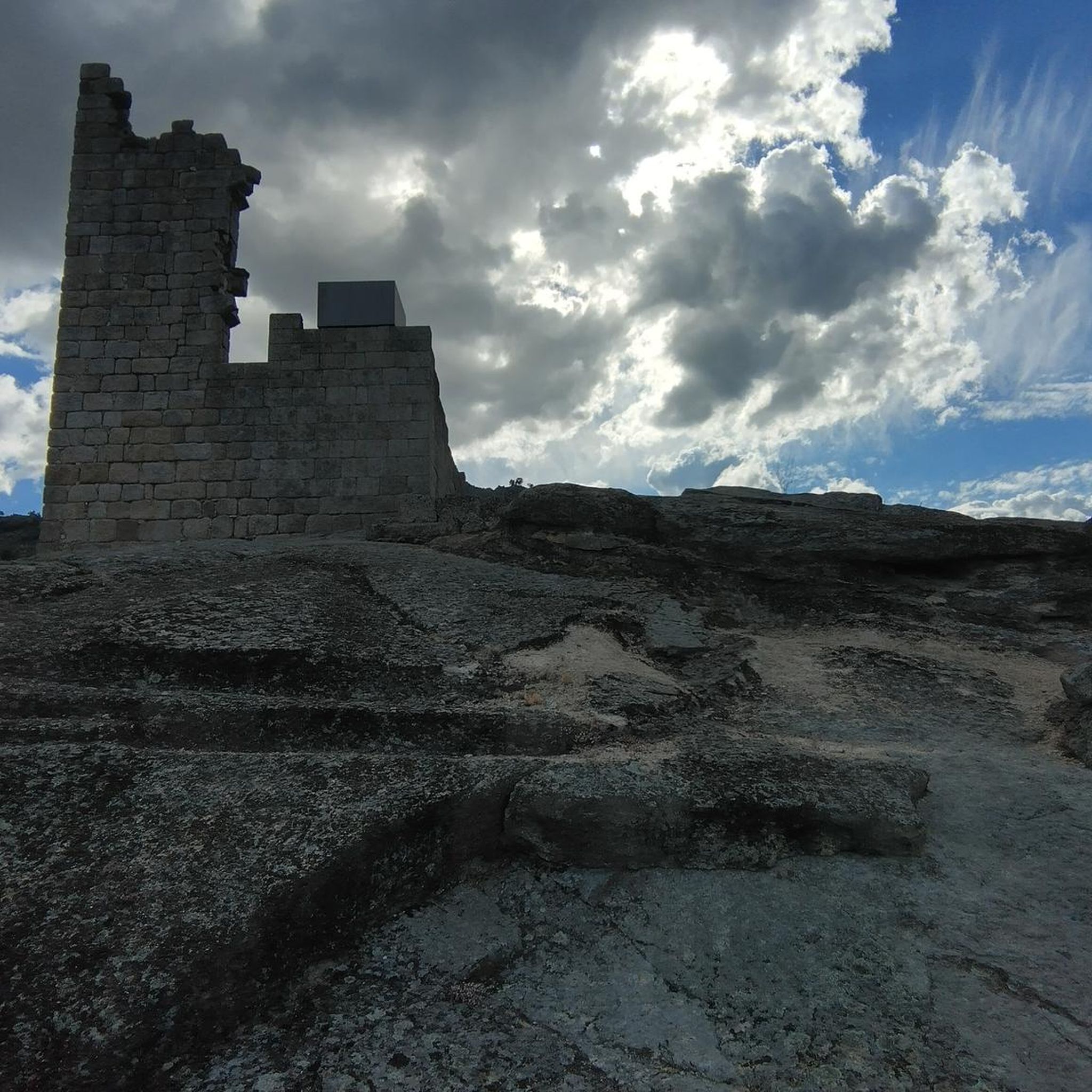
At the top of Gardunha, almost 1,000 meters above sea level, stands the Castelo Velho site. From here, the view reaches the Castelo Branco plain and continues to the Tagus River, an endless horizon. Among balanced rocks, blocks sculpted by time, and curious granite forms, this place is a veritable open book of geology and a privileged viewpoint of the mountains.
2
0
Frequently Asked Questions
What kind of terrain can I expect on running routes around Atalaia Do Campo?
The region offers a diverse mix of terrain, from shaded paths through pine and oak forests to routes with significant elevation gains in the Serra da Gardunha mountain range. You'll find varied surfaces, including some accessible paths and historical fertile terraces, providing a dynamic running experience.
Are there any easy running routes for beginners in Atalaia Do Campo?
While many routes in the area are considered difficult due to elevation, there is at least one moderate option. The Running loop from Alcongosta is a moderate 8.7 km path with a more manageable elevation gain, making it a good choice for those looking for a less strenuous run.
What are some notable landmarks or points of interest I might see while jogging?
The area around Atalaia Do Campo is rich in history and natural beauty. You might encounter historical sites like the Castelo Novo Castle Ruins or the charming Historic Village of Castelo Novo. The routes also offer stunning mountain views of the Serra da Gardunha.
Are there any circular running routes available?
Yes, many of the running routes in the Atalaia Do Campo area are designed as loops. For example, the Gardunha loop from Louriçal do Campo is a challenging 11 km circular route that allows you to start and finish in the same location.
Can I combine my run with a refreshing dip in the water?
Absolutely! The region features the Castelo Novo River Beach, which could be a perfect spot to cool down after a run, especially during warmer months. There are also mentions of seasonal streams and rivers that add to the natural charm.
What is the best time of year to go running in Atalaia Do Campo?
The presence of pine and oak forests suggests that running during warmer months could be pleasant due to shaded routes. However, the 'amazing mountain views' and varied terrain make it enjoyable across many seasons. Spring and autumn generally offer milder temperatures for outdoor activities.
Are there any long-distance running options for experienced runners?
Yes, for those seeking a significant challenge, the Gardunha – Gardunha loop from Soalheira is an extensive 29.1 km route with over 1000 meters of elevation gain, ideal for experienced runners looking for a long and demanding trail.
What kind of views can I expect on the running trails?
Runners can enjoy 'amazing mountain views' of the Serra da Gardunha range, offering inspiring backdrops throughout your run. Many routes traverse forested areas, providing scenic natural vistas.
How many running routes are available in the Atalaia Do Campo area?
There are several dedicated running routes around Atalaia Do Campo, with komoot featuring at least 6 distinct trails. These range in difficulty from moderate to difficult, offering options for various fitness levels.
Are there any specific challenges I should be aware of on these routes?
Many routes in the region are classified as 'difficult' and feature 'substantial elevation gain' or 'varied ascents and descents'. Runners should be prepared for challenging terrain and significant climbs, especially on trails like the Gardunha – Castelo Velho loop from Louriçal do Campo.
What do other runners say about the trails in Atalaia Do Campo?
The komoot community actively explores the trails here, with over 50 runners having used the platform to discover the varied terrain. Users often highlight the diverse landscapes, from forests to mountain vistas, and the challenging yet rewarding nature of the routes.
Are there any parks or green spaces suitable for jogging in the vicinity?
While specific dedicated jogging paths for Atalaia do Campo itself aren't extensively detailed, the presence of 'Parque Verde' and 'Parque do Convento' in the broader region suggests accessible green spaces that could serve as pleasant areas for jogging or as starting points for longer runs.
Most popular routes around Atalaia Do Campo
Most popular attractions around Atalaia Do Campo

Get inspired with the komoot mobile app


Explore more
Browse the best Running Trails & Routes in other regions.
