The best walks and hikes around Constantim
4.4
(6)
25
hikers
5
hikes
Hiking around Constantim offers a variety of trails through river valleys, greenways, and scenic viewpoints. The region is characterized by its waterways, such as the Rivera de los Molinos and the Angueira river, and features some notable elevation changes, particularly around the Douro Canyon. Trails often traverse rural landscapes, providing access to natural and historical points of interest. The terrain includes paths alongside rivers and routes leading to elevated viewpoints.
Best hiking trails around Constantim
- The most popular hiking route…
Last updated: July 4, 2026
5.0
(1)
9
hikers
Moderate hike. Good fitness required. Easily-accessible paths. Suitable for all skill levels.
1
hikers
10.1km
02:44
140m
130m
Moderate hike. Good fitness required. Easily-accessible paths. Suitable for all skill levels.

Sign up for free
2
hikers
Hard hike. Very good fitness required. Easily-accessible paths. Suitable for all skill levels.
3.7
(3)
4
hikers
10.7km
02:51
100m
100m
Moderate hike. Good fitness required. Easily-accessible paths. Suitable for all skill levels.
4.5
(2)
2
hikers
10.1km
02:42
120m
120m
Moderate hike. Good fitness required. Easily-accessible paths. Suitable for all skill levels.
Our route recommendations are based on thousands of hikes, rides, and runs completed by other people on komoot.
Start today with a free account
Your next adventure awaits.
Login or Signup

Tips from the Community

Peña el Pingón is a prominent natural landmark on the hiking trails of Alcañices. Located in a spectacular setting, it is one of the most highly recommended spots by both local and visiting hikers. At the base of Peña el Pingón, or in its immediate vicinity, lies a cave, seamlessly integrated into the surrounding rocky landscape. It adds to the area's charm and is a popular stopping point on hiking routes.
2
0
Mirador do Penedo Amarelo. It is located on Rua do Penedo Amarelo, in the urban area of Miranda do Douro. It offers wide panoramic views of the Douro River surrounded by green hills, the dam, the historic center and the co-cathedral of Miranda do Douro. It is one of the most outstanding urban viewpoints in the area.
3
0
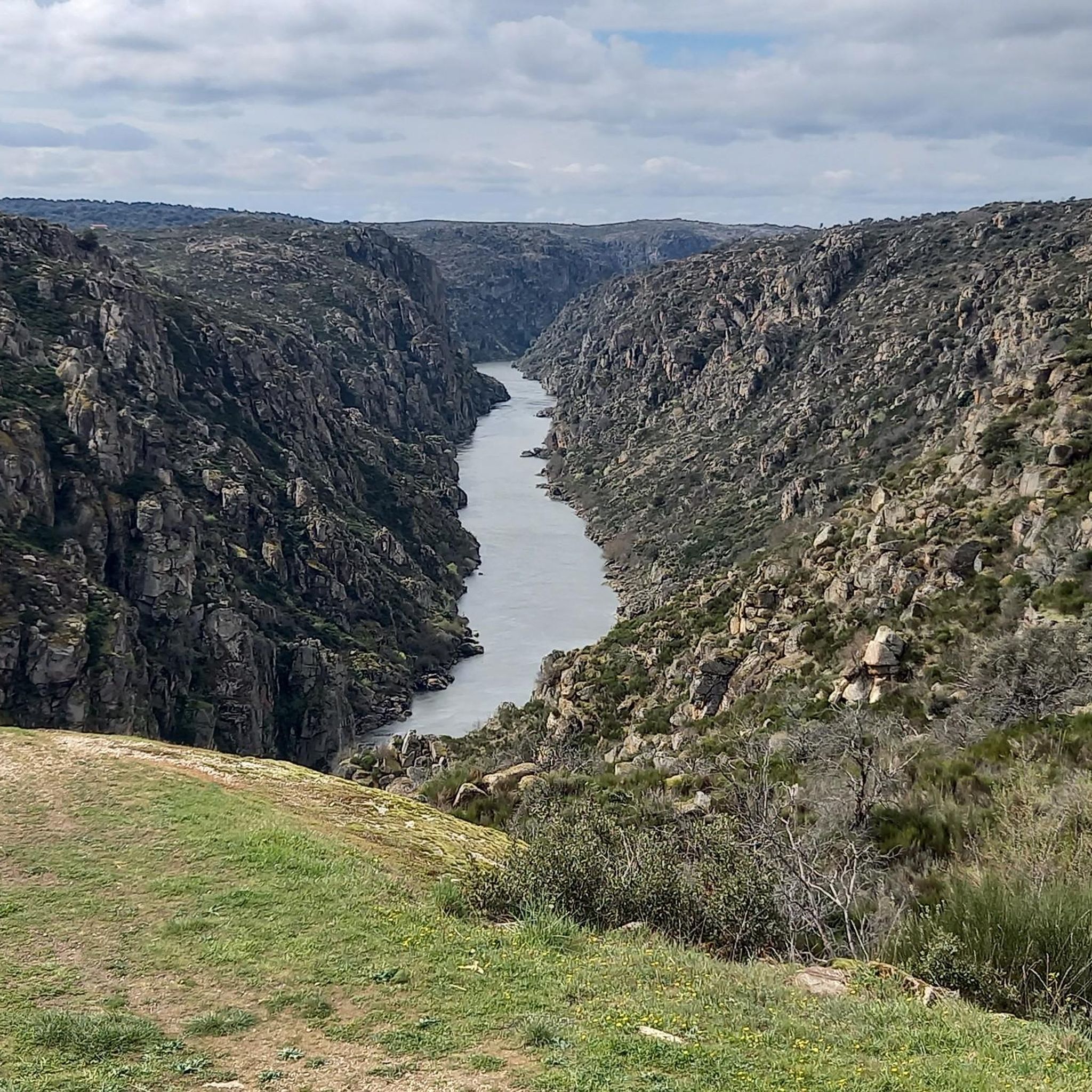
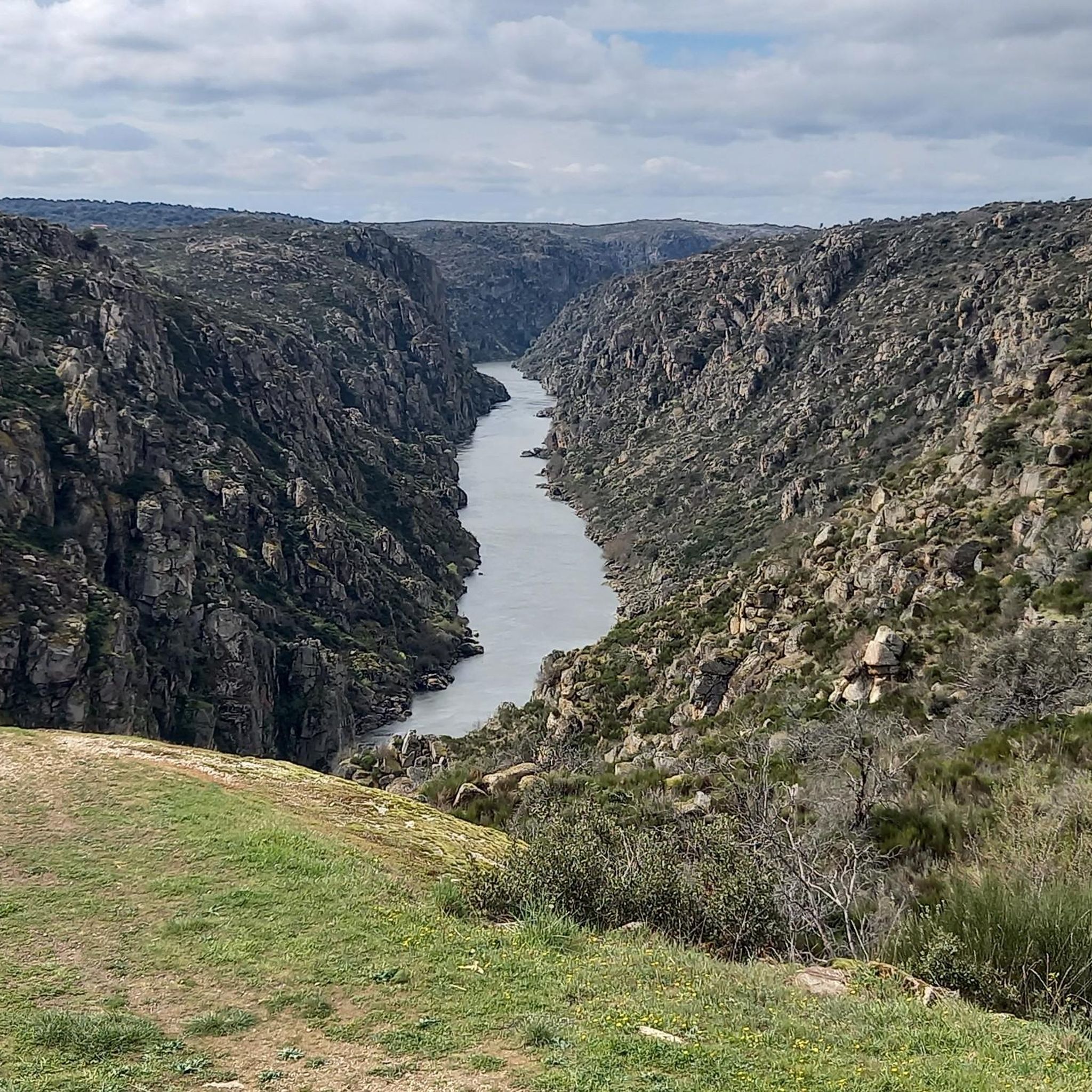
From the Vale de Águia hill fort, there is a natural viewpoint with spectacular views of one of the meanders of the Douro. At the São João das Arribas hermitage, you can also enjoy stunning panoramic views of the canyon and waterfalls on the Spanish slope. The landscape includes cliffs, meadows, oak groves, and pastures, with abundant flora and fauna.
5
0
The GR-36 trail in the Miranda do Douro area is one of the most spectacular routes in northern Portugal, especially for its views of the Douro Canyon, which forms the natural border with Spain.
6
0

The first bishops of Miranda had to live in the Castle. It was only in 1601 that construction began on the Episcopal Palace and the Seminary. When it was completed, more than a century later, its opulence was no less than that of the Cathedral, whose Renaissance style it imitated. The Palace was built around a central courtyard, surrounded by a cloister with lowered arcades, on monolithic columns. And, although badly damaged by successive fires during the 17th and 18th centuries, it was the definitive transfer of the seat of the Diocese to Bragança, in 1780, that caused it to fall into rapid ruin. The shadow of its monumentality can still be seen today in the cloister and on the portico of the Seminary. However, despite its state of ruin, its symbolic power remains because the bishops always continued to engrave their names on the respective memorial, at the entrance to the Renaissance portico of the first Episcopal Palace of the Diocese.
2
1
The castle of Miranda do Douro was built during a second period of settlement and ordering in Trás-os-Montes, which occurred during the reign of King Dinis. The first kings had provided this vast region with administrative units protected by Romanesque castles, called Terras, whose mission was to establish royal authority in an area of the kingdom that was notoriously peripheral. Over time, this power structure proved to be inadequate and King Afonso III initiated a different policy, the most visible of which was the founding of new urban towns. In the territory of Miranda do Douro, the new town was founded by King Dinis in 1286, thus culminating in the transfer of power from the old castle of Algoso, which had been the capital of the land until that date.
1
1
This park is located just outside the city center on the N-128 road toward the Santa Lucía neighborhood. It is a large park, located below the walled area of the Castle, on the banks of the Fresno River. Here, the river is dammed, and there is a bar-café with a very pleasant terrace where you can enjoy a drink, and where you can practice non-motorized water sports, such as canoeing or taking a trip along the river by renting a pedal boat. There is a significant gradient from the road to the riverbank, and numerous paths and pedestrian trails for leisurely strolls.
2
0
This park stretches for about 1.5 kilometres, following the course of the Fresno River. It is a leisure area that offers pedestrian trails along the banks and a pier with support facilities. Along the river, you can see restored mills, fountains and watermills.
2
0
Frequently Asked Questions
How many hiking trails are available around Constantim?
There are over 4 hiking trails around Constantim, offering a variety of experiences through river valleys, greenways, and scenic viewpoints. These routes are highly rated by the komoot community, with an average score of 4.5 stars.
Are there any circular hiking routes in Constantim?
Yes, many of the trails around Constantim are circular. For example, you can explore the Rivera de los Molinos on The Rivera de los Molinos de Brandilanes — circular from Castro de Alcañices, or follow the Angueira river on the Via verde del rio Angueira — circular desde Alcanices. Another option is the Traditional Dovecote – São João das Arribas Viewpoint loop from Castro de São João das Arribas.
What kind of terrain can I expect on hikes around Constantim?
The terrain around Constantim is diverse, featuring paths alongside rivers like the Rivera de los Molinos and the Angueira river, as well as routes leading to elevated viewpoints, particularly around the Douro Canyon. You'll encounter rural landscapes and some notable elevation changes.
Are there any easy hikes suitable for beginners or families in Constantim?
Yes, there is at least one easy route available. The Traditional Dovecote – São João das Arribas Viewpoint loop from Castro de São João das Arribas is an easy 1.5-mile (2.5 km) trail that takes about 46 minutes to complete, offering scenic viewpoints and local landmarks.
What can I see along the hiking trails in Constantim?
Many trails offer access to natural and historical points of interest. You can visit stunning viewpoints such as the São João das Arribas Viewpoint and the View of the Douro Canyon. Other notable attractions include the Peña el Pingón Cave and Bridge and the Peña Redonda Archaeological Site and Viewpoint.
What is the best time of year to go hiking in Constantim?
Constantim's trails can be enjoyed across various seasons. While specific recommendations depend on personal preference, the region's river valleys and greenways are generally pleasant in spring and autumn. For routes with significant elevation, like those near the Douro Canyon, milder weather is often preferred.
Are there any longer or more challenging hikes for experienced hikers?
Yes, for experienced hikers seeking a challenge, the Yellow Rock Viewpoint – View of the Douro Canyon loop from Castro de São João das Arribas is a difficult 15.7-mile (25.3 km) trail with significant elevation changes, offering expansive views of the Douro Canyon.
What do other hikers enjoy most about hiking in Constantim?
The komoot community rates the routes in Constantim highly, with an average score of 4.5 stars. Hikers often praise the diverse landscapes, from tranquil river paths to impressive viewpoints, and the opportunity to explore both natural beauty and local landmarks.
Are there any hikes that feature water elements like rivers or waterfalls?
Yes, the region is characterized by its waterways. You can find trails that follow rivers such as the Rivera de los Molinos, explored by The Rivera de los Molinos de Brandilanes — circular from Castro de Alcañices, and the Angueira river, featured in the Via verde del rio Angueira — circular desde Alcanices. While specific waterfalls are not highlighted, these routes offer pleasant riverside experiences.
Is there parking available near the trailheads in Constantim?
While specific parking information for each trailhead is not detailed here, many rural hiking areas in Constantim typically offer roadside parking or designated small parking areas near popular starting points. It's advisable to check local maps or komoot tour details for specific parking suggestions before your hike.
Are there any trails that lead to interesting viewpoints?
Absolutely. Constantim is known for its elevated viewpoints. The Traditional Dovecote – São João das Arribas Viewpoint loop from Castro de São João das Arribas directly leads to the São João das Arribas Viewpoint. Another route, the Yellow Rock Viewpoint – View of the Douro Canyon loop from Castro de São João das Arribas, offers spectacular views of the Douro Canyon.
What should I wear for hiking in Constantim?
Given the varied terrain, including river paths and elevated viewpoints, it's recommended to wear comfortable, sturdy hiking shoes with good grip. Layered clothing is also advisable to adapt to changing weather conditions, especially when hiking near the Douro Canyon where winds can be a factor.
Most popular routes around Constantim
Most popular attractions around Constantim

Get inspired with the komoot mobile app


Explore more
Browse the best Hikes in other regions.
