The best walks and hikes in Punta Arenas
4.5
(27)
319
hikers
5
hikes
Hiking in Punta Arenas offers diverse terrain at the southernmost tip of Chile, characterized by sub-polar forests, coastal landscapes, and Patagonian features. The region features ancient coigüe and lenga forests, coastal paths along the Strait of Magellan, and hills providing panoramic views. This unique environment supports a variety of ecosystems, making it suitable for different hiking experiences.
Best hiking trails in Punta Arenas
- The most popular hiking route is San Isidro Lighthouse loop from Fin del Camino, a 6.8 miles (11.0 km) trail that takes 2 hours 55 minutes to complete. This moderate route explores coastal areas and forests leading to the historic lighthouse.
- Another top favourite among local hikers is Loreto Pier, Punta Arenas – Sanctuary of Mary Help of Christians loop from Punta Arenas, a moderate 5.0 miles (8.0 km) path. This route offers urban and coastal scenery, connecting significant local landmarks.
- Local hikers also love the Sanctuary of Mary Help of Christians – Punta Arenas City Center loop from Punta Arenas, a 3.7 miles (6.0 km) trail leading through cityscapes and local points of interest, often completed in about 1 hour 33 minutes.
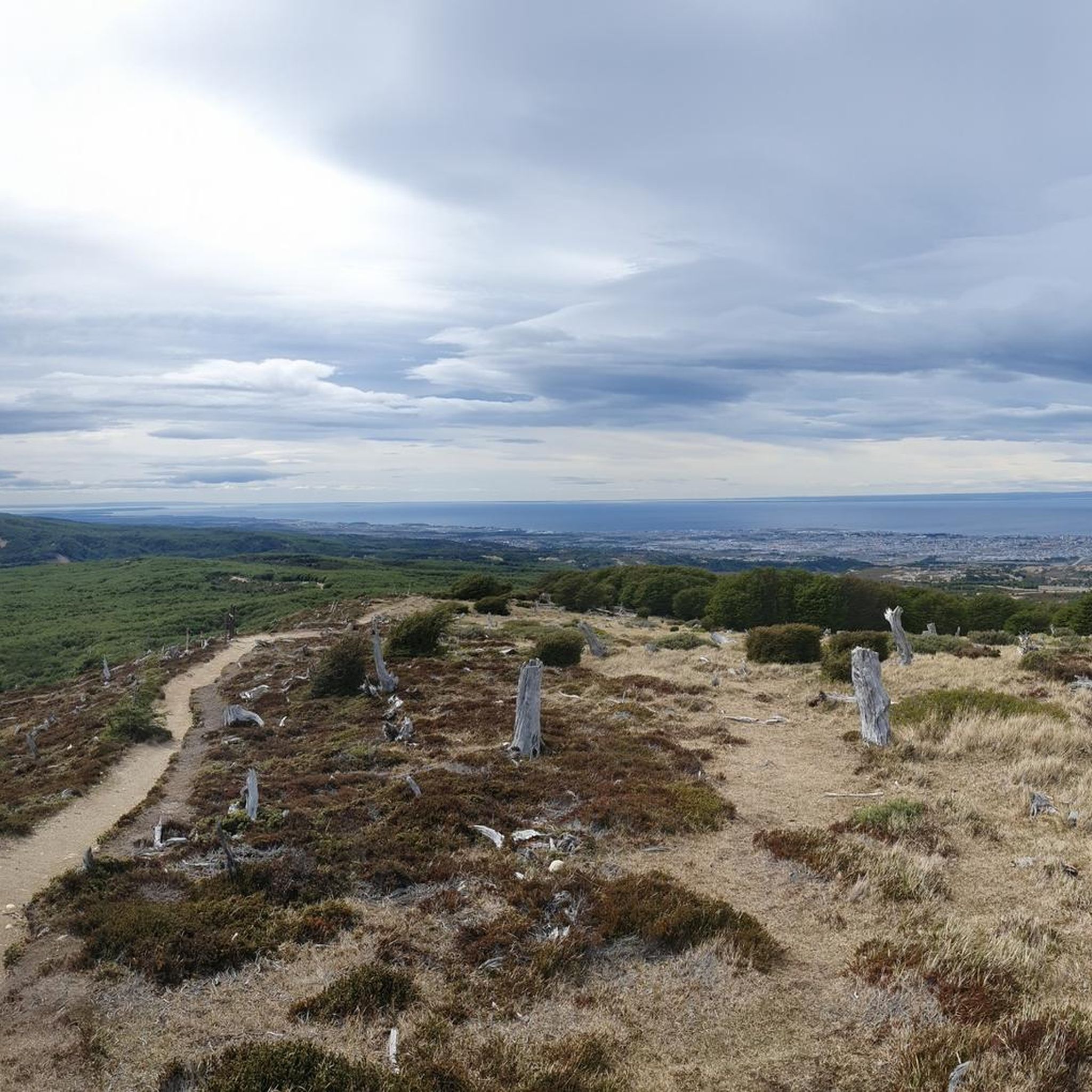
- Hiking in Punta Arenas is defined by coastal paths along the Strait of Magellan, sub-polar forests, and hills offering expansive views of the city and surrounding islands. The network offers options for both easy walks and more challenging moderate routes.
- The routes in Punta Arenas are highly rated by the komoot community with an average score of 4.5 stars from over 20 reviews. More than 270 hikers have used komoot to explore Punta Arenas's varied terrain.
Last updated: July 23, 2026
4.4
(25)
276
hikers
11.0km
02:55
120m
120m
Moderate hike. Good fitness required. Easily-accessible paths. Suitable for all skill levels.
4.0
(1)
26
hikers
7.93km
02:02
40m
40m
Moderate hike. Good fitness required. Easily-accessible paths. Suitable for all skill levels.

Sign up for free
9
hikers
Easy hike. Great for any fitness level. Easily-accessible paths. Suitable for all skill levels.
5.0
(1)
7
hikers
Easy hike. Great for any fitness level. Easily-accessible paths. Suitable for all skill levels.
1
hikers
Easy hike. Great for any fitness level. Easily-accessible paths. Suitable for all skill levels.
Our route recommendations are based on thousands of hikes, rides, and runs completed by other people on komoot.
Start today with a free account
Your next adventure awaits.
Login or Signup
Popular around Punta Arenas
Tips from the Community

Cozy place with lots of trees and benches.
0
0

This square has a lively atmosphere that attracts both tourists and locals. The focal point is the imposing Magellan Monument, built in honor of the famous navigator. It impressively depicts Magellan himself surrounded by native statues. Local legend says that touching the feet of the native statue brings good luck - a custom that many travelers like to take up, and you can also see how worn the feet have become. The plaza is also a good starting point for exploring other sights in the city, as it is surrounded by historic buildings. The small market stalls on the edge of the square, which offer local souvenirs and handicrafts, are particularly charming. If you have some time, it is worth just hanging around, people watching and soaking up the atmosphere.
0
0

It's a beautiful place up here! Great view of Punta Arenas and the wanderlust sign is an additional eye-catcher.
1
0
Beautiful to look at are the many flowering plants in front of the pink house.
1
0
This large cemetery, which was created and designed with a lot of love, is very interesting to look at.
3
0
The monument dedicated to the sheep workers of Patagonia is very beautiful to look at. It's worth a quick stop to take a close look at the realistically crafted figures.
3
0
Beach promenade, which is used for strolling, walking and looking at the water.
1
0

The monument, inaugurated on February 18, 1944, is dedicated to the sheep workers of Patagonia and consists of twelve figures: the shepherd, his horse, two sheep dogs and eight sheep. It symbolizes the economic boom in the region at the end of the 19th and beginning of the 20th century. It was initially made of granite and was replaced eighteen years later by figures made of bronze. The bronze sculptures were created by local sculptor Germán Montero. Fragments of the poem “El ovejero de mi tierra” by the Magellan poet José Grimaldi Acotto served as the basis for the work.
2
0
Frequently Asked Questions
How many hiking trails are available in Punta Arenas?
Punta Arenas offers a selection of 5 hiking routes, ranging from easy urban walks to moderate coastal and forest trails. These routes provide diverse experiences, from city landmarks to natural reserves.
Are there family-friendly hiking options in Punta Arenas?
Yes, Punta Arenas has several easy trails suitable for families. The Sanctuary of Mary Help of Christians – Punta Arenas City Center loop from Punta Arenas is a great option, offering a pleasant 3.7-mile (6.0 km) walk through cityscapes and local points of interest. Additionally, the Magallanes National Reserve, just west of the city, features well-maintained trails perfect for families to explore ancient forests.
What kind of views can I expect on hikes around Punta Arenas?
Hiking in Punta Arenas offers a variety of stunning views. Many trails provide panoramic vistas of the Strait of Magellan, the city itself, and neighboring islands like Tierra del Fuego and Dawson Island. Elevated points such as Monte Fenton offer expansive views, while coastal paths along the Brunswick Peninsula provide pristine landscapes of the Strait.
Are there any circular hiking routes in Punta Arenas?
Yes, many of the routes in Punta Arenas are circular. For instance, the popular San Isidro Lighthouse loop from Fin del Camino is a 6.8-mile (11.0 km) moderate trail that explores coastal areas and forests. Another option is the Loreto Pier, Punta Arenas – Sanctuary of Mary Help of Christians loop from Punta Arenas, which offers urban and coastal scenery.
What are some notable landmarks or attractions I can see while hiking in Punta Arenas?
Several hikes in Punta Arenas lead to or pass by significant landmarks. The San Isidro Lighthouse loop from Fin del Camino takes you to the historic San Isidro Lighthouse. Other routes, like the Loreto Pier, Punta Arenas – Sanctuary of Mary Help of Christians loop from Punta Arenas, connect you to urban attractions such as the Sanctuary of Mary Help of Christians and the Punta Arenas Waterfront and Old Pier.
What kind of terrain can I expect on the trails?
The terrain around Punta Arenas is diverse, featuring sub-polar forests with ancient coigüe and lenga trees, coastal paths along the Strait of Magellan, and hills offering expansive views. You might encounter muddy sections, especially on more challenging trails like Mount Tarn, and traces of old coal mine tunnels on routes like Monte Fenton.
Are there any challenging hikes for experienced trekkers?
For more experienced hikers, Mount Tarn, located about 65 km south of the city, presents a medium-high difficulty trek. This challenging ascent, famously summited by Charles Darwin, takes hikers through Magellanic rainforests and involves scrambling, offering spectacular views from its 825-meter summit.
What kind of wildlife might I encounter on the trails?
The diverse ecosystems around Punta Arenas support various wildlife. In the Magallanes National Reserve, you might observe birds such as woodpeckers and finches. Coastal hikes along the Strait of Magellan also offer opportunities to spot marine wildlife, though specific sightings depend on the season and location.
What do other hikers enjoy most about hiking in Punta Arenas?
The hiking routes in Punta Arenas are highly rated by the komoot community, with an average score of 4.5 stars from over 20 reviews. Hikers often praise the unique blend of coastal scenery, ancient sub-polar forests, and the panoramic views of the Strait of Magellan and surrounding islands.
Is it possible to access trailheads using public transport?
While some urban trails are easily accessible within Punta Arenas, for trails further afield like those in the Magallanes National Reserve, it's advisable to check local transport options or consider private transportation. The Magallanes National Reserve is noted for being easily accessible from the city.
What is the best time of year to go hiking in Punta Arenas?
Punta Arenas offers hiking opportunities throughout the year, but the austral summer (December to February) generally provides the most favorable weather conditions with longer daylight hours and milder temperatures. However, the region's weather can be unpredictable, so being prepared for various conditions is always recommended.
Are there any trails that offer a unique geological experience?
Yes, Pali Aike National Park, though a bit further afield, is renowned for its unique volcanic landscape. Hikers can explore archaeologically significant caves, lava flows, and impressive geological formations like the Escorial del Diablo and Pozos del Diablo, offering a distinct experience compared to the forest and coastal trails closer to Punta Arenas.
Most popular attractions in Punta Arenas

Get inspired with the komoot mobile app


Didn’t find what you were looking for?
Check out more Hikes throughout Punta Arenas below and find the perfect route in your destination.
Explore more
Browse the best Hikes in other regions.
