The best running trails around Ashgrove Loch
3.8
(5)
1,325
runners
128
runs
Jogging routes around Ashgrove Loch primarily feature flat coastal paths and sandy beaches in North Ayrshire, Scotland. While the loch itself is a Site of Special Scientific Interest with limited direct access for running due to its unique ecosystem and floating vegetation, the surrounding area offers accessible trails. These routes often connect to nearby towns like Stevenston and Kilwinning, providing opportunities to explore the region's natural and historical landscapes. The terrain is generally level, making it suitable for various fitness…
Last updated: July 7, 2026
9
runners
5.96km
00:37
50m
50m
Moderate run. Good fitness required. Mostly paved surfaces. Suitable for all skill levels.
8
runners
6.18km
00:38
30m
30m
Moderate run. Good fitness required. Mostly paved surfaces. Suitable for all skill levels.

Sign up for free
5
runners
Hard run. Very good fitness required. Mostly paved surfaces. Suitable for all skill levels.
4
runners
11.0km
01:08
40m
40m
Moderate run. Good fitness required. Mostly paved surfaces. Suitable for all skill levels.
3
runners
6.34km
00:40
50m
50m
Moderate run. Good fitness required. Mostly paved surfaces. Suitable for all skill levels.
Get access to more routes and recommendations from other explorers.
Sign up for free
Already have an account?
Our route recommendations are based on thousands of hikes, rides, and runs completed by other people on komoot.
Start today with a free account
Your next adventure awaits.
Login or Signup

Tips from the Community


The River the smallest of Ayrshire's six principal rivers, has its source on the southerly side of the Hill of Stake in the heart of the Clyde Muirshiel Regional Park.
0
0
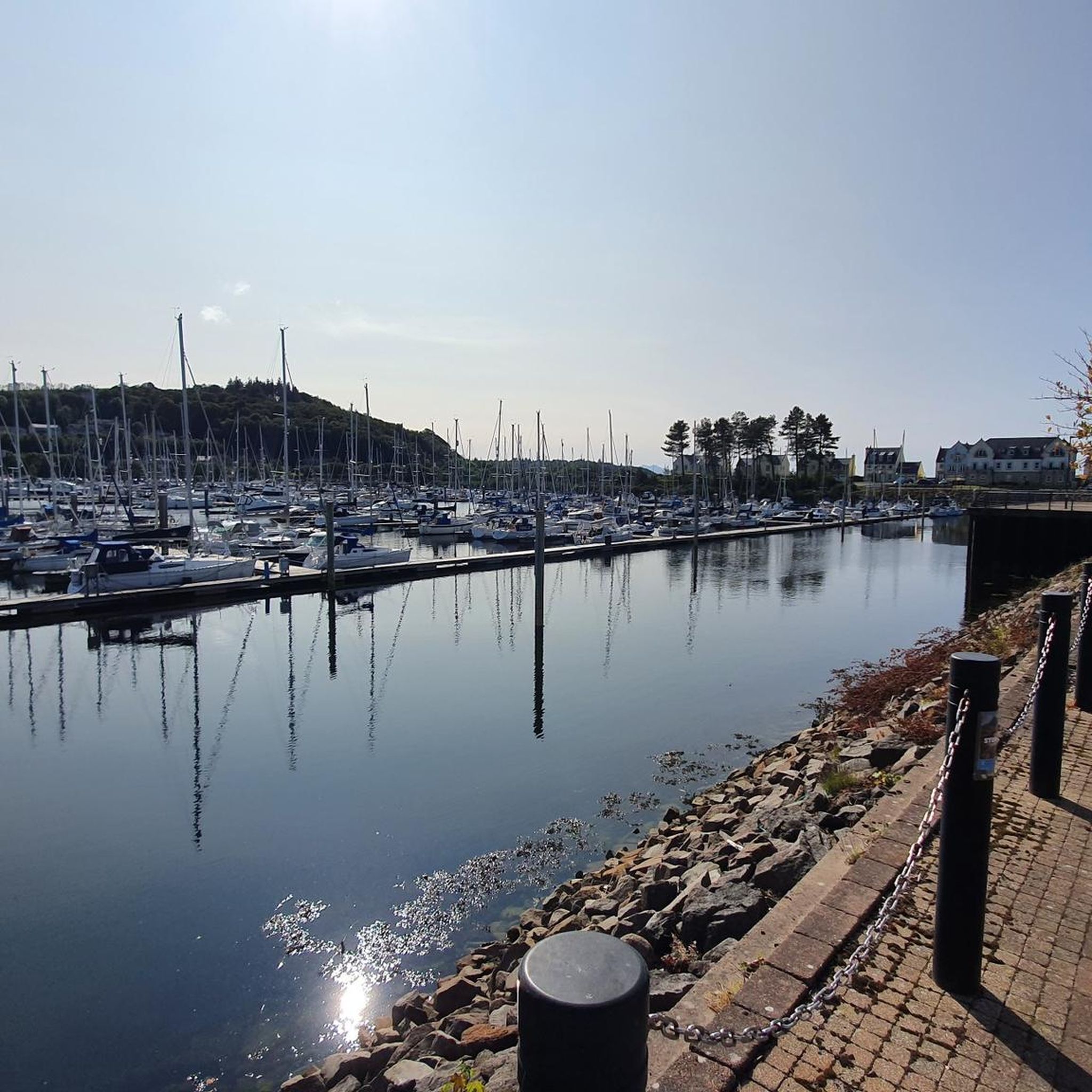
The harbours serving Irvine at Seagatefoot and Fullarton in North Ayrshire have had a long and complex history. Irvine's harbour was one of the most important ports in Scotland in the 16th century. Across from the main harbour at Fullarton on the River Irvine there was also terminal for the ICI-Nobel Explosives plant on the River Garnock. Much of the harbour went into decline in the 19th century when Glasgow, Greenock and Port Glasgow achieved higher prominence as sea ports. There was still some commercial sea traffic linked to local needs, though the harbour went into further terminal decline in the 20th century. The weir on the River Irvine forms the formal upper limit of the harbour. Formerly owned by ICI, Irvine Harbour is now the property of NPL Estates Irvine Harbour is now officially closed as a commercial port. Until recently NPL provided a slipway for dinghies, as well as moorings and berths for pleasure craft. However, silting has taken place and the Scottish Maritime Museum's berths are not for public use.
0
0

Irvine Beach Park boasts a lovely, traffic-free cycle path which is part of NCN 7. Keep an eye out for the abundance of rabbits frolicking about!
0
0
Kilwinning was a Tironensian Benedictine monastic community, named after Tiron in the diocese of Chartres. The abbey was dedicated to Saint Winning and the Virgin Mary, and founded sometime between 1162 and 1188 with monks coming from Kelso.
0
0
Street art murals on both sides beneath the Rivergate Shopping Centre bridge. Worth stopping for a look.
0
0
The River Garnock (Scottish Gaelic: Gairneag / Abhainn Ghairneig), the smallest of Ayrshire's six principal rivers,[1] has its source on the southerly side of the Hill of Stake in the heart of the Clyde Muirshiel Regional Park.
0
0

The Annick Water (previously also spelled as Annack, Annoch (1791) or Annock) is the largest tributary of the River Irvine. The river runs from Long Loch, just inside East Renfrewshire, in a generally south-western direction through North Ayrshire and East Ayrshire, to confluence with its parent river at Irvine, North Ayrshire on the west coast of Scotland. The name may derive from the Gaelic for 'overflowing' and Strathannick is very much prone to flooding as recorded by SEPA. The water now (2006) appears to be pollution free for most of its length. An independent survey in the Bourtreehill (1999) area revealed a strong colony of freshwater shrimp, a crustacean known only to live in relatively clean water. On 27 January 2009 a BP tanker train carrying liquid fuels (diesel and heating oil) from Mossend to Riccarton was derailed near the bridge over the Stewarton to Kilmaurs road at Peacockbank Farm. Several wagons subsequently caught fire. The Annick Water was polluted, however, it escaped major contamination.
0
0
Frequently Asked Questions
How many running routes are available around Ashgrove Loch?
There are over 130 running routes available around Ashgrove Loch and the surrounding area. These routes offer a variety of experiences, from easy jogs to more challenging long-distance runs.
What kind of landscape can I expect when running near Ashgrove Loch?
Runners can expect generally flat coastal paths and sandy beaches, particularly around towns like Stevenston. While Ashgrove Loch itself is a Site of Special Scientific Interest with limited direct access due to its unique ecosystem, the surrounding trails offer scenic views of the natural beauty and rich biodiversity of North Ayrshire.
Are there any historical sites or landmarks to see while running?
Yes, the area around Ashgrove Loch is rich in history. You can explore routes that pass by significant historical sites such as Kilwinning Abbey. The region also has ancient crannogs and traces of the historic 'King's Road', adding an intriguing layer to your run.
Can I run directly around Ashgrove Loch?
Direct access for running around Ashgrove Loch is limited. The loch is a Site of Special Scientific Interest (SSSI) due to its unique ecosystem and floating vegetation, and access is restricted to protect its sensitive wildlife. However, numerous running paths in the surrounding area allow you to experience the natural beauty nearby.
What do other runners enjoy the most about jogging in Ashgrove Loch?
The running routes around Ashgrove Loch are highly rated by the komoot community, with an average score of 3.75 stars from over 4 reviews. Runners often praise the accessible, generally flat terrain, the coastal views, and the opportunity to explore both natural and historical landscapes.
Are there easy running options suitable for beginners?
Yes, the area offers several easy running routes. With 8 routes classified as easy, you can find gentle paths perfect for beginners or those looking for a relaxed jog. Many of the coastal paths are relatively flat, making them ideal for a comfortable run.
Are there longer or more challenging running routes available?
For those seeking a greater challenge, there are 31 difficult routes and 91 moderate routes around Ashgrove Loch. An example of a longer route is the Irvine Beach Park Cycle Path – Irvine Harbour loop from Kilwinning, which covers nearly 39 km.
Are the running routes around Ashgrove Loch suitable for families?
Many of the flat coastal paths and shorter loops are well-suited for families. The generally level terrain makes them accessible for various fitness levels, allowing families to enjoy a run or walk together while exploring the scenic surroundings.
Can I bring my dog on the running trails?
While specific regulations for every trail may vary, generally, many outdoor paths in the region are dog-friendly. It's always recommended to keep dogs on a leash, especially in areas with wildlife or near livestock, and to clean up after them to preserve the natural environment.
Is there parking available for runners near the trails?
Yes, parking is generally available in the towns and villages that serve as starting points for many of the running routes, such as Stevenston and Kilwinning. Specific parking details can often be found on individual route pages on komoot.
How can I get to the running routes using public transport?
The towns of Stevenston and Kilwinning, which are common starting points for many routes, are accessible by public transport. You can plan your journey to these towns and then access the various running trails from there.
Are there circular running routes available?
Yes, many of the running options around Ashgrove Loch are circular routes, allowing you to start and finish in the same location. Examples include the Stevenston Solar Farm loop from Stevenston and the Running loop from Kilwinning.
What is the best time of year to go running around Ashgrove Loch?
The coastal paths and generally flat terrain make the area suitable for running throughout much of the year. Spring and autumn offer pleasant temperatures and beautiful scenery. While winter running is possible, be mindful of weather conditions, as coastal areas can be exposed to wind and rain.
Most popular routes around Ashgrove Loch

Get inspired with the komoot mobile app


Explore more
Browse the best Running Trails & Routes in other regions.
