The best running trails in Soquel Demonstration State Forest
175
runners
18
runs
Jogging in Soquel Demonstration State Forest offers a diverse environment within the Santa Cruz Mountains. The region is characterized by dense redwood and Douglas-fir forests, mixed hardwoods, and riparian areas along creeks. Elevations range from 450 to 2,400 feet, providing varied terrain from gently sloping fire roads to more challenging climbs. This landscape includes rolling hills and active geological features, creating a dynamic setting for running.
Best jogging routes in Soquel Demonstration State Forest
- The most popular jogging route is Fire Road SA31, a 3.5 miles (5.7 km) trail that takes about 1 hour to complete. This route is known for its wide, gently sloping path, suitable for varied running paces.
- Another top favourite among local runners is Highland Way, a difficult 17.4 miles (28.0 km) path. This route traverses varied terrain within the Santa Cruz Mountains, offering a longer and more challenging running experience.
- Local runners also love the Mount Umunhum Trail, a 5.0 miles (8.1 km) trail leading through forested areas to panoramic views, often completed in about 1 hour 4 minutes.
- Jogging in Soquel Demonstration State Forest is defined by towering redwood forests, rolling hills, and scenic creeks. The network offers options for different ability levels, from moderate climbs to more challenging distances.
- The routes in Soquel Demonstration State Forest are highly rated by the komoot community with an average score of 4.3 stars from several reviews. More than 250 runners have used komoot to explore Soquel Demonstration State Forest's varied terrain.
Last updated: September 27, 2026
5.71km
00:58
400m
400m
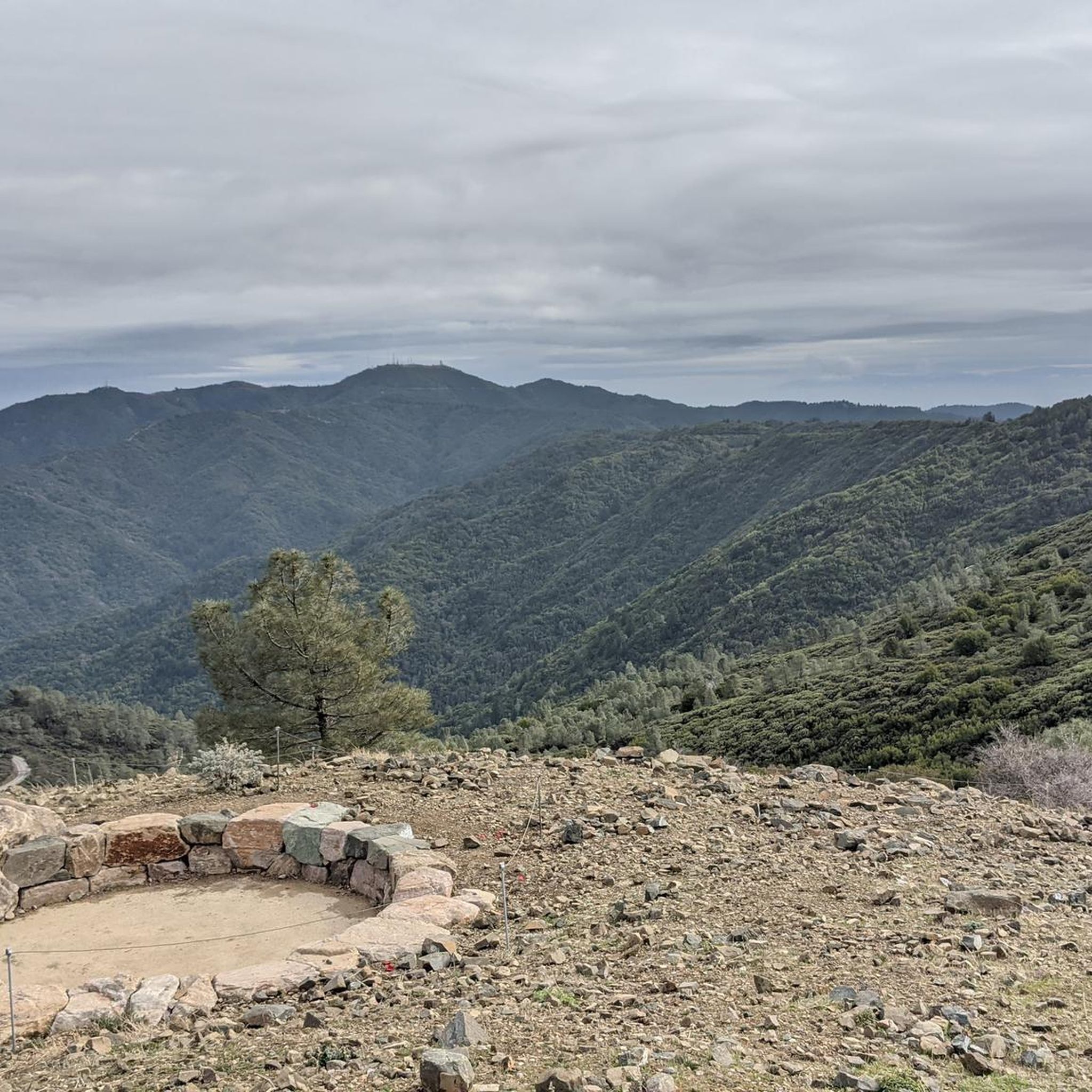
Fire Road SA31 offers a demanding uphill jogging experience through the forested Santa Cruz Mountains, rewarding your effort with truly expansive views. As you climb, you'll see Mount Umunhum and the Santa Clara Valley spread out below, with the Loma Prieta Way Overlook providing a prime spot to take it all in. This difficult 3.6-mile (5.7 km) route packs in 1320 feet (402 metres) of elevation gain, typically taking around 58 minutes to complete, making it a fantastic challenge for fit runners.
When planning your visit, you'll appreciate the convenient parking available right at the trailhead. This trail is best enjoyed when you're ready for a strenuous workout, so consider tackling it during cooler parts of the day or year. Always bring plenty of water, even for this relatively short but intense ascent.
This trail stands out for its direct and challenging ascent, providing a unique way to experience the natural beauty of the Santa Cruz Mountains. The panoramic vistas extend to both the Inner and Outer Coast Ranges, and on exceptionally clear days, you might even spot the Soquel Canyon State Marine Conservation Area. It's a serious physical test set against a backdrop of stunning natural scenery.
28.0km
03:03
490m
490m
Challenge yourself on the difficult 17.4-mile Highland Way jogging route in Soquel Demonstration State Forest, with 1617 feet of gain.

10
runners
12.9km
01:44
400m
400m
Hard run. Very good fitness required. Mostly paved surfaces. Suitable for all skill levels.
6
runners
9.51km
01:13
190m
190m
Moderate run. Good fitness required. Mostly paved surfaces. Suitable for all skill levels.
1
runners
8.12km
01:04
220m
220m
Jog the moderate 5.0-mile Mount Umunhum Trail for a rewarding climb, panoramic views, and a glimpse of the iconic Cold War-era "Cube".
Get access to more routes and recommendations from other explorers.
Already have an account?
Our route recommendations are based on thousands of hikes, rides, and runs completed by other people on komoot.
Start today with a free account
Your next adventure awaits.
Popular around Soquel Demonstration State Forest


Other adventures in Soquel Demonstration State Forest

Tips from the Community

If you make the summit a fantastic view awaits. Be aware the road goes down then up to the road about then up again to the summit!…
0
0

The Land of Medicine Buddha is a Buddhist refuge of over 100 acres. There are retreats on the property, and all trail users are urged to remember that this is a "meditation and retreat facility", not just a recreational space.
1
0

At the top of Loma Prieta Way, there is an overlook that allows you to see the Soquel Canyon State Marine Conservation Area on a clear day.
0
0
Eureka Canyon Road is a scenic, narrow road traveling through dense forests. There are amazing tall redwood trees lining the road and tons of shade, making for a great option on a hot day.
0
0

Mount Umunhum is one of the highest peaks in the mountain range at 3,486 feet. From this point, you can enjoy a panoramic view of the ocean and Sierra Nevada.
0
0
The Land of Medicine Buddha is a Buddhist refuge of over 100 acres. There are retreats on the property, and all trail users are urged to remember that this is a "meditation and retreat facility", not just a recreational space.
0
0

Bridge Creek flows down the mountain via several waterfalls from three plateaus.
0
0

Guadalupe Creek Overlook is a scenic viewpoint in the Sierra Azul Open Space Preserve. No matter if you're on your way to Mount Umunhum or if it's your final destination, make sure to include a stop and enjoy the view over the valley.
0
0
Frequently Asked Questions
How many running routes are available in Soquel Demonstration State Forest?
Soquel Demonstration State Forest offers a diverse network of over 20 running routes, catering to various fitness levels and preferences. These trails traverse the beautiful Santa Cruz Mountains, providing a rich outdoor experience.
What kind of terrain can I expect on the running trails in Soquel Demonstration State Forest?
The terrain in Soquel Demonstration State Forest is quite varied, ranging from wide, gently sloping fire roads to steeper sections with rocks and roots. Elevations span from 450 to 2,400 feet, offering rolling hills and diverse landscapes. You'll encounter ecosystems including redwood and Douglas-fir forests, mixed hardwoods, and riparian areas along creeks.
Are there challenging routes for experienced trail runners?
Yes, experienced trail runners will find several challenging options. For instance, Highland Way is a difficult 17.4-mile path with significant elevation changes, offering a demanding experience. Another option is the Land of Medicine Buddha loop from Enchanted Forest, which is also rated as difficult and covers nearly 8 miles.
What natural features or scenic views can I expect to see while running?
Runners in Soquel Demonstration State Forest can enjoy a rich array of natural beauty. You'll pass through dense redwood and tanoak forests, with old-growth redwoods visible in some areas like near Badger Springs on Hihn's Mill Road. The forest also offers panoramic views from peaks like Mount Umunhum, and on clear days, an overlook at the top of Loma Prieta Way provides views of the Soquel Canyon State Marine Conservation Area. Creeks such as the East Branch of Soquel Creek add to the scenic allure.
Are there any easy running routes for beginners?
While many routes offer moderate to difficult challenges, some sections are more suitable for beginners. For example, Fire Road SA31 is known for its wide, gently sloping path, making it suitable for varied running paces and potentially a good starting point for those new to trail running. Hihn's Mill Road is also described as a wide, gently sloping fire road that is relatively fast and easy.
Are dogs allowed on the running trails in Soquel Demonstration State Forest?
The provided information does not explicitly state the rules regarding dogs on trails in Soquel Demonstration State Forest. It's always best to check the official forest regulations or signage at trailheads before bringing your dog to ensure compliance.
Is parking available at the trailheads?
Yes, parking is generally available at designated trailheads within Soquel Demonstration State Forest. However, specific details about parking locations and capacity are not provided, so it's advisable to plan your visit and check for any specific parking instructions for your chosen trailhead.
What is the best time of year to go running in Soquel Demonstration State Forest?
Soquel Demonstration State Forest is open from dawn to dusk for day use only. The Santa Cruz Mountains climate generally offers pleasant conditions for running for much of the year. However, it's always wise to check current weather conditions, especially during winter for potential rain or in summer for warmer temperatures, and be aware of natural elements like poison oak and ticks.
Are there any circular running routes available?
Yes, there are circular running routes available. The Land of Medicine Buddha loop from Enchanted Forest is an example of a circular route, offering a challenging 8-mile loop through the forest.
What do other runners enjoy the most about jogging in Soquel Demonstration State Forest?
The komoot community highly rates the running experience in Soquel Demonstration State Forest, with an average score of 4.3 stars. Runners often praise the diverse environment, the towering redwood forests, rolling hills, and scenic creeks. The variety of routes, from moderate climbs to more challenging distances, is also a frequently appreciated aspect.
Can I reach the forest by public transport?
The provided information does not specify public transport options to Soquel Demonstration State Forest trailheads. Given its location in the Santa Cruz Mountains, access is typically by private vehicle. It is recommended to check local public transport schedules and routes if you plan to rely on public transit.
Are permits required for jogging in the forest?
Soquel Demonstration State Forest is open for public recreational opportunities, including jogging, from dawn to dusk for day use. The information does not mention any specific permits required for jogging. However, it's always good practice to check for any updated regulations before your visit.
Most popular routes in Soquel Demonstration State Forest

Get inspired with the komoot mobile app


Explore more
Browse the best Running Trails & Routes in other regions.
