The best MTB trails in Bunyaville Conservation Park
4.6
(18)
979
riders
29
rides
Mountain bike trails in Bunyaville Conservation Park are situated within an undulating landscape near Brisbane, characterized by open eucalypt forests, wetlands, and tranquil creeks. The park's terrain offers varied soil types and natural obstacles, making it well-suited for cross-country mountain biking. This area serves as a significant wildlife corridor, providing a natural bush retreat with diverse physical features for outdoor activities.
Best mountain bike trails in Bunyaville Conservation Park
- The most popular mountain bike trail is Bunyaville Conservation Park loop from Arana Hills, a 13.0 miles (21.0 km) trail that takes 1 hour 38 minutes to complete. This difficult route features significant elevation gain within the park's varied landscape.
- Another top favourite among local mountain bikers is Bunyaville Conservation Park loop from Everton Hills, a moderate 4.6 miles (7.3 km) path. This route offers a ride through the park's eucalypt forests with moderate elevation changes.
- Local mountain bikers also love the Wahminda Pond – Hall Reserve loop from Albany Creek, a 24.2 miles (39.0 km) trail leading through diverse parkland and creek areas, often completed in about 2 hours 39 minutes.
- Mountain biking in Bunyaville Conservation Park is defined by open eucalypt forests, tranquil creeks, and an undulating landscape with varied soil types. The network offers options for different ability levels, from easy paths to challenging technical trails.
- The routes in Bunyaville Conservation Park are highly rated by the komoot community with an average score of 4.7 stars from more than 20 reviews. More than 1200 mountain bikers have used komoot to explore Bunyaville Conservation Park's varied terrain.
Last updated: July 17, 2026
132
riders
21.0km
01:39
300m
300m
Hard mountain bike ride. Great for any fitness level. Advanced riding skills necessary. Some portions of the route may require you to push your bike.
5.0
(9)
110
riders
13.3km
01:02
160m
160m
Moderate mountain bike ride. Great for any fitness level. Advanced riding skills necessary.

Sign up for free
13
riders
7.35km
00:27
70m
70m
Moderate mountain bike ride. Great for any fitness level. Advanced riding skills necessary.
23
riders
Moderate mountain bike ride. Good fitness required. Advanced riding skills necessary.
5.0
(1)
4
riders
35.1km
01:50
110m
110m
Easy mountain bike ride. Great for any fitness level. Suitable for all skill levels.
Get access to more routes and recommendations from other explorers.
Sign up for free
Already have an account?
Our route recommendations are based on thousands of hikes, rides, and runs completed by other people on komoot.
Start today with a free account
Your next adventure awaits.
Login or Signup

Tips from the Community

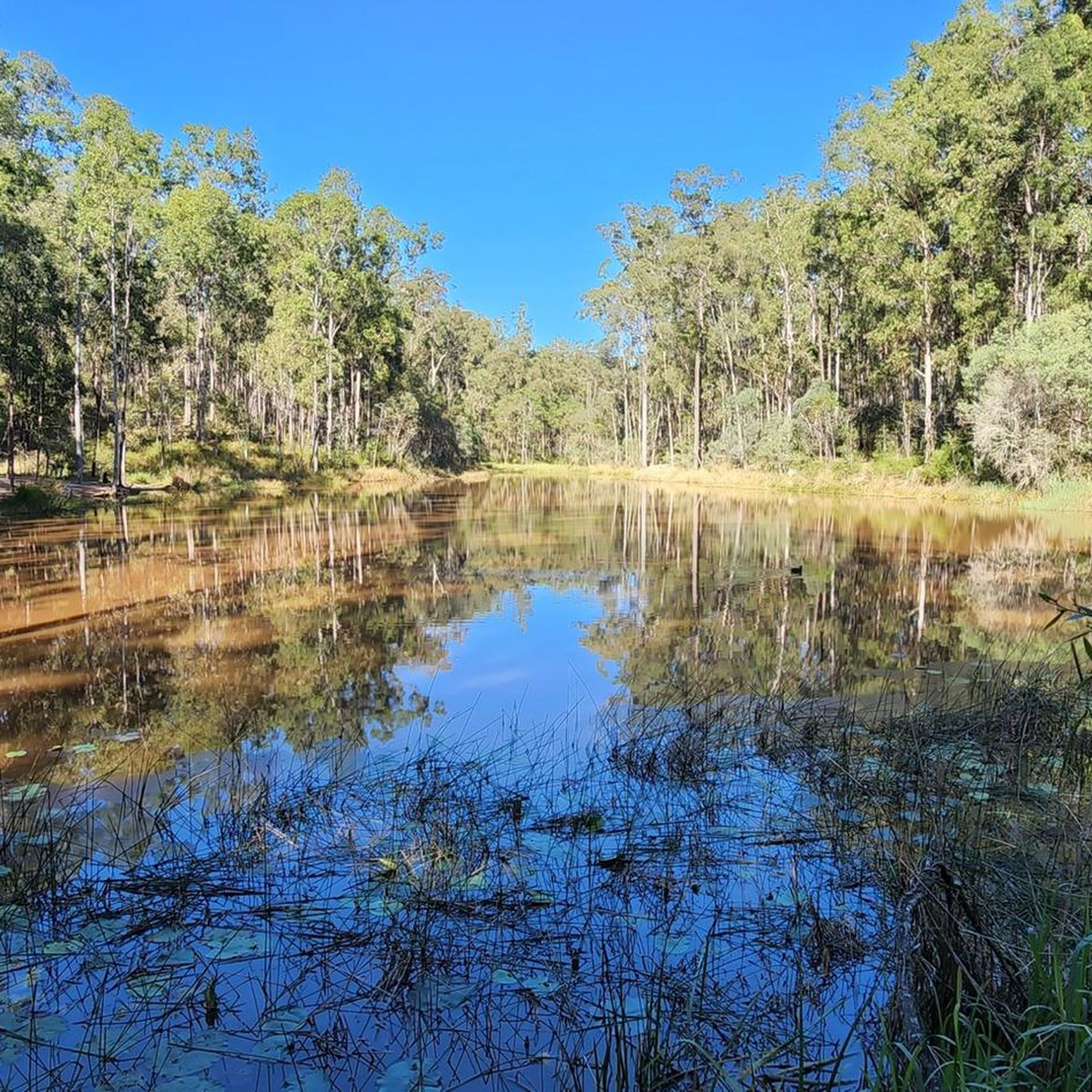
Kedron Creek passes under the Lanita Rail Trail and is a lively creek with ducks, herons, egrets, and kingfishers hanging out by the water's edge. It's scenic, surrounded by greenery and the bridge passing over it is very modern, looking like a wooden work of art.
0
0
Lanita Court transitions into the most western end of the Lanita Rail Trail at this point. A metal gate restricts vehicles from entering, and there is signage about the conservation area. This trackhead is just the end of a road and not an official parking area. It's best to park at the eastern end of the Lanita Rail Trail at the car park for Wahminda Park.
0
0

Samford Conservation Park protects a large area of open ironbark forest and shared bush trails on Brisbane’s northwestern fringe, popular with walkers, mountain bikers, trail runners, and horse riders. Ironbark Gully is the main day-use area, with picnic shelters, toilets, barbecues, drinking water, and access to several loop tracks through the reserve. The park is especially popular for fitness walks thanks to its rolling hills, wide gravel trails, and long shaded sections beneath the gums.
0
0
Geigers Road is one of the management trails through Samford Conservation Park, winding through open ironbark forest and spotted gums with steady climbs and long shaded sections. It’s popular with walkers, trail runners, mountain bikers, and horse riders thanks to its broad gravel surface and connections to several loop tracks through the reserve. Starting from the Ironbark Gully picnic area gives easy access to toilets, picnic tables, and nearby parking before heading deeper into the bush.
0
0
Bunker Road cuts through a quieter section of the reserve, surrounded by tall gums, dense bushland, and seasonal creek lines. It’s a popular access point for both walkers and mountain bikers, with several tracks branching deeper into the forest from here. The road itself is unsealed and can become muddy after wet weather.
0
0

Samford Conservation Park is a beautiful bushland reserve near the rural township of Samford Valley northwest of Brisbane. The park protects eucalypt forest and creek habitats that support native wildlife, including wallabies, koalas, and a variety of bird species, while also preserving part of the area’s natural catchment. There is a network of walking and cycling tracks and fire trails throughout the grounds, where you can explore the park’s ridgelines and gullies, making it an ideal location for quiet nature-based recreation close to the city.
0
0
Ironbark Gully picnic area is a popular day-use facility within Samford Conservation Park, set among open eucalypt forest near the park’s main access point at Samford Valley. There are picnic tables, shelters, and a trailhead for the short Crebra Circuit walking track, making it a convenient start or end point for exploring the park. Surrounded by ironbark woodland and native wildlife habitat, it’s a quiet bush setting ideal for a lovely picnic with access to the park’s wider trail network.
0
0

The river is a little washed out from floods but still peaceful.
0
0
Frequently Asked Questions
How many mountain bike trails are available in Bunyaville Conservation Park?
Bunyaville Conservation Park offers a network of over 40 mountain bike trails, catering to various skill levels. This includes 11 easy routes, 18 moderate routes, and 14 difficult routes, ensuring options for everyone from beginners to experienced riders.
Are there any family-friendly mountain bike trails in Bunyaville Conservation Park?
Yes, there are several family-friendly options. The park has 11 easy-rated mountain bike routes. For example, the Raven Street Reserve – Plaza Place Park loop from McDowall is an easy 35.1 km trail that takes about 1 hour 50 minutes, offering a pleasant ride through the park's eucalypt forests.
What kind of terrain can I expect on the mountain bike trails in Bunyaville Conservation Park?
The park features an undulating landscape with diverse terrain, including open eucalypt forests, wetlands, and tranquil creeks. You'll encounter varied soil types, natural obstacles like roots and rocks, and features such as jumps and berms. Trails range from gentle paths to challenging technical sections with steep gradients and switchbacks.
Are there any advanced or challenging mountain bike trails for experienced riders?
Absolutely. Bunyaville Conservation Park has 14 difficult-rated mountain bike routes. The Bunyaville Conservation Park loop from Arana Hills is a difficult 21 km trail with significant elevation gain, taking approximately 1 hour 38 minutes to complete. The park also features trails like the 'Carnivore Trail' and 'Jurassic Trail' known for their steep descents, rocks, jumps, and challenging obstacles.
What natural features or wildlife might I encounter while mountain biking in Bunyaville Conservation Park?
You'll ride through diverse landscapes including open eucalypt forests, wetlands, and along tranquil creeks such as Kingfisher Creek, Albany Creek, and Sandy Creek. The park is a vital wildlife corridor, so keep an eye out for koalas, wallabies, echidnas, goannas, and over 120 species of birds, including pied currawongs and laughing kookaburras.
Is Bunyaville Conservation Park suitable for mountain biking year-round?
While mountain biking is generally possible year-round, the best time to visit is typically during the cooler, drier months to avoid the heat and humidity of summer, and to ensure optimal trail conditions after heavy rain. Always check local weather conditions before heading out.
Are there any circular mountain bike routes in Bunyaville Conservation Park?
Yes, many of the mountain bike routes in Bunyaville Conservation Park are designed as loops. For instance, the Wahminda Pond – Hall Reserve loop from Albany Creek is a moderate 39 km trail that leads through diverse parkland and creek areas, and the Camp Mountain Lookout loop from Ferny Hills offers a 29.3 km moderate ride.
What do other mountain bikers say about the trails in Bunyaville Conservation Park?
The mountain bike trails in Bunyaville Conservation Park are highly rated by the komoot community, with an average score of 4.7 out of 5 stars from over 20 reviews. Many riders praise the park's diverse terrain, well-maintained tracks, and the opportunity to experience a natural bush retreat close to Brisbane.
Are dogs allowed on the mountain bike trails in Bunyaville Conservation Park?
No, domestic animals, including dogs, are not permitted in Bunyaville Conservation Park to protect the native wildlife. This rule applies to all trails, including those used for mountain biking.
Where can I find parking for mountain biking in Bunyaville Conservation Park?
Bunyaville Conservation Park offers several designated parking areas. The main day-use areas provide facilities like picnic tables, toilets, and barbecues, and are good starting points for accessing the trail network.
Are there any facilities like toilets or picnic areas in Bunyaville Conservation Park?
Yes, Bunyaville Conservation Park is well-equipped with facilities. You'll find picnic tables, toilets, and barbecues (some with wood supplied) in the day-use areas, making it convenient for a full day out or a family outing.
Can I access Bunyaville Conservation Park by public transport?
While the park is located near Brisbane, direct public transport access to the trailheads can be limited. It's advisable to check local bus routes and schedules or consider driving to the park's main entrances for easier access to the mountain biking trails.
Most popular routes in Bunyaville Conservation Park

Get inspired with the komoot mobile app


Explore more
Browse the best MTB trails in other regions.
