The best cycling routes in Gwandenwald
4.7
(529)
4,290
riders
258
rides
Touring cycling routes in Gwandenwald traverse a landscape characterized by its mountainous terrain and extensive forests. The region features significant elevation changes, with routes often leading to high-altitude huts and scenic viewpoints. This environment provides a challenging yet rewarding experience for touring cyclists.
Best touring cycling routes in Gwandenwald
- The most popular touring cycling route is Hochwechsel – Rabl-Kreuz-Hütte loop from Mönichwald, a 23.9 miles (38.4 km) trail that takes 3 hours 33 minutes to complete. This difficult route…
Last updated: October 11, 2026
5.0
(3)
76
riders
38.4km
03:33
1,270m
1,270m
Hard bike ride. Very good fitness required. Mostly paved surfaces. Suitable for all skill levels.
4.8
(4)
42
riders
27.1km
02:49
1,160m
1,160m
Hard bike ride. Very good fitness required. Mostly paved surfaces. Suitable for all skill levels.

5.0
(1)
34
riders
40.5km
03:38
1,050m
1,050m
Hard bike ride. Very good fitness required. You may need to push your bike for some segments of this route.
4.8
(6)
35
riders
25.9km
02:06
700m
700m
Hard bike ride. Very good fitness required. Mostly paved surfaces. Suitable for all skill levels.
5.0
(7)
22
riders
27.2km
02:15
710m
710m
Hard bike ride. Very good fitness required. Mostly paved surfaces. Suitable for all skill levels.
Get access to more routes and recommendations from other explorers.
Already have an account?
Our route recommendations are based on thousands of hikes, rides, and runs completed by other people on komoot.
Start today with a free account
Your next adventure awaits.

Tips from the Community

The border stone on the Grünberg marks a transition between Lower Austria and Styria. It lies directly on the state border and is a small, but interesting landmark along the hiking route. An inconspicuous detail on the path that makes it visible that you are switching from one federal state to another here.
3
0
The large wooden „W“ stands directly on the Hochwechsel and marks the start of the Hochwechsel Trail „The WU“. It serves as a kind of gateway to the mountain bike trail, which leads from here across the alpine pasture in the direction of Marienseer Schwaig. Due to its striking shape, the „W“ is now also a distinctive photo motif directly on the Hochwechsel.
3
0
The Wetterkoglerhaus is located directly on the summit of the Hochwechsel at 1,743 meters and is a hut of the Austrian Alpine Club. With good visibility, the hut offers a magnificent panorama over the Wechsel region to Schneeberg, Rax, and Hochschwab. Due to its immediate proximity to the summit cross and chapel, the Wetterkoglerhaus is an ideal resting and refreshment stop at the highest point of the tour.
4
0
„The WU“ is an approximately 2.7-kilometer-long singletrail that leads from the Hochwechsel near the Wetterkoglerhaus across the alpine pasture in the direction of Marienseer Schwaig. Over roots, stones, curves, and open alpine meadows, the trail runs through a particularly scenic landscape of the Wechsel region. It is actually designed as a mountain bike trail; therefore, at intersections, special attention must be paid to cyclists and other trail users.
3
0

The Masenberg at 1,262 m above sea level is the last high spur of the Central Alps towards the east. With its elongated mountain ridge, it separates the Vorau basin to the north and the Lafnitztal to the east.
0
0

At the Vorauerhof, you can indulge not only in typical Styrian and Austrian specialties, but also in international delicacies and new creations. Daily menus, homemade cakes and desserts, and a wide selection of ice cream from Easter until the end of September complete the culinary offerings. The restaurant seats approximately 40 people. The light-filled conservatory, with space for 50 people, is particularly popular and perfect for small celebrations. During the summer months, guests can enjoy a centrally located beer garden. For larger celebrations or groups, such as weddings, christenings, birthdays, or company parties, the banquet hall (for approximately 110 people) provides the perfect setting. Following the philosophy "The future has tradition," the restaurant is constantly evolving while remaining true to its ancestors' original traditions and placing great emphasis on a personal touch. Whether you're looking for a cozy meal, planning a large celebration, or simply want to unwind – let yourself be pampered!
0
0

A lovely little chapel, a short stop is worthwhile.
0
0
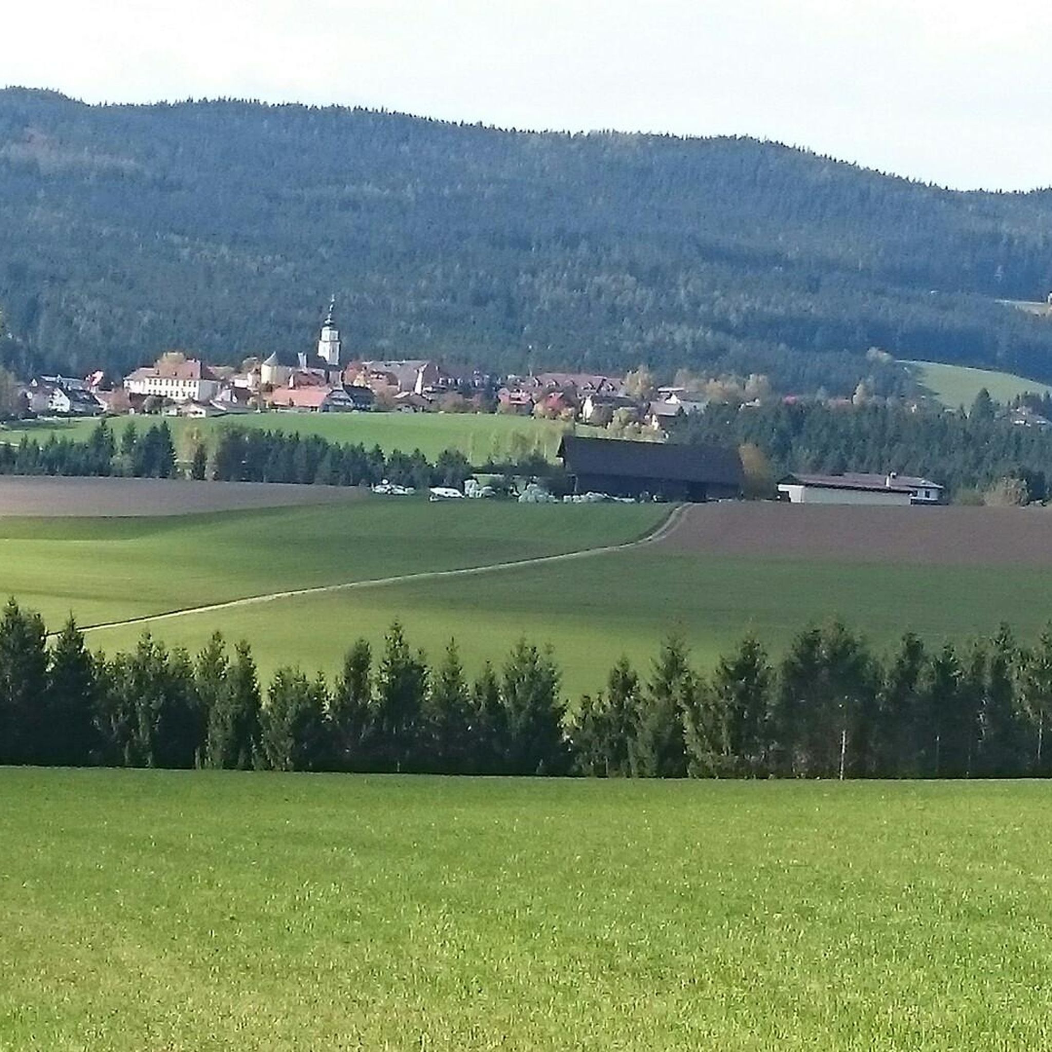
Great view of Pöllau
3
0
Frequently Asked Questions
How many touring cycling routes are available in Gwandenwald?
Gwandenwald offers a wide selection of touring cycling routes, with over 270 options available. These routes traverse a landscape characterized by mountainous terrain and extensive forests, providing a challenging yet rewarding experience.
What is the overall difficulty level of touring cycling in Gwandenwald?
The touring cycling routes in Gwandenwald are primarily designed for experienced cyclists due to significant elevation changes and challenging mountain climbs. While there are over 190 difficult routes, you can also find around 70 moderate options and a smaller selection of 8 easy routes for less strenuous rides.
Are there any easy touring cycling routes suitable for beginners in Gwandenwald?
Yes, while Gwandenwald is known for its challenging terrain, there are 8 easy touring cycling routes available. These routes offer a gentler introduction to the region's beautiful landscapes, though they may still feature some elevation changes typical of the area.
What kind of landscapes can I expect on touring cycling routes in Gwandenwald?
Touring cycling in Gwandenwald offers breathtaking alpine scenery. You can expect routes that lead through dense forests, past high-altitude huts, and to scenic viewpoints with panoramic views of snow-capped peaks and lush valleys. The region's mountainous character ensures dramatic backdrops for your rides.
What do other cyclists say about the touring routes in Gwandenwald?
The touring cycling routes in Gwandenwald are highly regarded by the komoot community, boasting an average rating of 4.7 stars from over 400 reviews. Cyclists often praise the challenging climbs, the stunning alpine views, and the rewarding experience of reaching high-altitude viewpoints.
Are there circular touring cycling routes in Gwandenwald?
Yes, many touring cycling routes in Gwandenwald are designed as loops, allowing you to start and end your journey in the same location. For example, the Hochwechsel – Rabl-Kreuz-Hütte loop from Mönichwald and the Wetterkogler House – Hochwechsel loop from Mönichwald are popular circular options that offer significant climbs and panoramic views.
What interesting sights or landmarks can I explore along touring cycling routes in Gwandenwald?
Along your touring cycling routes in Gwandenwald, you can discover several interesting points. Consider visiting the Holzer cider tavern for a local experience, or the historic Parish Church of Waldbach and Marian Column. Other unique spots include Wiedner's Water Features and the Nordic Walking Sculpture.
Are there places to stop for refreshments or a meal along the touring cycling routes?
Yes, you'll find opportunities for refreshments and meals. Many routes lead to high-altitude huts, and you might encounter places like Grizzly's Hut & Alpaca Shop, which can serve as a welcome stop. Additionally, the Holzer cider tavern offers a chance to experience local hospitality.
What is the best time of year for touring cycling in Gwandenwald?
The best time for touring cycling in Gwandenwald is typically from late spring to early autumn (May to October). During these months, the weather is generally more stable, and mountain passes are clear of snow, offering optimal conditions to enjoy the region's stunning alpine landscapes.
Can I go touring cycling in Gwandenwald during winter?
Touring cycling in Gwandenwald during winter can be challenging due to snow and ice, especially on higher elevation routes. Many trails may be impassable or require specialized equipment. It's generally recommended to stick to lower, cleared roads if cycling in winter, or consider other winter sports the region offers.
Are there family-friendly touring cycling routes in Gwandenwald?
While many routes in Gwandenwald are challenging, there are 8 easy touring cycling routes that could be more suitable for families or those looking for a less strenuous ride. These routes allow you to enjoy the natural beauty without the intense climbs found on more difficult trails.
Is public transport accessible for reaching touring cycling routes in Gwandenwald?
Given its location in a mountainous region, public transport options like buses or trains often serve the main towns and trailheads in and around Gwandenwald. It's advisable to check local transport schedules for specific routes to see how well they connect to your chosen starting points.
Where can I find parking for touring cycling routes in Gwandenwald?
Parking is generally available in the villages and at popular trailheads throughout Gwandenwald. For example, if you're starting a loop from Mönichwald or Wenigzell, you'll typically find designated parking areas. Always check local signage for parking regulations and fees.
Most popular routes in Gwandenwald
Most popular attractions in Gwandenwald

Get inspired with the komoot mobile app


Explore more
Browse the best Cycling routes in other regions.
