The best mountain hikes in Finstertalwald
4.8
(101)
1,034
hikers
25
hikes
Mountaineering in Finstertalwald offers a challenging alpine experience, characterized by rugged peaks and demanding ascents. The region features prominent summits like Kammspitze and Stoderzinken, with cliffs reaching up to 500 meters in height around the Salza Reservoir. These Finstertalwald mountaineering routes often traverse varied alpine terrain, requiring good physical condition and experience. The landscape provides a robust environment for advanced mountaineers seeking significant elevation gains.
Best mountaineering routes in Finstertalwald
- The most popular mountaineering route is Kammspitze Summit – Miesbodensee…
Last updated: July 18, 2026
5.0
(1)
21
hikers
8.50km
06:16
1,220m
1,220m
Hard mountaineering route. Very good fitness required. Sure-footedness, sturdy shoes and alpine experience required.
36
hikers
13.0km
07:12
1,280m
1,280m
Hard mountaineering route. Very good fitness required. Sure-footedness, sturdy shoes and alpine experience required.

Sign up for free
5.0
(1)
5
hikers
18.0km
07:34
1,210m
1,210m
Hard mountaineering route. Very good fitness required. Sure-footedness, sturdy shoes and alpine experience required.
5.0
(1)
8
hikers
12.9km
06:19
1,130m
1,130m
Hard mountaineering route. Very good fitness required. Mostly accessible paths. Sure-footedness required.
5.0
(1)
15
hikers
Hard mountaineering route. Good fitness required. Sure-footedness, sturdy shoes and alpine experience required.
Get access to more routes and recommendations from other explorers.
Sign up for free
Already have an account?
Our route recommendations are based on thousands of hikes, rides, and runs completed by other people on komoot.
Start today with a free account
Your next adventure awaits.
Login or Signup
Tips from the Community

From Assach, the ascent is very comfortable up to the Assacher Scharte, followed immediately by a steep, rope-secured section. The summit ridge continues relatively flat, and shortly before the summit, there's another rope-secured section. Overall, every potentially dangerous and exposed section is well secured with ropes and footholds.
0
0

When descending from the Stoderzinken you have a breathtaking view of the Dachstein Mountains.
0
0

At the crossroads where the path to the summit branches off.
1
0


Only the Flora via ferrata can be done without via ferrata equipment, provided that you have sturdy shoes and are sure-footed. All others require the necessary equipment, but are also more fun 😉. Very nice views included👍. At the top, near the "normal" summit path, there is a suspension bridge that belongs to the climbing garden. This can be easily avoided and was often the location for the ZDF series “The Mountain Rescuers”.
0
0

great via ferratas here on the Stoderzinken!
1
0
Frequently Asked Questions
How many mountaineering routes are available in Finstertalwald?
Finstertalwald offers a robust selection of mountaineering routes, with over 25 challenging options to explore. The region is primarily geared towards experienced mountaineers seeking demanding ascents and high alpine terrain.
What is the typical difficulty level of mountaineering routes in Finstertalwald?
The vast majority of mountaineering routes in Finstertalwald are classified as difficult. Out of the 29 available routes, 25 are considered difficult, requiring good physical condition and experience. You'll encounter significant elevation gains and varied alpine terrain.
Are there any easier mountaineering options for beginners in Finstertalwald?
While Finstertalwald is known for its challenging routes, there are a few less demanding options. The guide data indicates 1 easy and 3 moderate routes, but the region is predominantly suited for experienced mountaineers. It's crucial to assess your skill level and choose routes accordingly.
What kind of terrain can I expect on mountaineering routes in Finstertalwald?
Mountaineering in Finstertalwald involves diverse and demanding alpine terrain. You can expect rugged peaks, steep ascents, and high alpine landscapes. Routes often traverse rocky sections and exposed areas, requiring sure-footedness and appropriate gear.
Are there any circular mountaineering routes in Finstertalwald?
Yes, Finstertalwald features several excellent circular mountaineering routes. For instance, you could try the Kammspitze Summit – Miesbodensee loop from Knoppen, a difficult 4.3-mile route, or the Kammspitze Summit loop from Gröbming, which is 5.3 miles long. Another notable loop is the Friedenskircherl Stoderzinken – Stoderzinken Summit loop from Weyern Jägerwirt, an 11.3-mile journey through high alpine terrain.
What natural features or landmarks can I see along the mountaineering routes in Finstertalwald?
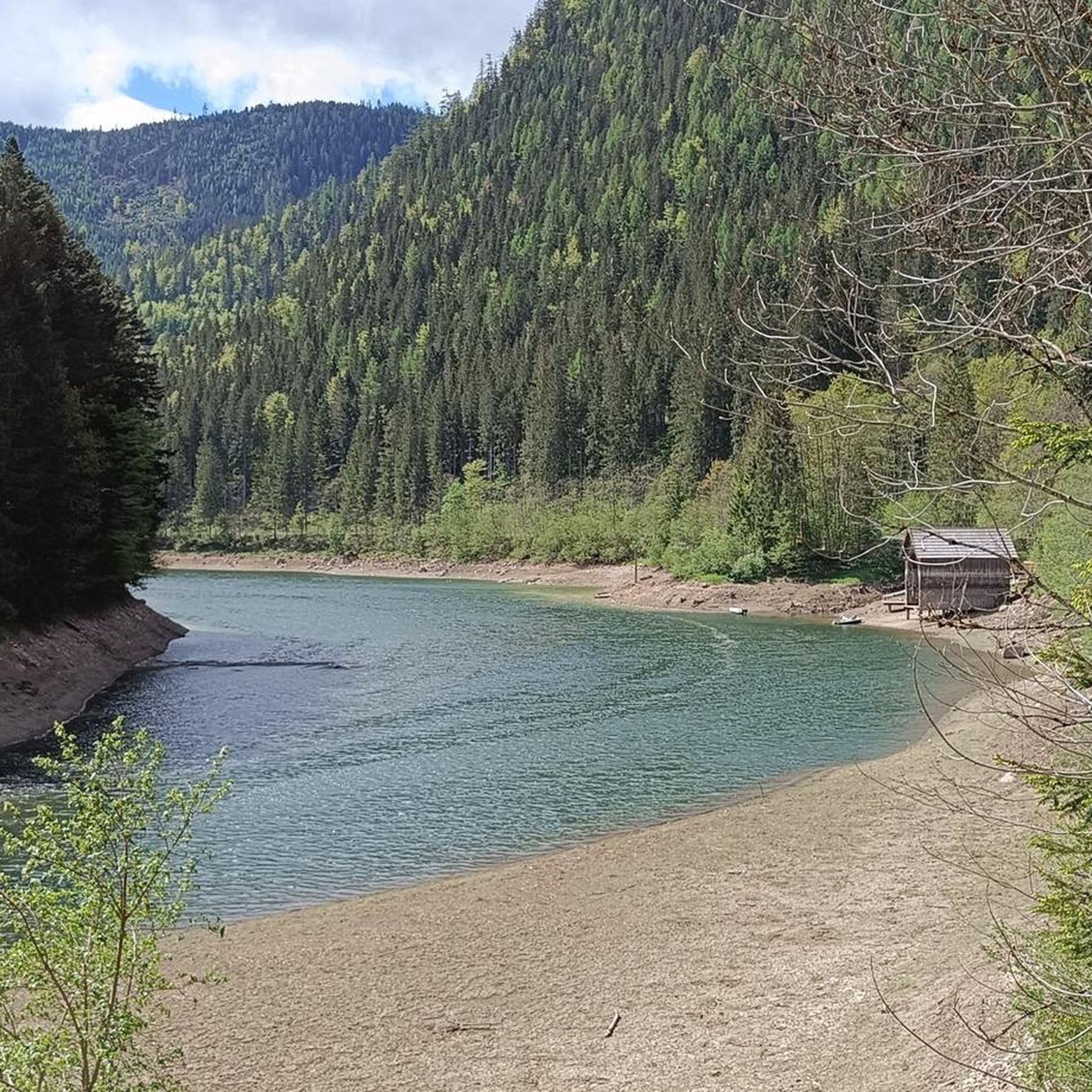
Along your mountaineering adventures in Finstertalwald, you can encounter several notable natural features and landmarks. Keep an eye out for the serene Salza Reservoir and the impressive Hochmühleck Summit. These offer stunning views and picturesque spots during your ascent.
Are there any waterfalls to discover in Finstertalwald?
Yes, Finstertalwald is home to the beautiful Salza Waterfall. While not directly on every mountaineering route, it's a significant natural attraction in the region that you might consider visiting as part of your trip.
What do other mountaineers say about their experience in Finstertalwald?
The mountaineering routes in Finstertalwald are highly regarded by the komoot community, boasting an impressive average rating of 4.9 stars from over 90 reviews. Mountaineers frequently praise the challenging summit ascents, the dramatic high alpine terrain, and the rewarding panoramic views from peaks like Kammspitze and Stoderzinken.
Is Finstertalwald suitable for winter mountaineering?
While the guide focuses on general mountaineering, the high alpine nature of Finstertalwald suggests that winter mountaineering would be extremely demanding and require specialized skills, equipment, and knowledge of avalanche conditions. Always check local conditions and forecasts if considering winter ascents.
Are there any family-friendly mountaineering routes in Finstertalwald?
Given that 25 out of 29 routes are classified as difficult, Finstertalwald is generally not considered ideal for family-friendly mountaineering with young children. The routes involve significant elevation gain and challenging terrain. For families, it might be better to look for easier hiking trails in the broader region rather than the dedicated mountaineering routes.
Can I bring my dog on the mountaineering trails in Finstertalwald?
While specific regulations for dogs on Finstertalwald's mountaineering trails are not detailed, it's common in high alpine regions for dogs to be permitted on trails if kept on a leash. However, due to the difficult terrain, steep ascents, and potential exposure, these routes may not be suitable for all dogs. Always ensure your dog is fit for the challenge and respect local wildlife.
Where can I find parking for mountaineering routes in Finstertalwald?
For routes like the Friedenskircherl Stoderzinken – Stoderzinken Summit loop, starting points like Weyern Jägerwirt often have designated parking. Similarly, routes from Knoppen or Gröbming would have parking facilities nearby. It's advisable to check specific route descriptions on komoot for detailed parking information at the trailhead.
Are there any places to eat or drink near the mountaineering trails?
While the guide data doesn't specify cafes or pubs directly on the trails, starting points for routes like those around Stoderzinken, such as Weyern Jägerwirt or Kneippanlage Gröbming, are likely to have amenities or be close to villages where you can find refreshments after your mountaineering adventure.
Most popular routes in Finstertalwald
Most popular attractions in Finstertalwald

Get inspired with the komoot mobile app


Explore more
Browse the best Mountain Hikes & Routes in other regions.
