The best walks and hikes in Forêt D'Avaise
4.5
(70)
249
hikers
39
hikes
Hiking in Forêt D'Avaise, also known as Parc du Bois d'Avaize, offers trails through a biodiverse woodland near Saint-Étienne, France. This area is a Natura 2000 site, notable for its unique ecological significance and its history as a reclaimed mining site. The landscape features a rich variety of plant species, including the rare dwarf gorse, and provides insights into Carboniferous geological layers. Located on one of Saint-Étienne's hills, it blends natural immersion with historical context.
Best hiking trails in Forêt…
Last updated: July 11, 2026
5.0
(1)
3
hikers
6.33km
01:41
70m
70m
Easy hike. Great for any fitness level. Easily-accessible paths. Suitable for all skill levels.
5.0
(1)
3
hikers
11.0km
03:02
180m
180m
Moderate hike. Good fitness required. Easily-accessible paths. Suitable for all skill levels.

Sign up for free
1
hikers
8.77km
02:20
90m
90m
Moderate hike. Good fitness required. Easily-accessible paths. Suitable for all skill levels.
4.8
(4)
7
hikers
9.64km
02:50
260m
270m
Moderate hike. Good fitness required. Easily-accessible paths. Suitable for all skill levels.
4.3
(4)
16
hikers
5.16km
01:31
140m
150m
Easy hike. Great for any fitness level. Easily-accessible paths. Suitable for all skill levels.
Get access to more routes and recommendations from other explorers.
Sign up for free
Already have an account?
Our route recommendations are based on thousands of hikes, rides, and runs completed by other people on komoot.
Start today with a free account
Your next adventure awaits.
Login or Signup



Tips from the Community

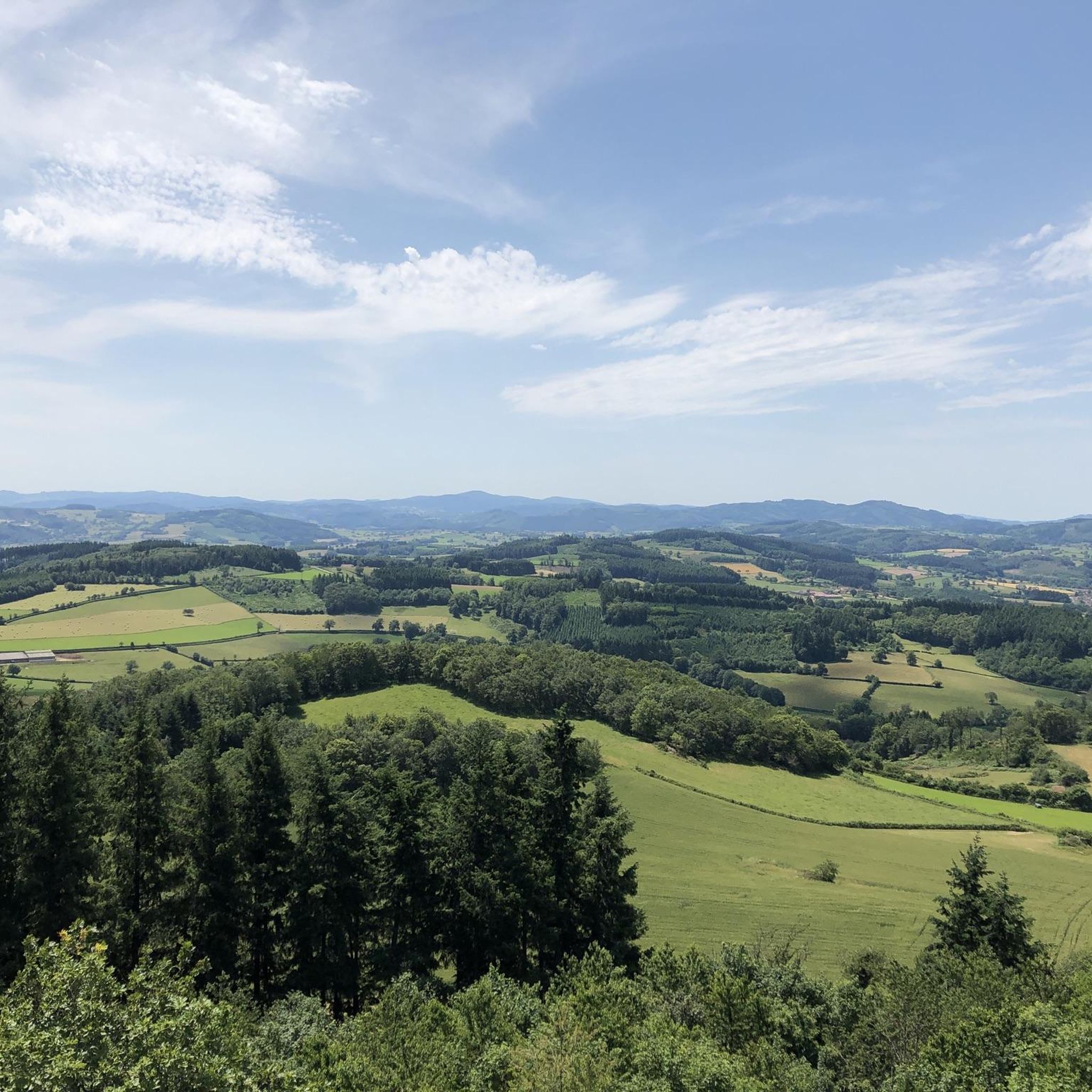
La Butte de Suin is a 593-meter-high viewpoint hill in the Saône-et-Loire department, near the small French municipality of Suin. From the summit, there is an impressive 360-degree panoramic view. In clear weather, you can look far over the hilly landscapes of Southern Burgundy (including the Charolais and Clunysois regions, and as far as Beaujolais). At the summit, there is a striking statue of the Virgin Mary, an orientation table for hikers, and the remains of an old fortress that was used from the Celtic period until the 16th century.
0
0

The Bois de Morphée is a small wood. It is a quiet road that avoids the main road.
1
0

Driveway over small streets, great panorama without disturbing tree tops.
0
0

Superb rendering I loved it and a great view to redo in good weather
1
0

the last 200m very steep. great view. Restauration with rest day
0
0

Clear point of view over the whole region. It climbs nicely no matter which side you take, but it's worth it. The descent to St-Bonnet by small road is pretty.
0
0

An essential point of view. The Butte de Suin rises to 593 meters. A path leads to the statue of the Virgin where there is an orientation table. From there, a magnificent circular panorama is revealed. We can see the Charolais to the west, Mont Saint-Vincent and Montceau-les-Mines to the north-west, the Chalonnaise region to the north-east, the Clunysois to the east, Mont Saint-Cyr and the foothills of Beaujolais South. The mound housed a fortified site from the Celtic period until the 16th century.
1
0

On the Butte de Suin you have a wonderful panoramic view over the country. Easy to reach by car (A smaller parking lot at the restaurant, a big something behind). At the observation deck is an information board, so you can assign the individual hills. Furthermore, a generous green area invites you to camp. On an information board four trails are described, from 2 to 15 kilometers in length. We made the S2 with 5 kilometers, nice, but the majority is on tarmac.
2
1
Frequently Asked Questions
How many hiking trails are available in Forêt D'Avaise?
Forêt D'Avaise, also known as Parc du Bois d'Avaize, offers nearly 40 hiking routes. These trails cater to various preferences, ranging from easy strolls to more challenging excursions through its unique landscape.
What are the typical difficulty levels for hikes in Forêt D'Avaise?
The trails in Forêt D'Avaise offer a range of difficulty levels. You'll find 15 easy routes, 22 moderate paths, and 2 more challenging hikes, ensuring options for most fitness levels.
What do other hikers say about the trails in Forêt D'Avaise?
The trails in Forêt D'Avaise are highly regarded by the komoot community, boasting an average rating of 4.5 stars from over 60 reviews. Hikers often praise the park's serene natural immersion despite its proximity to the city, and the unique blend of biodiverse woodlands with historical context.
What kind of terrain can I expect when hiking in Forêt D'Avaise?
When hiking in Forêt D'Avaise, you can expect varied terrain primarily through biodiverse woodlands. The area is a reclaimed former mining site, so trails may feature gentle slopes, natural paths, and areas showcasing unique geological formations from the Carboniferous Stephanian layer.
What unique natural features can I discover while hiking in Forêt D'Avaise?
Forêt D'Avaise is a Natura 2000 site, rich in biodiversity. Hikers can discover a wide array of plant species, including the rare dwarf gorse, which marks its easternmost known geographical limit for an Atlantic plant. The park's ecosystem supports 42 bird species and 10 butterfly species, making it a fascinating area for nature observation.
Are there any historical points of interest within Forêt D'Avaise?
Yes, Forêt D'Avaise holds significant historical interest as a former mining site active until 1931. The landscape itself is a testament to nature's ability to rewild, showcasing how industrial heritage has transformed into thriving natural habitats. A dedicated discovery trail helps visitors explore these unique aspects.
Are there any circular walks available in Forêt D'Avaise?
Yes, many of the routes in Forêt D'Avaise are circular, allowing you to start and end at the same point. An example is the moderate Morpheus Woods – Suin Hill loop from Suin, which covers nearly 10 km.
Are the hiking trails in Forêt D'Avaise suitable for families?
Yes, Forêt D'Avaise is well-suited for families. The park features amenities such as picnic areas and play areas, and many of its trails, including easy options like the Château de Chaumont loop from Ballore, are accessible and enjoyable for all ages.
Is Forêt D'Avaise accessible by public transport?
Yes, Forêt D'Avaise is easily accessible by public transport. You can reach the park using Saint-Étienne's STAS bus lines M3 and 29, making it a convenient destination for a day out in nature without needing a car.
What is the best time of year to hike in Forêt D'Avaise?
Forêt D'Avaise is enjoyable year-round, but spring and autumn offer particularly pleasant conditions with mild temperatures and vibrant natural colors. The park's biodiverse woodland and unique flora are especially beautiful during these seasons.
Can I bring my dog on the trails in Forêt D'Avaise?
While the region research doesn't explicitly state dog-friendly policies, most natural parks in France allow dogs on leash. Given the park's focus on outdoor activities and its natural setting, it's generally acceptable to bring dogs, provided they are kept under control to protect the local wildlife and flora, especially as it's a Natura 2000 site.
Are there any longer, more immersive hikes in the area?
For those seeking a longer experience, the moderate Étang d'Hautvel – Étang d'Availly loop from Vauzelle offers an 11 km journey through varied woodland terrain and past natural ponds, providing a more immersive exploration of the park's natural beauty.
Most popular routes in Forêt D'Avaise

Get inspired with the komoot mobile app


Explore more
Browse the best Hikes in other regions.
