The best running trails in K'Ómoks Royston Lands
4.3
(3)
249
runners
26
runs
Jogging in K'Ómoks Royston Lands offers a varied landscape within the Comox Valley on Vancouver Island. The region features a blend of coastal and forested environments, providing diverse terrains for runners. Joggers can experience routes ranging from coastal paths with views across Comox Harbour to trails through extensive regenerated second-growth forests. Some paths offer significant elevation changes, while others are flatter, catering to different fitness levels.
Best jogging routes in K'Ómoks Royston Lands
- The most popular jogging route is Running loop from South Island Highway at Gartley Road (NB), a 5.9 miles (9.5 km) trail that takes 1 hour 5 minutes to complete, featuring moderate elevation changes through varied terrain.
- Another top favourite among local runners is Willemar Bluff loop from Comox, a moderate 4.3 miles (6.9 km) path offering scenic views and a mix of surfaces.
- Local runners also love the Running loop from Comox, a 4.0 miles (6.4 km) trail leading through local parks and residential areas, often completed in about 40 minutes.
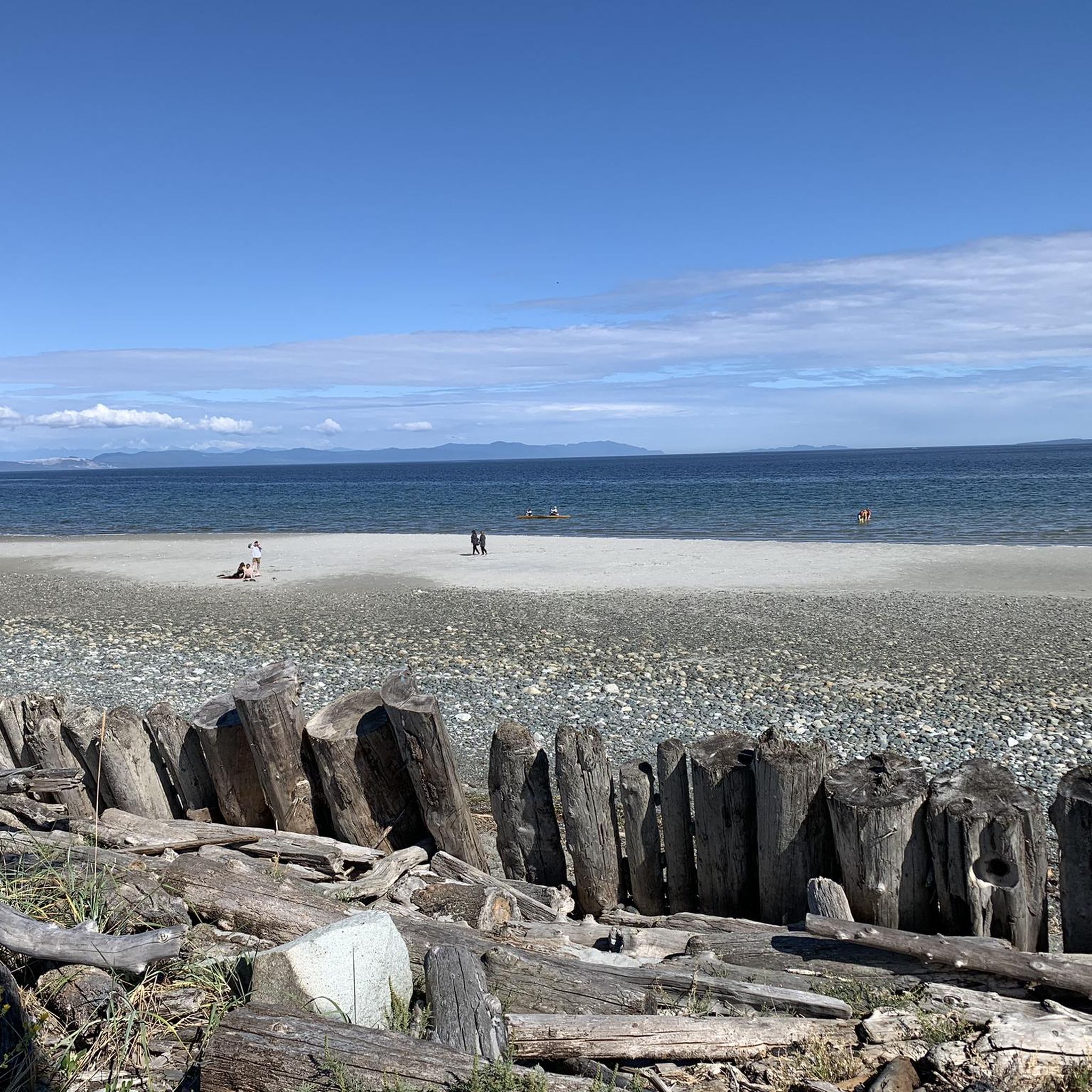
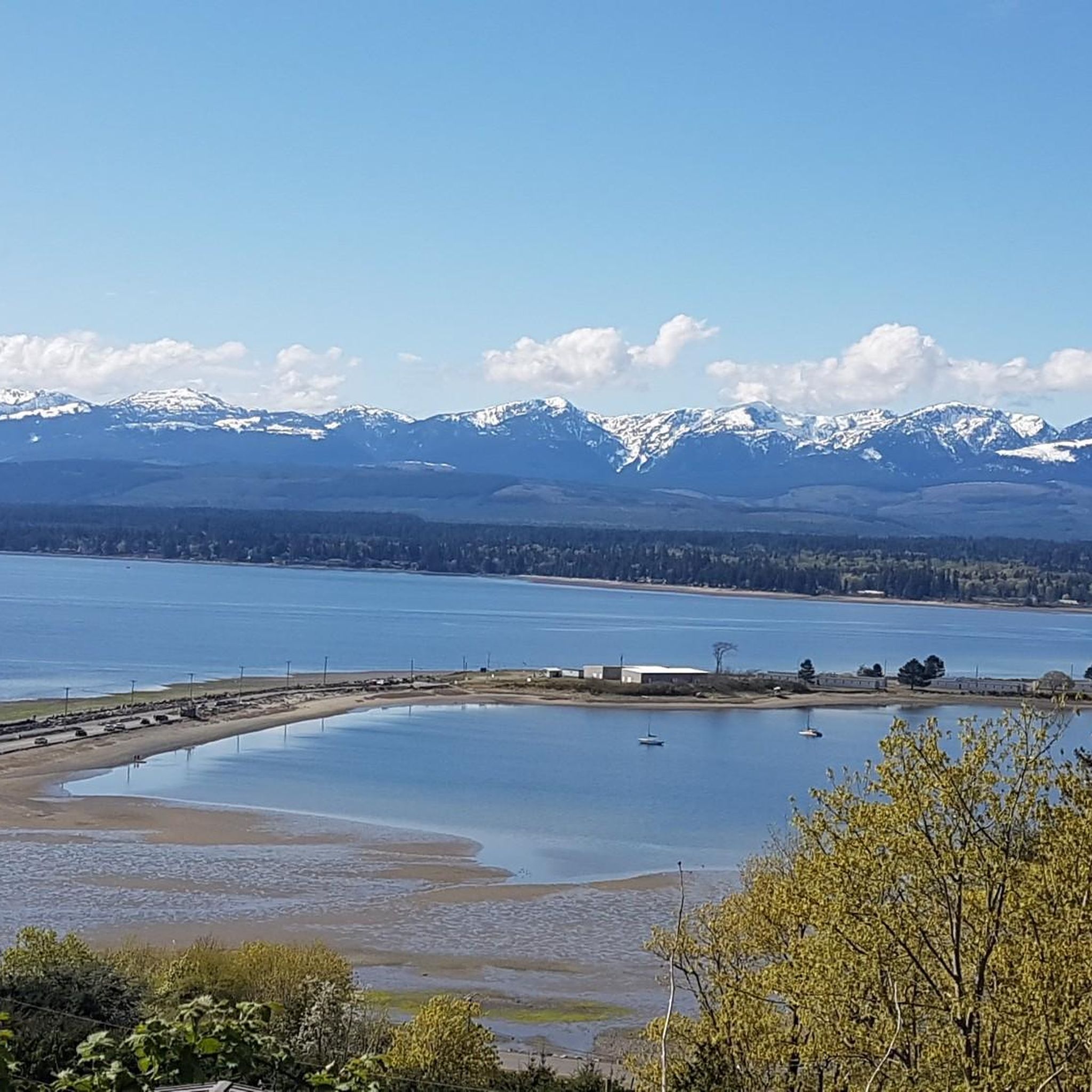
- Jogging in K'Ómoks Royston Lands is defined by coastal paths, extensive forests, and views of the Beaufort Mountains. The network offers options for different ability levels, from accessible paths to more challenging runs.
- The routes in K'Ómoks Royston Lands are highly rated by the komoot community with an average score of 5.0 stars from over 1 review. More than 200 runners have used komoot to explore K'Ómoks Royston Lands's varied terrain.
Last updated: July 8, 2026
6
runners
9.49km
01:05
120m
120m
Moderate run. Good fitness required. Mostly paved surfaces. Suitable for all skill levels.
3
runners
6.91km
00:45
90m
90m
Moderate run. Good fitness required. Mostly paved surfaces. Suitable for all skill levels.

Sign up for free
7
runners
6.39km
00:40
70m
60m
Moderate run. Good fitness required. Mostly paved surfaces. Suitable for all skill levels.
12
runners
13.7km
01:28
110m
110m
Moderate run. Good fitness required. Mostly paved surfaces. Suitable for all skill levels.
32
runners
24.1km
02:57
410m
410m
Hard run. Very good fitness required. Mostly accessible paths. Some sure footedness required.
Get access to more routes and recommendations from other explorers.
Sign up for free
Already have an account?
Our route recommendations are based on thousands of hikes, rides, and runs completed by other people on komoot.
Start today with a free account
Your next adventure awaits.
Login or Signup

Tips from the Community

Cumberland Community Forest stretches more than 500 acres, and is mostly second-growth coastal forest with a web of well-maintained trails. These trails are open to hiking, mountain biking, trail running.
0
0
Frequently Asked Questions
How many running routes are available in the K'ómoks Royston Lands?
The K'ómoks Royston Lands offer a wide selection of running routes, with over 25 trails available for exploration. These routes cater to various fitness levels, ranging from easy paths to more challenging runs with significant elevation changes.
What kind of terrain can I expect on the running trails in K'ómoks Royston Lands?
Joggers in the K'ómoks Royston Lands can experience a diverse mix of landscapes. You'll find coastal paths offering stunning views, trails through extensive regenerated second-growth forests, and some routes with significant elevation changes. Many paths are mostly paved or accessible, while others offer more natural, varied surfaces.
Are there running routes with scenic coastal views in the K'ómoks Royston Lands?
Yes, the region is renowned for its stunning coastal views, particularly across Comox Harbour and along sections like the Royston Seaside Trail. The Comox Promenade also offers views of the Beaufort Mountain Range and the Comox Glacier, providing a beautiful backdrop for your run.
Can I find trails suitable for beginners or those looking for an easier run?
Absolutely. While some routes feature significant elevation changes, there are also flatter, more accessible paths suitable for beginners or those seeking a less strenuous run. The region offers a good mix to accommodate different fitness levels.
Are there any loop running routes in the K'ómoks Royston Lands?
Yes, several popular running routes are designed as loops. For example, you can explore the Running loop from South Island Highway at Gartley Road (NB), the Willemar Bluff loop from Comox, or the Running loop from Comox. These offer varied distances and scenery.
What natural features or landmarks can I see while running in the K'ómoks Royston Lands?
The K'ómoks Royston Lands are rich in natural beauty. You can expect to see extensive regenerated second-growth forests, coastal areas with views of Comox Harbour, and the dramatic backdrop of the Beaufort Mountains and Comox Glacier. The Royston Seaside Trail passes by historic wrecks at an old breakwater, and Seal Bay Nature Park offers opportunities for bird and seal viewing along its waterfront trails.
Are the running trails in K'ómoks Royston Lands suitable for families or dog walking?
Many trails in the K'ómoks Royston Lands are multi-use and suitable for various activities, including dog walking. Seal Bay Nature Park, for instance, is well-regarded for dog walking and offers forest trails and waterfront areas. It's always a good idea to check specific trail regulations for leash requirements.
What makes the K'ómoks Royston Lands a unique place for jogging compared to other areas?
The K'ómoks Royston Lands stand out due to their unique blend of coastal and extensive forest environments, offering diverse terrains from flat, accessible paths to routes with significant elevation changes. The stunning views across Comox Harbour, the presence of regenerated second-growth forests, and the backdrop of the Beaufort Mountains create a particularly scenic and varied running experience.
What do other runners enjoy most about jogging in K'ómoks Royston Lands?
The area is highly rated by the komoot community, with an average score of 5.0 stars. Runners often praise the varied terrain, from coastal paths with beautiful views to tranquil forest trails, and the options available for different ability levels.
Are there any longer running routes for endurance training?
Yes, for those looking for longer distances, the Running loop from Lazo Marsh-North East Comox Wildlife Management Area offers a substantial 13.7 km (8.5 miles) route with moderate elevation changes, providing a good option for endurance training.
Is there a running route that offers a mix of forest and coastal scenery?
The K'ómoks Royston Lands are characterized by this very blend. Routes like those found within Seal Bay Nature Park offer forest trails that lead to waterfront areas, allowing you to experience both dense woodlands and coastal views, often with opportunities for wildlife spotting.
Most popular routes in K'Ómoks Royston Lands

Get inspired with the komoot mobile app


Explore more
Browse the best Running Trails & Routes in other regions.
