The best walks and hikes around Thirlby
4.5
(894)
6,466
hikers
256
hikes
Hiking around Thirlby is situated on the edge of the North York Moors National Park. The region's terrain is characterized by rolling hills, ancient woodlands like Garbutt Wood, and the prominent escarpment of Sutton Bank. Many circular walks from Thirlby feature natural landmarks such as Gormire Lake, one of the few natural lakes in Yorkshire. The area offers a network of trails suitable for various fitness levels.
Best hiking trails around Thirlby
- The most popular hiking route is Hood Hill & Gormire Lake loop from Sutton Bank, a 7.2 miles (11.5 km) trail that takes 3 hours 20 minutes to complete. This moderate hike offers views from the Sutton Bank escarpment and circles Hood Hill.
- Another top favourite among local hikers is View from Sutton Bank – Gormire Lake loop from Hambleton Mosses, a moderate 7.3 miles (11.8 km) path. This route provides access to viewpoints over Gormire Lake and traverses varied terrain.
- Local hikers also love the Cleveland Way and Sutton Bank Loop, a 11.6 miles (18.7 km) trail leading through moorland scenery and along the escarpment, often completed in about 5 hours 9 minutes.
- Hiking around Thirlby is defined by moorland scenery, wooded nature reserves, and paths along escarpments. The network of trails provides options for different ability levels, from short, accessible walks to more difficult long-distance hikes.
- The routes in Thirlby are highly rated by the komoot community with an average score of 4.5 stars from over 700 reviews. More than 6,000 hikers have used komoot to explore Thirlby's varied terrain.
Last updated: September 28, 2026
4.7
(47)
286
hikers
11.5km
03:20
270m
270m
Moderate hike. Good fitness required. Mostly accessible paths. Sure-footedness required.
4.7
(15)
55
hikers
18.7km
05:08
290m
290m
Hard hike. Very good fitness required. Mostly accessible paths. Sure-footedness required.

4.5
(19)
144
hikers
11.8km
03:22
240m
240m
Moderate hike. Good fitness required. Easily-accessible paths. Suitable for all skill levels.
4.9
(16)
122
hikers
23.8km
06:32
390m
390m
Hard hike. Very good fitness required. Easily-accessible paths. Suitable for all skill levels.
5.0
(4)
70
hikers
Moderate hike. Good fitness required. Easily-accessible paths. Suitable for all skill levels.
Get access to more routes and recommendations from other explorers.
Already have an account?
Our route recommendations are based on thousands of hikes, rides, and runs completed by other people on komoot.
Start today with a free account
Your next adventure awaits.

Tips from the Community

Actually a varied hike with great views. Demanding because of the steep ascent to White Horse. Definitely avoid the last turn to the right (you have to climb over a barrier) and instead continue straight ahead. Not only does a guard dog follow you barking loudly along the entire "path". The path is mostly completely overgrown with thistles and giant nettles and you have to climb over two fences.
0
0

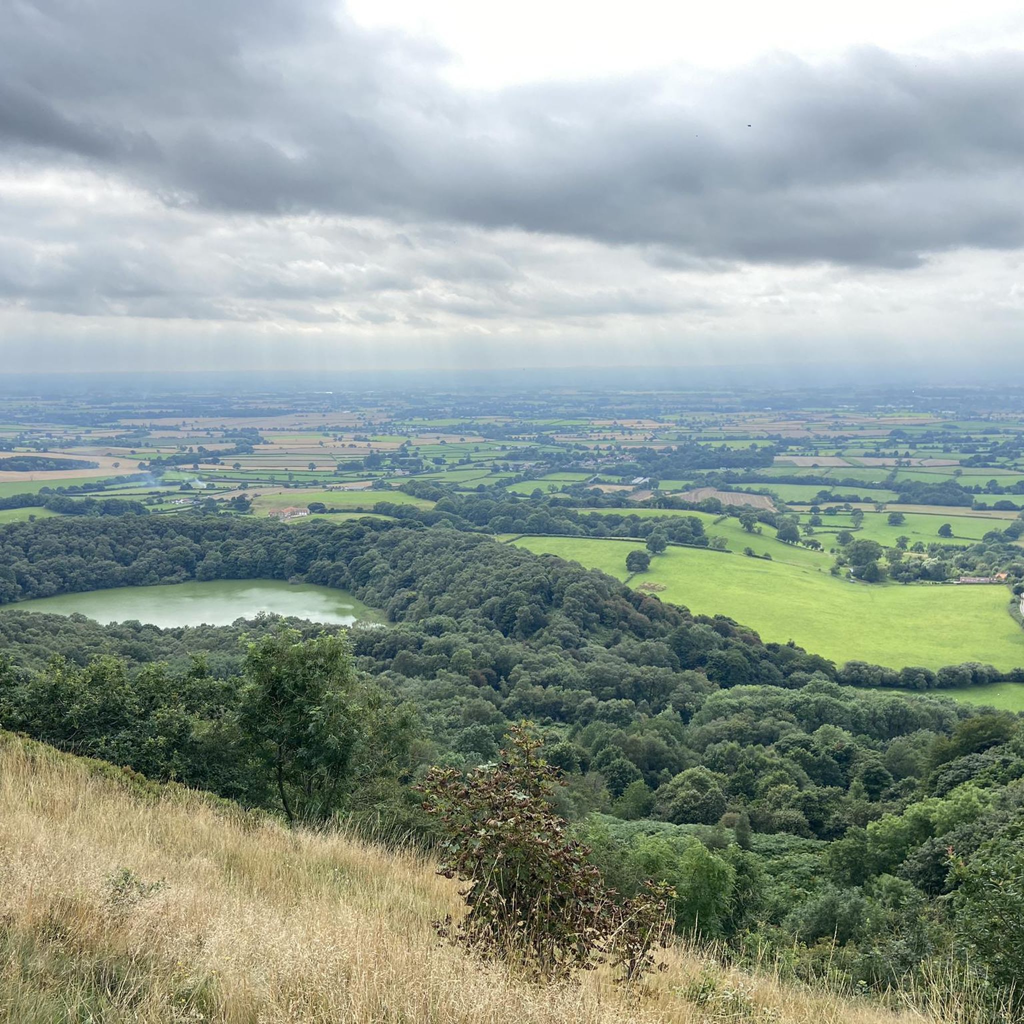
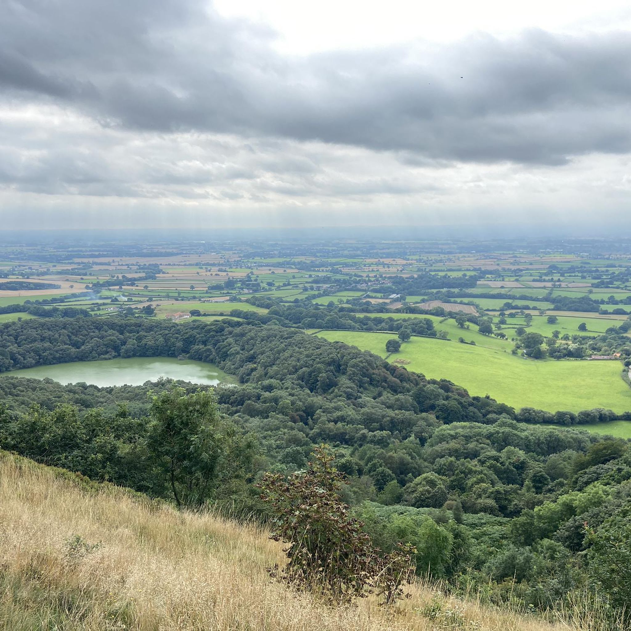
Gormire Lake is a natural lowland lake that lies at the foot of Whitestone Cliff, a western escarpment of the Hambleton Hills
0
0

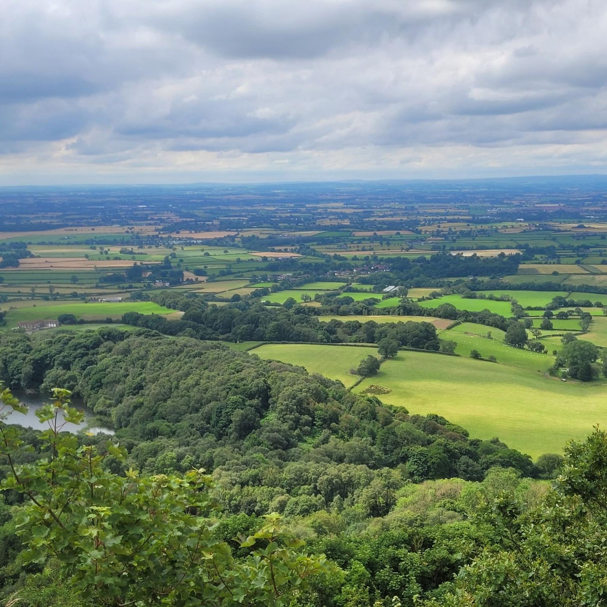
Finest View in England
1
0

Expensive parking but some nice routes
0
0
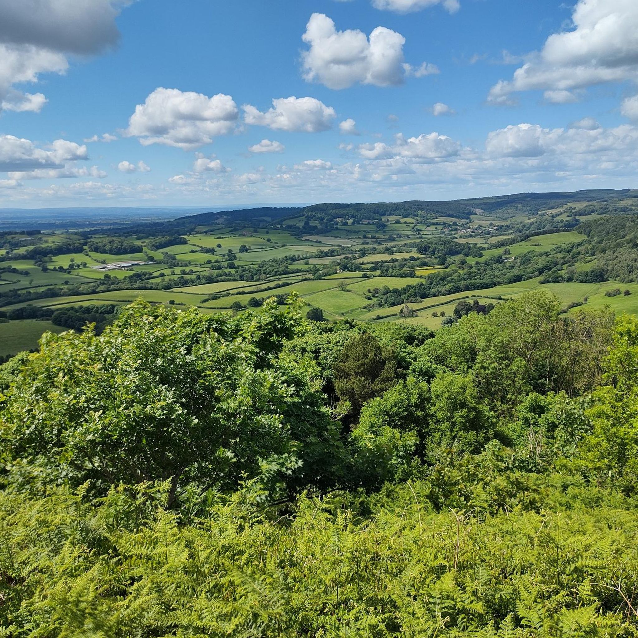
Trails along the escarpment taking in the best views over the North York Moors.
0
0

A superb stretch of the Cleveland Way. Sneck Yate car park (free) is very close by, and then the option to walk south to Sutton Bank or north onto the Moors.
0
0
Meaning "filthy swamp", there are many local legends and myths surrounding this lake, such as it is bottomless (it is 6.5m deep) and was created by an earthquake that swallowed a village resulting in the lake today (it is a glacial lake).
0
0
Well worth taking the path down from the Cleveland Way to Gormire Lake, where you can enjoy the peace of the ancient woodland that is Garbutt Wood Nature Reserve.
1
0
Frequently Asked Questions
Are there many circular walks starting from Thirlby?
Yes, the area around Thirlby is excellent for circular hikes. Many routes are designed to start and end near the village, taking in key landmarks. For example, you can find loops that incorporate the stunning views from Sutton Bank and the serene Gormire Lake, allowing you to return to your starting point without retracing your steps.
What are the trail conditions like around Thirlby?
Trails vary from well-maintained paths along the Cleveland Way to more rugged, natural tracks through woodlands and across moorland. Paths can be steep and uneven in places, particularly on the ascent to the Sutton Bank escarpment. After rain, some woodland sections, like those in Garbutt Wood, can become muddy, so appropriate waterproof footwear is recommended.
Are the hiking trails near Thirlby suitable for dogs?
Many trails in the Thirlby area are dog-friendly, offering great open spaces for them to explore. However, you will be walking through farmland with livestock and sensitive wildlife areas like nature reserves. Always keep your dog on a lead where indicated by signs and maintain control, especially during bird nesting season on the moors (typically spring and early summer).
Can I find any easy, family-friendly walks in the area?
Certainly. While the region has challenging climbs, there are also gentler options perfect for families. The View from Sutton Bank – Gormire Lake loop from Thirlby is a shorter, accessible route that still offers rewarding scenery without being too strenuous for younger walkers.
Where is the best place to park for walks around Thirlby?
For many popular routes, the Sutton Bank National Park Centre has a large pay-and-display car park which serves as a starting point for trails heading towards Gormire Lake and along the escarpment. For walks starting directly from Thirlby, there is limited on-street parking, so please park considerately and respect local residents.
What kind of scenery can I expect on hikes near Thirlby?
The landscape is defined by its variety. Expect dramatic cliffs and panoramic views from the Sutton Bank escarpment, tranquil scenes around Gormire Lake, and ancient woodlands like the Garbutt Wood Nature Reserve. You'll also find classic rolling hills and expansive heather moorland characteristic of the North York Moors National Park.
Are there any long-distance trails that pass near Thirlby?
Yes, the renowned Cleveland Way National Trail runs along the nearby Sutton Bank escarpment. You can join this well-marked path for a challenging long-distance hike or simply walk a shorter section of it as part of a circular route from the Thirlby area, enjoying some of the best views in the region.
What do other hikers think of the trails around Thirlby?
The trails are highly regarded by the komoot community, with an average rating of 4.5 stars. Hikers often praise the breathtaking panoramic views from the escarpment and the variety of the landscape, from peaceful lakeside paths to shaded woodland walks.
Are there any challenging hikes for experienced walkers?
Yes, the area offers several demanding routes for those with good fitness. The High Paradise Farm and Garbutt Wood Nature Reserve loop is a longer trek of over 11 miles that takes you through varied and sometimes challenging terrain.
How many hiking routes are available around Thirlby?
There is a wide selection of trails to explore, with over 270 routes mapped on komoot in the region. These range from easy strolls of just a few miles to difficult all-day treks, ensuring there's a walk to suit every ability level.
What are the best viewpoints in the Thirlby area?
The most famous viewpoint is from the top of the Sutton Bank escarpment, which offers sweeping panoramic views over the Vale of York and Gormire Lake below. The path along the cliff edge provides numerous opportunities to stop and take in the scenery. For a different perspective, the trail around Hood Hill also provides excellent views of the surrounding countryside.
Are there any woodland walks near Thirlby?
Yes, the area is home to beautiful ancient woodlands. A popular choice is a walk through the Garbutt Wood Nature Reserve, which lies on the path to Gormire Lake. These woods offer a peaceful atmosphere, shaded trails, and are especially beautiful in spring and autumn.
Most popular attractions around Thirlby

Get inspired with the komoot mobile app


Explore more
Browse the best Hikes in other regions.
