The best walks and hikes around Thirn
4.4
(533)
3,169
hikers
129
hikes
Hiking around Thirn offers a variety of trails through diverse landscapes. The region features a mix of river valleys, such as the River Ure, and extensive woodlands like Hackfall Wood. Trails often pass by historical sites, including Jervaulx Abbey, and incorporate scenic country roads. The terrain generally includes moderate elevation changes, providing accessible routes for various fitness levels.
Best hiking trails around Thirn
- The most popular hiking route is St John's Church and Stark Bank Road loop from Jervaulx Abbey…
Last updated: June 24, 2026
4.4
(11)
31
hikers
Embark on a moderate hike through diverse landscapes on the St John's Church and Stark Bank Road loop. This 7.9-mile (12.7 km) route, which takes about 3 hours and 28…
4.3
(3)
17
hikers
18.3km
04:59
260m
260m
Embark on the Hackfall Wood and Himalayan Garden and Sculpture Park loop from Masham, a moderate hiking route that spans 11.4 miles (18.3 km) with an elevation gain of 869…

Sign up for free
4.5
(47)
166
hikers
12.2km
03:20
170m
170m
Moderate hike. Good fitness required. Easily-accessible paths. Suitable for all skill levels.
4.8
(28)
180
hikers
13.7km
03:33
90m
80m
Moderate hike. Good fitness required. Easily-accessible paths. Suitable for all skill levels.
4.7
(26)
165
hikers
11.7km
03:02
70m
70m
Moderate hike. Good fitness required. Easily-accessible paths. Suitable for all skill levels.
Get access to more routes and recommendations from other explorers.
Sign up for free
Already have an account?
Our route recommendations are based on thousands of hikes, rides, and runs completed by other people on komoot.
Start today with a free account
Your next adventure awaits.
Login or Signup
Tips from the Community


Grade II listed bridge that crosses the River Burn
1
0


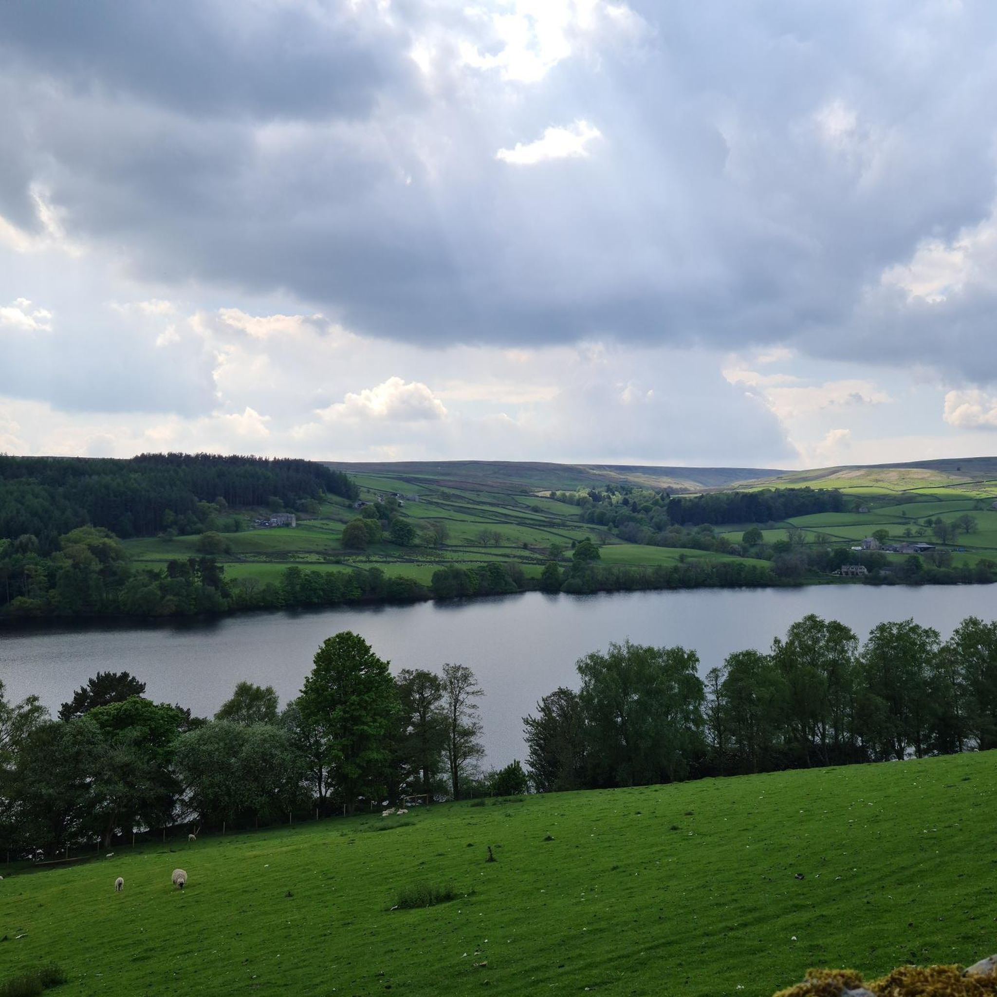
Tremendous views unfold from this elevated vantage point where the River Ure winds its way through a lush green valley. From here you can enjoy sweeping panoramas of rolling hills and vibrant meadows with the river carving a graceful path through the picturesque landscape.
3
0

The River Ure in Yorkshire is about 74 miles (119 km) long from its source to where it joins the River Ouse. It starts near Ure Head on Abbotside Common and joins the Ouse at Cuddy Shaw Reach near Linton-on-Use. Along its meandering journey are numerous well-known beauty spots, including Aysgarth Falls, and it is bordered by plenty of beautiful walking paths, including the Rippon Rowel Walk.
1
1

Masham is a small market town that is built around a large square. It has held a market charter since 1250 and thrived due to the easy access of the flocks of sheep from nearby Fountains and Jervaulx Abbeys. There is still a sheep fair every September where huge numbers of sheep are bought and sold.
0
0
Masham Market Place is one of the largest in England. It has elegant Georgian houses that stand around its periphery and an ancient cross with cobbled area at its centre.
0
0

Stark Bank Road, between Jervaulx and Ellingstring, rises steeply to the south; when at the top end, look to the north for superb views of Wensleydale. Apparently, this might have been an ancient route from the coal mines at Colsterdale to Jervaulx Abbey.
0
0
Frequently Asked Questions
How many hiking trails are available around Thirn?
Thirn offers a wide selection of hiking routes, with over 130 trails to explore. These range from easy strolls to more challenging moderate paths, ensuring options for various fitness levels.
What is the general difficulty level of hikes in Thirn?
The hiking trails around Thirn cater to a broad range of abilities. You'll find approximately 44 easy routes, 75 moderate routes, and 12 more difficult trails, providing options for casual walkers and experienced hikers alike.
Are there any circular hiking routes in Thirn?
Yes, many of the trails around Thirn are designed as loops, allowing you to start and finish in the same location. For example, the St John's Church and Stark Bank Road loop from Jervaulx Abbey is a popular circular option.
What kind of landscapes can I expect to see on a hike around Thirn?
Hiking around Thirn offers diverse landscapes, including picturesque river valleys like the River Ure, extensive woodlands such as Hackfall Wood, and scenic country roads. Many routes also pass by historical sites, adding cultural interest to your walk.
Are there easy hiking trails suitable for families with children?
Yes, Thirn has around 44 easy hiking routes that are generally suitable for families or those looking for a less strenuous walk. These trails often feature gentle terrain and shorter distances, perfect for a leisurely outing.
Are dogs allowed on the hiking trails in Thirn?
Most public footpaths and trails in the Thirn area are dog-friendly, though it's always recommended to keep dogs on a lead, especially when passing through farmland with livestock or in nature reserves to protect wildlife. Always check local signage for specific restrictions.
Are there any hikes that pass by waterfalls?
Yes, you can find trails that lead to beautiful waterfalls in the area. For instance, some routes may take you near Hackfall Wood, which features cascades, or the notable Harmby Waterfall.
Can I find scenic viewpoints on hikes in Thirn?
Absolutely. The varied terrain around Thirn offers several spots with rewarding views. You might encounter scenic overlooks such as the View of Leighton Reservoir, providing expansive vistas of the surrounding landscape.
What do other hikers say about the trails in Thirn?
The hiking routes in Thirn are highly regarded by the komoot community, with an average rating of 4.4 stars from over 490 reviews. Hikers often praise the region's diverse scenery, well-maintained paths, and the blend of natural beauty with historical interest.
Are there any historical sites or landmarks to see along the trails?
Yes, the Thirn area is rich in history. Many trails incorporate historical sites like Jervaulx Abbey. You might also encounter unique landmarks such as The Druid's Temple, adding an interesting dimension to your hike.
What is the best time of year to go hiking in Thirn?
Thirn offers enjoyable hiking throughout the year. Spring brings blooming wildflowers, summer provides longer daylight hours, and autumn showcases vibrant foliage. Winter can be beautiful, but trails may be muddy or icy, so appropriate gear is essential.
Are there any trails that include a visit to a garden or sculpture park?
Yes, some routes offer unique attractions beyond natural landscapes. The Hackfall Wood and Himalayan Garden and Sculpture Park loop from Masham is a great example, combining woodland walking with a visit to a distinctive garden and art installation.
Most popular routes around Thirn
Most popular attractions around Thirn

Get inspired with the komoot mobile app


Explore more
Browse the best Hikes in other regions.
