The best cycling routes around Thirlwall
4.1
(57)
680
riders
56
rides
Touring cycling around Thirlwall offers routes through a landscape defined by the historic Hadrian's Wall and the Northumberland National Park. The area features open views, historic scenery, and the gentle banks of the Tipalt Burn. Cyclists can explore hill-top positions and dramatic whinstone outcrops like Walltown Crags, which provide extensive vistas. The terrain includes sections along ancient Roman frontiers and diverse natural environments.
Best touring cycling routes around Thirlwall
- The most popular touring cycling route is Lanercost Priory – Hadrian's…
Last updated: June 26, 2026
4.5
(2)
21
riders
47.3km
03:01
510m
520m
Hard bike ride. Very good fitness required. Mostly paved surfaces. Suitable for all skill levels.
17
riders
54.4km
03:59
630m
630m
Hard bike ride. Very good fitness required. Mostly paved surfaces. Suitable for all skill levels.

Sign up for free
4.0
(2)
13
riders
40.7km
02:32
370m
370m
Moderate bike ride. Good fitness required. Mostly paved surfaces. Suitable for all skill levels.
7
riders
26.1km
01:38
260m
260m
Moderate bike ride. Good fitness required. Mostly paved surfaces. Suitable for all skill levels.
4
riders
8.02km
00:46
80m
80m
Easy bike ride. Great for any fitness level. Mostly paved surfaces. Suitable for all skill levels.
Get access to more routes and recommendations from other explorers.
Sign up for free
Already have an account?
Our route recommendations are based on thousands of hikes, rides, and runs completed by other people on komoot.
Start today with a free account
Your next adventure awaits.
Login or Signup


Tips from the Community

Everyday communications along Hadrian’s Wall would have been conveyed in a number of ways. Normally, detailed messages would have been by horseback. However, with the commanding views offered by Pike Signal Tower, it could also communicate with adjoining turrets either by smoke or by lit beacons using simple, predetermined codes. There is evidence that they also used a system of beams to transmit messages using a semaphore messaging system. It is a shame that very little is known of how the latter worked.
1
0
Well, we got here nearly at the end of our Hadrian's Wall hike for the day and had a bit of bad luck. Fancy turning up at one of the best Roman forts on Hadrian's Wall to be told it was closed because the wind was too strong and it might blow us off the wall. A place to come back to.
0
0

Cawfields Crag is a steep rock face that forms a natural bastion in the landscape and was a strategic point for the Romans. Near Milecastle 42, the northern gate of the fort literally opens onto the vertical face of Cawfields Crag – a testament to the rigid Roman building principles. From the summit, there are panoramic views of Hole Gap and the surrounding hills.
8
0
Cawfields Crag is a steep rock face that forms a natural bastion in the landscape and was a strategic point for the Romans. Near Milecastle 42, the northern gate of the fort literally opens onto the vertical face of Cawfields Crag – a testament to the rigid Roman building principles. From the summit, there are panoramic views of Hole Gap and the surrounding hills.
2
0
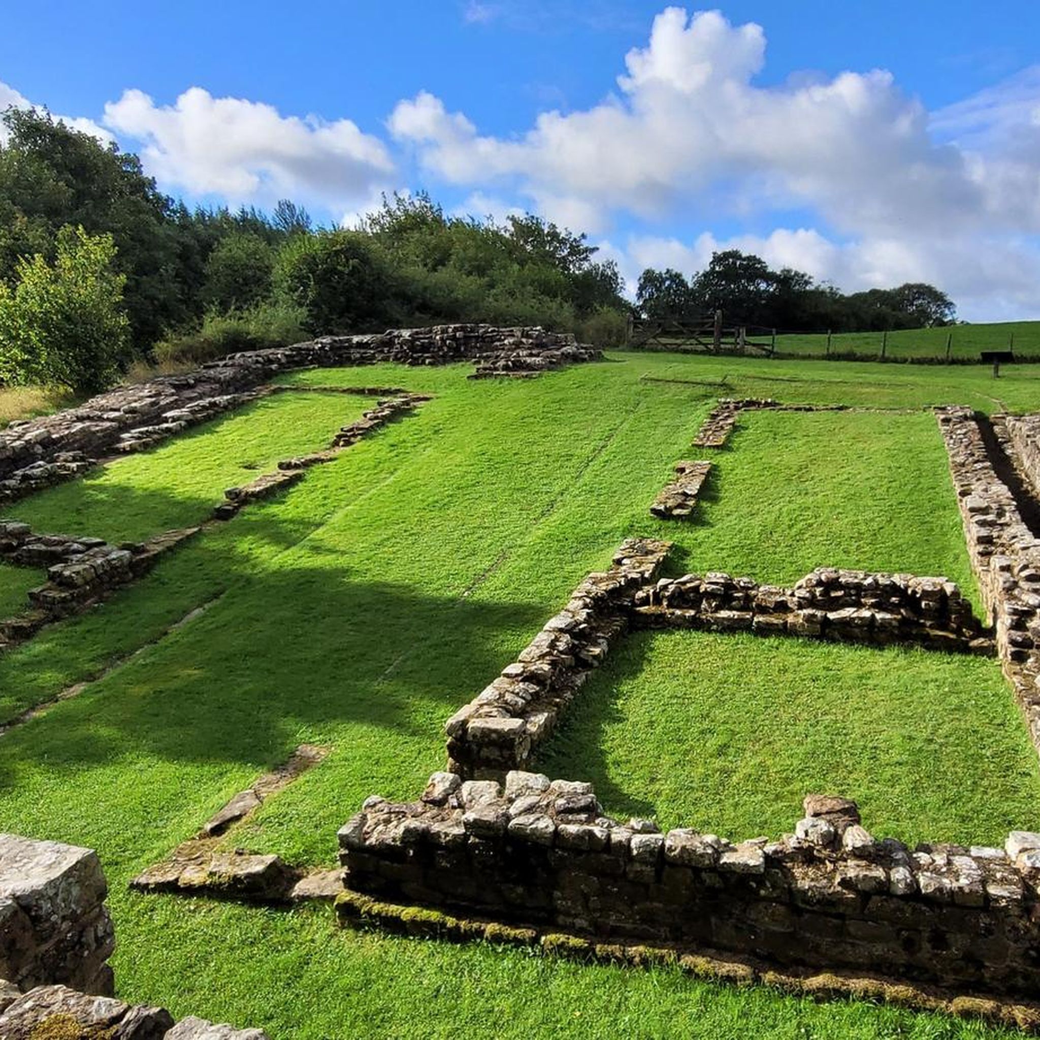
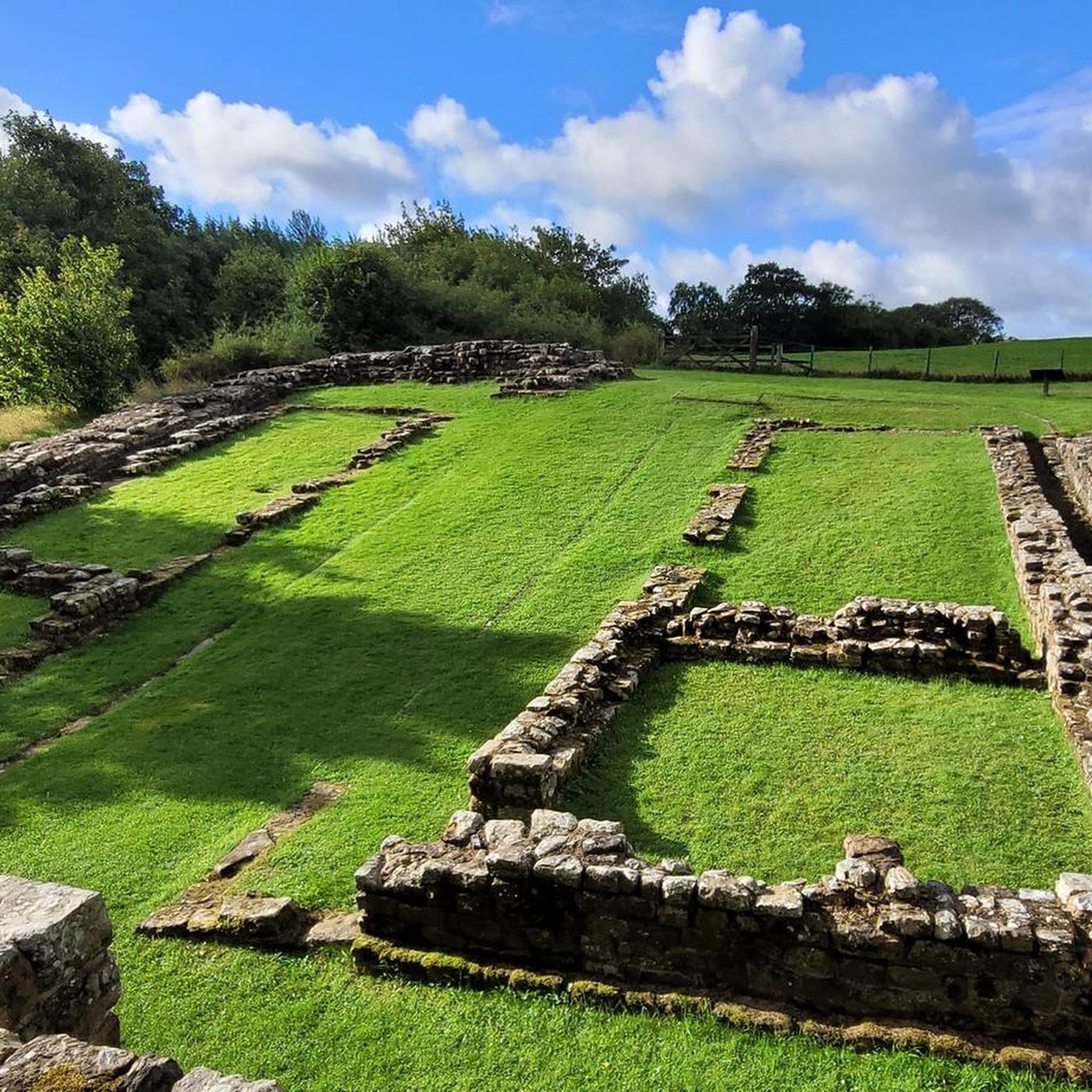
Along Lanercost Road near Banks in Cumbria, you'll find the well-preserved remains of Leahill Turret (51B), a Roman watchtower built around 122 AD as part of Hadrian's Wall. The tower was fully excavated and consolidated in 1958 and is still visible today to a height of approximately one meter. Leahill Turret served as a staging post between Milecastles 51 and 52, providing Roman soldiers with a strategic vantage point over the northern border region. Inside, traces of a raised platform against the north wall and a later shelter structure against the south wall are visible, suggesting reuse in the 4th century.
11
0
A short climb away lies the remains of the Pike Hill Signal Tower, a 2nd-century Roman watchtower strategically located along Stanegate—the military road that preceded the construction of Hadrian's Wall. The tower was part of a network of signaling posts that allowed Roman troops to quickly communicate between forts and watchtowers. From this vantage point, you have a commanding view of the surrounding landscape. The tower's position, diagonally positioned relative to the Wall, demonstrates the ingenious design of Roman engineers, focused on maximum visibility and military coordination. During the construction of Hadrian's Wall, the tower was integrated between two turrets: 51B and 52A, near the fort of Banna (Birdoswald).
11
0
Banks East Turret, also known as Turret 52A, is one of the best-preserved watchtowers along the western section of Hadrian's Wall. Built around 122 AD on the orders of Emperor Hadrian, this tower was part of an ingenious network: two turrets stood between each milecastle, manned by a handful of soldiers who guarded the boundary. The tower is built of stone, even though the wall here was originally turf—a rare example of early Roman engineering. You'll find an impressive section of wall reaching 1.75 meters high at the tower itself. The site offers panoramic views of the southern landscape, while the northern terrain is higher—a strategic yet surprising choice.
11
0
Indeed, a lovely place to relax. Very hospitable and helpful staff. I can only recommend this place.
9
0
Frequently Asked Questions
How many touring cycling routes are available around Thirlwall?
There are over 50 touring cycling routes around Thirlwall, offering a wide range of options for exploring the historic Hadrian's Wall area and the Northumberland National Park.
What kind of terrain can I expect on touring cycling routes near Thirlwall?
The terrain around Thirlwall is diverse, featuring open views, historic scenery along Hadrian's Wall, and the gentle banks of the Tipalt Burn. You'll encounter hill-top positions and dramatic whinstone outcrops like Walltown Crags, which provide extensive vistas. Routes often follow ancient Roman frontiers and vary from riverside sections to more remote landscapes within the Northumberland National Park.
Are there touring cycling routes suitable for beginners in Thirlwall?
Yes, Thirlwall offers several routes suitable for beginners. Out of the 58 available touring cycling routes, 6 are rated as easy, providing a gentle introduction to cycling in the area. Many moderate routes are also available for those looking for a slightly greater challenge.
What historical landmarks can I explore while cycling around Thirlwall?
Thirlwall is rich in history, particularly Roman. You can cycle past significant sites such as Thirlwall Castle Ruins, a 12th-century castle built partly from Hadrian's Wall stones. Other notable Roman sites include the Roman Vindolanda Fort and Museum and Housesteads Roman Fort. Routes like the Lanercost Priory – Hadrian's Wall loop from Gilsland connect many of these heritage sites.
Are there any circular touring cycling routes in the Thirlwall area?
Yes, many touring cycling routes around Thirlwall are designed as loops. For example, the Hadrian's Wall – Lanercost Priory loop from Thirlwall offers a moderate 25.7-mile ride through historic Roman sites and countryside, starting directly from Thirlwall.
What natural features or viewpoints can I expect to see on a touring cycle ride?
Cyclists can enjoy stunning natural features and viewpoints. Walltown Crags offers excellent views in all directions, and you might encounter the dramatic Sycamore Gap (Robin Hood Tree), Steel Rigg and Hadrian's Wall, or the serene Crag Lough. The Hadrian's Wall – Birdoswald Roman Fort loop from Gilsland, for instance, provides expansive views across the historic landscape.
What do other touring cyclists enjoy most about cycling in Thirlwall?
The area is highly rated by the komoot community, with an average score of 3.9 stars from over 40 reviews. Cyclists often praise the unique blend of historical exploration along Hadrian's Wall with the natural beauty of the Northumberland National Park, as well as the variety of routes available for different skill levels.
Is there parking available for cyclists near the routes in Thirlwall?
Yes, parking is available in several key locations. Thirlwall Castle has its own small car park, and Walltown Country Park also offers visitor facilities and serves as a starting point for routes, providing parking options for cyclists.
Are there any cafes or pubs along the touring cycling routes in Thirlwall?
While specific cafes and pubs directly on every route are not listed, the nearby village of Haltwhistle offers amenities, and areas like Walltown Country Park have visitor facilities. Many routes, such as the Hadrian's Wall – Lanercost Priory loop from Magnis Roman fort, pass through or near small settlements where you can find refreshments.
What is the best time of year for touring cycling in Thirlwall?
The spring and summer months generally offer the most favorable weather for touring cycling in Thirlwall, with longer daylight hours and milder temperatures. However, the historic landscapes are beautiful year-round, and autumn can provide stunning scenery with changing foliage.
Are there any particularly challenging touring cycling routes in Thirlwall?
Yes, for experienced touring cyclists, there are several challenging routes. Out of the 58 routes, 27 are rated as difficult. An example is the Gravel Road to Kielder loop from Robin Rock Drift, which covers over 60 km with significant elevation gain, offering a demanding ride through varied landscapes.
Most popular attractions around Thirlwall

Get inspired with the komoot mobile app


Explore more
Browse the best Cycling routes in other regions.
