The best cycling routes in Tlaltenango
4.8
(14)
182
riders
7
rides
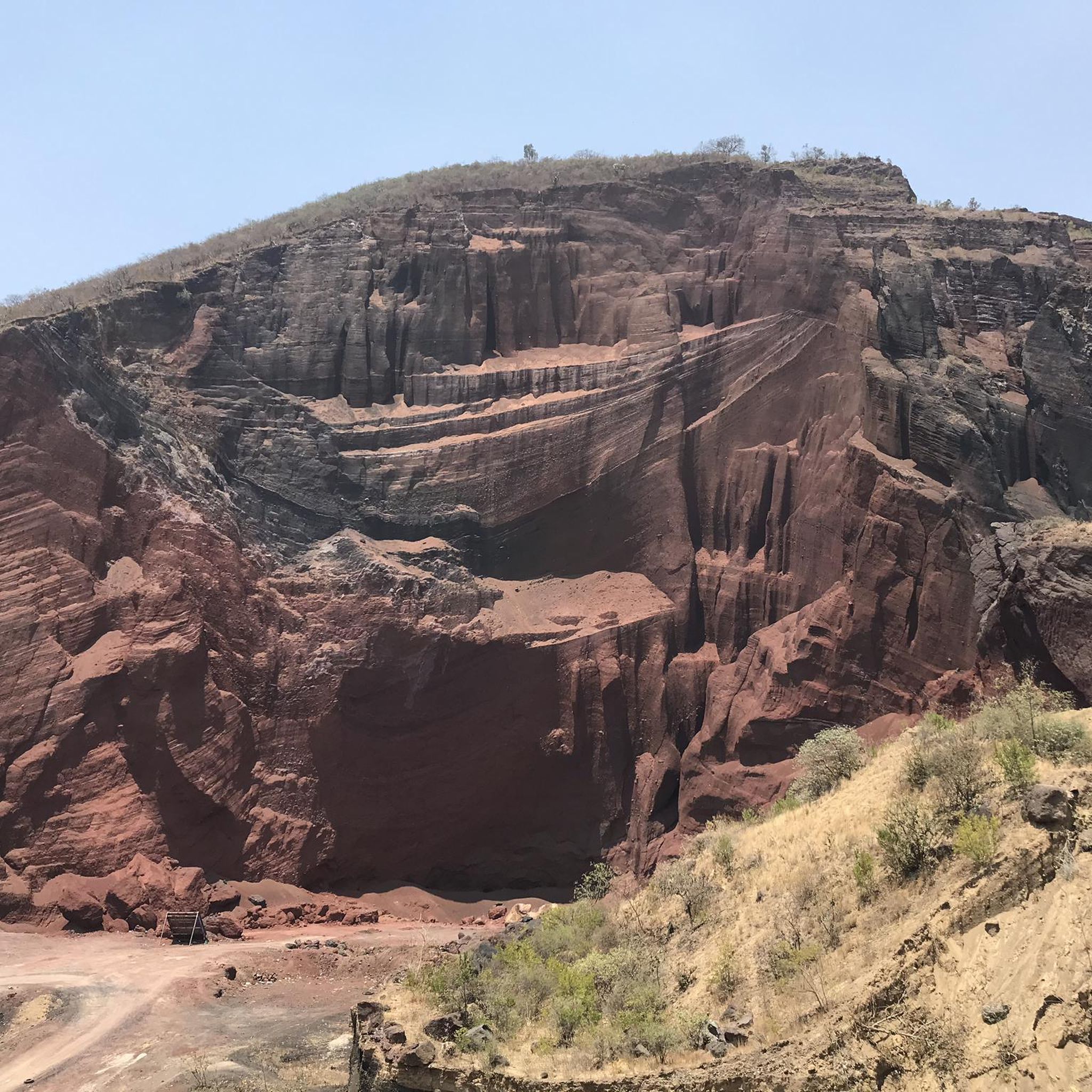
Touring cycling in Tlaltenango de Sánchez Román is characterized by its diverse terrain, situated within a valley bordered by the Sierra de Morones mountain range. The region features significant elevation changes, with an average elevation of 1,723 meters (5,653 ft), offering varied routes for cyclists. The Tlaltenango River flows through the municipality, providing opportunities for routes along its banks. This landscape combines rugged mountain slopes with gentler valley areas, suitable for different cycling preferences.
Best touring cycling routes in Tlaltenango
…Last updated: July 1, 2026
4.0
(3)
43
riders
52.4km
03:16
490m
490m
Hard bike ride. Very good fitness required. Mostly paved surfaces. Suitable for all skill levels.
5.0
(6)
37
riders
25.4km
01:37
200m
200m
Moderate bike ride. Good fitness required. Mostly paved surfaces. Suitable for all skill levels.

Sign up for free
19
riders
Hard bike ride. Very good fitness required. Mostly paved surfaces. Suitable for all skill levels.
2
riders
45.1km
02:46
380m
380m
Moderate bike ride. Good fitness required. Mostly paved surfaces. Suitable for all skill levels.
15
riders
9.87km
00:55
210m
210m
Hard bike ride. Good fitness required. You may need to push your bike for some segments of this route.
13
riders
10.00km
01:01
250m
250m
Moderate bike ride. Good fitness required. Mostly paved surfaces. Suitable for all skill levels.
3
riders
30.4km
01:51
160m
160m
Moderate bike ride. Good fitness required. Mostly paved surfaces. Suitable for all skill levels.
5.0
(2)
3
riders
48.7km
03:01
360m
360m
Moderate bike ride. Good fitness required. Mostly paved surfaces. Suitable for all skill levels.
3
riders
16.5km
01:04
130m
130m
Easy bike ride. Great for any fitness level. Mostly paved surfaces. Suitable for all skill levels.
4
riders
Moderate bike ride. Good fitness required. Mostly paved surfaces. Suitable for all skill levels.
Our route recommendations are based on thousands of hikes, rides, and runs completed by other people on komoot.
Start today with a free account
Your next adventure awaits.
Login or Signup



Tips from the Community

The road is somewhat sandy in sections during the dry season.
0
0
It is a good place to start the ride towards the Popobike route, as it has parking and clean bathrooms, and they also have a restaurant. Good food and reasonable prices.
0
0

This street is full of beautifully painted houses. The restaurant at the intersection is a very nice photo opportunity
1
0
Frequently Asked Questions
How many touring cycling routes are available in Tlaltenango?
There are 7 touring cycling routes available in Tlaltenango, offering a variety of experiences across the region's diverse terrain. These routes are highly rated by the komoot community, with an average score of 5.0 stars.
What kind of terrain can I expect on touring cycling routes in Tlaltenango?
Tlaltenango de Sánchez Román is situated in a valley bordered by the majestic Sierra de Morones, so you can expect a mix of mountainous landscapes and riverine features. Routes often feature significant elevation changes, with the municipality averaging 1,723 meters (5,653 ft) above sea level. You'll find challenging ascents and descents, as well as potentially gentler paths along the Tlaltenango River and through agricultural lands.
Are there routes suitable for beginners or families in Tlaltenango?
Yes, Tlaltenango offers routes suitable for various ability levels. While many routes feature challenging climbs, there are 2 easy touring cycling routes available. These might include paths along the Tlaltenango River, offering a more relaxed experience for families or those new to touring cycling.
Are there any circular touring cycling routes in Tlaltenango?
Many of the touring cycling routes in Tlaltenango are designed as loops, allowing you to start and end at the same point. For example, the View Near Puebla – Great Pyramid of Cholula loop from Cholula is a popular option, as is the Cerro Zapotecas loop from El Refugio.
What are some scenic viewpoints or landmarks I can see along the touring cycling routes?
While specific landmarks directly on the routes are not detailed, the region itself offers stunning natural beauty. You can expect panoramic views of the Sierra de Morones mountain range and picturesque scenes along the Tlaltenango River. The area is known for its diverse scenery, transitioning from mountain vistas to river valleys and agricultural areas. For broader exploration, the state of Zacatecas features natural parks like Sierra de Órganos, known for unique rock formations, which could be incorporated into longer tours.
What is the best time of year for touring cycling in Tlaltenango?
Given the region's mountainous terrain and elevation, the best time for touring cycling in Tlaltenango is generally during the dry seasons to avoid heavy rains and ensure more comfortable riding conditions. Spring and autumn typically offer pleasant temperatures. Always check local weather forecasts before heading out.
Are there any dog-friendly touring cycling routes in Tlaltenango?
While specific dog-friendly designations for touring cycling routes are not available, many natural trails and open areas in Tlaltenango's valley and mountain regions are suitable for cycling with a well-behaved dog, provided they are on a leash and you adhere to local regulations. Always ensure your dog is fit for the distance and terrain, and carry enough water for both of you.
Where can I find parking for bike trails in Tlaltenango?
Specific parking information for individual trailheads is not provided. However, as a general practice in Tlaltenango de Sánchez Román, you can often find parking in or near the town center, or at designated areas close to popular natural attractions. It's advisable to check local maps or inquire locally upon arrival for the most convenient parking spots near your chosen route's starting point.
Can I use public transport with my bike in Tlaltenango?
Information regarding public transport options that accommodate bicycles in Tlaltenango de Sánchez Román is limited. In many smaller Mexican towns, local buses or collective taxis might not be equipped for bikes. For longer distances, intercity buses sometimes allow bikes for an extra fee, often requiring them to be disassembled or packed. It's recommended to inquire directly with local transport providers for their specific policies.
Are there any permits required for touring cycling in Tlaltenango?
Generally, no specific permits are required for touring cycling on public roads or established trails in Tlaltenango. However, if you plan to cycle through private land or protected natural areas, it's always best to check for any specific access rules or permit requirements with local authorities or landowners. For general information about the municipality, you can refer to Wikipedia.
What do other touring cyclists enjoy most about touring cycling in Tlaltenango?
The touring cycling routes in Tlaltenango are highly rated by the komoot community, with an average score of 5.0 stars from over 10 reviews. Cyclists often praise the diverse terrain, which offers a mix of challenging mountain passes and scenic valley rides. The opportunity to experience the natural beauty of the Sierra de Morones and the Tlaltenango River is frequently highlighted.
Are there any cafes or places to eat near the touring cycling routes?
Tlaltenango de Sánchez Román is a vibrant Mexican town, and you can expect to find local cafes, restaurants, and markets within the town center. While specific establishments directly on the routes are not listed, many routes will likely pass through or near populated areas where you can refuel and experience local cuisine. It's a good idea to carry snacks and water, especially on longer or more remote sections.
How long do the touring cycling routes in Tlaltenango typically take to complete?
The duration of touring cycling routes in Tlaltenango varies significantly based on distance, elevation, and your cycling pace. For instance, the Zócalo de Puebla – San Juan loop from Cholula is about 15.8 miles (25.4 km) and typically takes around 1 hour 37 minutes, while the more challenging Barranca Xumetitla – Atotonilco loop from San Pedro Cholula, at 60.7 km, can take over 3 hours 50 minutes.
Most popular routes in Tlaltenango

Get inspired with the komoot mobile app


Explore more
Browse the best Cycling routes in other regions.
