The best running trails in Machupicchu
84
runners
3
runs
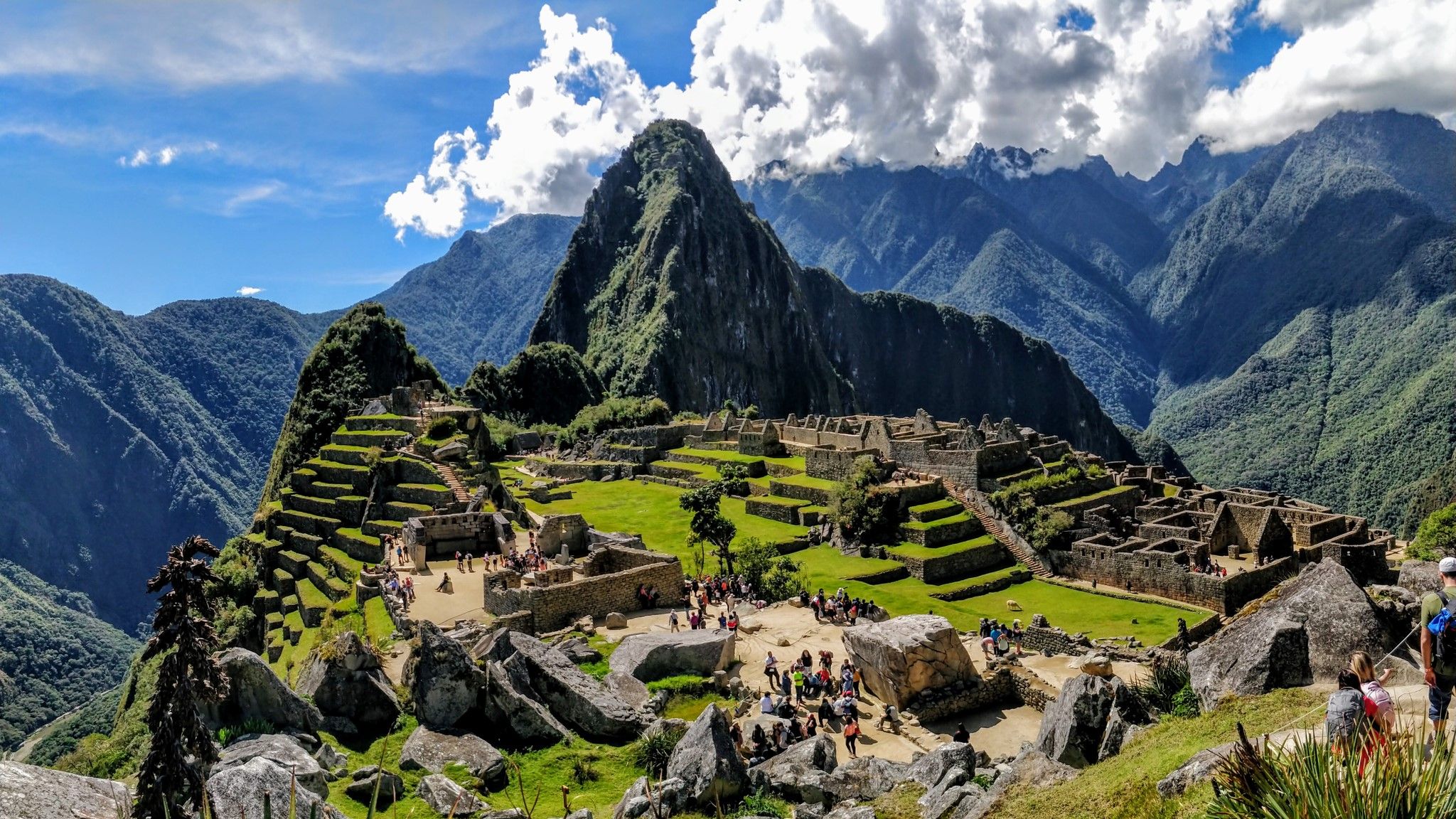
Jogging in Machupicchu presents a unique challenge due to its high altitude and rugged Andean terrain. The region is characterized by towering peaks, deep river canyons carved by the Urubamba River, and lush cloud forests. While the ancient Inca citadel offers a dramatic backdrop, the trails are often steep and uneven, making them more suitable for experienced trail runners. The elevation, which can exceed 7,900 feet (2,400 meters), requires acclimatization for any strenuous activity.
Best jogging routes in Machupicchu
- The…
Last updated: July 23, 2026
38
runners
11.7km
01:35
570m
570m
Hard run. Very good fitness required. Mostly paved surfaces. Suitable for all skill levels.
16
runners
4.15km
01:18
580m
580m
Hard run. Very good fitness required. Sure-footedness, sturdy shoes and alpine experience required.

Sign up for free
30
runners
13.9km
02:10
810m
810m
Hard run. Very good fitness required. Sure-footedness, sturdy shoes and alpine experience required.
Our route recommendations are based on thousands of hikes, rides, and runs completed by other people on komoot.
Start today with a free account
Your next adventure awaits.
Login or Signup
Popular around Machupicchu
Other adventures in Machupicchu

Tips from the Community

Those who are not fit should not undertake the ascent and descent in bad weather. It's a good 600 meters of elevation gain, mostly on steps. And slippery downhill, especially when wet.
0
0

It's the highest viewpoint. You can pass it from the trail, but otherwise the climb is worth it.
0
0

How times change. This used to be a place to take a break, everyone had their snack with them and took their lunch break or afternoon nap here. It was a place to relax. But in recent years the number of visitors has increased so much that more and more areas have been closed or regulated. I like to remember this wonderful time when we could still enjoy this amazing view without any time restrictions.
0
0

This spot offers the best view of Macchu Picchu. If you get here very early, you have the chance to enjoy the ruins without the many selfie photographers. Here you are in awe of the achievement of the Incas in building such a city in this place.
0
0
Aguas Calientes (as the name suggests) used to be known for its thermal baths, I remember when almost all of us would relax our muscles in the baths there after the Inca Trail. To get to the baths you have to walk up the hill in town, here you can rent towels or swimming trunks.
1
0

Huayna Picchu, also called Wayna Picchu, means "young peak" in Quechua. It is widely believed in the region that the mountain served as a watchtower to protect the sanctuary of Machu Picchu. The Machu Picchu site is located between two mountains - Huayna Picchu and Machu Picchu Mountain. Although both offer exciting hiking routes, there are certain differences between Huayna Picchu and Machu Picchu that you need to be aware of, including altitude, difficulty, and duration. From both mountains, you can enjoy beautiful views of the Machu Picchu ruins and the surrounding mountains. Huayna Picchu is the majestic, cone-shaped mountain that you often see in the background of the most famous photographs and postcards of Machu Picchu. The Huayna Picchu hike is generally considered moderate to difficult, so it can be challenging at times.
0
0
The climb was extremely steep...if you choose too high a pace and depending on your luggage and previous load (Inca Trail) you will quickly experience strong signs of fatigue...very painful thighs...take it easy and slowly
0
0
We were allowed to walk along here in the heavy rain, all completely wrapped up in colorful rain ponchos...the stones are extremely slippery, be careful
0
0
Frequently Asked Questions
What is the terrain like for running routes in Machupicchu?
Running in Machupicchu involves challenging terrain. The routes are often steep, rocky, and uneven, making them more suitable for experienced trail runners. The region is characterized by towering Andean peaks, deep river canyons, and lush cloud forests, offering a dramatic backdrop but requiring sure-footedness.
Are there any easy or beginner-friendly running routes in Machupicchu?
Due to the high altitude and rugged terrain, dedicated easy or beginner-friendly jogging paths are limited. The routes available, such as the Montaña Huayna Picchu loop from Machu Picchu and the Montaña Machupicchu loop from Machu Picchu, are generally classified as difficult, involving significant ascents and challenging conditions. Acclimatization to the altitude is crucial for any strenuous activity here.
What kind of permits are needed for trail running in the Machupicchu area?
Access to trails within the Machu Picchu Sanctuary, including routes like Huayna Picchu and Machu Picchu Mountain, typically requires specific permits or entrance tickets to the archaeological site. These permits are often limited and should be booked well in advance. It's advisable to check official regulations before planning your run.
What is the best time of year for trail running in Machupicchu?
The dry season, from May to October, is generally considered the best time for trail running in Machupicchu. During these months, you can expect clearer skies and less rainfall, which makes the trails safer and offers better visibility of the stunning landscapes. The rainy season, from November to April, can make trails slippery and more challenging.
Are there any family-friendly running options in Machupicchu?
Given the high altitude and challenging nature of the trails, most running routes in Machupicchu are not typically considered family-friendly for casual jogging, especially with younger children. The terrain is more suited for experienced hikers and trail runners. For families, gentler walks might be found along the Urubamba River in the Sacred Valley, which offers flatter sections.
Can I bring my dog on the running trails in Machupicchu?
Regulations regarding pets, especially dogs, are strict within the Machu Picchu Historic Sanctuary and on many trails in the surrounding protected areas. Generally, pets are not permitted on the main archaeological sites or on many of the designated trekking routes to preserve the natural environment and wildlife. It's best to confirm specific rules with local authorities or tour operators.
What are some notable landmarks or natural features I might see while running in Machupicchu?
While running in Machupicchu, you'll be surrounded by incredible sights. You might encounter the iconic Huayna Picchu peak, the ancient Inca citadel of Machu Picchu itself, and the dramatic Urubamba River carving through deep canyons. The region is also rich in cloud forests, diverse flora, and offers panoramic views of the Andean peaks like Salkantay Pass.
How many running routes are available in Machupicchu?
There are 3 dedicated running routes detailed in this guide for Machupicchu. These include challenging options like the Montaña Huayna Picchu loop from Machu Picchu and two variations of the Montaña Machupicchu loop from Machu Picchu, all offering strenuous ascents and breathtaking views.
What amenities are available near the running trailheads in Machupicchu?
The town of Aguas Calientes (Machu Picchu Pueblo), located at the base of the mountain, serves as the primary hub for amenities. Here you'll find various cafes, restaurants, and accommodation options. Access to the main trailheads for the citadel and surrounding mountains is typically via bus from Aguas Calientes.
Are there any circular running routes in Machupicchu?
Yes, the routes featured in this guide are designed as loops. For instance, the Montaña Huayna Picchu loop from Machu Picchu and the Montaña Machupicchu loop from Machu Picchu both offer circular paths, allowing you to experience varied scenery without retracing your steps.
What should I know about the altitude when planning a run in Machupicchu?
Machu Picchu is situated at over 7,900 feet (2,430 meters) above sea level, and nearby starting points like Cusco are even higher. The lower oxygen levels at these elevations can significantly impact running performance and pose a risk of altitude sickness. It is highly recommended to spend 2-3 days acclimatizing in a lower altitude area like Cusco or the Sacred Valley before attempting strenuous runs.
How can I get to the trailheads for running routes in Machupicchu?
The primary way to reach the trailheads for routes around the Machu Picchu citadel is by taking a bus from Aguas Calientes (Machu Picchu Pueblo). Aguas Calientes itself is accessible by train from Cusco or Ollantaytambo. There is no direct road access for private vehicles to Machu Picchu or Aguas Calientes.
Most popular attractions in Machupicchu

Get inspired with the komoot mobile app


Explore more
Browse the best Running Trails & Routes in other regions.
