The best MTB trails in San Miguel
4.5
(4)
114
riders
4
rides
Mountain biking in San Miguel offers a diverse range of trails within the Santiago Metropolitan area. The terrain features varied elevations, from gentle climbs to more challenging ascents, with routes traversing urban fringes and natural landscapes. This region provides mountain bike trails suitable for different skill levels, from easy loops to difficult descents.
Best mountain bike trails in San Miguel
- The most popular mountain bike trail is Old El Panul Bridge – Bosque Panul loop from Quilín, a 24.2…
Last updated: July 24, 2026
5.0
(1)
65
riders
Hard mountain bike ride. Good fitness required. Advanced riding skills necessary. Some portions of the route may require you to push your bike.
3.0
(1)
16
riders
36.2km
03:02
840m
840m
Hard mountain bike ride. Good fitness required. Advanced riding skills necessary. Some portions of the route may require you to push your bike.

Sign up for free
5.0
(1)
18
riders
9.80km
00:45
180m
180m
Easy mountain bike ride. Great for any fitness level. Suitable for all skill levels.
5.0
(1)
10
riders
39.0km
03:39
1,080m
1,080m
Hard mountain bike ride. Very good fitness required. Suitable for all skill levels.
5
riders
50.0km
03:45
880m
880m
Hard mountain bike ride. Good fitness required. Advanced riding skills necessary. Some portions of the route may require you to push your bike.
1
riders
31.8km
01:48
210m
210m
Easy mountain bike ride. Great for any fitness level. Suitable for all skill levels.
Our route recommendations are based on thousands of hikes, rides, and runs completed by other people on komoot.
Start today with a free account
Your next adventure awaits.
Login or Signup

Tips from the Community

This iconic cross is a stopping point for many of the routes that follow the trails in the Las Condes area.
0
0

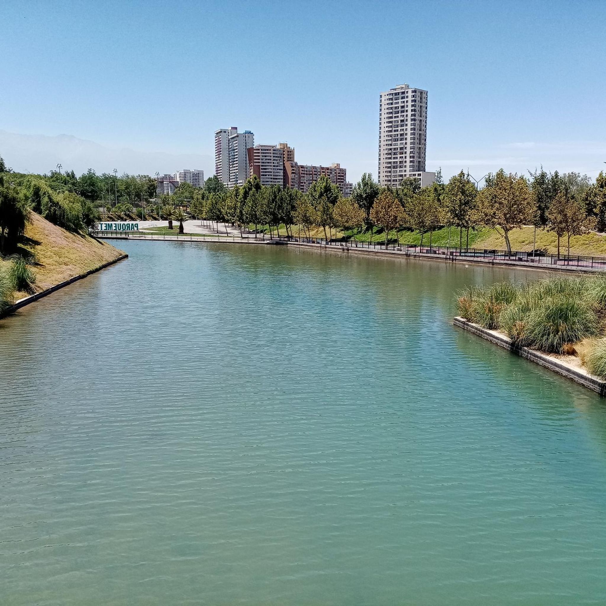
From this point in the park, you can appreciate the large buildings that line the waterfront. Some of them have architectural interest.
0
0

Cerro Los Gemelos, at 798 meters, is one of the easier peaks in Santiago's Metropolitan Park, offering good views of the valley and the city without requiring great physical exertion. The ascent follows dirt paths through scrubland and open areas, ideal for a quick and short hike. Wear shoes with good traction, as the ground is often dry and loose in the summer.
1
0
The Sunset Lookout offers a sweeping view of Santiago and the hills of Metropolitan Park, ideal for ending a hike in the golden light. Access combines dirt paths and ramps, easy but with some steeper sections. It's a great place to rest and enjoy the scenery; always bring water and wear sturdy shoes.
1
0
The Japanese Garden in Santiago's Metropolitan Park is a tranquil space with ponds, bridges, and carefully arranged vegetation, perfect for a relaxing break during a hike in the hills. It offers beautiful views and shaded areas that are much appreciated on hot days. Access involves dirt paths and stairs, so comfortable shoes with good traction are recommended.
1
0
The trails through the natural park begin right next to the Cordillera San Carlos de Apoquindo Park administration building. An information panel with a map is located here.
0
0


Bring plenty of water as you will need it on the way up
1
0
Frequently Asked Questions
How many mountain bike trails are available in San Miguel de Allende?
Komoot features several mountain bike trails in San Miguel de Allende, offering a variety of experiences. While the region boasts over 800 miles of diverse trails, our guide highlights 7 specific routes for you to explore.
What are the difficulty levels of mountain bike trails in San Miguel de Allende?
The trails in San Miguel de Allende cater to various skill levels. You'll find a mix of easy loops suitable for beginners and more challenging routes with significant elevation changes for experienced riders. Our selection includes 2 easy and 5 difficult routes.
Are there any circular mountain bike routes in San Miguel de Allende?
Yes, many of the mountain bike trails in San Miguel de Allende are designed as loops, allowing you to start and end your ride in the same location. For example, the Cerro Chacarillas loop is a popular option, offering a scenic ride through local hills.
What is the best time of year for mountain biking in San Miguel de Allende?
San Miguel de Allende's high-desert climate makes it suitable for mountain biking year-round. However, the cooler, drier months from October to April are generally preferred, offering more comfortable temperatures for riding. Always check local weather conditions before heading out.
What kind of terrain can I expect on mountain bike trails in San Miguel de Allende?
The terrain in San Miguel de Allende is incredibly diverse. Riders can expect everything from soft, powdery dust and rough, rocky paths to cobblestone sections and old bridges. Trails traverse ranchlands, high desert areas with mesquite and cholla vegetation, and rolling hills, offering a varied and engaging experience.
Are there any family-friendly mountain bike trails in San Miguel de Allende?
Yes, there are easier routes that can be suitable for families, especially those with some biking experience. Trails like the Mountainbike loop from Barrio Vista Hermosa are classified as easy and offer a good starting point for a family outing.
What are some scenic mountain bike trails in San Miguel de Allende?
Many trails offer breathtaking views of the high-desert landscape, historic churches, and rolling hills. Routes often pass through areas with mesquite trees and various cacti. For panoramic vistas, consider trails that offer views towards the Mirador de la Cruz or the countryside surrounding La Presa Allende.
What do other mountain bikers say about the trails in San Miguel de Allende?
The mountain bike routes in San Miguel de Allende are highly rated by the komoot community, with an average score of 4.3 stars from over 3 reviews. Riders often praise the varied terrain and the unique blend of natural beauty and cultural landmarks along the trails.
Are there any local attractions or points of interest near the mountain bike trails?
Absolutely! San Miguel de Allende is rich in attractions. You can explore the stunning botanical garden and nature reserve of El Charco del Ingenio, or visit La Presa Allende for tranquil reservoir views. The trails often weave through areas offering glimpses of historic churches and traditional ranchlands.
Can I find mountain bike trails that avoid paved roads in San Miguel de Allende?
Yes, the mountain biking experience in San Miguel de Allende is characterized by minimal paved roads. Trails predominantly feature natural surfaces like dirt, rock, and even cobblestone sections, ensuring an authentic off-road adventure through the diverse landscapes.
Are there options for advanced mountain bikers looking for a challenge?
Definitely. San Miguel de Allende offers several challenging routes for advanced riders. Trails like the Old El Panul Bridge – Bosque Panul loop and the Plaza El Tranque – Cruz de Las Varas loop feature significant elevation gains and technical sections, providing a demanding and rewarding experience.
Where can I find maps for mountain bike trails in San Miguel de Allende?
Komoot provides detailed maps and navigation for all the mountain bike trails listed in San Miguel de Allende. You can download routes for offline use, view elevation profiles, and get turn-by-turn directions directly from the komoot app or website.

Get inspired with the komoot mobile app


Explore more
Browse the best MTB trails in other regions.
