The 8 Most Amazing Peaks around Thurmansbang
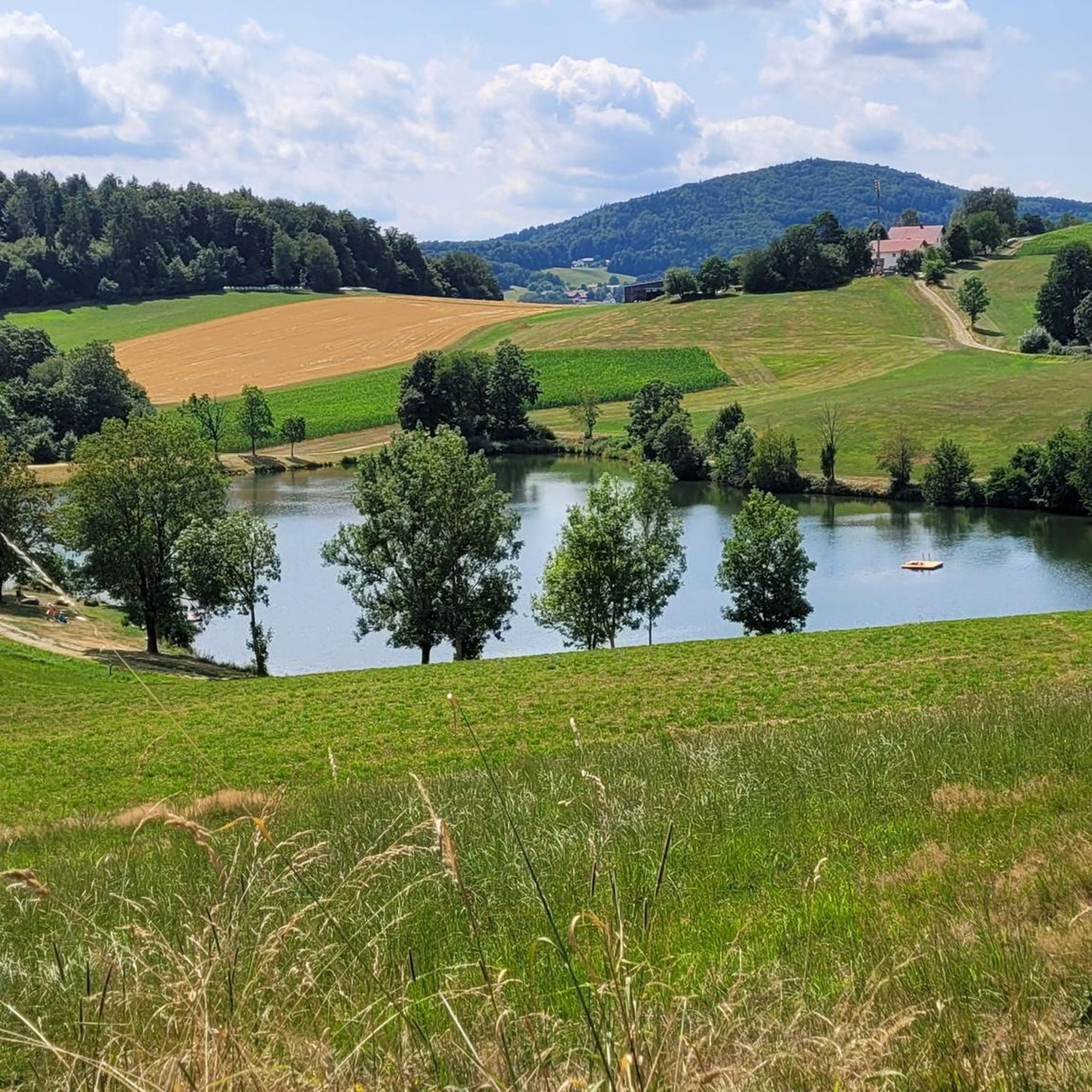
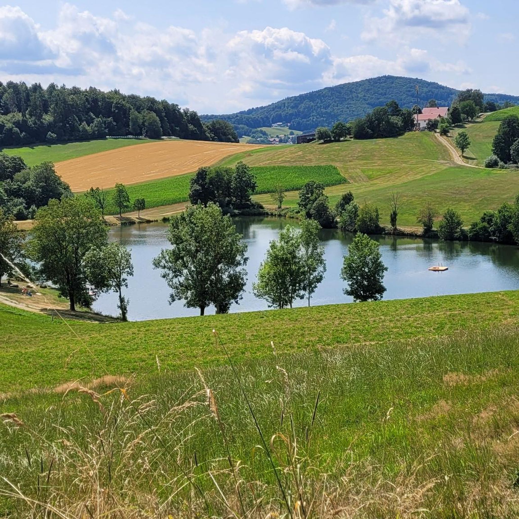
Best mountain peaks around Thurmansbang are situated within the Bavarian Forest, characterized by rolling hills, green forests, and clear lakes. This region offers diverse opportunities for exploring its natural landscape. The area is known for its prominent peaks that provide expansive views of the surrounding countryside. Thurmansbang serves as a base for accessing these elevated points, which are a key feature of the local geography.
Best mountain peaks around Thurmansbang
- The most popular mountain peaks is Brotjacklriegel Summit and Observation…
Last updated: July 6, 2026
Brotjacklriegel Summit and Observation Tower
Highlight • Summit
Translated by Google •
Tip by

Großer Büchelstein summit cross and panoramic view
Highlight • Summit
Translated by Google •
Tip by

Sign up now to discover places like this
Get recommendations on the best single tracks, peaks, & plenty of other exciting outdoor places.
Sign up for free
Little Büchelstein Viewpoint
Highlight • Viewpoint
Translated by Google •
Tip by

High Saxony
Highlight • Summit
Translated by Google •
Tip by

Büchelstein Viewpoint
Highlight • Viewpoint
Translated by Google •
Tip by
Sign up for free to discover even more peaks around Thurmansbang.
Sign up for free
Already have an account?
Start today with a free account
Your next adventure awaits.
Login or Signup
Tips from the Community

The summit cliff of the Hoher Sachse is a valuable geotop The summit of the Hoher Sachse is formed by a summit cliff of granitic-granodioritic dark diatexites with large potassium feldspar crystals with almost vertical walls. Below, a block field follows. The current morphology is the result of Pleistocene erosion, during which the Tertiary weathering crust was removed and more compact rock sections were exposed. The rock cliffs and blocks are consistently overgrown. Bavarian State Office for the Environment (LfU). https://www.umweltatlas.bayern.de/standortauskunft/rest/reporting/sb_geotope/generate?additionallayerfieldvalue=272R034
0
0

Always worth a detour for bikers or hikers
0
0

The Großer Büchelstein in the municipality of Grattersdorf rises majestically above the Sonnenwald region. With a height of 832 meters, it offers a panoramic view that extends as far as the Alps in clear weather. The summit is a popular starting point for hang gliders and paragliders, who enjoy the thermals and the spectacular views. Hikers can follow well-marked trails through dense forests and over rolling hills that unfold their own charm in every season. Source: https://region-sonnenwald.de/berge/buechelstein?task=ggvz
5
0
The Kleiner Büchelstein is in no way inferior to its big brother. With a height of 808 meters, it also offers impressive views and is an ideal place for a relaxed hike. The path to the summit takes you through idyllic forests and past picturesque clearings that invite you to linger and enjoy nature. Especially in autumn, when the leaves shine in bright colors, the Kleiner Büchelstein is a true paradise for photographers and nature lovers. Source: https://region-sonnenwald.de/berge/buechelstein?task=ggvz
5
0

Better on foot than by mountain bike. In wet weather, surefootedness is required! The view is now somewhat overgrown, but "Franz von Asisi" and a real summit cross await! Below the summit, there is a nice, stable bench between the rocks where you can rest.
0
0

The view is great and if you're lucky you can watch a hang glider take off.
3
0
The large and small Büchelstein is definitely worth a detour. But when the weather is nice, there are a lot of people
2
0

Rocky descent - always happy
4
0
Frequently Asked Questions
What makes the Brotjacklriegel a popular destination in Thurmansbang?
The Brotjacklriegel Summit and Observation Tower, standing at 1,011 meters, is a landmark of the region. Its wooden observation tower offers a panoramic view across the Bavarian-Bohemian border ridge, the Passauer Land, and the Danube plain, extending all the way to the Alps. There's also a small refreshment spot, the "Turm-Stüberl," at the tower.
What kind of views can I expect from Großer Büchelstein?
From the Großer Büchelstein summit cross and panoramic view, visitors can enjoy expansive panoramic views, especially on clear days. It's a highly recommended destination for its long-distance visibility, suitable for visits in both summer and winter.
Are there other notable viewpoints around Thurmansbang besides the main summits?
Yes, you can also visit the Little Büchelstein Viewpoint, which, despite a steep ascent, rewards you with a great view and seating for rest. Another spot is the Viewpoint Kleiner Aschenstein, offering a beautiful vista that invites you to linger.
What hiking opportunities are available near the mountain peaks in Thurmansbang?
The region around Thurmansbang offers diverse hiking trails. You can explore routes like the 'Goldsteig Loop: Thurmansbang - Saldenburg' or the 'Brotjacklriegel Transmitter – Viewpoint Kleiner Aschenstein loop from Zenting'. For more options, check out the Hiking around Thurmansbang guide.
Are there any legends or historical facts associated with the mountain peaks?
Yes, the Brotjacklriegel has a local legend. A small, bearded man named Jackl found refuge in a cave on the mountain during the Swedish War. He always had enough bread, leading to the mountain's name. You can find more about this at the Brotjacklriegel nameplate.
What is the best time to visit the mountain peaks in Thurmansbang?
The mountain peaks, particularly Großer Büchelstein, are recommended for visits in both summer and winter, provided the weather is clear for optimal long-distance views. The observation tower on Brotjacklriegel is also accessible year-round.
Are there any facilities or refreshment options available at the mountain peaks?
At the Brotjacklriegel Summit and Observation Tower, you'll find the "Turm-Stüberl," a small refreshment spot. This provides an opportunity for a little break after climbing the 127 steps to the top of the tower.
What other outdoor activities can I do in the Thurmansbang area?
Beyond hiking, Thurmansbang offers opportunities for road cycling and running. You can find various routes, such as the 'Wirtshaus Seeufer – Sinn's Dance Barn loop from Kneisting' for road cycling or the 'Ochsenstiegl Lookout Tower – Bavarian Forest Open-Air Museum loop from Thurmansbang' for running. Explore more in the Road Cycling Routes around Thurmansbang and Running Trails around Thurmansbang guides.
What do visitors enjoy most about the mountain peaks around Thurmansbang?
Visitors consistently praise the stunning panoramic views from the summits and viewpoints, especially the extensive long-distance visibility from places like Brotjacklriegel and Großer Büchelstein. The effort of steep ascents is often highlighted as being well worth it for the rewarding vistas.
Is there an entrance fee to access the observation tower on Brotjacklriegel?
Yes, there is a small 'ascension' fee of one Euro to climb the 127 steps to the top of the observation tower on Brotjacklriegel to enjoy the panoramic views.
Are the mountain peaks around Thurmansbang suitable for families?
While specific family-friendly trails are not detailed for every peak, the general area of Thurmansbang, with its rolling hills and green forests, provides a scenic backdrop for outdoor activities. The observation tower on Brotjacklriegel can be an exciting destination, and many hiking routes in the region are of moderate difficulty, which can be suitable for active families.
What is the elevation of the highest peaks in the Thurmansbang region?
The Brotjacklriegel is one of the highest mountains in the Bavarian Forest, standing at 1,011 meters above sea level. Other prominent peaks like Großer Büchelstein also offer significant elevation and expansive views.
Most popular routes around Thurmansbang
Most popular attractions around Thurmansbang

Get inspired with the komoot mobile app


Explore more
See even more amazing summits around Thurmansbang with these guides:
