The best cycling routes in Cajolá
5.0
(1)
40
riders
4
rides
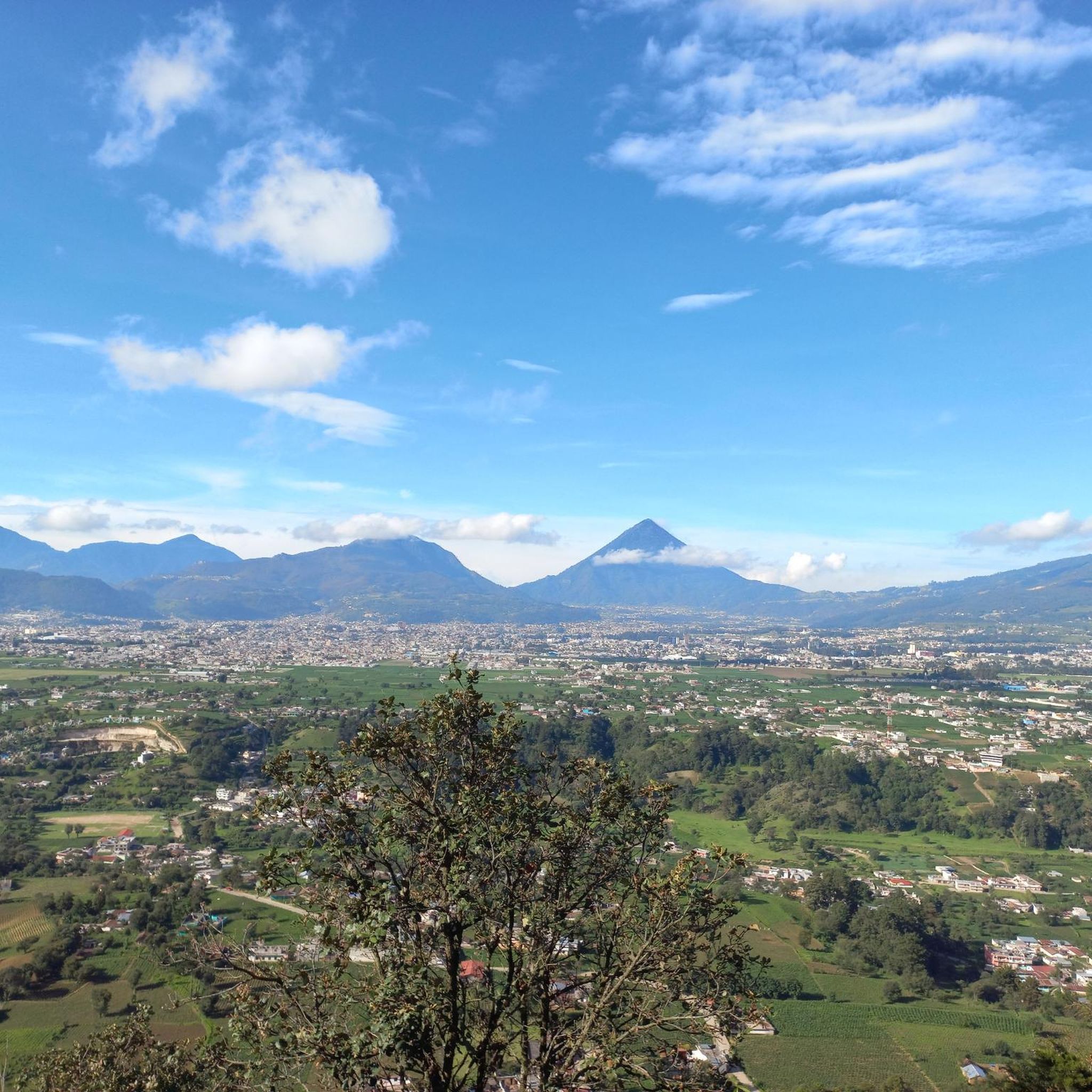
Touring cycling in Cajolá, located in the Guatemalan highlands, offers routes through varied terrain. The region features rolling hills and volcanic landscapes, providing diverse gradients for cycling. Fertile volcanic soil supports lush areas, including coffee plantations, and montane pine forests offer shaded sections. These physical features contribute to a dynamic backdrop for touring cyclists.
Best touring cycling routes in Cajolá
- The most popular touring cycling route is Viewpoint at the White Cross loop from Quetzaltenango, a 20.4 miles (32.8…
Last updated: July 5, 2026
5.0
(1)
9
riders
33.7km
02:21
420m
420m
Moderate bike ride. Good fitness required. Mostly paved surfaces. Suitable for all skill levels.
6
riders
29.4km
02:34
860m
860m
Hard bike ride. Very good fitness required. Mostly paved surfaces. Suitable for all skill levels.

Sign up for free
5
riders
15.0km
01:19
390m
390m
Moderate bike ride. Good fitness required. Mostly paved surfaces. Suitable for all skill levels.
8
riders
24.2km
02:05
620m
620m
Hard bike ride. Very good fitness required. Mostly paved surfaces. Suitable for all skill levels.
4
riders
24.2km
01:53
410m
410m
Moderate bike ride. Good fitness required. Mostly paved surfaces. Suitable for all skill levels.
2
riders
16.0km
01:33
490m
490m
Hard bike ride. Very good fitness required. You may need to push your bike for some segments of this route.
3
riders
26.7km
02:47
860m
860m
Hard bike ride. Very good fitness required. You may need to push your bike for some segments of this route.
1
riders
38.6km
02:42
450m
450m
Moderate bike ride. Good fitness required. Mostly paved surfaces. Suitable for all skill levels.
Our route recommendations are based on thousands of hikes, rides, and runs completed by other people on komoot.
Start today with a free account
Your next adventure awaits.
Login or Signup
Popular around Cajolá

Tips from the Community


Frequently Asked Questions
How many touring cycling routes are available in Cajolá?
Cajolá offers 8 touring cycling routes, providing a range of options for exploring the region's diverse landscapes. These routes include both moderate and difficult options, catering to different skill levels.
What is the best time of year for touring cycling in Cajolá?
The dry season, which typically runs from November to April, is generally recommended for touring cycling in Cajolá. During this period, you can expect more favorable weather conditions, though some cyclists also enjoy the lush greenery that follows the rainy season.
What kind of terrain can I expect on touring cycling routes in Cajolá?
Touring cycling in Cajolá features varied terrain characterized by rolling hills and volcanic landscapes. You'll encounter routes winding through fertile volcanic soil, often passing by coffee plantations, and enjoy the shade of montane pine forests. Expect significant elevation changes, offering both rewarding climbs and scenic descents.
Are there routes suitable for beginners or those looking for an easier ride?
Yes, Cajolá offers several moderate routes. For a less strenuous option, consider the Bike loop from La Esperanza, which is 9.3 miles (15.0 km) long and leads through rolling hills. Another moderate choice is the In Case I Get Lost loop from La Esperanza, covering 14.8 miles (23.7 km).
Are there challenging routes for experienced touring cyclists?
Absolutely. For experienced touring cyclists seeking a challenge, Cajolá has several difficult routes with substantial climbs. The Bike loop from Seminario San Jose is a difficult 18.2 miles (29.4 km) path with significant elevation gain. Another demanding option is the Bike loop from Quetzaltenango, which spans 15.0 miles (24.1 km) and also features considerable ascents.
Can I find circular touring cycling routes in Cajolá?
Yes, many of the touring cycling routes in Cajolá are designed as loops, allowing you to start and end at the same point. Examples include the popular Viewpoint at the White Cross loop from Quetzaltenango and the Viewpoint at the White Cross – Parque Bonito loop from Quetzaltenango, both offering circular journeys through the scenic highlands.
What natural features or viewpoints can I see along the routes?
The routes in Cajolá offer stunning natural features and viewpoints. You'll cycle through montane pine forests and areas shaped by volcanic terrain. The region is known for its abundant springs, and the rich volcanic soil supports lush landscapes, including coffee plantations. Many routes, like those leading to the White Cross viewpoint, provide expansive views of the surrounding highlands.
What cultural experiences can I expect while cycling in Cajolá?
Cajolá is a predominantly Mam community, offering a unique opportunity to experience traditional Mam culture. As you cycle, you may pass through remote Mayan villages, observing local life and potentially interacting with communities where women often wear distinct, traditionally woven clothing. The proximity to Quetzaltenango also allows for access to a vibrant cultural hub.
What do other cyclists say about touring cycling in Cajolá?
The touring cycling routes in Cajolá are highly rated by the komoot community, with an average score of 5.0 stars from over 3 reviews. Cyclists often praise the varied terrain, the challenging yet rewarding climbs, and the opportunity to experience the natural beauty and cultural richness of the Guatemalan highlands.
What should I consider regarding weather and gear for cycling in Cajolá?
Given the mountainous terrain, be prepared for significant elevation changes. The dry season (November to April) offers more stable weather, but conditions can vary. It's advisable to bring appropriate gear for strenuous ascents, such as light gearing and disc brakes for descents. Layers of clothing are recommended due to potential temperature fluctuations in the highlands.
Are there any routes that combine viewpoints with other natural attractions?
Yes, the In Case I Get Lost – Parque Bonito loop from Quetzaltenango is a difficult 19.7 miles (31.7 km) route that combines scenic viewpoints with the natural beauty of Parque Bonito, offering a comprehensive experience of the region's landscapes.
Most popular routes in Cajolá

Get inspired with the komoot mobile app


Explore more
Browse the best Cycling routes in other regions.
