The best MTB trails in Tlajomulco De Zúñiga
4.9
(215)
931
riders
30
rides
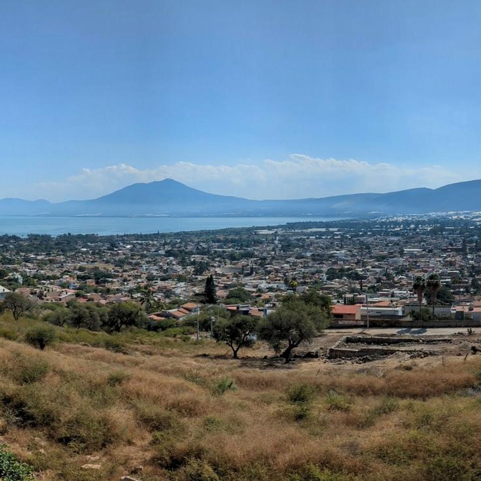
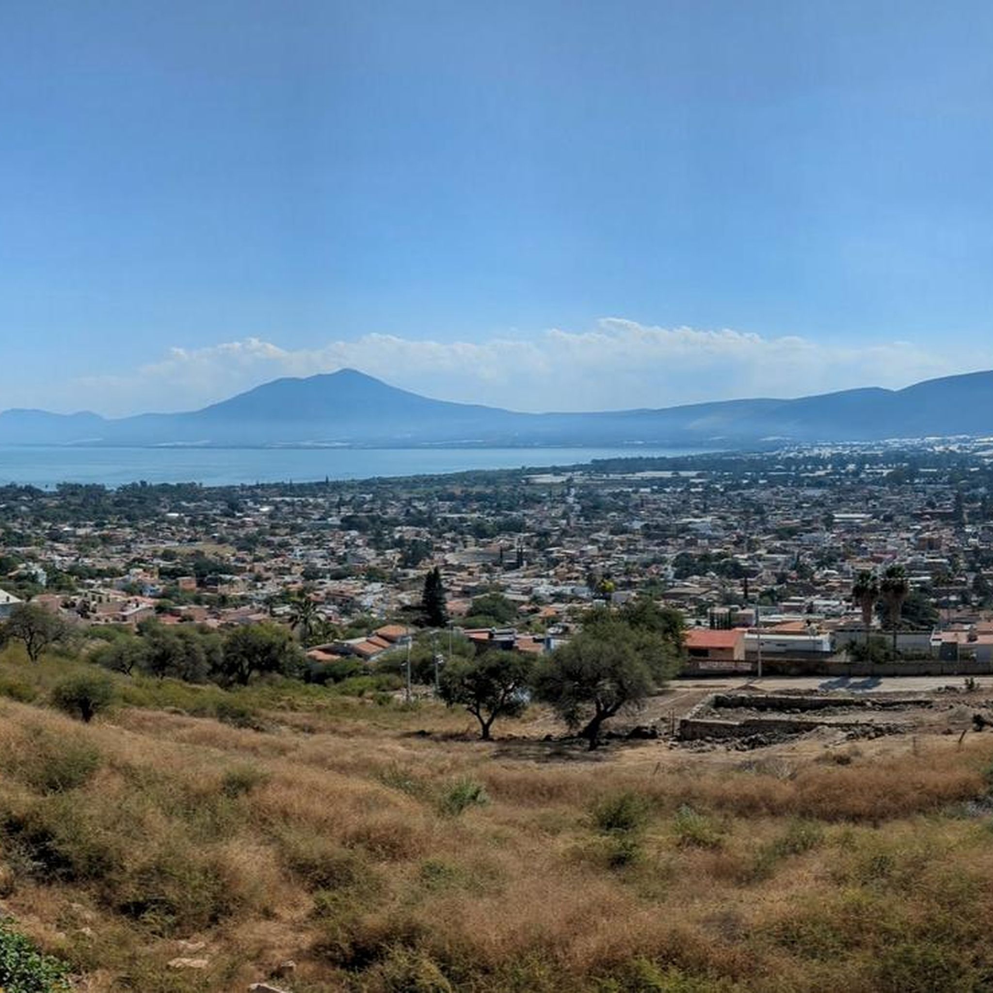
Mountain biking in Tlajomulco De Zúñiga offers diverse terrain for outdoor enthusiasts. The region is characterized by its varied topography, including prominent features like Cerro Viejo and extensive forests. Semi-flat zones and rugged areas reaching up to 2,700 meters provide a range of environments for mountain biking. The area is recognized for its favorable geography, particularly around Cerro Viejo, which supports a network of mountain bike trails.
Best mountain bike trails in Tlajomulco De Zúñiga
- The most popular mountain bike trail is Fly – Wooden Bridge loop from Prolongacion Mariano Otero, a 20.2 miles (32.5 km) trail that takes about 3 hours 9 minutes to complete. This route features challenging terrain with significant elevation gain.
- Another top favourite among local mountain bikers is Fly – Bike City loop from Av. Paseo del Bosque, a difficult 16.2 miles (26.1 km) path. This trail navigates through varied landscapes, offering a demanding ride.
- Local mountain bikers also love the View of the Valley – Tower 1 loop from San Agustín, an 18.7 miles (30.1 km) trail leading through diverse terrain, often completed in about 2 hours 50 minutes.
- Mountain biking in Tlajomulco De Zúñiga is defined by its prominent Cerro Viejo, extensive oak forests, and varied topography. The network offers options for different ability levels, from moderate paths to difficult singletracks.
- The routes in Tlajomulco De Zúñiga are highly rated by the komoot community with an average score of 4.9 stars from over 200 reviews. More than 900 mountain bikers have used komoot to explore Tlajomulco De Zúñiga's varied terrain.
Last updated: July 15, 2026
5.0
(6)
68
riders
32.5km
03:09
660m
660m
Hard mountain bike ride. Good fitness required. Advanced riding skills necessary. Some portions of the route may require you to push your bike.
5.0
(41)
47
riders
30.1km
02:50
680m
680m
Moderate mountain bike ride. Good fitness required. Advanced riding skills necessary.

Sign up for free
5.0
(10)
45
riders
10.4km
00:55
130m
130m
Hard mountain bike ride. Great for any fitness level. Advanced riding skills necessary. Some portions of the route may require you to push your bike.
4.0
(2)
33
riders
37.0km
03:33
760m
760m
Hard mountain bike ride. Good fitness required. Advanced riding skills necessary. Some portions of the route may require you to push your bike.
5.0
(1)
36
riders
10.3km
00:59
180m
180m
Hard mountain bike ride. Great for any fitness level. Advanced riding skills necessary. Some portions of the route may require you to push your bike.
5.0
(3)
28
riders
57.3km
05:54
1,380m
1,380m
Hard mountain bike ride. Very good fitness required. Advanced riding skills necessary. Some portions of the route may require you to push your bike.
4.8
(11)
31
riders
15.8km
01:31
270m
270m
Hard mountain bike ride. Great for any fitness level. Advanced riding skills necessary. Some portions of the route may require you to push your bike.
21
riders
21.8km
02:17
610m
610m
Moderate mountain bike ride. Good fitness required. Advanced riding skills necessary.
8
riders
31.9km
03:14
700m
700m
Hard mountain bike ride. Good fitness required. Advanced riding skills necessary. Some portions of the route may require you to push your bike.
5.0
(1)
10
riders
41.1km
04:07
920m
920m
Hard mountain bike ride. Very good fitness required. Advanced riding skills necessary. Some portions of the route may require you to push your bike.
Get access to more routes and recommendations from other explorers.
Sign up for free
Already have an account?
Our route recommendations are based on thousands of hikes, rides, and runs completed by other people on komoot.
Start today with a free account
Your next adventure awaits.
Login or Signup


Tips from the Community

An excellent place to start your shoot and finish with a delicious breakfast. They have very good dishes and there are shop advisers, so that more than a coffee, you can get closer to a whole cycling experience from the place where it is practiced
0
0
Frequently Asked Questions
How many mountain bike trails are available in Tlajomulco De Zúñiga?
Tlajomulco De Zúñiga offers over 30 mountain bike trails, catering to various skill levels. The region is particularly known for its challenging routes, with a significant number of difficult trails.
Are there any easy mountain bike trails for beginners in Tlajomulco De Zúñiga?
While the area is predominantly known for its more challenging terrain, there is at least one easy mountain bike trail available. Most routes are classified as moderate to difficult, making it a great destination for experienced riders.
What are some of the more challenging mountain bike routes in Tlajomulco De Zúñiga?
For experienced riders seeking a challenge, routes like the Bike City – Fly loop from Av. Paseo del Bosque stand out. This difficult trail covers nearly 57.4 km with significant elevation gain, offering a demanding ride through varied landscapes.
Are there any mountain bike trails with scenic viewpoints in Tlajomulco De Zúñiga?
Yes, many trails in Tlajomulco De Zúñiga offer stunning views, especially those around Cerro Viejo, the region's prominent natural landmark. The summit of Cerro Viejo provides breathtaking panoramic vistas. You can experience some of these views on routes like the View of the Valley – Tower 1 loop from Seven Eleven.
What is the best season for mountain biking in Tlajomulco De Zúñiga?
Given the diverse topography and natural features, mountain biking in Tlajomulco De Zúñiga is generally enjoyable during the dry season, typically from November to May, when trails are less muddy and weather conditions are more stable. However, always check local conditions before heading out.
Are there any loop mountain bike trails in the area?
Yes, many of the mountain bike trails in Tlajomulco De Zúñiga are designed as loops, offering a complete circuit. An example is the Fly – Wooden Bridge loop from Cerro el Culebreado, which provides a circular route through the terrain.
What kind of landscapes can I expect to see while mountain biking in Tlajomulco De Zúñiga?
You can expect a varied landscape, from rugged areas reaching up to 2,700 meters to semi-flat zones and extensive oak forests. The region is defined by its prominent Cerro Viejo and the serene Laguna de Cajititlán, offering diverse environments for your ride.
What do other mountain bikers say about the trails in Tlajomulco De Zúñiga?
The mountain bike trails in Tlajomulco De Zúñiga are highly rated by the komoot community, with an average score of 4.9 stars from over 200 reviews. Riders often praise the varied terrain and the challenging nature of the routes, particularly around Cerro Viejo.
Are there any specific attractions or natural features to look out for along the mountain bike routes?
Beyond the trails themselves, the region offers natural attractions like Cerro Viejo, the second highest peak in Jalisco, known for its panoramic views. The Laguna de Cajititlán, surrounded by traditional Mexican towns, is also a tranquil spot with picturesque landscapes and diverse migratory birds. While not directly on all bike routes, these are prominent features of the area.
How long do mountain bike trails typically take to complete in Tlajomulco De Zúñiga?
The duration varies significantly depending on the trail's distance and difficulty. For instance, a difficult route like the Vista Panoramica General – El Pequeño Puente loop from Km 10.5, covering about 15.8 km, might take around 1 hour 30 minutes, while longer, more challenging routes can take several hours.
Are there any moderate difficulty mountain bike trails in Tlajomulco De Zúñiga?
Yes, there are a few moderate trails available for those looking for a step up from easy routes but not yet ready for the most difficult ones. An example is the View of the Valley – Tower 1 loop from San Agustín, which is an 18.7-mile trail often completed in about 2 hours 50 minutes.
Where can I find parking for mountain biking in Tlajomulco De Zúñiga?
Many routes start from accessible points, often near main roads or residential areas, which may offer parking options. For example, the Puente Pérez – Wooden Bridge loop from Km 10.5 suggests a starting point that might have parking facilities nearby. It's always advisable to check the specific route details on komoot for recommended starting points and potential parking information.

Get inspired with the komoot mobile app


Didn’t find what you were looking for?
Check out more MTB trails throughout Tlajomulco De Zúñiga below and find the perfect route in your destination.
Explore more
Browse the best MTB trails in other regions.
