The best walks and hikes around Hattstedtermarsch
4.6
(2228)
12,243
hikers
702
hikes
Hiking around Hattstedtermarsch offers access to the unique landscapes of the North Sea coast in Northern Germany. The region is characterized by its flat marshland terrain, extensive dikes, and proximity to the Wadden Sea, a UNESCO World Heritage Site. Hikers can explore vast salt marshes and enjoy panoramic views of the intertidal zone and distant Halligen islands. The area provides a distinctive environment shaped by tides, ideal for coastal exploration.
Best hiking trails around Hattstedtermarsch
- The most popular hiking route…
Last updated: July 1, 2026
4.7
(63)
292
hikers
Easy hike. Great for any fitness level. Easily-accessible paths. Suitable for all skill levels.
4.9
(18)
60
hikers
10.8km
02:46
40m
40m
Moderate hike. Good fitness required. Easily-accessible paths. Suitable for all skill levels.

Sign up for free
4.7
(15)
64
hikers
Easy hike. Great for any fitness level. Easily-accessible paths. Suitable for all skill levels.
4.6
(12)
60
hikers
Easy hike. Great for any fitness level. Easily-accessible paths. Suitable for all skill levels.
4.8
(10)
64
hikers
Easy hike. Great for any fitness level. Easily-accessible paths. Suitable for all skill levels.
Get access to more routes and recommendations from other explorers.
Sign up for free
Already have an account?
Our route recommendations are based on thousands of hikes, rides, and runs completed by other people on komoot.
Start today with a free account
Your next adventure awaits.
Login or Signup



Tips from the Community

Unfortunately now largely closed. However, there are vending machines for refreshments. https://www.zum-strandkorb-nordstrand.de/
0
0

Schobüller Forest, not ‘Schönböhler’
0
0

Very interesting for those interested in nature!
0
0
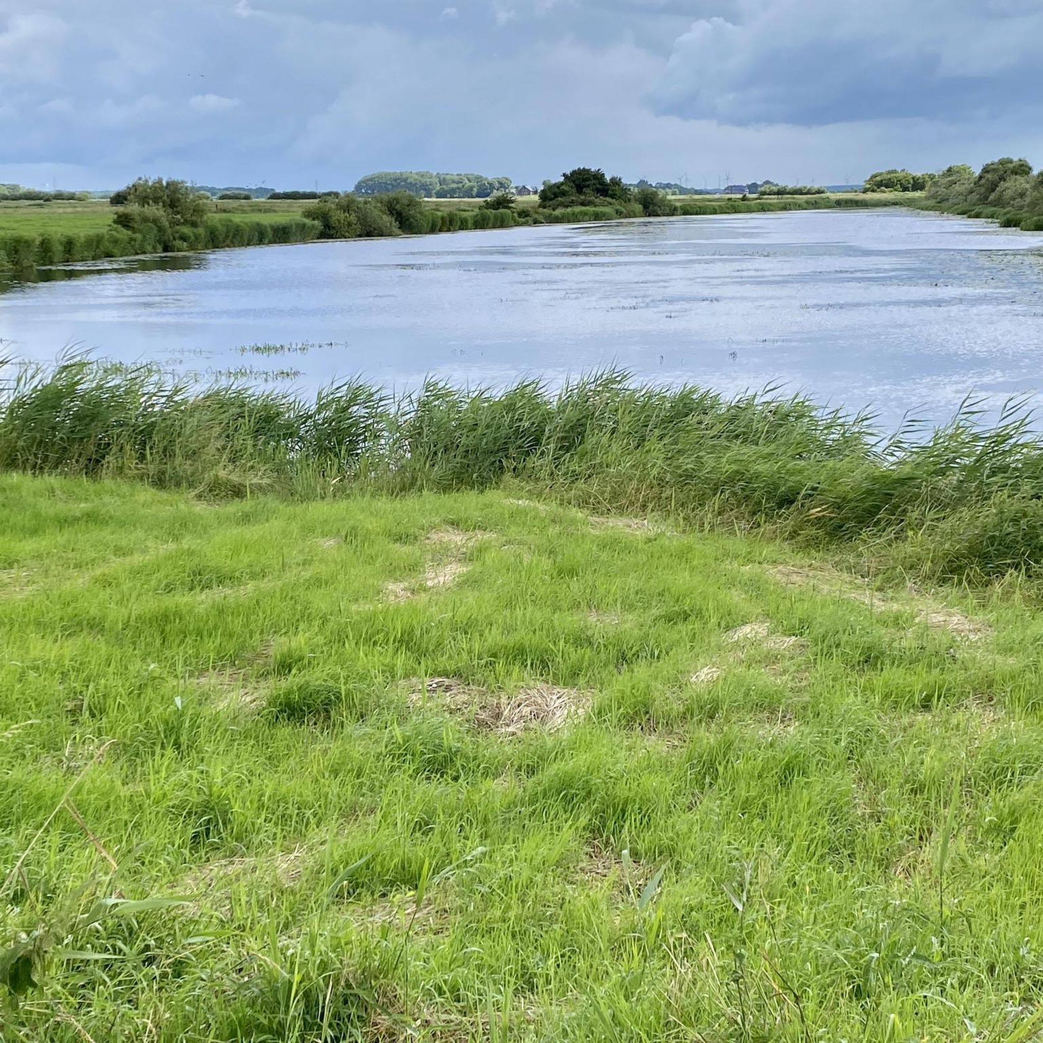
Quite a wide river!
0
0

Nearby, about 350 meters off the route, past the lock, it's worth taking a short break. The Deichhotel Arlau has a small café with a great viewing terrace.
0
0

Grave mound from the Bronze Age
0
0

From the birdwatching huts, you have fantastic views of the birdlife in the Beltringharder Koog. This is especially interesting at dusk when the birds are flying away and returning.
1
0

The Arlauschleuse pumping station was built in 1924 to drain water from the marshlands of the Hattstedtermarsch at the mouth of the Arlau River into Nordstrand Bay.
0
0
Frequently Asked Questions
What kind of terrain can I expect when hiking in Hattstedtermarsch?
Hiking in Hattstedtermarsch is characterized by its unique North Sea coastal landscape. You'll primarily find flat marshland terrain, extensive dikes, and vast salt marshes. These features offer panoramic views of the Wadden Sea, a UNESCO World Heritage Site, and distant Halligen islands. The trails are generally easy to moderate, shaped by the tides and coastal environment.
How many hiking routes are available in Hattstedtermarsch?
There are over 700 hiking routes available in Hattstedtermarsch. The komoot community has explored more than 12,000 tours in the area, with options ranging from easy strolls to more challenging paths.
Are there any easy hiking trails suitable for beginners or leisurely walks?
Yes, Hattstedtermarsch offers a wide selection of easy hiking trails. Over 500 routes are classified as easy, making them perfect for beginners or those looking for a relaxed walk. An example is the Beltringharder Koog Dike – Café Zum Strandkorb loop from Badestelle Holmer Siel, an easy 3.7-kilometer trail.
What are some natural attractions or viewpoints I can see along the trails?
The region is rich in natural beauty. You can enjoy views of the Wadden Sea, the Halligen, and extensive salt marshes. Specific highlights include the Beltringharder Koog Nature Reserve, the Lüttmoorsiel Seawall and View over the Beltringharder Koog, and the Lüttmoordamm Birdwatching Hide. These spots offer excellent opportunities for birdwatching and experiencing the unique coastal ecosystem.
Are there any circular hiking routes in Hattstedtermarsch?
Many of the trails in Hattstedtermarsch are designed as loops, allowing you to start and end at the same point. For instance, the View over the Beltringharder Koog – Aarlau lock pumping station loop from Kleiner Deichhof is a popular 4.6-kilometer circular route that takes you through the Beltringharder Koog.
Is Hattstedtermarsch a good destination for family-friendly hikes?
Absolutely. The generally flat terrain and numerous easy routes make Hattstedtermarsch ideal for family-friendly hikes. Many trails are suitable for children, offering opportunities to explore the dikes and observe the coastal landscape without significant elevation changes. The Lüttmoordamm loop from Badestelle Lüttmoorsiel is an easy 4.1-kilometer option that families might enjoy.
Can I bring my dog on the hiking trails in Hattstedtermarsch?
Yes, many trails in Hattstedtermarsch are dog-friendly. However, as much of the area is a nature reserve and close to the Wadden Sea UNESCO World Heritage Site, it's crucial to keep dogs on a leash, especially on dikes and in sensitive marshland areas, to protect local wildlife and livestock like sheep. Always check local signage for specific regulations.
What is the best time of year to go hiking in Hattstedtermarsch?
The best time to hike in Hattstedtermarsch is generally from spring to early autumn (April to October). During these months, the weather is milder, and the salt marshes are vibrant. However, the coastal environment can be windy and rainy at any time of year, so always be prepared for changing conditions. Winter hikes can also be beautiful, offering a different, starker perspective of the landscape, but require appropriate gear for cold and potentially muddy conditions.
Are there places to eat or stay near the hiking trails in Hattstedtermarsch?
While Hattstedtermarsch itself is a quiet, rural area, the nearby town of Husum offers a wider range of amenities including cafes, restaurants, and accommodation options. You can also find smaller establishments in surrounding villages. The region's focus on outdoor activities means many places cater to hikers and cyclists.
What do other hikers enjoy most about the trails in Hattstedtermarsch?
The hiking trails in Hattstedtermarsch are highly rated by the komoot community, with an average score of 4.5 stars from over 2,100 reviews. Hikers often praise the unique coastal scenery, the peaceful atmosphere of the marshlands, and the expansive views over the Wadden Sea and dikes. The well-maintained paths and the opportunity to experience a UNESCO World Heritage site are frequently highlighted.
Is public transport available to access hiking trailheads in Hattstedtermarsch?
Public transport options to specific trailheads in Hattstedtermarsch can be limited due to the rural nature of the area. It's advisable to check local bus schedules in advance, especially if you plan to rely on public transport. Many visitors prefer to use a car to reach starting points, as this offers more flexibility for exploring the various dikes and marshland areas.
Where can I find parking at the trailheads in Hattstedtermarsch?
Parking is generally available at common starting points for popular routes, such as near Badestelle Lüttmoorsiel or Wobbenbüll. These areas often have designated parking spaces for hikers and visitors. However, specific parking regulations or fees may apply in certain locations, so it's always good to look for signage upon arrival.
Most popular routes around Hattstedtermarsch
Most popular attractions around Hattstedtermarsch

Get inspired with the komoot mobile app


Explore more
Browse the best Hikes in other regions.
