The best road cycling routes in Carmen De Carupa
4.0
(2)
68
riders
6
rides
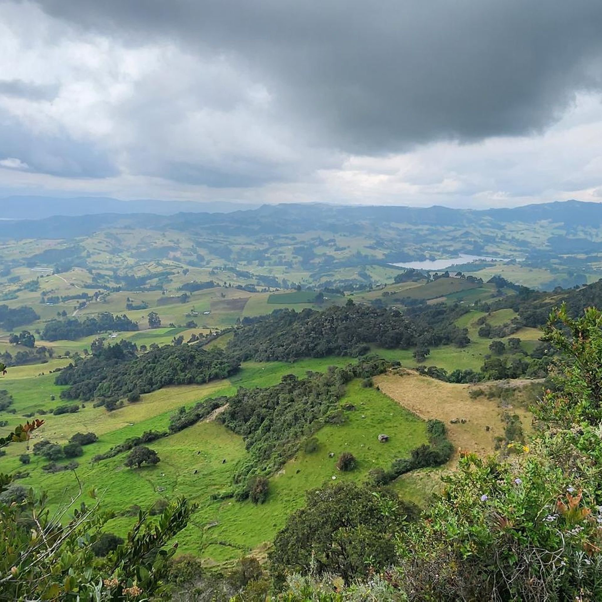
Road cycling in Carmen De Carupa is characterized by its high-altitude terrain, offering routes with significant ascents and descents. The region, situated at around 2980 meters above sea level, features a páramo climate and diverse natural landscapes. Cyclists encounter altiplano scenery, including potato crops, country houses, and views of the El Hato Reservoir. The area provides a challenging environment for road cyclists seeking elevation gains and varied topography.
Best road cycling routes in Carmen De Carupa
- The most popular road…
Last updated: August 25, 2026
3.0
(1)
31
riders
Hard road ride. Very good fitness required. Some segments of this route may be unpaved and difficult to ride.
11
riders
42.1km
02:02
480m
480m
Moderate road ride. Good fitness required. Mostly well-paved surfaces and easy to ride.

Sign up for free
10
riders
56.5km
02:33
400m
400m
Moderate road ride. Good fitness required. Mostly well-paved surfaces and easy to ride.
5.0
(1)
7
riders
40.2km
02:23
690m
690m
Moderate road ride. Good fitness required. Some segments of this route may be unpaved and difficult to ride.
5
riders
21.8km
01:11
270m
270m
Easy road ride. Great for any fitness level. Mostly well-paved surfaces and easy to ride.
Our route recommendations are based on thousands of hikes, rides, and runs completed by other people on komoot.
Start today with a free account
Your next adventure awaits.
Login or Signup
Popular around Carmen De Carupa

Tips from the Community

Mirador de la laguna de fuquene, shops. On the road. avoid night traffic
0
0
Heavy traffic highway, one lane and no shoulder. watch out
0
0
Sigle track that connects the village of Novoa with Sutatausa.
0
0
Small town paved in its streets, they recognize her as "The pretty girl of the Ubaté Valley" with the church in the upper part of the mountain, food and lodging are obtained, currently it is recommended for XC, DH has high-level slopes. and adventure connecting municipalities such as Suesca, Leguanzaque, Ubaté, Sutatausa and Guachetá
0
0
Path that connects the path of Palacio and Novoa (Sutatausa) with the main road that goes to Cucunuba
0
0
Municipality of Fúquene, 7 km from the main highway 45A, characterized by work the "junco" that is produced in the lagoon and is the raw material of its crafts.
0
0
Frequently Asked Questions
How many road cycling routes are available in Carmen De Carupa?
Carmen De Carupa offers a selection of 6 road cycling routes, catering to various skill levels from easy to difficult. These routes are designed to showcase the region's unique high-altitude terrain and scenic landscapes.
What kind of terrain can I expect when road cycling in Carmen De Carupa?
Road cycling in Carmen De Carupa is characterized by its high-altitude terrain, with routes featuring significant ascents and descents. You'll encounter diverse landscapes, including the typical altiplano scenery with vast potato crops, traditional country houses, and expansive views of the El Hato Reservoir. The region's páramo climate ensures cool, clean air and a distinct high-mountain environment.
Are there challenging road cycling routes in Carmen De Carupa?
Yes, Carmen De Carupa is known for its challenging routes. For experienced riders seeking a demanding ride, the View of Laguna de Fúquene – Novoa–Chircal Connector Trail loop from Sutatausa is a difficult 82.4-mile (132.5 km) route with substantial elevation changes, offering extensive views of Laguna de Fúquene and high-altitude sections.
Are there easier road cycling options for beginners or families?
Yes, there are easier options available. The Tausavita Trail – Sutatausa loop from Ubaté is an easy 13.5-mile (21.8 km) route, perfect for those looking for a less strenuous ride while still enjoying the region's beauty. This route offers a gentler introduction to road cycling in the area.
What scenic viewpoints can I discover along the road cycling routes?
The region boasts several breathtaking viewpoints. Cyclists can enjoy panoramic vistas from spots like Neusa Viewpoint / Alto del Borracho and Sucre Viewpoint. These locations offer impressive views of the surrounding mountains, the El Hato Reservoir, and the expansive skies characteristic of the high-altitude plateau.
Are there any natural features or landmarks to see while cycling?
Absolutely. Carmen De Carupa is rich in natural beauty. You can cycle past the significant Neusa Reservoir, which is surrounded by typical altiplano landscapes including potato crops and country houses. The area also features the Alto de Tausa Páramo, offering a unique high-mountain environment.
What is the best time of year for road cycling in Carmen De Carupa?
Carmen De Carupa's high-altitude location at around 2980 meters above sea level means it generally has a cool climate year-round. While specific seasonal recommendations aren't provided, the cool, clean air makes it a pleasant destination for cycling away from city heat. It's always advisable to check local weather forecasts before heading out, especially considering the páramo climate.
Are there circular road cycling routes in Carmen De Carupa?
Yes, many of the routes in Carmen De Carupa are designed as loops, allowing you to start and end in the same location. Examples include the moderate Laguna de Fúquene – View of Laguna de Fúquene loop from Ubaté and the shorter View of Fúquene – Fúquene Town Center loop from Ubaté, both offering scenic rides.
What do other road cyclists appreciate most about the routes in Carmen De Carupa?
The routes in Carmen De Carupa are highly rated by the komoot community, with an average score of 4.0 stars. Cyclists often praise the challenging high-altitude terrain, the stunning views of the El Hato Reservoir and vast potato fields, and the tranquil environment that offers a peaceful escape from city life.
Is there parking available for cyclists in Carmen De Carupa?
While specific parking facilities for cyclists are not detailed, Carmen De Carupa is a municipality that welcomes outdoor activities. It is generally recommended to look for designated parking areas in town centers or near popular starting points for routes, such as Ubaté or Sutatausa, which serve as common access points for these cycling tours.
How accessible is Carmen De Carupa by public transport for cyclists?
Carmen De Carupa is located approximately 88 kilometers north of Bogotá, making it a relatively accessible destination. While direct public transport options for cyclists with bikes might require specific arrangements, buses typically run from Bogotá to nearby towns like Ubaté, from where you can often find local transport or cycle to your starting point. It's advisable to check with bus operators regarding bike transport policies.
Can I find places to eat or drink near the cycling routes?
Carmen De Carupa and its surrounding towns, such as Ubaté and Sutatausa, offer local eateries and cafes where cyclists can refuel. These establishments often provide traditional Colombian fare and refreshments. It's a good idea to plan your route to pass through these towns for convenient stops.
Most popular routes in Carmen De Carupa
Most popular attractions in Carmen De Carupa

Get inspired with the komoot mobile app


Explore more
Browse the best Road cycling routes in other regions.
