The 4 Most Amazing Peaks around Hülsede
Best mountain peaks around Hülsede are found within a landscape of gentle hills, lush forests, and scenic elevated areas in Germany's Schaumburg region. While not home to traditional towering peaks, the area offers elevated natural features and "mountain tours" for hiking. Notable areas include the Süntel and Bückeberg, which provide challenging trails and picturesque views. These natural features contribute to the region's appeal for outdoor activities.
Best mountain peaks around Hülsede
- The most popular mountain peaks is Nordmannsturm and forest…
Last updated: June 29, 2026
Annaturm and Annaturm Forest Inn
Highlight • Viewpoint
Translated by Google •
Tip by

Nordmannsturm and forest restaurant
Highlight • Viewpoint
Translated by Google •
Tip by

Sign up now to discover places like this
Get recommendations on the best single tracks, peaks, & plenty of other exciting outdoor places.
Sign up for free
Barsinghausen Telecommunications Tower
Highlight • Monument
Translated by Google •
Tip by

View from Rodenberger Höhe
Highlight • Viewpoint
Translated by Google •
Tip by

Möncheberg
Highlight • Mountain Hut
Translated by Google •
Tip by

Sign up for free to discover even more peaks around Hülsede.
Sign up for free
Already have an account?
Start today with a free account
Your next adventure awaits.
Login or Signup
Tips from the Community

The Möncheberg shelter is located in the heart of the Wesergebirge ridge nature reserve, a protected forest area known for its ancient beech trees, calcareous slopes, and rare flora and fauna. Those who climb the narrow path to the shelter will find a tranquil retreat, surrounded by the gentle rustling of the forest and the soft light filtering through the canopy. The shelter serves hikers as a short rest stop and offers a glimpse into the diverse, pristine landscape of the Wesergebirge – a place where the peace of nature can be experienced most directly.
1
0

The Rodenberger Höhe rises west of Heisterburg Castle at 322 m above sea level. It is a trigonometric point for the national survey and the site of a tower with telecommunications equipment. About 600 meters northwest of this spot – still in the parcel of land of the same name – is the Rodenberger Hütte, which is why many Deister hikers also call it the "Rodenberger Höhe." As early as the reign of Kaiser Wilhelm II, the Hanover Tourist Association built a shelter here from rubble stone with a flat roof serving as an observation platform, offering a magnificent view of Lake Steinhude, the Süntel Valley, the Süntel, and the Bückeberge Mountains. Today, the view is limited by the fast-growing trees below the hut and will surely soon become overgrown unless the responsible Saupark (Springe) Forestry Office takes countermeasures. Source: https://guentherklapproth.hier-im-netz.de/nachtrag_5_rodenberger_hoehe.html
1
0
The Rodenberger Höhe rises to the west of the Heisterburg at 322 m above sea level. It is a trigonometric point for the national survey and the location for a tower with telecommunications equipment. About 600 meters northwest of this point you will find the Rodenberger Hütte - still in the parcel of land of the same name - which is why many Deister hikers also call it the "Rodenberger Höhe". As early as the reign of Kaiser Wilhelm II, the Hanover Tourist Association had built a shelter here out of quarry stone with a flat roof that served as a viewing platform, from which a wonderful view of the Steinhuder Meer, Sünteltal, Süntel and Bückeberge was possible. Source: https://guentherklapproth.hier-im-netz.de/nachtrag_5_rodenberger_hoehe.html
2
0
The Rodenbergerhöhe rises to the west of the Heisterburg at 322 m above sea level. It is a trigonometric point for national surveying and a location for a tower with telecommunications facilities. About 600 meters north-west of this point you will find - still in the field of the same name - the Rodenberger Hütte, which is why many Deister hikers also call it "Rodenbergerhöhe". Source: http://www.guentherklapproth.privat.t-online.de/nachtrag_5_rodenberger_hoehe.html
2
0
The communications tower Barsinghausen (internal: radio transmission point Barsinghausen 2) is a 150 meter high communications tower of Deutsche Funkturm. It is located on the 361 meter high Great Neck within the Deister and was put into operation in 1969. Structurally, it is an FMT 2 type tower. Radio programs are broadcast from here in addition to non-public directional radio. Source: https://de.wikipedia.org/wiki/Fernmeldeturm_Barsinghausen
5
0
The Rodenbergerhöhe rises to the west of the Heisterburg at 322 m above sea level. It is a trigonometric point for national surveying and a location for a tower with telecommunications facilities. About 600 meters northwest of this point you will find the Rodenberger Hütte - still in the parcel of the same name - which is why many Deister hikers also refer to it as "Rodenbergerhöhe". Already during the reign of Kaiser Wilhelm II, the Hanover Tourist Association had built a shelter here from rubble stones with a flat roof serving as a viewing platform, from which a magnificent view of the Steinhuder Meer, Sünteltal, Süntel and Bückeberge was possible. Source: http://guentherklapproth.homepage.t-online.de/nachtrag_5_rodenberger_hoehe.html
3
0

Small restaurant for the hunger in between 👍, to be recommended.
11
1

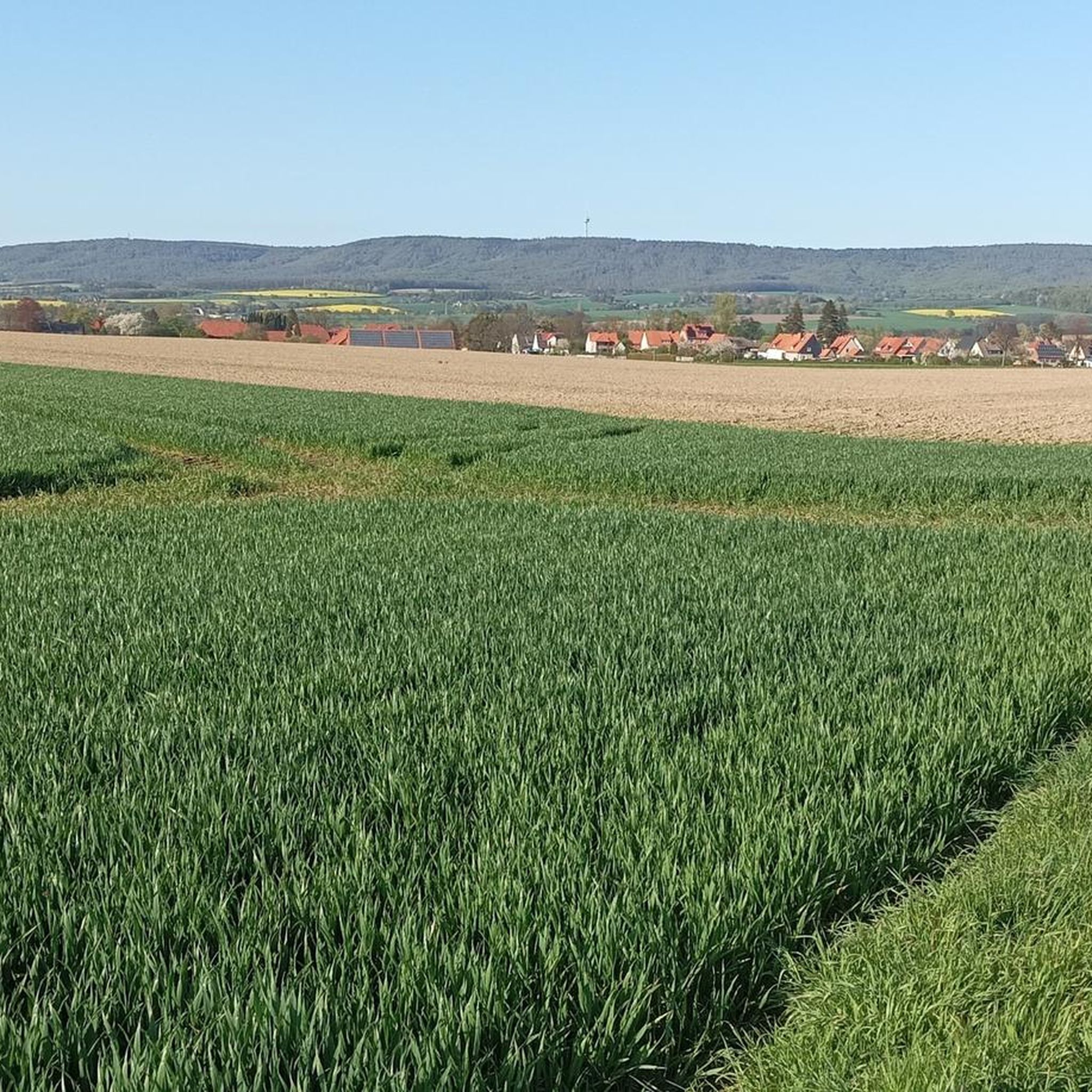
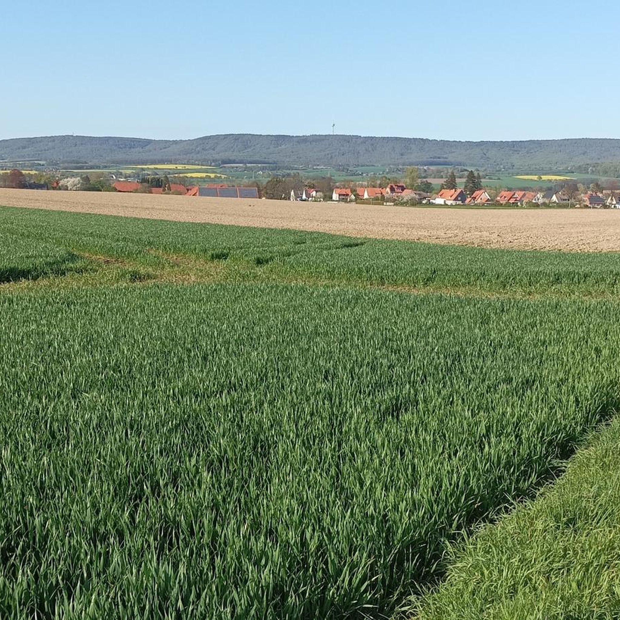
From here, on a clear day, you have a wonderful view of the Weser Mountains on the right and the Süntel on the left.
2
0
Frequently Asked Questions
What are the most popular elevated spots and viewpoints around Hülsede?
The region around Hülsede offers several highly-rated viewpoints. Among the most popular are Nordmannsturm and forest restaurant, which provides panoramic views from its 19-meter observation tower, and Annaturm and Annaturm Forest Inn, another viewpoint with an observation tower and a forest inn for refreshments. Visitors also appreciate the View from Rodenberger Höhe, an observation platform offering great views overlooking the valley.
Are there challenging hiking opportunities near Hülsede?
Yes, for those seeking more demanding trails, the **Süntel** ridge offers significant hiking opportunities, including a challenging 25 km 'Süntel Tour' with a considerable elevation gain of 462 meters. The **Bückeberg** region is also known for its 'Klippentouren' (cliff tours), which are challenging routes with spectacular views and impressive rocky cliffs.
What kind of natural features can I expect to see around Hülsede?
While Hülsede is characterized by gentle hills and lush forests rather than towering peaks, you'll find diverse natural features. The **Süntel** and **Bückeberg** areas offer elevated terrain with panoramic views and rugged landscapes. The Möncheberg, located in the Wesergebirge ridge nature reserve, is known for its ancient beech trees and diverse flora. Additionally, the Hülser Bruch Nature Reserve provides wetlands, meadows, and small streams.
Are there family-friendly hiking options near Hülsede?
Yes, several areas cater to families. While specific family-friendly routes are not detailed, the general vicinity of Hülsede, including sections of the Weserberglandweg, offers relatively flat paths suitable for families. The Annaturm and Annaturm Forest Inn is also categorized as family-friendly, suggesting accessible areas around it.
Where can I find refreshments or a place to eat while hiking?
You'll find options for refreshments at popular viewpoints. The Nordmannsturm and forest restaurant offers a good place to stop for food and drink. Similarly, the Annaturm and Annaturm Forest Inn has a small restaurant. Along the Süntel Tour, you can find places for refreshment like the Gaststätte Süntelturm.
What are some recommended hiking trails near Hülsede?
The region offers a variety of hiking trails. For a challenging experience, consider the 'Totental (Valley of the Dead) – Stairway Trail to Hohenstein loop' or the 'Stairway Trail to Hohenstein – Green Altar Viewpoint loop'. For moderate hikes, try the 'Hülsede Water Castle – Süntel beeches Dachtelfeld loop'. Easier options include the 'Dachtelfeld Shelter – Süntel Beech at Dachtelfeld loop' and 'View of the Weser Uplands – St. Aegidien Church Hülsede loop'. You can find more details on these and other routes in the Hiking around Hülsede guide.
Are there opportunities for mountain biking (MTB) near Hülsede?
Yes, there are several mountain biking trails in the area. Popular routes include the 'Südwehe Viewpoint – Blutbach Spring loop' and the 'Blutbach Spring – View from Hohenstein loop'. Other options are the 'Söltjerbrunnen Fountain – Hamel Spring loop' and the 'Süntel Tower – View of the Weser Valley loop'. Explore more MTB trails in the MTB Trails around Hülsede guide.
What do visitors enjoy most about the elevated spots around Hülsede?
Visitors frequently highlight the fantastic panoramic views, especially from observation towers like the Nordmannsturm, which offers vistas of the Calenberger Land and Weserbergland. The peaceful retreat offered by places like the Möncheberg shelter, surrounded by ancient beech trees and pristine nature, is also highly appreciated.
Can I find historical sites or man-made monuments among the elevated areas?
Yes, several elevated spots also feature historical or man-made monuments. The Nordmannsturm and Annaturm are both observation towers with historical significance. The Barsinghausen Telecommunications Tower is another prominent man-made structure that also serves as a viewpoint.
Are there road cycling routes available near Hülsede's elevated areas?
Yes, road cyclists can enjoy routes that pass through the scenic surroundings of Hülsede. Options include the 'Nienstedter Pass – Caffè Bar B loop' and the 'Nienstedter Pass – Curvy Descent to Nienstedt loop'. For more road cycling adventures, refer to the Road Cycling Routes around Hülsede guide.
What is the Weserberglandweg and is it accessible from Hülsede?
The Weserberglandweg is a long-distance hiking trail stretching over 225 kilometers, known for its breathtaking views. While not directly starting in Hülsede, parts of this trail are accessible in the general vicinity and offer sections suitable for families due to their relatively flat terrain, allowing you to experience the broader Weserbergland region.
What is the best time to visit the elevated areas around Hülsede?
The region is enjoyable throughout the year, but spring and autumn often offer the most pleasant hiking conditions with mild temperatures and beautiful scenery. Summer is also popular, though trails can be busier. Winter hikes are possible, especially in areas like the Deister, but require appropriate gear and caution.
Most popular routes around Hülsede
Most popular attractions around Hülsede

Get inspired with the komoot mobile app


Explore more
See even more amazing summits around Hülsede with these guides:
