The best walks and hikes in Mount Ainslie Nature Reserve
4.4
(61)
2,266
hikers
101
hikes
Hiking in Mount Ainslie Nature Reserve offers a network of trails through diverse landscapes within Canberra, Australia. The reserve is characterized by its prominent Mount Ainslie, an 843-meter peak providing panoramic views of the city and surrounding areas. Trails traverse eucalyptus woodlands, open grasslands, and rocky outcrops, supporting a variety of native flora and fauna. The terrain includes gentle slopes suitable for easy walks and more challenging ascents to the Mount Ainslie lookout.
Best hiking trails in Mount Ainslie Nature Reserve
- The most popular hiking route is Hiking loop from Australian War Memorial, a 2.7 miles (4.4 km) trail that takes 1 hour 25 minutes to complete. This easy route offers a convenient starting point near the city.
- Another top favourite among local hikers is Mount Majura Summit loop from Watson, an easy 3.4 miles (5.4 km) path. This trail provides views of the surrounding hills and valleys.
- Local hikers also love the Mount Majura Summit – Hackett Trailhead loop from Watson, a 4.3 miles (6.9 km) trail leading through varied bushland, often completed in about 2 hours 10 minutes.
- Hiking in Mount Ainslie Nature Reserve is defined by eucalyptus forests, open grasslands, and scenic viewpoints, offering a range of options for different ability levels.
- The routes in Mount Ainslie Nature Reserve are highly rated by the komoot community with an average score of 4.4 stars from over 60 reviews. More than 2,700 hikers have used komoot to explore Mount Ainslie Nature Reserve's varied terrain.
Last updated: July 21, 2026
8
hikers
8.86km
02:24
120m
120m
Moderate hike. Good fitness required. Easily-accessible paths. Suitable for all skill levels.
6
hikers
13.3km
04:18
560m
560m
Moderate hike. Good fitness required. Easily-accessible paths. Suitable for all skill levels.

Sign up for free
4.9
(7)
284
hikers
4.22km
01:24
210m
210m
Easy hike. Great for any fitness level. Easily-accessible paths. Suitable for all skill levels.
5.0
(2)
65
hikers
5.40km
01:46
250m
250m
Easy hike. Great for any fitness level. Easily-accessible paths. Suitable for all skill levels.
4.8
(5)
48
hikers
6.94km
02:11
270m
270m
Moderate hike. Good fitness required. Easily-accessible paths. Suitable for all skill levels.
Get access to more routes and recommendations from other explorers.
Sign up for free
Already have an account?
Our route recommendations are based on thousands of hikes, rides, and runs completed by other people on komoot.
Start today with a free account
Your next adventure awaits.
Login or Signup



Tips from the Community

The Mount Ainslie Lookout is wheelchair accessible from the Mount Ainslie Lookout Bus and Car Park. The large observation deck is paved and has amazing views of Canberra and the Molonglo River. All around the viewing platform are informational plaques describing landmarks that can be seen from up here.
1
0
Mount Majura rises to 890 metres and is the highest peak in suburban Canberra. The summit can be reached by several tracks, including Mount Majura from Mackenzie Street, and the Mount Majura Ssummit loop. The summit is marked with a white Airservices Australia radar tower, and there are nice views from beyond the trees. The area is dog-friendly on a leash, popular with locals, runners, bushwalkers and birdwatchers.
1
0

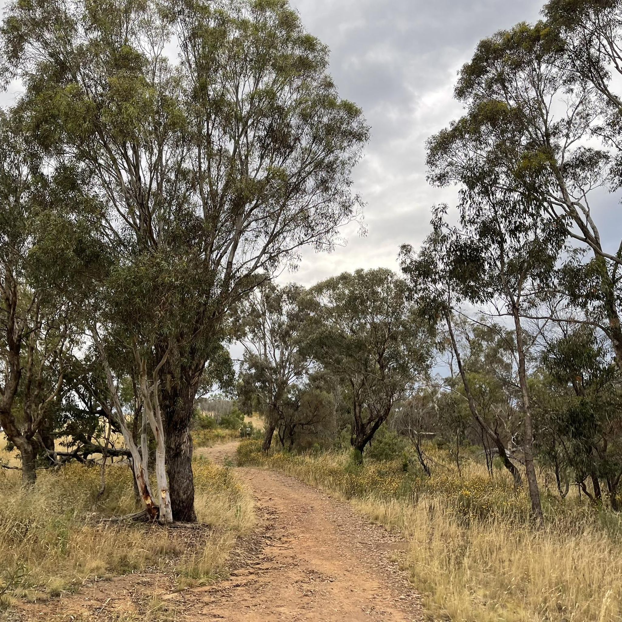
Hancocks Road is a wide management track that makes up part of Mount Ainslie Nature Reserve’s network of walking, cycling, and equestrian routes. Following along the northern base of the mountain, the gravel road runs through open eucalypt woodland and connects to several surrounding trails, including the West 132kVA Track and the Telecom Trail. It’s one of the main connector routes that make up many longer walks throughout the reserve, and the wide track offers plenty of room to walk side by side with a friend to enjoy some conversation.
0
0
Campbell Link Trail is a management track that connects the suburb of Campbell with the trail network in Mount Ainslie Nature Reserve. The wide gravel path passes through open eucalypt woodland and links routes to the summit and several others throughout the reserve, for plenty of options for longer walks around the base of the mountain.
0
0
Mount Ainslie Nature Reserve covers 637 hectares of native bushland on Canberra's northeast edge, adjacent to Mount Majura Nature Reserve. There is a network of shared trails that wind through eucalypt forest, leading to beautiful views of Lake Burley Griffin and the city from the summit. Aside from the popular trails, the reserve also protects critically endangered grassy woodlands and diverse habitats that support threatened birds, rare plants, and native wildlife.
0
0

Late evening views emphasise characteristics of Canberra that one does not get from Mt Ainslie or Black Mountain.
0
0

Great bit of dirt road up behind the houses and the War Memorial.
1
0

Relatively quiet (one way up / one way back) road climb up to the lookout atop Mt Ainslie.
0
0
Frequently Asked Questions
What is the difficulty level of hiking trails in Mount Ainslie Nature Reserve?
Mount Ainslie Nature Reserve offers a variety of trails suitable for different fitness levels. You'll find 61 easy routes, 52 moderate routes, and 4 more challenging options. This ensures there's a suitable path whether you're a beginner or an experienced hiker.
Are there family-friendly hiking options in Mount Ainslie Nature Reserve?
Yes, many trails in Mount Ainslie Nature Reserve are suitable for families. The reserve features numerous easy walks through eucalyptus woodlands and open grasslands. For example, the Hiking loop from Australian War Memorial is an easy 2.7-mile (4.4 km) route that's popular and accessible.
Can I bring my dog on the trails in Mount Ainslie Nature Reserve?
Dogs are permitted in Mount Ainslie Nature Reserve but must be kept on a leash at all times to protect the native wildlife. Please check local signage for any specific restrictions on certain trails or areas within the reserve.
What kind of wildlife can I expect to see while hiking in Mount Ainslie Nature Reserve?
Mount Ainslie Nature Reserve is home to diverse wildlife. You might spot eastern grey kangaroos, wallabies, and various bird species, including rosellas and kookaburras. Keep an eye out for reptiles too, especially on warmer days.
Are there any circular walks in Mount Ainslie Nature Reserve?
Yes, many of the trails in Mount Ainslie Nature Reserve are designed as loops, offering varied scenery without retracing your steps. An example is the Mount Ainslie Lookout – Mount Ainslie Quarry Site II loop from Ainslie, a moderate 6.7-mile (10.8 km) route.
What are some notable landmarks or attractions to see along the trails?
Along the trails, you can explore several interesting points. The Kokoda Memorial Track— Mount Ainslie offers a historical perspective, and the Mount Ainslie Summit Lookout provides panoramic views of Canberra. You can also discover the historical Mount Ainslie Quarry Tramway.
How long does it typically take to hike to the Mount Ainslie summit?
The time it takes to reach the Mount Ainslie summit varies depending on your starting point and pace. A popular moderate route, the Mount Ainslie Lookout – Mount Ainslie Summit Lookout loop from Australian War Memorial, is 10.3 miles (16.5 km) and typically takes around 5 hours to complete.
Is there public transport access to the trailheads?
Yes, some trailheads, particularly those closer to the city, are accessible via public transport. The trailhead near the Australian War Memorial is a common starting point and can be reached by local bus services in Canberra.
Where can I park when visiting Mount Ainslie Nature Reserve?
Parking is available at several points around the reserve. A common and convenient parking area is near the Australian War Memorial, which serves as a popular trailhead for many routes leading up Mount Ainslie.
What do other hikers enjoy most about Mount Ainslie Nature Reserve?
The area is highly rated by the komoot community, with an average score of 4.4 stars from over 60 reviews. Reviewers often praise the stunning panoramic views from the summit, the well-maintained trails, and the opportunity to experience nature so close to the city.
Are there any cafes or facilities near the Mount Ainslie trails?
While there are no cafes directly on the trails within the nature reserve itself, you'll find various cafes and amenities in the nearby suburbs of Ainslie and Campbell, which are just a short drive or walk from many of the trailheads.
What is the best time of year to hike in Mount Ainslie Nature Reserve?
The best time to hike in Mount Ainslie Nature Reserve is generally during spring (September-November) and autumn (March-May) when the weather is mild and pleasant. Summer can be very hot, so early morning or late afternoon hikes are recommended then. Winter offers crisp air and clear views, though it can be chilly.
Most popular routes in Mount Ainslie Nature Reserve
Most popular attractions in Mount Ainslie Nature Reserve

Get inspired with the komoot mobile app


Explore more
Browse the best Hikes in other regions.
