The best MTB trails in Montacute Conservation Park
4.3
(8)
72
riders
2
rides
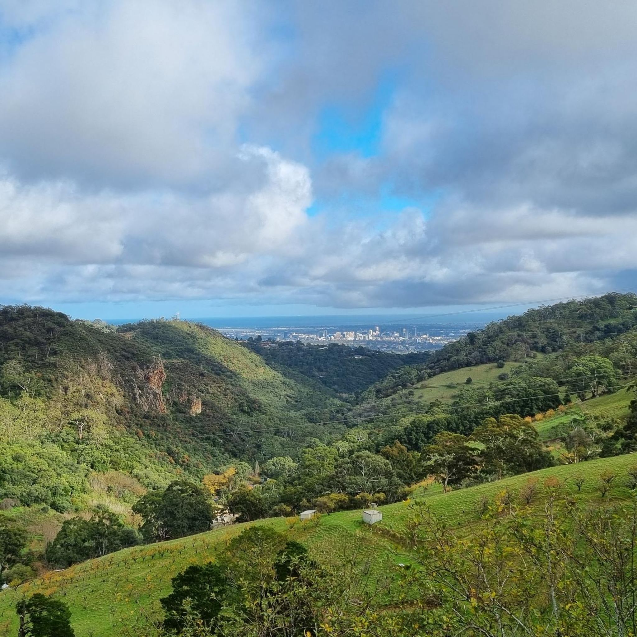
Montacute Conservation Park mountain bike trails navigate a rugged landscape characterized by steep ridges, rocky gullies, and significant elevation changes within the Mount Lofty Ranges. The park's 200 hectares feature diverse vegetation, including towering river red gums along creek lines and woodlands of stringybarks and blue gums on higher slopes. Ancient geological formations, such as Precambrian dolomite rocks and Stonyfell quartzite, are present along the routes. Panoramic views of the Adelaide Plains are available from higher elevations.
Best mountain bike…
Last updated: July 4, 2026
14
riders
39.6km
02:13
210m
210m
Moderate mountain bike ride. Good fitness required. Suitable for all skill levels.
4.0
(1)
3
riders
36.6km
02:32
450m
460m
Moderate mountain bike ride. Good fitness required. Suitable for all skill levels.

Sign up for free
4.6
(7)
10
riders
36.6km
03:17
810m
810m
Hard mountain bike ride. Good fitness required. Advanced riding skills necessary. Some portions of the route may require you to push your bike.
45
riders
33.4km
02:42
690m
690m
Moderate mountain bike ride. Good fitness required. Advanced riding skills necessary.
Our route recommendations are based on thousands of hikes, rides, and runs completed by other people on komoot.
Start today with a free account
Your next adventure awaits.
Login or Signup


Tips from the Community

River Torrens (Karrawirra Pari) is Adelaide’s central river, flowing about 85 kilometres from the Adelaide Hills through the city centre and west to the sea at Henley Beach. Lined by parks, wetlands, and walking trails through much of metropolitan Adelaide, the river supports birdlife, recreation, and important green spaces while also holding deep cultural significance for the Kaurna people, who know it as Karrawirra Pari, meaning “red gum forest river.” Along its course, the river varies from narrow, tree-lined sections and wetlands to more expansive stretches, including the well-known waters of Torrens Lake in central Adelaide.
0
0
River Torrens Linear Park is a long green corridor that follows the River Torrens (Karrawirra Pari) through Adelaide, linking parks, wetlands, picnic areas, and shared-use trails from the Adelaide Hills to the coast at Henley Beach. Established to improve river health and public access, the park combines open lawns, native vegetation, wetlands, playgrounds, and shaded riverbanks that support birdlife and recreation throughout the city. Its mostly flat, continuous pathway makes it popular for walking and cycling, with multiple access points connecting the surrounding suburbs and reserves.
0
0
Torrens Linear Parkway is a long, 35-kilometre shared walking and cycling route that follows the River Torrens (Karrawirra Pari) through Adelaide, connecting parklands, wetlands, and riverside reserves from the hills to the coast. This section is an easy walk through Adelaide’s eastern suburbs along the peaceful riverside corridor under river red gums and through pockets of wetland vegetation. Along the way, you’ll pass open parklands and quiet stretches of water before reaching Lochiel Park, an environmentally focused reserve with wetlands, picnic areas, and additional walking loops for plenty of options to extend your walk.
0
0

This viewpoint along the ridgeline of Mount Osmond have great views of the city to one side and the surrounding mountains an valleys on the other.
1
0
Located just 22 kilometres from Adelaide's CBD, this national park has rich plant and animal life and wonderful geologic features like Mount Lofty and Waterfall Gully. The park sits on shared territory of the Kaurna and Peramangk people, who have called this area home for millennia. The park also holds the Cleland Wildlife Park, which allows visitors to get up close to a variety of native wildlife.
0
0

Set along the Torrens Linear Track, this viewpoint looks across the River Torrens toward the Adelaide Convention Centre and surrounding city skyline. The modern footbridge spans the river in the foreground, with clear reflections on calmer days, making it a great spot to pause and take in the scenery.
0
0
Bartrill Spur Track is a relatively steep path that climbs the hillside above the reserve. The narrow track ascends through native eucalyptus woodland, gaining elevation as it winds toward the higher ridgelines of the hills’ face. Along the climb, there are occasional gaps in the trees with beautiful views across the foothills toward Adelaide.
0
0
This multi-use track winds through the quiet valley of the reserve, climbing gradually through eucalyptus woodland, and follows the gully past rocky slopes and seasonal creek lines. Compared with the nearby Waterfall Gully to Mount Lofty Summit Trail, it offers a more secluded route through natural bushland. However, it is a shared trail used by walkers, runners, and mountain bikers, so keep an eye out for other users while enjoying the peaceful bush setting.
0
0
Frequently Asked Questions
What kind of terrain can I expect when mountain biking in Montacute Conservation Park?
Montacute Conservation Park offers rugged terrain with steep ridges, rocky gullies, and significant elevation changes. The trails often involve strenuous climbs and descents through diverse bushland, including areas with towering river red gums along creek lines and woodlands of stringybarks and blue gums on higher slopes.
Are there any beginner-friendly mountain bike trails in Montacute Conservation Park?
The mountain bike routes in Montacute Conservation Park are generally considered challenging. Based on available data, all listed routes are rated as 'moderate' or 'difficult', indicating that the park is better suited for experienced riders seeking demanding routes rather than beginners.
What natural features or landmarks can I see along the mountain bike trails?
While riding, you can encounter ancient geological formations like Precambrian dolomite rocks (over 570 million years old) and Stonyfell quartzite outcrops. Higher elevations offer panoramic views of the Adelaide Plains. The park also features several small creeks lined with river red gums, contributing to its natural beauty.
Is Montacute Conservation Park suitable for family mountain biking?
Due to the rugged terrain, steep climbs, and challenging nature of the trails, Montacute Conservation Park is generally not recommended for casual family rides or young children. The routes are more suited for experienced riders looking for a physically demanding experience.
Are dogs allowed on the mountain bike trails in Montacute Conservation Park?
Montacute Conservation Park is a conservation area, and generally, dogs are not permitted on trails to protect wildlife and natural habitats. It's always best to check the official park regulations for the most current information regarding pets before your visit: parks.sa.gov.au.
What is the best time of year to go mountain biking in Montacute Conservation Park?
The Mount Lofty Ranges, where Montacute Conservation Park is located, can experience hot summers. Spring and autumn generally offer more pleasant temperatures for mountain biking. Winters can be cooler and wetter, potentially making some trails muddy and more challenging. Always check weather forecasts before heading out.
Where can I park when visiting Montacute Conservation Park for mountain biking?
Parking is typically available at designated entry points to the park. Specific parking areas may vary depending on which section of the park you plan to access. It's advisable to check local signage upon arrival for official parking locations.
Do I need a permit to mountain bike in Montacute Conservation Park?
While the park officially states there are no designated mountain biking trails, some walking and cycling tracks are used by mountain bikers. It's important to be aware that bikes are generally not permitted on designated walking tracks. For specific permit requirements or regulations regarding cycling on shared paths, consult the official park website: parks.sa.gov.au.
What kind of wildlife might I encounter while mountain biking?
The park is home to a variety of birdlife. You may also spot native Australian animals such as kangaroos, emus, and echidnas, particularly during quieter times of the day. Please ride responsibly and respect the wildlife.
Are there any cafes or amenities near Montacute Conservation Park?
Montacute Conservation Park is primarily a natural bushland area. For cafes, pubs, or other amenities, you would typically need to visit nearby towns or suburbs such as Lobethal or Highbury, which are starting points for some of the routes.
How long do mountain bike rides typically take in Montacute Conservation Park?
The duration of rides varies depending on the route and your pace. For example, the Gorge Weir – Kangaroo Creek Reservoir loop from Highbury is a 42.8 km trail that typically takes around 3 hours 29 minutes, while the Earth Tank, Farm Dam loop from Lobethal, at 36.6 km, is often completed in about 2 hours 31 minutes.
What do other mountain bikers say about the trails in Montacute Conservation Park?
The routes in Montacute Conservation Park are highly rated by the komoot community, with an average score of 4.3 stars from over 8 reviews. Riders often praise the challenging nature of the terrain, the diverse bushland, and the rewarding views from higher elevations.
Are there any particularly difficult mountain bike routes for expert riders?
Yes, for expert riders seeking a significant challenge, routes like the Mount Osmond Trails loop from Magill (36.9 km with nearly 800m elevation gain) or the Debney's Gravel Road – Cypress Hotel loop from Magill (48 km with over 1000m elevation gain) are rated as 'difficult' and offer demanding experiences with substantial climbs and descents.
Most popular routes in Montacute Conservation Park

Get inspired with the komoot mobile app


Explore more
Browse the best MTB trails in other regions.
