The best MTB trails in Coralinga Forest Reserve
4.0
(1)
19
riders
1
ride
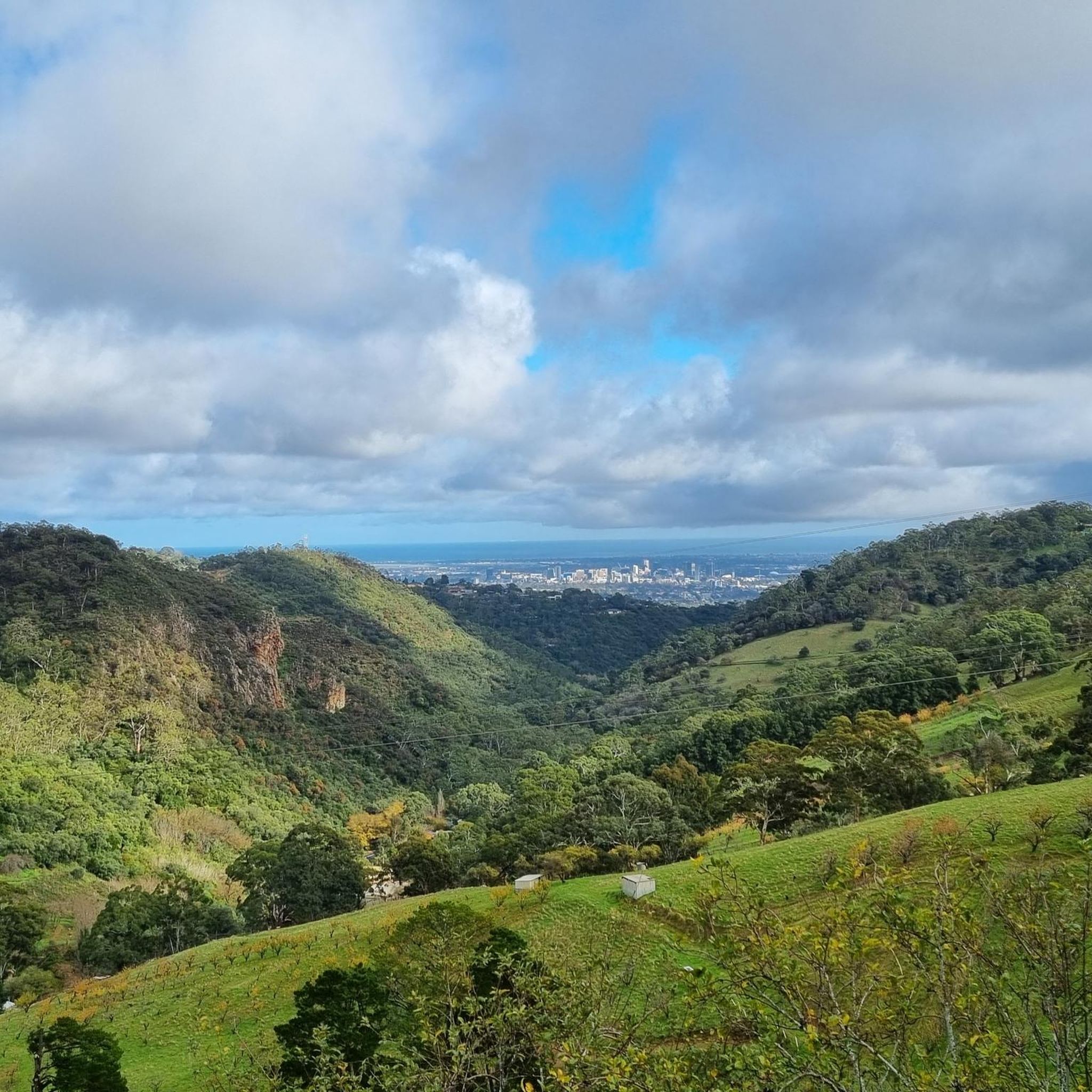
Mountain biking in Coralinga Forest Reserve offers a diverse range of trails within its 933.0 acres (377.7 hectares) of native vegetation. The landscape features native forest, woodland, and shrubland, with areas described as rocky, hilly, and thickly timbered with stringybark. This varied terrain provides a natural setting for mountain bike routes, including both downhill and cross-country options. The reserve's extensive trail network caters to different skill levels, with natural, hand-cut trails that incorporate features like loose-on-hardpack, dirt, rocks, and natural…
Last updated: July 4, 2026
4.0
(1)
3
riders
36.6km
02:32
450m
460m
Moderate mountain bike ride. Good fitness required. Suitable for all skill levels.
2
riders
57.7km
04:31
810m
810m
Moderate mountain bike ride. Good fitness required. Suitable for all skill levels.

Sign up for free
14
riders
39.6km
02:13
210m
210m
Moderate mountain bike ride. Good fitness required. Suitable for all skill levels.
Our route recommendations are based on thousands of hikes, rides, and runs completed by other people on komoot.
Start today with a free account
Your next adventure awaits.
Login or Signup




Tips from the Community

River Torrens (Karrawirra Pari) is Adelaide’s central river, flowing about 85 kilometres from the Adelaide Hills through the city centre and west to the sea at Henley Beach. Lined by parks, wetlands, and walking trails through much of metropolitan Adelaide, the river supports birdlife, recreation, and important green spaces while also holding deep cultural significance for the Kaurna people, who know it as Karrawirra Pari, meaning “red gum forest river.” Along its course, the river varies from narrow, tree-lined sections and wetlands to more expansive stretches, including the well-known waters of Torrens Lake in central Adelaide.
0
0
River Torrens Linear Park is a long green corridor that follows the River Torrens (Karrawirra Pari) through Adelaide, linking parks, wetlands, picnic areas, and shared-use trails from the Adelaide Hills to the coast at Henley Beach. Established to improve river health and public access, the park combines open lawns, native vegetation, wetlands, playgrounds, and shaded riverbanks that support birdlife and recreation throughout the city. Its mostly flat, continuous pathway makes it popular for walking and cycling, with multiple access points connecting the surrounding suburbs and reserves.
0
0
Torrens Linear Parkway is a long, 35-kilometre shared walking and cycling route that follows the River Torrens (Karrawirra Pari) through Adelaide, connecting parklands, wetlands, and riverside reserves from the hills to the coast. This section is an easy walk through Adelaide’s eastern suburbs along the peaceful riverside corridor under river red gums and through pockets of wetland vegetation. Along the way, you’ll pass open parklands and quiet stretches of water before reaching Lochiel Park, an environmentally focused reserve with wetlands, picnic areas, and additional walking loops for plenty of options to extend your walk.
0
0

Set along the Torrens Linear Track, this viewpoint looks across the River Torrens toward the Adelaide Convention Centre and surrounding city skyline. The modern footbridge spans the river in the foreground, with clear reflections on calmer days, making it a great spot to pause and take in the scenery.
0
0

The University of Adelaide Footbridge was built in 1937, part of the Adelaide City Council's contribution to South Australia's Centenary in 1936. In 1971, there was a prank on Prosh Day in which engineering students suspended a car hanging from the bridge under the cover of night. This prank is still talked about as part of Adelaide University folklore.
1
0
Looking out across the river, five origami-like boats sit on the water, part of Shaun Kirby’s Talking Our Way Home installation on the Karrawirra Pari, also known as the River Torrens. Taking a look at the boats, there is writing, which is letters written to loved ones by migrants in the 19th and 20th centuries who immigrated here.
0
0
In this area, there are wild bats, and here is a warning sign for them. They are flying foxes and keep an eye up in the trees for them. Never touch them, as they can carry diseases. Keep a distance from the trees they are in, and avoid walking under them.
0
0

Along the dammed Torrens River, beautiful green spaces and sports facilities in the middle of the city
0
0
Frequently Asked Questions
What kind of terrain can I expect on mountain bike trails in Coralinga Forest Reserve?
Coralinga Forest Reserve offers diverse terrain for mountain biking. You'll find natural, hand-cut trails with features like loose-on-hardpack, dirt, and rocks. Some sections include small kickers, tree stumps, natural techy descents, and rock gardens. The landscape is characterized by native forest, woodland, and shrubland, with areas that are rocky, hilly, and thickly timbered with stringybark.
Are there any loop trails for mountain biking in Coralinga Forest Reserve?
Yes, several mountain bike routes in and around Coralinga Forest Reserve are designed as loops. For example, you can explore the Earth Tank, Farm Dam loop from Lobethal, which is a moderate 22.8 miles (36.6 km) ride. Another option is the longer Richard Mills Reserve loop from Oakbank, covering 35.8 miles (57.6 km).
What is the best time of year to go mountain biking in Coralinga Forest Reserve?
The temperate climate of Coralinga Forest Reserve, with mild winters and warm summers, makes it suitable for mountain biking year-round. However, conditions can vary. It's always a good idea to check local weather forecasts and trail conditions before heading out, especially during periods of heavy rain or extreme heat.
Are there any family-friendly mountain bike trails in Coralinga Forest Reserve?
While the listed routes are generally moderate in difficulty, the reserve's extensive network includes trails of varying levels. The natural, hand-cut trails offer a mix of flow and technical challenges. For families, it's recommended to assess individual trail descriptions and difficulty ratings on komoot to find routes that best suit their skill and experience levels.
Can I bring my dog on the mountain bike trails in Coralinga Forest Reserve?
Coralinga Forest Reserve is managed by ForestrySA, which focuses on conserving indigenous plant and animal communities. While many reserves have specific rules regarding dogs, it's best to check the latest regulations directly with ForestrySA or local signage to confirm their policy on dogs on mountain bike trails.
What are the typical elevations and distances for mountain bike routes in the area?
The mountain bike routes in and around Coralinga Forest Reserve vary in length and elevation. For instance, the Gorge Weir – Kangaroo Creek Reservoir loop from Highbury is 26.6 miles (42.8 km) long with an elevation gain of approximately 887 meters. Another route, the Hope Valley Reservoir Reserve loop from Highbury, covers 40.5 miles (40.5 km) with about 219 meters of elevation gain.
Are there any specific viewpoints or natural features to look out for while mountain biking?
The reserve is known for its diverse natural beauty, including native forest, woodland, and shrubland, with areas described as rocky and thickly timbered with stringybark. While specific named viewpoints are not highlighted, the varied landscapes themselves offer scenic riding experiences. Keep an eye out for the diverse flora and fauna that contribute to the reserve's idyllic setting.
What do other mountain bikers enjoy most about Coralinga Forest Reserve?
The mountain bike routes in Coralinga Forest Reserve are highly rated by the komoot community, with an average score of 4.0 stars. Riders often praise the diverse native forests, rocky sections, and extensive trail networks that offer options for different ability levels, from flowing sections to technical challenges.
Is there parking available for mountain bikers at Coralinga Forest Reserve?
While specific parking areas are not detailed in the guide, forest reserves typically provide designated parking facilities near trailheads. It is advisable to check maps or local signage upon arrival to locate the most convenient parking for mountain biking access.
Are there any cafes or pubs near Coralinga Forest Reserve for post-ride refreshments?
Coralinga Forest Reserve is located near Cherryville, South Australia, and is also accessible from towns like Lobethal, Oakbank, and Highbury. These nearby towns offer various amenities, including cafes and pubs, where you can find refreshments after your ride.
What kind of wildlife might I encounter while mountain biking in Coralinga Forest Reserve?
As an IUCN Category IV Reserve, Coralinga Forest Reserve is important for habitat and species management. It is home to diverse flora and fauna. While mountain biking, you might encounter various native birds and other wildlife typical of Australian native forests and woodlands. Always ride respectfully and be aware of your surroundings.
What is the general difficulty level of mountain bike trails in Coralinga Forest Reserve?
The mountain bike trails in Coralinga Forest Reserve cater to a range of skill levels. The routes listed in this guide are all rated as moderate, indicating they require a reasonable level of fitness and some technical skill. However, the extensive network includes options from flowing sections to more technical challenges, so you can find trails that match your ability.
Most popular routes in Coralinga Forest Reserve

Get inspired with the komoot mobile app


Explore more
Browse the best MTB trails in other regions.
