The best walks and hikes in Freycinet National Park
4.6
(327)
3,723
hikers
11
hikes
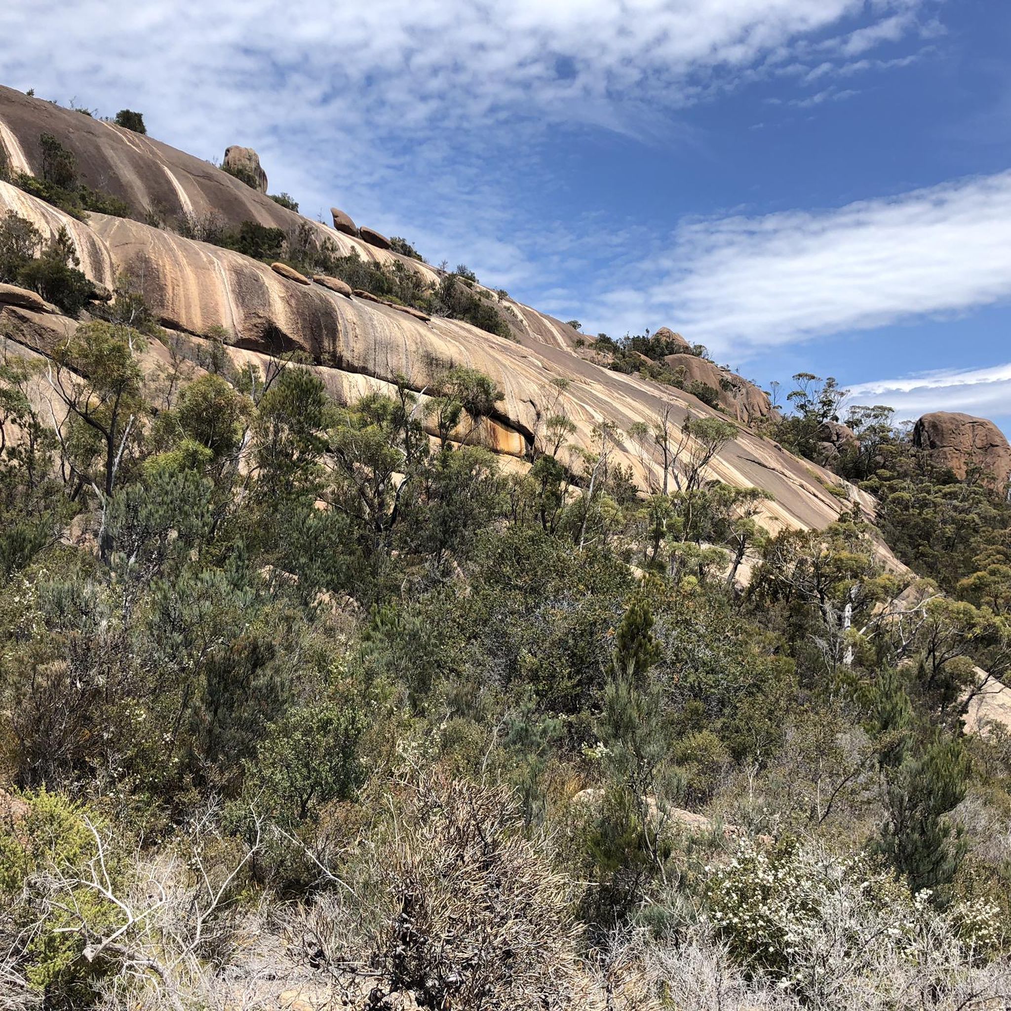
Hiking in Freycinet National Park traverses a landscape characterized by dramatic pink granite peaks, secluded bays, and pristine white sandy beaches. The region features coastal cliffs, dense forests, and diverse terrain ranging from sea level to hills over 200 meters. These physical features provide a variety of hiking experiences across the Freycinet Peninsula, with an interior comprising dry sclerophyll forests and heathlands.
Best hiking trails in Freycinet National Park
- The most popular hiking route is Coles Bay Lookout – Wineglass Bay Lookout loop from Honeymoon Bay, a 1.9 miles (3.0 km) trail that takes 1 hour 10 minutes to complete. This moderate route offers views of Hazards Beach and the coastline.
- Another top favourite among local hikers is Mount Amos Track, a difficult 2.6 miles (4.2 km) path. This trail involves a steep climb over granite slabs, leading to panoramic views of Wineglass Bay.
- Local hikers also love the Wineglass Bay Lookout loop, a 1.9 miles (3.0 km) trail leading through coastal heathland, often completed in about 1 hour 10 minutes.
- Hiking in Freycinet National Park is defined by pink granite peaks, white sandy beaches, and coastal paths. The network offers options for different ability levels, from easy strolls to challenging ascents.
- The routes in Freycinet National Park are highly rated by the komoot community with an average score of 4.6 stars from over 390 reviews. More than 4,000 hikers have used komoot to explore Freycinet National Park's varied terrain.
Last updated: July 15, 2026
4.9
(163)
1,384
hikers
11.7km
03:24
250m
250m
Moderate hike. Good fitness required. Mostly accessible paths. Sure-footedness required.
4.7
(61)
816
hikers
2.99km
01:10
150m
150m
Moderate hike. Great for any fitness level. Mostly accessible paths. Sure-footedness required.

Sign up for free
4.9
(41)
590
hikers
4.16km
02:28
390m
390m
Hard hike. Good fitness required. Sure-footedness, sturdy shoes and alpine experience required.
5.0
(1)
87
hikers
8.91km
03:01
340m
340m
Moderate hike. Good fitness required. Mostly accessible paths. Sure-footedness required.
4.9
(29)
519
hikers
6.03km
02:15
330m
330m
Moderate hike. Good fitness required. Mostly accessible paths. Sure-footedness required.
Get access to more routes and recommendations from other explorers.
Sign up for free
Already have an account?
Our route recommendations are based on thousands of hikes, rides, and runs completed by other people on komoot.
Start today with a free account
Your next adventure awaits.
Login or Signup
Popular around Freycinet National Park
Tips from the Community

No Merlot here — the shelf stands empty, quiet, waiting for a bottle that never comes. Kein Merlot hier — das Regal bleibt leer, still, wartend auf eine Flasche, die nie kommt. Pas de Merlot ici — l'étagère reste vide, silencieuse, attendant une bouteille qui n'arrive jamais. No hay Merlot aquí — el estante queda vacío, silencioso, esperando una botella que nunca llega.
0
0

Peninsula Track is a picturesque coastal walking route that connects Hazards Beach, Wineglass Bay, and the northern end of the Freycinet Peninsula, winding through a mix of bushland and exposed shoreline. The track follows sandy beaches and low coastal scrub, with sections that pass lagoons and wetlands behind the dunes, and is a quieter and more varied alternative to the main lookout route. It’s also part of the longer Freycinet Peninsula Circuit, giving it a more remote feel with fewer crowds and plenty of wildlife, including wallabies and a variety of seabirds.
0
0

This lookout point is quite the reward for the hike to get here! Turquoise water, a white-sand beach, and hills surrounding the bay, all seen from above. You may choose to descend to this beach via the "1000 Stairs," but be aware that you are descending first; that's the easy part. You then must climb back up.
1
0
Wineglass Bay Track is impressively well-maintained, with stone steps, guardrails, clear signage, and jaw-dropping viewpoints. The boulder fields have interestingly shaped giant stones that really invoke the imagination.
1
0
As you weave in and out of this impressive boulder field, check out this balanced rock; it's a great spot for a photo. This rock formation is one of Tasmania's famous pink-and-orange granite formations in the Hazards Mountain range. These huge, rounded boulders were created from ancient molten granite that slowly cooled far beneath the Earth's surface 370 million years ago. Over time, they became exposed through uplift and erosion.
1
0
This purpose-built lookout provides the park’s signature view over the perfectly curved shoreline and turquoise water of Wineglass Bay. Set on the saddle between the Hazards peaks, it offers an elevated panoramic vantage point, framed by granite mountains and dense coastal bushland. The spacious viewing platform includes seating and railings, making it a comfortable place to pause and take in one of Tasmania’s most iconic coastal vistas.
0
0
Hazards Beach Track forms the southern leg of the circuit, linking Wineglass Bay with the long, quieter shoreline of Hazards Beach. The route crosses low coastal woodland and sandy sections behind the dunes, offering a contrast to the granite scenery on the Wineglass Bay side. It is roughly 4 kilometres between the beaches and is a peaceful stretch of walking with opportunities for wildlife sightings and plenty of ocean views.
0
0
From this spot at the summit of Mount Amos, Wineglass Bay stretches below in a perfect crescent of white sand and turquoise water. The pink‑granite Hazards rise around the bay, framing one of Tasmania’s most iconic vistas. On clear days, the view extends across the Freycinet Peninsula and out to the Tasman Sea, making this one of the state’s most celebrated viewpoints.
0
0
Frequently Asked Questions
How many hiking trails are available in Freycinet National Park?
Freycinet National Park offers a diverse range of hiking experiences with over 10 routes documented on komoot. These trails cater to various fitness levels, from easy strolls to challenging ascents, allowing you to explore the park's unique landscapes.
What types of terrain can I expect on hikes in Freycinet National Park?
Hiking in Freycinet National Park features a varied landscape. You'll encounter dramatic pink granite peaks, pristine white sandy beaches, coastal cliffs, and dense forests. Trails range from sea level paths to ascents over 200 meters, offering a rich mix of environments.
Are there any easy hikes suitable for families or those seeking a gentle walk?
Yes, Freycinet National Park has several easy trails. For a relatively short and scenic option, consider the Coles Bay Lookout – Wineglass Bay Lookout loop from Honeymoon Bay. This moderate 3 km route offers beautiful views and is a good introduction to the park's coastal beauty.
Where can I find panoramic views of Wineglass Bay?
For iconic panoramic views of Wineglass Bay, the Wineglass Bay Lookout is a must-visit. A moderate hike, such as the Wineglass Bay Lookout – Wineglass Bay Beach loop from Honeymoon Bay, will lead you to this breathtaking viewpoint. For a more challenging ascent with even more expansive vistas, the Mount Amos loop from Honeymoon Bay provides extraordinary views down onto Wineglass Bay and across much of the Freycinet Peninsula.
Are there any challenging hikes for experienced trekkers?
Absolutely. For experienced hikers, the Mount Amos loop from Honeymoon Bay is a difficult 4.2 km path involving a steep climb over granite slabs. It requires good fitness and sure-footedness but rewards with unparalleled views of Wineglass Bay and the surrounding area.
Can I find circular hiking routes in Freycinet National Park?
Yes, there are several excellent circular routes. A popular moderate option is the Hazards Beach – Coles Bay Lookout loop from The Fisheries, which is about 10.6 km long and offers views of Hazards Beach and the coastline. Another great loop is the Wineglass Bay Lookout – Wineglass Bay Beach loop from Honeymoon Bay, a 6.1 km trail that takes you through coastal heathland to the famous bay.
What natural features or landmarks can I see along the trails?
Freycinet National Park is rich in natural landmarks. You can explore the iconic Wineglass Bay Lookout, relax on Hazards Beach, and admire the dramatic pink granite peaks known as The Hazards. Other notable spots include Honeymoon Bay, Sleepy Bay with its colorful red rocks, and the sweeping coastal views from the Cape Tourville Lighthouse Walk.
What do other hikers enjoy most about hiking in Freycinet National Park?
The area is highly rated by the komoot community, with an average score of 4.6 stars from nearly 300 reviews. Reviewers often praise the stunning coastal scenery, the pristine beaches, and the diverse range of trails that cater to all abilities, from gentle walks to challenging climbs with rewarding views.
Are there any trails that lead directly to a beach?
Yes, many trails offer access to the park's beautiful beaches. The Wineglass Bay Lookout – Wineglass Bay Beach loop from Honeymoon Bay will take you down to the sands of Wineglass Bay itself. Additionally, the Hazards Beach – Coles Bay Lookout loop from The Fisheries provides access to the secluded Hazards Beach.
What kind of wildlife might I encounter while hiking?
Freycinet National Park is home to diverse wildlife. While hiking, you might spot wallabies, wombats, and echidnas. The park is also a haven for various bird species. Along the coast, there are opportunities to see marine life such as dolphins and, during migration seasons, whales.
What is the best time of year to go hiking in Freycinet National Park?
Freycinet National Park is beautiful year-round, but the shoulder seasons (spring and autumn) generally offer the most pleasant hiking conditions with mild temperatures and fewer crowds. Summer can be warm, ideal for combining hikes with swimming, while winter offers crisp air and dramatic skies, though some trails might be more challenging due to weather.
Most popular routes in Freycinet National Park
Most popular attractions in Freycinet National Park

Get inspired with the komoot mobile app


Explore more
Browse the best Hikes in other regions.
