The best walks and hikes in Bälsalvret
4.5
(17)
35
hikers
7
hikes
Hiking trails in Bälsalvret traverse a diverse landscape characterized by water-rich fens and ancient gravel ridges. This nature reserve in Gotland, Sweden, features groundwater springs that support unique plant life and flowing watercourses. Old spruce and pine trees grow on the gravel ridges, some of which are former ancient sea beaches. The area offers a tranquil environment for exploration.
Best hiking trails in Bälsalvret
- The most popular hiking route is Hiking loop from Burggathagens naturreservat, a 5.5 miles (8.9…
Last updated: July 12, 2026
5.0
(1)
5
hikers
8.85km
02:16
40m
40m
Moderate hike. Good fitness required. Easily-accessible paths. Suitable for all skill levels.
4.7
(6)
8
hikers
13.2km
03:25
70m
70m
Moderate hike. Good fitness required. Easily-accessible paths. Suitable for all skill levels.

Sign up for free
4.8
(4)
8
hikers
8.30km
02:06
20m
20m
Moderate hike. Good fitness required. Easily-accessible paths. Suitable for all skill levels.
1
hikers
Easy hike. Great for any fitness level. Easily-accessible paths. Suitable for all skill levels.
4.8
(4)
7
hikers
6.89km
01:45
20m
20m
Easy hike. Great for any fitness level. Easily-accessible paths. Suitable for all skill levels.
Get access to more routes and recommendations from other explorers.
Sign up for free
Already have an account?
Our route recommendations are based on thousands of hikes, rides, and runs completed by other people on komoot.
Start today with a free account
Your next adventure awaits.
Login or Signup
Popular around Bälsalvret

Tips from the Community

Very beautiful path. Although no longer boggy.
0
0

Viking grave made of boulders in boat shape
0
0

The ship setting Tjelvars Grave (Swedish: Tjelvars grav) is located on a small side road about 1.3 km west of Länsvägs 146, near Tjälder, south of Boge. It is located in an area with other prehistoric and early historical evidence, which consists of two Iron Age forts, a small burial ground and individual stone settings. The ship setting, like other ship settings of this type on Gotland, is dated to the Late Bronze Age. https://de.wikipedia.org/wiki/Tjelvars_Grab
0
0

The cliffs on each side of this road once served as ancient fortresses. On rock fortresses, like the ancient fortresses at Tjælder, easily accessible places have been reinforced with walls. Walls and ramparts may have been crowned by wooden palisades like the illustration above. When the ancient castle at Tjälder was active, there was a lake at the northern end, Mästermyr, which today is farmed. At the southern end of the lake was the large Bronze Age cairn Majster rojr. A road towards Gane in Bäl used to go past the ancient towns. It is believed that the road may date back to the Bronze Age, as it passes many ancient remains from the Bronze Age.
0
0
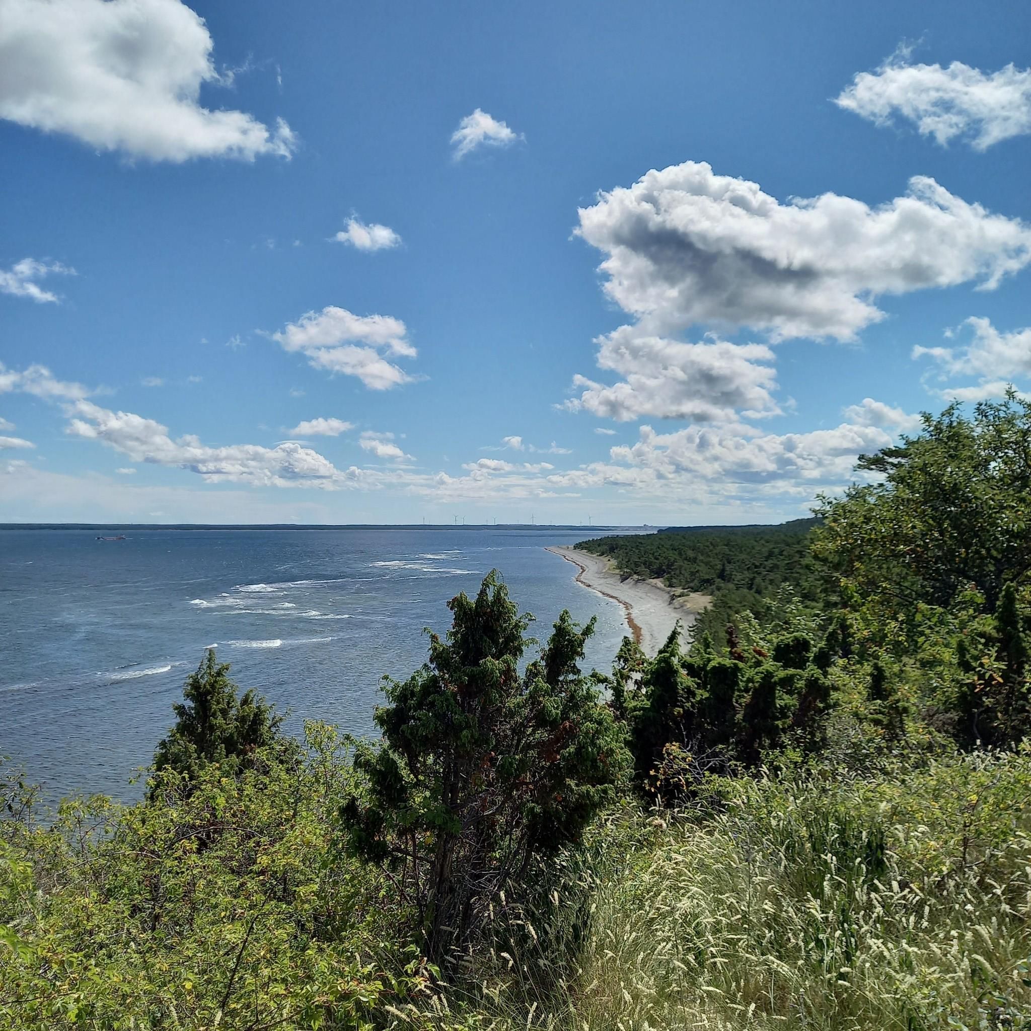
Beautiful nature experience, forest and sea end a sunny and blue sky.
0
0
Frequently Asked Questions
What kind of landscape can I expect to see while hiking in Bälsalvret?
Bälsalvret is known as a 'water's kingdom,' featuring rich fens, flowing watercourses, and groundwater springs that support unusual plants and mosses. You'll also traverse ancient gravel ridges, some of which were former sea beaches, adorned with old spruce and pine forests. The diverse environment offers a tranquil and immersive experience.
How many hiking trails are available in Bälsalvret?
There are 7 hiking trails available in Bälsalvret, ranging from easy to moderate difficulty, offering various options for exploration.
Are there any easy hiking trails suitable for beginners in Bälsalvret?
Yes, Bälsalvret offers easy trails perfect for beginners. One such option is the Tjelvar's Grave – Tjälder Ancient Fortress loop from Vitvikens Strand, which is 5.5 km long and takes about 1 hour 24 minutes to complete.
Are there any circular walks in Bälsalvret?
Yes, many of the trails in Bälsalvret are circular, allowing you to start and end at the same point. For example, the Gothemhammar – View of the Landscape loop from Hammarbo is an easy 6.9 km circular route.
What do other hikers enjoy the most about hiking in Bälsalvret?
The area is highly rated by the komoot community, with an average score of 4.5 stars from over 15 reviews. Hikers often praise the tranquil environment, the unique water-rich fens, and the ancient forests that make for a peaceful and engaging outdoor experience.
Is Bälsalvret suitable for family-friendly hikes?
Yes, Bälsalvret offers several easy trails that are well-suited for families. The diverse landscape with its unique flora and ancient geological features provides an interesting environment for children to explore.
What is the best time of year to hike in Bälsalvret?
Bälsalvret offers beauty throughout the year. In autumn, the ground is vibrant with a variety of colorful mushrooms, making it a picturesque time for nature enthusiasts. The water-rich environment and old-growth forests are appealing in spring and summer as well.
Can I bring my dog on the hiking trails in Bälsalvret?
As a nature reserve, Bälsalvret generally welcomes dogs, but they must be kept on a leash to protect the wildlife and sensitive plant life, especially in areas with groundwater springs and unique flora. Always check local signage for specific regulations.
Are there any viewpoints or notable natural features to look out for?
While hiking, you'll encounter several notable natural features. Keep an eye out for the groundwater springs and the unusual plants they foster. The ancient gravel ridges, which were once part of the Littorina Sea, also offer unique topographical elements and views within the old spruce and pine forests.
What is the longest hiking trail in Bälsalvret?
The longest hiking trail available is the Hejnum Church loop from Hejnum hällars naturreservat, a moderate 13.2 km path that takes approximately 3 hours 25 minutes to complete.
Are there any moderate difficulty trails for more experienced hikers?
Yes, for those seeking a more challenging experience, Bälsalvret has 5 moderate trails. A popular choice is the Hiking loop from Burggathagens naturreservat, which is 8.9 km long and takes about 2 hours 17 minutes.
What kind of unique plant life can be found in Bälsalvret?
Due to its groundwater springs and rich fens, Bälsalvret is home to unusual plants and mosses. The reserve's protected status as a Natura 2000 area ensures the preservation of this unique biodiversity, making it a fascinating spot for botanists and nature lovers.
Most popular routes in Bälsalvret

Get inspired with the komoot mobile app


Explore more
Browse the best Hikes in other regions.
