The best cycling routes in Vilnios Hidrografinis Draustinis
4.5
(135)
1,151
riders
44
rides
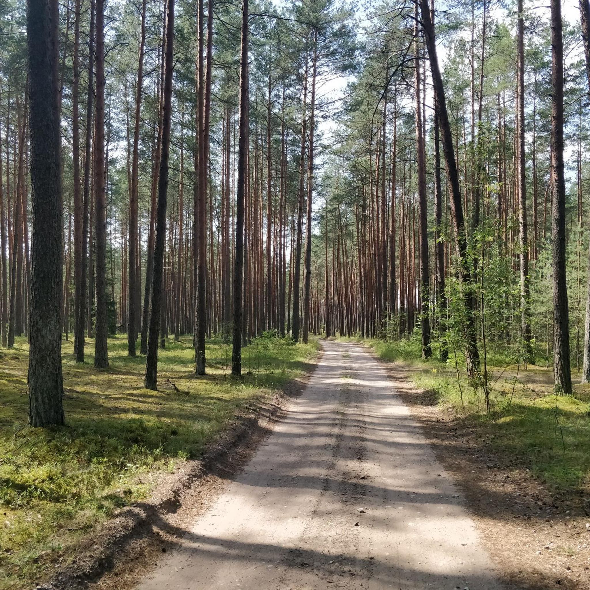
Touring cycling in Vilnios Hidrografinis Draustinis offers routes through a diverse landscape centered around the meandering Vilnia River. This hydrographic reserve spans 1222 hectares, featuring extensive wooded territories with spruce, birch, and pine trees, interspersed with sunny meadows. Cyclists encounter varied terrain, including both paved and unpaved sections, within a shallow floodplain valley. The area provides a mix of gentle undulations and flatter river-side paths suitable for different cycling preferences.
Best touring cycling routes in Vilnios Hidrografinis Draustinis
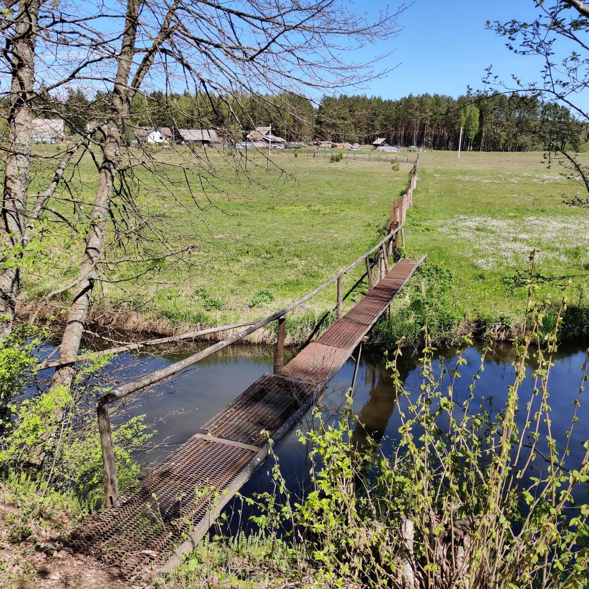
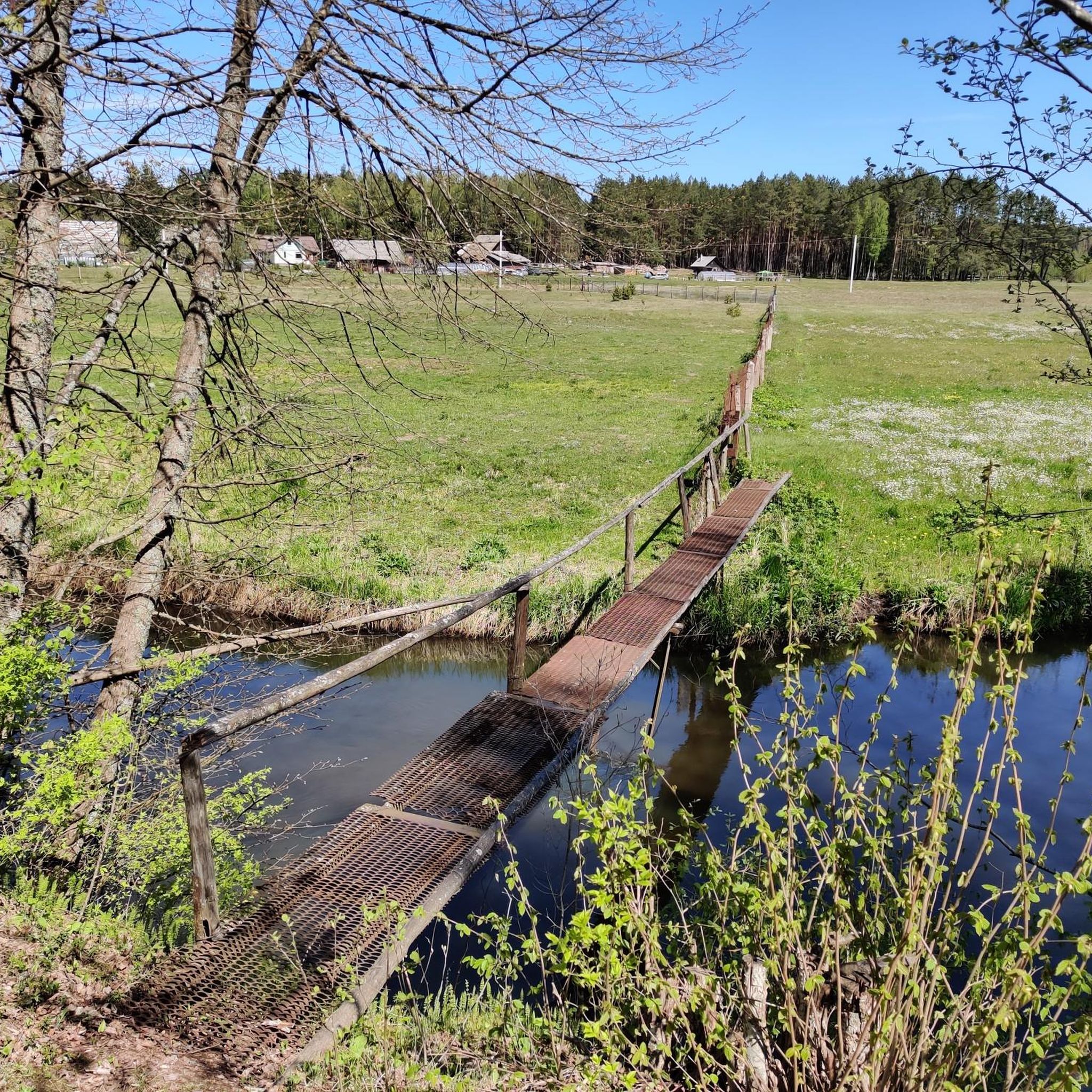
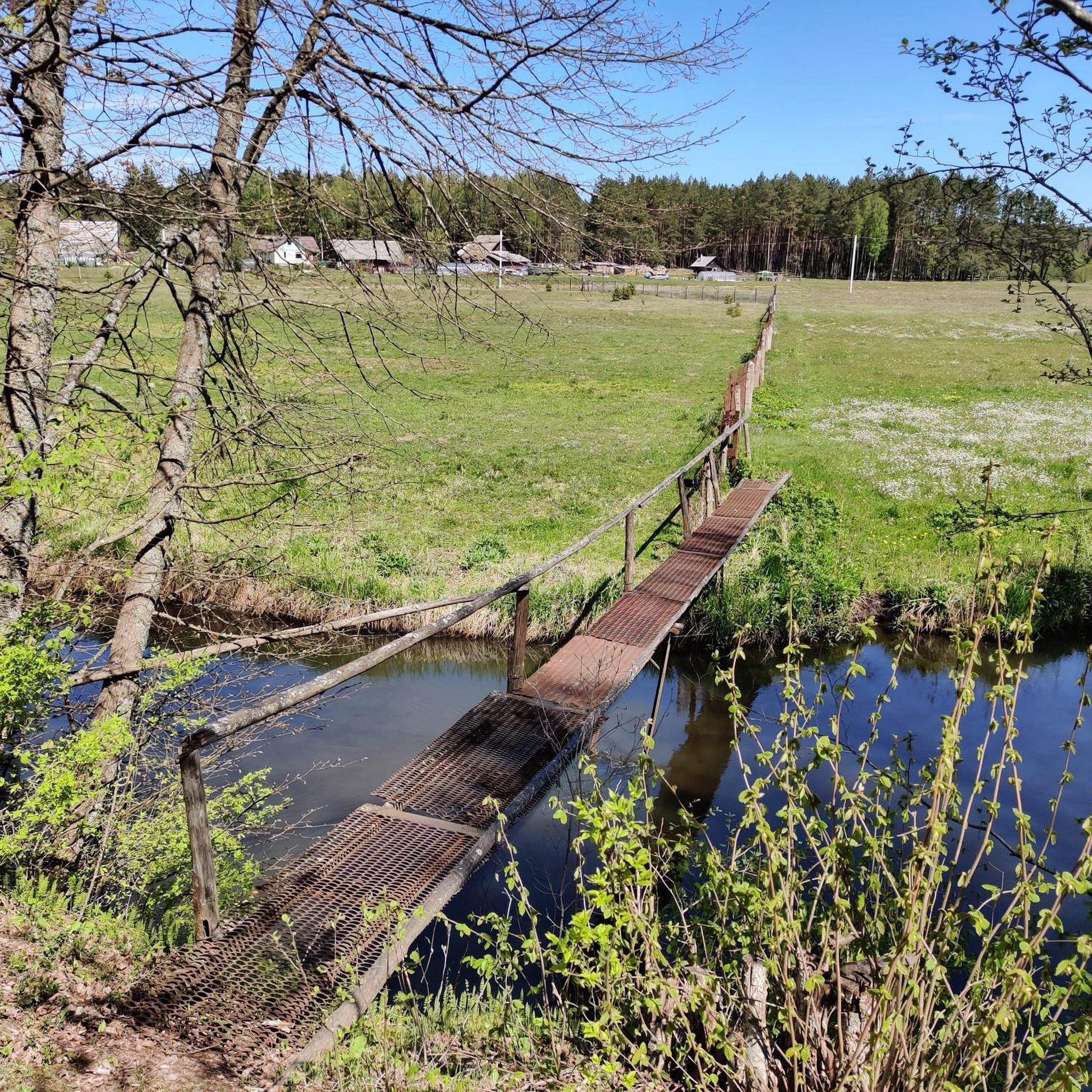
- The most popular touring cycling route is Metal Bridge – Mickūnai Church loop from Viktariškės, a 6.1 miles (9.8 km) trail that takes about 43 minutes to complete. This easy route follows the Vilnia River through forested areas.
- Another top favourite among local touring cyclists is Naujoji Vilnia Railway Station – Tuputiškės Serpentine Road loop from Elektrinių traukinių depas-2, a moderate 14.3 miles (23.0 km) path. This route features varied terrain and passes through different landscapes of the reserve.
- Local touring cyclists also love the Bike loop from Bezdoniai Eldership, a 19.4 miles (31.2 km) trail leading through wooded territories and open areas, often completed in about 1 hour 56 minutes.
- Touring cycling in Vilnios Hidrografinis Draustinis is defined by the meandering Vilnia River, dense woodlands, and sunny meadows, offering options for different ability levels.
- The routes in Vilnios Hidrografinis Draustinis are highly rated by the komoot community with an average score of 4.5 stars from over 130 reviews. More than 1100 touring cyclists have used komoot to explore Vilnios Hidrografinis Draustinis's varied terrain.
Last updated: July 10, 2026
9
riders
Moderate bike ride. Good fitness required. Mostly paved surfaces. Suitable for all skill levels.
3
riders
50.5km
03:52
250m
250m
Moderate bike ride. Good fitness required. Mostly paved surfaces. Suitable for all skill levels.

Sign up for free
4.0
(2)
21
riders
31.2km
01:56
150m
150m
Moderate bike ride. Good fitness required. Mostly paved surfaces. Suitable for all skill levels.
4.9
(7)
8
riders
8.68km
00:38
50m
50m
Easy bike ride. Great for any fitness level. Mostly paved surfaces. Suitable for all skill levels.
4.0
(1)
3
riders
13.8km
01:04
70m
70m
Easy bike ride. Great for any fitness level. Mostly paved surfaces. Suitable for all skill levels.
Get access to more routes and recommendations from other explorers.
Sign up for free
Already have an account?
Our route recommendations are based on thousands of hikes, rides, and runs completed by other people on komoot.
Start today with a free account
Your next adventure awaits.
Login or Signup
Tips from the Community

Very nice path along the Neris river with beautiful views
0
0

Remains of an old water mill.
0
0

Nice road for hiking. You can take a shortcut via a flight of stairs.
0
0
The ruins of an old mill and a gurgling small waterfall are worth seeing. Spectacular views of nature along the way...
1
0


A serpentine road is a mountain pass with many hairpin turns. Tuputiškės Serpentine Road is the only such road in Lithuania, though it hardly compares to the winding mountain passes in terms of height and length. The road goes upwards in a steep incline and its hairpin turns connect the Lower Pavilnys and the Upper Pavilnys. The Tuputiškės Serpentine Road runs along the forested Žiedų Street in Tuputiškės within the area of the Pavilnys Regional Park. In 1997, the road was recorded in the list of Cultural Heritage Objects. A stone cobbled mountain pass was first constructed in the beginning of the 20th century and connected to the Lower Pavilnys which was a settlement of railway workers that started to grow in 1908. Up to the beginning of the 20th century, Tuputiškės were sparsely settled in. In 1912, land lots were allocated from the Tuputiškės Folwark to establish a colony for the Vilnius railway workers.
0
0
The only one serpentine road in Vilnius, more than 100 years old.
0
0

Did you know? It is a church standing in the eastern part of Vilnius, in Aukštas Pavilnis. Worship services are held in Lithuanian and Polish. The only wooden Catholic church in Vilnius.
0
0
Frequently Asked Questions
What kind of terrain can I expect when touring cycling in Vilnios Hidrografinis Draustinis?
The reserve features a diverse landscape centered around the meandering Vilnia River. You'll encounter extensive wooded territories with spruce, birch, and pine trees, interspersed with sunny meadows. The terrain includes both paved and unpaved sections, offering a mix of gentle undulations and flatter river-side paths. Some routes may require good fitness due to varied surfaces.
How many touring cycling routes are available in Vilnios Hidrografinis Draustinis?
There are over 45 touring cycling routes in Vilnios Hidrografinis Draustinis, catering to various skill levels. This includes 23 easy routes, 20 moderate routes, and a few more challenging options.
Are there any easy touring cycling routes suitable for beginners or families?
Yes, there are many easy routes. For instance, the Metal Bridge – Mickūnai Church loop from Viktariškės is an easy 9.8 km trail that follows the Vilnia River through forested areas. Another accessible option is the Bike loop from Gailiūnai, which is 8.7 km long.
What are some notable natural features or landmarks I might see along the cycling routes?
The core natural feature is the moderately winding Vilnia River itself, which flows through a shallow floodplain valley. You'll cycle through large stretches of wooded territories and sunny meadows. As you approach areas like Rokantai, the forest recedes, opening up to a wider river valley, offering changing scenic views. The reserve also encompasses charming villages such as Pečiulinė, Žagariškės, and Taurija.
Are there any circular touring cycling routes in the reserve?
Yes, many routes are designed as loops. For example, the Bike loop from Bezdoniai Eldership is a 31.2 km trail that leads through wooded territories and open areas, offering a complete circular experience.
What do other touring cyclists enjoy most about cycling in Vilnios Hidrografinis Draustinis?
The area is highly rated by the komoot community, with an average score of 4.5 stars from over 130 reviews. Cyclists often praise the diverse landscapes, the serene beauty of the Vilnia River, and the variety of terrain that makes for an engaging touring experience.
Is Vilnios Hidrografinis Draustinis suitable for different types of bikes, like gravel or mountain bikes?
Yes, the reserve's diverse terrain, including both paved and unpaved sections, makes it suitable for various cycling disciplines. While this guide focuses on touring cycling, you'll find options that can accommodate road cycling, mountain biking, and gravel biking, depending on the specific route's surface and your fitness level.
Are there any moderate touring cycling routes for those looking for a bit more challenge?
Certainly. The Naujoji Vilnia Railway Station – Tuputiškės Serpentine Road loop from Elektrinių traukinių depas-2 is a moderate 23.0 km path featuring varied terrain and passing through different landscapes of the reserve. Another good option is the UNO Adventure Park loop from Galgiai, a 20.7 km moderate route.
What is the best time of year to go touring cycling in Vilnios Hidrografinis Draustinis?
The reserve is beautiful throughout the warmer months. Spring offers lush greenery and blooming flora, while summer provides pleasant temperatures for longer rides. Autumn brings vibrant fall colors to the extensive wooded areas, making it a picturesque time to visit. Always check local weather conditions before your ride.
Are there any villages or potential rest stops along the routes?
Yes, scattered villages such as Pečiulinė, Žagariškės, and Taurija are nestled within the forest fringes. These can offer glimpses into local life and potential spots for a short break during your ride.
How accessible are the cycling paths in the reserve?
The reserve provides easily accessible paths for various activities, including cycling. It serves as a beautiful natural park within Vilnius County, offering an escape into nature just outside the city, making it approachable for different fitness levels.
Most popular routes in Vilnios Hidrografinis Draustinis

Get inspired with the komoot mobile app


Explore more
Browse the best Cycling routes in other regions.
